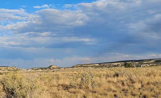
Dispersed camping options near Cleveland, Utah extend throughout the San Rafael Swell region where elevations range from 4,000 to 7,000 feet, creating dramatic temperature variations. This high desert terrain features soft silty soils that become impassable when wet, particularly in spring and fall. During summer months, daytime temperatures frequently exceed 90°F while dropping to the 40s overnight.
What to do
Mountain biking at Wedge Overlook: The area offers excellent trail access with moderate to challenging terrain. "This site is at the halfway point of the mountain bike trail. This site is at the top of a shallow drainage. Other sites are literally right on the rim," notes Carrie C. about Wedge Overlook.
Explore archaeological sites: The region contains numerous rock art panels and historical sites. "After two days of camping and biking here we took Buckhorn Draw Road down to I-70 and then Temple Mountain to Goblin Valley. Very scenic drive. National Park quality stuff," reports one camper at Little Grand Canyon Dispersed Camping.
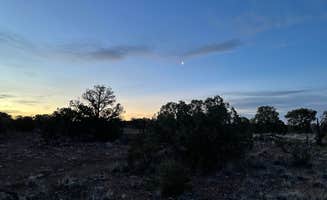
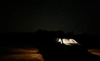
Stargazing opportunities: The remote location provides exceptional dark skies. "Absolutely stunning views and the most beautiful night skies I've ever seen. I'll be returning with the family in May," shares Jason at Little Grand Canyon Dispersed Camping.
What campers like
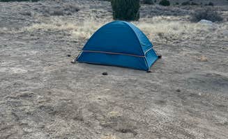
Canyon rim camping: Many primitive sites offer direct canyon views. "Wake up to incredible canyon views. Pit toilets at the beginning of the road and fire pits at the sites. Visited in mid-April and saw very few other campers," reports Meg at Little Grand Canyon Dispersed Camping.
Seasonal temperature variations: Different seasons offer distinct camping experiences. "We stayed here at the very beginning of October. It was 80 during the day and 40s at night, so dress accordingly. Sites are first come first serve and free!" writes Patrick M. about Wedge Overlook.
Privacy between sites: Natural terrain creates separation between camping areas. "Dispersed camp spots, some REALLY primo ones on edge of canyon with dramatic views. Juniper trees create some privacy between spots," explains Flo B. at Horse Canyon Road - Dispersed Open Area.
What you should know
Road conditions vary significantly: Access becomes difficult after rain. "The road leading in is about 20 miles so make sure you have everything you need, but if not there is a town about 40 minutes away," advises Patrick M. about Wedge Overlook.
Water availability is nonexistent: "This BLM campground now has designated campsites, a picnic table, large deep fire rings, pit toilets and no trash service. Also no water," explains Lois A. at Buckhorn Draw Designated Campsite #17.
Cell service fluctuates by location: Connectivity varies based on elevation and terrain. "Cell signal is excellent. Closest town is Castle Dale 20 mi away. Road access is a wide graded gravel road from Castle Dale," reports Greg L. about Wedge Overlook.
Weather preparation is essential: Wind and rapid temperature changes affect camping comfort. "Around dusk the wind picked up and almost destroyed our camp and sent it into the canyon. Tie everything down or be in camp for the show! The ground is hard for tent stakes," warns Dave L. about Wedge Overlook.
Tips for camping with families
Group sites availability: Several areas accommodate larger family groups. "This is a group designated site, $50, and is one of the best due to the cottonwood trees for shade. Table and fire ring. No water, no trash, no toilet, no cell signal," notes Greg L. about Buckhorn Draw Designated Group Campsite #16.
Toilet access considerations: Limited facilities exist in specific locations. "Free to camp all along the Wedge. Multiple campsites available. One vaulted toilet at the beginning. No other amenities. T-mobile cell coverage very good. Very peaceful and quiet during the week," shares Honeymooners O.
Educational opportunities: Rock formations provide learning experiences. "Lots of roads off the main road to camp on. Was really busy during the weekend but slowed down a lot during the week. If you pass by the established camp grounds by the historical bridge, there are nice secluded spots within the canyon," explains Ashlee T.
Tips from RVers
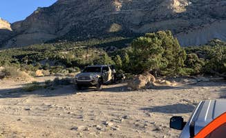
Leveling requirements: Terrain presents challenges for larger vehicles. "Dispersed BLM good for boondocking one night while traveling. Small Class C, just watch your approach," advises The G. about CO2 Road Dispersed Campsite.
RV site limitations: Few areas accommodate larger rigs. "We got tired on the way to Moab, so I found Horse Canyon Road on this app and it looked good for dry camping! Turn into the Horse Canyon Rd rest stop area and just keep driving until you find your type of spot. We stopped about a half mile down the road, lots of places to turn around, and found a mostly flat spot for our Motorhome," explains Aubrey S.
Highway noise considerations: Some sites experience road noise. "Found this area on the way through and decided to stop. Make sure you get far enough away from the highway or you will hear the road noise that never stops. There are places to camp all over throughout the area," notes Shane W. about CO2 Road Dispersed Campsite.