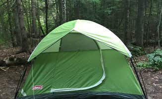
Pictured Rocks National Lakeshore spans 42 miles along Lake Superior, with over 100 miles of trails weaving through forests of maple, beech, and pine. The area receives approximately 30-35 inches of annual precipitation, creating diverse wetland habitats adjacent to camping areas. Seasonal black fly hatches typically occur during the third week of May, requiring additional preparation for campers planning early season trips.
What to do
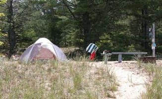
Kayaking access points: Several backcountry sites at Pictured Rocks National Lakeshore Backcountry Sites offer water access, with campers noting specific entry locations. "Tucked off the north country trail path lies a group site and 5 campsites. Nice access to water," reports one visitor about the Au Sable East area.
Fishing in nearby streams: East Branch of Fox River campground provides excellent brook trout fishing opportunities in a designated trout stream. According to one camper, "The brook trout fishing is great, especially if you're willing to put on waders and break brush. But you can catch some decent sized ones from one of the many stone bridges that cross-cross the river."
Winter adventures: For experienced campers, winter offers a unique perspective on the lakeshore. "Traveling in the winter by snowshoes requires more planning and skill. We brought a sled and embraced the weather. Seeing picture rocks in the winter is well worth the adventure and exhaustion to get there," notes one winter visitor who encountered challenging conditions.
What campers like
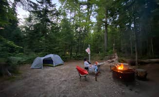
Secluded lake access: South Gemini Lake State Forest Campground provides quiet waterfront sites away from crowds. "Great little campground in the middle of nowhere. 15 minute drive off the beaten path keeps the crowds away. Couple spots right on the water," shares a recent visitor who appreciated the remoteness.
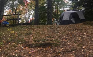
Wildlife viewing: The wilderness setting around tent campsites near Pictured Rocks National Lakeshore creates opportunities for animal encounters. One camper at Lake Superior State Forest noted, "Bear, Deer, Porcupine, Raccoons and other wildlife are easy to come across," highlighting the natural inhabitants you might spot during your stay.
Star visibility: Areas farther from towns offer exceptional night skies. "On clear nights, Star Gazing is Fantastic. I have never seen so many stars at one time as I did along Lake Superior," reports a camper who enjoyed the dark skies that result from minimal light pollution in this remote region.
What you should know
Seasonal insects: Different pests emerge throughout the summer months. "We made the mistake of camping once during the black fly hatch (third week of May) and they were miserable," warns a camper about East Branch of Fox River campground, adding that mosquitoes near water sources require preparation regardless of timing.
Cell service limitations: Most campgrounds near Lake Superior State Forest Campground lack connectivity. "Verizon doesn't get data but at least one bar to send SMS messages," notes one visitor about signal strength in the area, important information for emergency planning or weather updates.
Site occupancy rules: Regulations require campers to physically occupy sites rather than reserving them with equipment. "Please remember tagging sites is prohibited you must occupy the site. You can't just leave a chair," reminds one experienced camper familiar with forest service regulations.
Tips for camping with families
Access considerations: Chapel Beach Backcountry Campsites requires proper planning for families. "Access to beach is provided by wooden ladder-like steps down the bluffs," notes one visitor, suggesting parents should assess children's abilities to navigate these trails before committing to the hike.
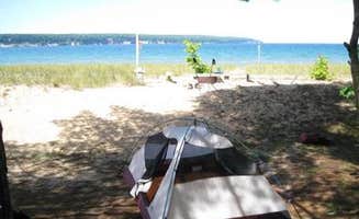
Water safety protocols: Lake Superior's conditions can change rapidly, affecting swimming and boating plans. "The strong winds here should not be trusted. You can access the campground by North Light Creek beach," cautions a kayaker at Shelter Ridge Campsite, emphasizing the importance of weather awareness with children.
Site selection strategy: Arrive early to secure family-friendly spots. "All sites are first come first served so get there early if you want a spot. We got lucky and grabbed one of the last sites available," advises a camper who observed multiple vehicles searching for openings later in the day.
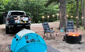
Tips from RVers
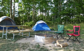
Road conditions: Catchin' Crickets Campground offers developed sites suitable for small trailers. "Clean, sites are level. I was charged $45 for a site with electricity. A site without is $35," reports a visitor, noting the pricing structure for different amenity levels.
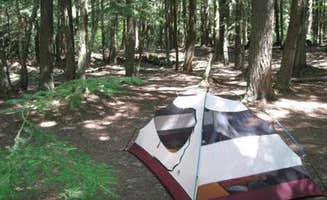
Site dimensions: Most rustic campgrounds limit vehicle size significantly. "I tent camped so it was no problem. Small camper or trailer could probably fit," explains a visitor to Cusino Lake State Forest Campground, indicating that larger RVs would not be accommodated at this location.
Limited hookup options: Planning for self-sufficiency is essential as most sites near Pictured Rocks lack services. "Rustic and beautiful," summarizes one RVer about the camping experience, with most state forest campgrounds offering only vault toilets and hand pumps for water rather than electrical or water hookups.


 Traveler