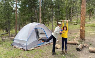
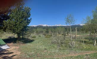
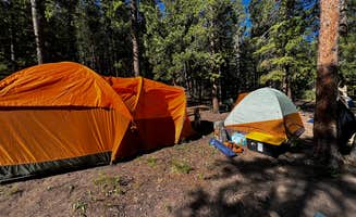
Dispersed camping sites surround Lafayette, Colorado at elevations ranging from 8,000 to 10,000 feet in the Roosevelt National Forest. Many accessible locations require a short hike or high-clearance vehicle to reach tent camping areas. Weather patterns can change rapidly in this region, with afternoon thunderstorms common from June through August.
What to do
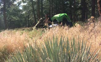
Hike along flowing creeks: Ceran St. Vrain Trail Dispersed Camping offers hike-in tent sites along a stream with fishing opportunities. "My son and I joined a friend from Longmont and headed to this trail to camp for a couple days... Our spot was set back from the trail, right next to the stream. Just an amazing view, ample room for lots of tents, nice fire rings and huge logs around them for sitting," reports one visitor to Ceran St. Vrain Trail Dispersed Camping.
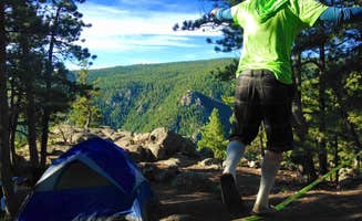
Explore national forest trails: Just 10 minutes from Nederland, campers can set up tent campsites near multiple hiking trails. "I loved this spot! It's only about 10 minutes from Nederland and 45 minutes from boulder. There are mountains and aspen forests and wildflowers everywhere! I also saw elk nearby," notes a visitor to N Boulder Creek Dispersed Camping.
Wildlife observation: Morning and evening hours provide opportunities to spot wildlife near tent camping areas. According to one camper at Gordon Gulch Dispersed Area: "Moose visitors at dawn and evening, and hungry bears scavenging for food at night is a common occurrence. Luckily my car alarm scared them off pretty easily."
What campers like
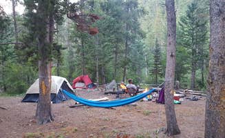
Privacy between campsites: At Allenspark Dispersed Camping, tent sites offer natural separation. "I spent multiple days at this site due to its remote beauty. Campsites far apart, and it was quiet other than the occasional ATV," writes a camper at Allenspark Dispersed Camping.
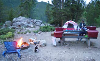
Night sky views: The higher elevation tent campsites provide excellent stargazing opportunities on clear nights. One Ceran St. Vrain camper noted: "The stars were AMAZING and the sky was perfectly clear. Lots of firewood around-we brought our hand saw and cut enough feld wood to last until around 4am."
Stream noise for sleeping: Many tent campers appreciate the natural white noise from nearby water sources. As one Allenspark visitor described: "Road gets tougher the further back you go, but my low clearance vehicle made it by driving slow. Well worth the visit. Lots of Aspen!"
What you should know
Road conditions vary seasonally: Most dispersed tent sites require travel on unpaved roads that deteriorate after rain or snow. A camper at Winiger Ridge at Gross Reservoir cautions: "Gnarly ass road, not for trailers/sedans. Camp sites are nice, but except for a few (~5) the rest require a serious climb (drive) up a gnarly hill with deep ruts."
Wildlife safety precautions: Bears actively search for food at night around tent campsites. Store all scented items properly. One Gordon Gulch visitor warned: "You'll hear dirtbikes during the day. The only main complaint I had was the lack of peace due to constant checks from boulder sheriffs."
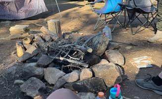
Fire restrictions change frequently: During summer months, complete fire bans are common at tent camping areas near Lafayette. When allowed, only use established fire rings. At Dream Canyon, a camper noted: "The coordinates on Dyrt are a little off from the actual location but if you drive down roads that lead toward views of the canyon, you'll get there."
Tips for camping with families
Choose established campgrounds: For families with young children, sites with designated facilities provide easier logistics. A visitor to Sawmill Hiker Campground explains: "My husband and I came in through the West Trailhead. It is a 1 mile, easy hike. The first 1/3 of a mile is dirt, the remainder is gravel. It is fairly hilly, but easy enough that we actually opted to push our Jogging Stroller with our kid the entire way."
Pack for temperature swings: Tent campsites near Lafayette experience wide temperature variations between day and night, even in summer. A camper at N Boulder Creek noted: "It got a bit chilly at night but not too bad! I also had 1 bar of 5G with T-mobile."
Check cell coverage beforehand: Reception varies dramatically between camping areas, with higher ridge locations offering better connectivity. At Aspen Meadows Campground, one visitor reported: "Quiet (mid-week stay) campground with access to hiking trails. Some sites are more secluded than others. No service from Sprint/T-Mobile at the campground, but accessible near panorama point."
Tips from RVers
Identify accessible sites before arrival: Many tent campsites near Lafayette have limited access for larger vehicles. At Dream Canyon Campsites, a visitor advises: "The trailhead parking lot has one giant rut that you must be careful to navigate around. 2 Wheel Dr. and low clearance vehicles can do it, but should be extremely careful in how they approach."
Plan for no hookups: Bring sufficient water and power for your entire stay as dispersed camping areas provide no services. One camper at Allenspark noted: "It was gorgeous! Lots of spots, and also lots of people. Some folks coming in late night. It's definitely a bumpy ride in."
Arrive early for weekend camping: Popular tent campsites fill quickly Friday afternoons. A visitor to Gordon Gulch recommended: "It wasn't a bad experience by any means. If you can get there early, definitely do so. Not all campgrounds are really that flat but it's free and it's Boulder, CO environment so I can't complain."