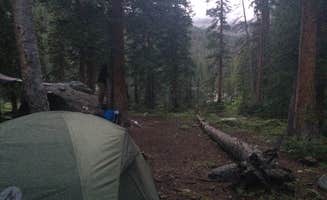
Dispersed camping opportunities near Edwards, Colorado provide access to the surrounding White River National Forest. Most sites sit at elevations between 8,000-10,000 feet where summer temperatures typically range 45-75°F with frequent afternoon thunderstorms. Winter camping remains possible at lower elevations, though many forest roads close after significant snowfall.
What to do
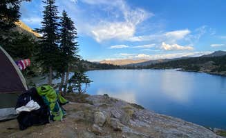
Hiking to alpine lakes: From Homestake Reservoir Rd campsites, several trails lead to high-elevation lakes. "Beautiful clear lakes, lots of mountains over 14000 feet, lots of wildlife, lots of hiking trails," reports one camper, though they note "not a lot of fish, can be busy."
Creek access camping: Several dispersed sites along creeks provide water access. At Red Sandstone, one camper mentioned, "You can drive or walk down a mile which leads to a trail to Lost Lake, which you can swim in." Be aware that mountain lakes remain cold even in summer.
Mountain biking: Forest roads around camping areas offer various biking options. Multiple reviews note seeing mountain bikers on trails near Boreas Pass Road. "Plenty of keep traffic, mountain and e-bikes. Enjoyed the views!" reports one reviewer about the area.
What campers like
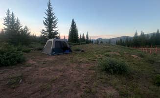
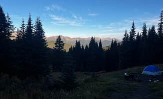
Seclusion at higher elevations: Many campers value finding quiet spots away from crowds. At Boreas Pass, one reviewer noted, "Our site was far enough from the neighboring spots that we couldn't see or hear other campers, making it feel peaceful and secluded."
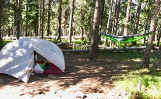
Wildlife viewing: The tent camping areas near Edwards provide opportunities to observe local wildlife. "Wildlife was another highlight—there were clear signs of moose activity nearby, and fellow campers just up the road mentioned seeing a moose wander around their site," explains a Boreas Pass camper.
Water features: Camping near streams or lakes ranks high with visitors to Blue Lake Camp. "The water is crystal clear and lovely for a dip (if you can handle the cold!). A few kind souls have even left their row boats in the woods next to the lake," shares one camper about this primitive camping area.
What you should know
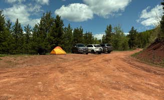
Road conditions vary significantly: Many roads to dispersed camping deteriorate during wet weather. At Bellyache Road, one camper states, "Definitely would advise 4x4, and not for travel trailers at all. Bringing one up could lead to a serious situation, since there are no places to turn around whatsoever."
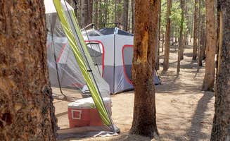
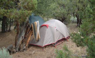
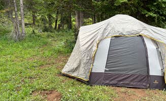
Limited facilities: Most tent camping near Edwards lacks facilities. "No services at all. Gotta pack everything out," notes a Homestake Reservoir Road camper. Bring sufficient water and portable toilet supplies for dispersed sites.
Fire restrictions: Fire bans frequently occur during dry periods. Check current restrictions with Eagle-Holy Cross Ranger District before camping. Some areas prohibit fires year-round regardless of conditions.
Mosquito prevalence: Multiple reviews mention insects as an issue. "SO MANY MOSQUITOS," warns one Red Sandstone camper, while another notes, "I don't regret bringing my travel trailer up here because it's meant for rough roads but had I known the road was this rough I wouldn't have started."
Tips for camping with families
Halfmoon Campground accessibility: For families seeking more established facilities, Halfmoon Campground offers vault toilets and defined sites. "The campground itself is basic, 7 spots and two vault toilets. The spots are fairly spaced out and can fit a few tents in each," explains one reviewer.
Site selection timing: Arrive early, especially on weekends. "We arrived on a Sunday around 5 and had no trouble finding a private spot," notes a Boreas Pass camper, though conditions vary by season and location.
Weather preparedness: Mountain weather changes rapidly. Pack layers and rain gear even in summer, when afternoon thunderstorms frequently develop. Morning temperatures often drop into the 40s even in July and August.
Altitude considerations: Sites near Edwards sit at high elevations. "Being at a higher elevation, one person in our group did experience some mild altitude discomfort, even though we're from the Denver area—something to keep in mind if you're sensitive to elevation changes," warns a camper.
Tips from RVers
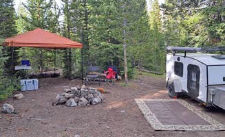
Size restrictions: Most tent camping areas near Edwards accommodate smaller RVs only. "The areas to park are fairly small, one or maybe two cars but this is definitely not an area you want to bring a big RV or trailer," notes a camper about Halfmoon Campground.
Water access planning: No RV hookups exist at dispersed sites. One Vail Area visitor warns, "There is no parking for RV around town in walking distance (Long Walk included). All parking only for cars," making resupply challenging.
Road scouting: Check road conditions before attempting access with larger vehicles. "Camp is a 5, road is a 2. Very rough, slow, rutted road," explains one Red Sandstone visitor, suggesting scouting difficult roads before bringing an RV.


 Ranger