Dispersed camping options near Black Hawk, Colorado range from 8,500 to 10,500 feet in elevation, with most sites accessible from May through October when mountain roads remain clear. Winter camping becomes challenging as many access roads close or require specialized vehicles with snow chains. Temperature swings of 30-40 degrees between day and night occur even in summer months.
What to do
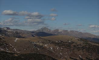
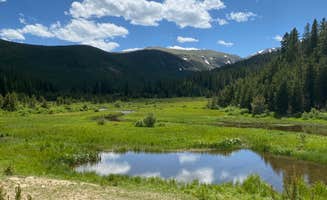
Hiking to alpine lakes: The trail around Fall River Reservoir offers moderate terrain suitable for most skill levels. "The hiking around it is beautiful. Would definitely camp there again," reports a visitor. Several unmarked paths branch off to higher viewpoints.
Mountain biking on established trails: The network around West Magnolia Campground provides both technical and beginner-friendly routes. A camper noted, "Great location with single tracks for hiking and mountain biking. Camping spots are well-marked." Some routes connect directly to Nederland trails.
Fishing in stocked waters: Early mornings at high elevation waters yield best results. "Our tent was literally right next to a stream of water which was good fishing as me and my friend caught our daily limit of fish very quickly," a camper at Fall River Reservoir shared. Local regulations require Colorado fishing licenses, available in Idaho Springs.
What campers like
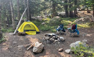
Accessible wilderness: Most sites around Chinns Lake Dispersed Camping require moderate off-road capability but deliver remarkable isolation. "The camp site was awesome and very peaceful. It did get pretty windy at night and it also dropped into the upper 30's," reported one visitor. Many sites feature established rock fire rings.
Wildlife viewing opportunities: Dawn and dusk bring the most activity. "Lots of chipmunks and hummingbirds due to the many wild flowers," observed a camper at Gordon Gulch Dispersed Area. Moose sightings occur regularly in some areas, particularly in spring and fall.
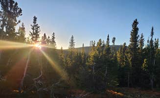
Night sky visibility: The elevation and distance from light pollution create exceptional stargazing conditions. A camper at Beaver Park Reservoir shared, "It was a super windy night. Popular spot." Sites with southern exposure offer the best astronomical viewing during clear nights.
What you should know
Weather patterns: Afternoon thunderstorms occur frequently in summer months. "Went on a Sunday, the weekend after the 4th of July. It was quite easy to find a campground for dispersed camping with other sites marked," a visitor to Gordon Gulch reported, also noting, "Recommend a 4-wheel drive vehicle to reach some of the spots, especially if there is poor weather."
Temperature fluctuations: Pack for both warm days and freezing nights regardless of season. At Dream Canyon Campsites, a camper experienced, "Beautiful spot; close enough to civilization to feel secure yet secluded enough to feel private." Night temperatures can drop below freezing even in July.
Site availability strategies: Weekday arrival significantly improves chances of securing prime locations. "I went up solo camping... The spot was great though," shared a visitor to Loch Lomond. Thursday arrivals typically offer better site selection than Fridays, when weekend crowds begin forming.
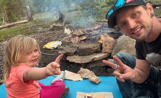
Tips for camping with families
Beginner-friendly locations: Less challenging terrain exists at lower elevations. "For those that can't find it, putting 'Hidden Wilderness Rd' in the GPS should help. It's a dirt road at the top of the neighborhood road," advised a camper at Hidden Wilderness Roadside Camp #2.
Child-appropriate activities: Several locations offer natural exploration opportunities. "There is a super easy family-friendly mini hike with great view and a little cell access," a Beaver Park Reservoir visitor noted. "If you are facing the lake, to your right just behind you there are some rocks... 15 minutes if you have a small child."
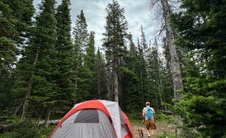
Safety considerations: Wildlife encounters require proper food storage. "Moose visitors at dawn and evening, and hungry bears scavenging for food at night is a common occurrence," one camper reported. Keep children within sight due to steep drop-offs and changing weather conditions.
Tips from RVers
Access limitations: Most dispersed areas have specific size constraints. "We have a 25 foot camper and feet nicely in. Road in was good as well," shared a visitor to Beaver Park Reservoir. Larger rigs should scout ahead before committing to narrow forest roads.
Leveling challenges: Many rustic sites near Black Hawk present natural slopes. "We did see a few brave drivers in Subaru's, but most campers had high clearance 4x4 vehicles," observed a Fall River Reservoir camper. Bring adequate leveling blocks and test ground firmness before setting up.
Turnaround space: Forest roads often lack designated turning areas. "The road up can be pretty tight in a few spots. I had to stop and hug in to the side to let others drive by," warned a Loch Lomond visitor. Plan entry and exit routes carefully, especially with trailers or larger vehicles.