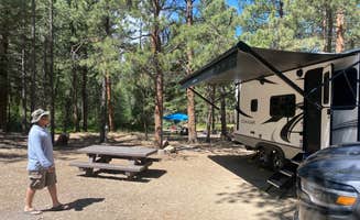
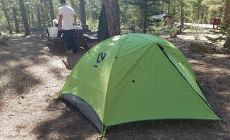
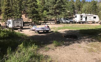
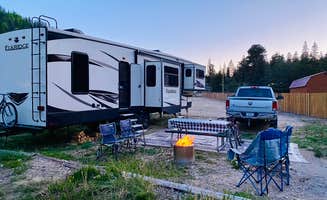
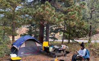
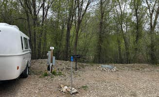
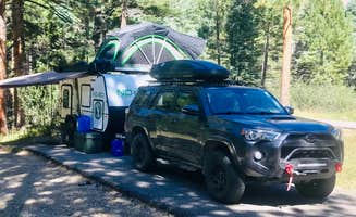
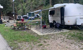
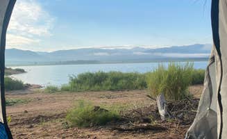
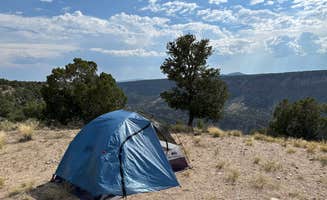
Campground photo 1
Campground photo 2
Campground photo 3

Places to Camp near Costilla, NM

639 Reviews

Whether you're a tent camper, an RVer, or just passing through, Costilla, NM has a lot to offer. There's so much to see and do, from exhilarating hikes or bike rides to exploring the local dining and shopping. Find the best campgrounds near Costilla, plus reviews and photos from other campers like you.

Best Camping Sites Near Costilla, NM (157)

  1. Camper-submitted photo from Blue Lake Campground - Temporarily Closed

    1.

    Blue Lake Campground - Temporarily Closed

    36 Reviews
    130 Photos
    187 Saves
    La Veta, Colorado

    Overview

    Blue Lake Campground is located in the beautiful San Isabel National Forest at an elevation of 10,500 ft. Views of the nearby Culebra Range Mountains with aspen and spruce forests offer campers a genuine Colorado experience.

    Recreation

    A well-marked trail system between Bear Lake and Blue Lake is open to foot and horse traffic. Across the road from the campground FSR 436, a rough jeep road, provides access to Trinchera Peak where Big Horn Sheep are often seen.

    Facilities

    This rustic campground has 16 campsites, each with a table and fire ring. Some are shaded; others provide full sunlight. An on-site camp host offers firewood bundles for sale. Vault toilets and drinking water are available. No electric or septic hook-ups are available. Both reservation and first-come, first-served sites are available.

    Natural Features

    A tributary of the Cuchara River runs through the campground. Blue Lake is 1/2 mile from the campground, and Bear Lake is one mile away. Both of these small lakes are stocked several times during the summer providing for good fishing.

    Nearby Attractions

    The nearby mountain town of Cuchara offers shopping and visitor information. The town of La Veta offers a grocery store, gas stations, and shops. The Spanish Peaks Wilderness, 14 miles from the campground, is a popular hiking destination.

    Charges & Cancellations

    Cancellations Individual Campsites: Cancellations up to 2 days before a reservation start date incur a $10.00 cancellation fee.__ A visitor who cancels a reservation the day before or on the day of arrival will pay a $10.00 service fee AND forfeit the first night's use fee including tax and applicable add-on for a campsite. Cancellations for a one-night reservation will forfeit the entire amount paid and will not be subject to an additional service fee. No-Shows A no-show visitor is one who does not arrive at a campground and does not cancel the reservation by check-out time on the day after the scheduled arrival date. Staff will hold a campsite until check-out time on the day following the arrival date. No-shows are assessed $20.00 service fee and forfeit the first night's rate, taxes and applicable add-on for a campsite.____ Refunds Visitors may submit a refund request through their Recreation.gov profile within 7 days of the end date of their reservation. Refunds will not be issued after the 7 days has ended. Refunds for debit or credit card payments will be issued as a credit to the original bank or credit card used to pay. For check or cash purchases, Recreation.gov will mail a Treasury check for refunds of cash, check, or money order payments to the address associated with the reservation. Treasury check refunds may take up to 6-8 weeks to arrive.__ In the event of an emergency closure, the Recreation.gov team or facility manager will refund all fees and will attempt to notify you using the contact information within the Recreation.gov visitor profile.

    • Pets
    • Fires
    • Phone Service
    • RVs
    • Tents
    • Standard (Tent/RV)

    $24 / night

  2. Camper-submitted photo from Sacred White Shell Mountain
  3. Camper-submitted photo from Zapata Falls Campground

    3.

    Zapata Falls Campground

    66 Reviews
    251 Photos
    679 Saves
    Blanca, Colorado

    Overview

    A short drive up the gravel road that leads to the Bureau of Land Management___s Zapata Falls Campground (CG) will let visitors to the area see the San Luis Valley and Great Sand Dunes National Park & Preserve from a whole new perspective. The campground offers bird___s-eye views of the valley floor below, the San Juan Mountains to the west, the adjacent Great Sand Dunes National Park and Preserve, and several 14er___s and many other towering peaks of the Sangre de Cristo Mountain range that Zapata Falls CG sits on ___ not to mention spectacular sunrises, sunsets and night skies!____ Zapata Falls CG has 23 single campsites, 1 group site and 1 camp host site nestled among pi__on pines along two one-mile long loops. The sites on one loop are designed for tent campers. Parking spurs on the second loop vary a little in length but in general can handle RVs, towed campers, or other configurations of vehicles up to about 50 feet long.____ A new trailhead in the campground supplies a link to the South Zapata Creek Trail and the Sangre de Cristo Wilderness. A second trail, next door to the campground in the day-use area, leads visitors on a mildly steep half-mile hike to Zapata Falls, which gives the campground its name.

    Recreation

    Zapata Falls Recreation Area is a destination known for its waterfall viewing and sweeping vistas of the San Luis Valley, its soaring mountain ranges, and the adjacent Great Sand Dunes National Park. From the waterfall, the trail continues onto the Rio Grande National Forest, for those seeking a backcountry experience in the high country above and the Sangre de Cristo Wilderness.__ Recreation Sites ___ Standard Nonelectric ___ Rv Nonelectric ___ Group Tent Only Area Nonelectric ___ Overnight

    Facilities

    ___ Road signs from highway to Recreation Area. ___ Improved gravel roads in Recreation Area (no pavement). ___ No public drinking water system. ___ 6 vault (or pit-type) toilets. ___ Trash bins throughout campground and day-use areas. ___ 23 Individual sites (11 Tent, 12 RV, 1 Group Tent, 1 CG Host Site, 7 Picnic sites. ___ Standard campground amenities-table, tent pads, fire ring, food storage locker, parking. ___ Interpretive, informational, and directional signs. ___ Trailhead and overflow parking areas. ___ Foot and horse trails. ___ All facilities open year-round. ___ Cell phone service is good.

    Natural Features

    Zapata Falls Special Recreation Management Area The Zapata Falls Special Recreation Management Area (SRMA) is rich in history and geology and offers opportunities to hike, camp, mountain bike and view spectacular scenery. Zapata Falls and the 628 acres surrounding them are State Trust Lands owned by the Colorado State Land Board and are also a designated Colorado Natural Area. They are cooperatively managed with the Bureau of Land Management. History The name ___Zapata___ is the Spanish word for shoe and is tied to the history of settlement in the San Luis Valley. In 1864, Mexican families established the community of Zapata at the western base of the Sangre de Cristo Mountains and raised sheep and other livestock. In the 1870s, cattleman consolidated land holdings and established one of the San Luis Valley___s first and largest cattle ranches know as Zapata Ranch, which remains an active ranch today.__ Geology Zapata Falls SRMA perches on the edge of an active rift valley. The San Luis Valley was formed when geologic activity along the Rio Grande Rift, a giant crack in the earth___s top layers, caused the rugged Sangre de Cristo Mountains to rise and the flat plain of the San Luis Valley to sink. Bedrock lies 5,000 to 13,000 feet below the valley floor, beneath layers of gravel, soil, and water. Approximately two million years ago, alpine glaciers inched down the steep slopes of the Sangre de Cristo Mountains. Water flowing from the glacier and snowfields in the valley above found a weak spot near the end of a moraine ___ a huge rock pile deposited thousands of years ago by a glacier. For thousands of years, water has carved its path, forming Zapata Falls. Don___t Take the Plunge at Zapata Falls The cold waters of South Zapata Creek drop more than 25 feet through a narrow, rocky canyon. Please use extreme caution when hiking or wading around the base of Zapata Falls. In spring and summer, the water is cold, the current may be strong, and the rocks are slippery. In winter, climbing to the base of the falls is a slick proposition. Zapata Creek freezes into a sheet of ice blanketed by snow. Beware, the ice may not be thick enough to support your weight. There is no view of the falls from above; trying to climb the rocky walls is dangerous to you and to people below you. The falls are home to the black swift, a rare and elusive bird that nests only in the misty reaches of waterfalls. Stay on the trails to keep from disturbing the birds nesting in the cliffs.__

    Nearby Attractions

    Zapata Falls Trail__ To reach Zapata Falls, you will need to take a short but arduous hike to Zapata Creek. The falls are upstream from where the trail meets the creek. The only way to view the falls is to get your feet wet by wading carefully upstream to the base of the falls. Length: 1/2 mile each way Elevation: 9,000 to 9,400 feet Connections: South Zapata Lake Trail (U.S. Forest Service Trail #852)____ Other Nearby Attractions: ___ NPS-Great Sand Dunes National Park and Preserve.____ ___ USFS-Rio Grande National Forest and Sangre de Cristo Wilderness. ___ BLM-Blanca Wetlands Recreation Area. ___ USFWS-Baca and Alamosa National Wildlife Refuges. ___ Great Sand Dunes Oasis-Restaurant, gift shop, and lodge (near GRSA Park entrance). ___ Ft. Garland Museum and Cultural Center. ___ Colorado Gators Reptile Park. ___ UFO Watchtower. ___ Sand Dunes Hot Springs Pool. Other Nearby Campgrounds: Pinyon Flats CG, Great Sand Dunes NPP

    • Pets
    • Fires
    • Phone Service
    • RVs
    • Tents
    • Group
  4. Camper-submitted photo from Rio Costilla Park

    4.

    Rio Costilla Park

    8 Reviews
    23 Photos
    181 Saves
    Red River, New Mexico

    Rio Costilla ~ Pristine Wilderness is located in Northern Taos County, New Mexico. Lush forests offer Spring & Summer Recreation through Labor Day Weekend and are a Hunter’s Paradise throughout the year.

    Camping, Fishing, Hiking, Bike Riding, Rock Hounding, and just plain Relaxing are among many activities to be enjoyed during warmer months of the year in Rio Costilla Park.

    • Pets
    • Fires
    • RVs
    • Tents
    • Group
    • Equestrian

    $30 / night

  5. Camper-submitted photo from Columbine Campground (NM)

    5.

    Columbine Campground (NM)

    10 Reviews
    28 Photos
    167 Saves
    Questa, New Mexico

    Overview

    Columbine Campground is located between Questa and Red River, New Mexico. The Red River flows past the campground and a trailhead leads into the Columbine-Hondo Wilderness area. Columbine Campground sits at 7,900 feet in elevation.

    Recreation

    The Columbine Twining hiking trail can be found at the south end of the campground and gives access to 14 miles of hiking trails, and leads into the Columbin-Hondo Wilderness area. The Red River runs near the campground and can be accessed near the first loop.

    Facilities

    This campground offers 26 single sites, potable water, and vault toilets. Each site is has a fire ring, picnic table, and tent pad. Please note that no water can be filled directly into a trailer, rv, or motorhome anywhere in this campground - the potable water is only for filling containers you bring back to your site.

    Natural Features

    The campground is composed of two loops. One small loop at the campground entrance, has all open sites and views of the towering mountains. The other is a long loop up the canyon along the fast-flowing Columbine Creek. The campsites in this loop are tucked in among pine, spruce and some aspen providing ample shade and good privacy between campsites.

    contact_info

    For facility specific information, please call (928) 537-8888.

    Nearby Attractions

    Be sure to explore Red River, Questa, and the Enchanted Circle while in the area.

    • Pets
    • Fires
    • Phone Service
    • RVs
    • Tents
    • Cabins

    $22 / night

  6. Camper-submitted photo from Home Mountain Reservoir SWA - Dispersed Campsites

    6.

    Home Mountain Reservoir SWA - Dispersed Campsites

    11 Reviews
    27 Photos
    253 Saves
    San Luis, Colorado

    This is an irrigation reservoir that's stocked throughout the summer with trout. Camping and restrooms are available. NOTE: Reservoir is open to ice fishing during the winter.

    Interactive Map: https://ndismaps.nrel.colostate.edu/index.html?app=FishingAtlas&keyword=fspot&value=262

    Fishing Coldwater lake

    Recreation Camping, Boating

    Facilities Boat Ramp, Restrooms

    Restrictions Colorado Parks and Wildlife reminds visitors to check current hunting, fishing and land use regulations when planning to visit a State Wildlife Area. Refer to the Recreational Lands Brochure, as well as the Fishing and Hunting Regulation Brochures located on the Regulations Brochures Page. State Wildlife Area visitors can also find rules and regulations information in Chapter 9 Regulations.​

    • Pets
    • Fires
    • Phone Service
    • Dispersed
    • Toilets
    • Alcohol
  7. Camper-submitted photo from Cimarron Campground

    7.

    Cimarron Campground

    10 Reviews
    46 Photos
    140 Saves
    Red River, New Mexico

    Overview

    Cimarron Campground is located in the scenic Valle Vidal within Carson National Forest in northern New Mexico, at an elevation of 9,300 feet. The sites are tucked among spruce, aspen and fir trees, and the camp offers an open range feel. Visitors have opportunities to enjoy a variety of recreational activities in a picturesque setting. Viewing wildlife and simply relaxing in the mountain air are popular activities.

    Recreation

    Anglers can fish for Rio Grande cutthroat trout in Comanche Creek and the Rio Pueblo. Nearby Shuree Ponds offers excellent fishing. The smaller pond is a fishing hole for kids 12 and under. The main pond is stocked with rainbow trout and is also popular for float tubing. The area around the campground is open to horseback riding, and there are few maintained trails. Elk and deer hunting is excellent.

    Facilities

    The campground contains 36 overnight campsites, which includes eleven horse sites and one double site. Vault toilets and drinking water are provided. Sites are equipped with picnic tables and campfire rings with grills. Horse corrals and water troughs are available in the campground. A host is on-site.

    Natural Features

    Some of the finest mountain scenery in the Southwest is found in the 1.5 million acres within the Carson National Forest. Elevations range from 6,000 feet to 13,161 feet at Wheeler Peak, the highest in New Mexico. Big game animals roam the Carson, including mule deer, elk, antelope, black bear, mountain lion and bighorn sheep. Many species of smaller animals and songbirds can also been found in the forest. Cimarron Campground is located within the beautiful Valle Vidal, a Spanish term meaning "Valley of Life," of the Sangre de Cristo Mountains. Shuree Ponds, Comanche Creek and the Rio Pueblo are all near the campground, offering excellent fishing.

    contact_info

    For facility specific information, please call (928) 537-8888.

    • Pets
    • Fires
    • RVs
    • Tents
    • Group
    • Equestrian

    $22 / night

  8. Camper-submitted photo from Great Sand Dunes Oasis

    8.

    Great Sand Dunes Oasis

    48 Reviews
    128 Photos
    360 Saves
    Great Sand Dunes National Park And Preserve, Colorado
    • Pets
    • Fires
    • Electric Hookups
    • Phone Service
    • Reservable
    • ADA Access

    $25 - $169 / night

  9. Camper-submitted photo from Cebolla Mesa Campground
  10. Camper-submitted photo from Fawn Lakes Campground

    10.

    Fawn Lakes Campground

    6 Reviews
    22 Photos
    103 Saves
    Red River, New Mexico

    Overview

    Fawn Lakes Campground is located in Carson National Forest, one of a few campgrounds located along the scenic canyons of Red River. Visitors enjoy fishing and exploring nearby hiking trails.

    Recreation

    Located between Questa and Red River, many activities such as hiking and fishing are available to visitors either at the campground or a short drive away. There is fishing access for Red River and to the nearby small lakes. Columbine Trailhead is within 4 miles and starts at Columbine Campground.

    Facilities

    The campground contains 18 family overnight sites, of which three are tent-only sites. Vault toilets and drinking water are provided. Firewood is available for purchase from the host.

    Natural Features

    The Red River runs adjacent to the campground. Two small fishing lakes are within a short walk from the campground. The surrounding mountains comprise a beautiful forest of ponderosa pine that blankets the campground and offers partial shade.

    Nearby Attractions

    The City of Red River is about 3 miles away, with groceries, gas, showers, laundry facilities and a caf__. An RV dump station is within 1 mile of the campground.

    contact_info

    For facility specific information, please call (928) 537-8888.

    • Pets
    • Fires
    • Phone Service
    • RVs
    • Tents
    • Standard (Tent/RV)

    $22 / night

Showing results 1-10 of 157 campgrounds

Popular Camping Styles near Costilla

Pet-friendly camping near Costilla

Recent Reviews In Costilla

639 Reviews of 157 Costilla Campgrounds