Best Camping near Los Alamos, NM
Are you in need of a campground near Los Alamos, NM? Enjoy the scenic camping, fun activities, and sights and sounds of Los Alamos. You're sure to find the perfect campground for your Los Alamos camping trip.
Juniper Family Campground is the ideal place to camp on the Pajarito Plateau. Located just inside the main park entrance, the campground is a short drive from the Bandelier Visitor Center, the Frijoles Canyon Shuttle bus system (mid-May to mid-October), and the adjacent towns of Los Alamos and White Rock. Juniper Family Campground is the perfect "home base" to explore the Pajarito Plateau, Jemez Mountains, and all of north central New Mexico! The campground is divided into 3 loops: Abert's Squirrel Loop (Loop A) campsites are available year-round as first-come, first serve only. Pay for first-come, first-serve campsites at the self-pay kiosk located at the Juniper Family Campground or in-person at the Bandelier Visitor Center during business hours. Black Bear Loop (Loop B) campsites are open year-round and are reservable up to 6 months in advance. Some sites may open on shorter booking windows (7 or 14 days in advance or the day of arrival). Coyote Loop (Loop C) campsites are open seasonally, March 1 October 31, and are reservable up to 6 months in advance. Some sites may open on shorter booking windows (7 or 14 days in advance). You may also book campsite reservations in Loops B & C on the day of arrival (subject to availability). HOWEVER, cell service/data is not always reliable in the park and no public WiFi is available. The park highly recommends booking your reservation from the neighboring towns of Los Alamos and White Rock before heading to Bandelier. Group campsites (in Loop A) are available by reservation only up to 12 months in advance until the day before arrival (subject to availability). Same day reservations are not available for group campsites.
Bandelier is home to over 70 miles (113 km) of hiking trails most of which are located within federally designated wilderness. Two trails are accessible directly from Juniper Family Campground. The Frey Trail follows the historic route into Frijoles Canyon and descends down the canyon wall to the Visitor Center and the Main Loop Trail. The Tyuonyi Overlook Trail leaves the amphitheater parking area for a 3/4-mile (1.2 km) hike across the open mesa top to an overlook providing breathtaking views of Frijoles Canyon and of Tyounyi, an ancestral Pueblo village. The Bandelier Visitor Center houses museum exhibits, park film, information and ranger programs, Western National Parks Association sales outlet, and more. Entrance to Frijoles Canyon and the Visitor Center is by shuttle bus only (or by hiking) from mid-May to mid-October. These areas are accesibile by private vehicle outside the shuttle bus period. Many other opportunities for recreation and exploring the history and culture of the area are nearby, such as Valles Caldera National Preserve, Manhattan Project National Historical Park, Los Alamos museums, the Jemez District of the Santa Fe National Forest, US Department of Energy public recreation trails, and others around Los Alamos County. Rock climbing is prohibited within Bandelier National Monument, however many popular climbs are within a short drive up Route 4 into the Jemez Mountains.
Bandelier National Monument protects over 33,000 acres (13355 ha) of rugged, beautiful canyon and mesa country which features evidence of human presence going back over 11,000 years. Petroglyphs, dwellings carved into the soft rock cliffs, and standing masonry walls pay tribute to the early days of a culture that still survives in the surrounding communities. Bandelier National Monument sits at the southern end of the Pajarito (Spanish for little bird) Plateau. The plateau was formed by two eruptions 1.6 and 1.4 million years ago. Home to the Bandelier Wilderness, Bandelier ranges from 5340 ft (1628 m) at the Rio Grande River to the south and 10,199 ft (3109 m) at the summit of Cerro Grande to the north, almost a mile of elevation change in just under 12 miles (19 km). This elevation gradient creates a unique diversity of habitats specific to Northern New Mexico. The diversity of habitats and quick access to water supported a relatively large population of Ancestral Pueblo people. Currently, Pi__on-Juniper woodlands dominate in the southern parts of the park transitioning through ponderosa pine savannahs and forests, finally reaching mixed conifer forests at the highest elevation. Scattered throughout the park are desert grasslands, montane meadows, and riparian areas in the canyon bottoms. Over 70 miles (113 km) of trails at Bandelier climb in and out of deep canyons and cross large flat mesas, showcasing the entire spectrum of volcanic geology and ecosystems found within the park. The park is home to over 55 species of mammals including mule deer, Abert's squirrels, mountain lions, black bears, and 16 species of bats. Reptiles and amphibians of all shapes and sizes can be seen. Birds such as Steller's jays, canyon towhees and mountain chickadees stay year-round, whereas turkey vultures, western tanagers, and black-headed grosbeaks are summer residents.
The town of Los Alamos has shopping, museums, amenities, a movie theater, ice rink, ski hill, and is home to Manhattan Project National Historic Site. Nearby Department of Energy and US Forest Service lands provide trails which accommodate pets. Valles Caldera National Preserve is 16 miles (26 km) west of Bandelier. Jemez Historic Site is 37 miles (60 km) west. Pecos National Historical Park is 70 miles (113 km) southeast. Santa Fe, 40 miles (64 km) south of the park, is home to the New Mexico state capitol, museums, historic districts, art galleries, food, accomodations, and more.
This location is unstaffed. To speak with our main office for general information, please call: (505) 672-3861.
$50 / night
Cochiti Recreation Area is located in Sandoval County, New Mexico, within the boundaries of the Pueblo de Cochiti Indian Reservation. The lake offers two public recreation areas: Cochiti on the west side of the lake and Tetilla Peak on the east side. Both sides offer spectacular scenic views of the water and surrounding mountains. The Cochiti Dam is one of the ten largest earth-fill dams in the United States, and also one of the largest in the world. The lake derives its name from the Indian Pueblo on the Cochiti Reservation.
Our quiet lake is an ideal location for all paddle, wind surfing, and sailing craft. The lake is also a popular fishing spot for species such as bass, crappie, walleye, pike, catfish, sunfish and trout. Cochiti Recreation Area has a popular, family friendly, swim beach Day Use area for public enjoyment. It is a fee area, $5 per vehicle, but the cost is covered by the campsite fee for visitors staying in the campground. Additionally, the Cochiti picnic area has 21 covered picnic sites with a large group site that can be reserved by calling the main office. Cochiti Day Use Areas are open from April 15th to October 15th.
Cochiti Lake sits at 5,343ft in elevation and is nestled in the foothills of the Jemez Mountains. Our high desert environment is dominated by juniper, pinon trees, and mixed grasslands. There are many opportunities for wildlife viewing. Four osprey nesting platforms have been erected around the lake to provide nesting sites, as well as viewing opportunities. On the east side of the lake, deer, coyote, river otters, rabbits, beavers, and the occasional bear are often sighted.
Cochiti Lake is five miles from Tent Rocks National Monument, which has fascinating geological formations.
$20 / night
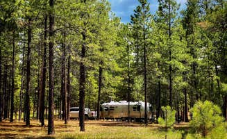
Jemez Falls Campground is located in a stunning Ponderosa Pine and forest meadow environment. The campground elevation is 7,880 feet above sea level. Come prepared for warm days and cool nights. The Cerro Pelado Area closure prohibits members of the public from entering Trail 137 from access points South of the East Fork Trailhead. Entry is allowed North from the East Fork Trailhead to Las Conchas Trailhead. Please remember that this campground is special. Help keep it clean and beautiful by using the trash dumpsters. Campground has 52 camp sites with picnic table and fire ring. Paved access which allows trailers and RV's up to 40 feet. For the 2022 Season of Use, loop 4 sites are non-generator use areas. Loops 1-3 may use generators from 6:00 AM to 10:00 PM. There is paved access from the highway and paved internal roads to individual campsites. There are no RV hook-ups. Drinking water is provided from spigots conveniently located throughout the campground. Vault toilets provide basic sanitation needs. A campground host is on duty.
Overnight camping, fishing, and hiking are main attractions. Other recreational activities include outdoor photography and nature viewing. The campground is within the heart of the Jemez National Recreation Area.
The East Fork Jemez Wild and Scenic River runs close to the campground. The campground is situated on rolling terrain shaded by pines and sunny in open meadows.
Jemez Falls, the largest waterfall in the Jemez Mountains, is a half mile hike from the campground. The Valles Caldera National Preserve and Bandelier National Monument are within short driving distance along the Jemez Mountain Trail National Scenic Byway.
$20 / night
Santa Fe Skies RV Park is family built, owned and operated. It sits on 17 acres overlooking the beautiful mountains of Santa Fe, New Mexico. We are "Big Rig friendly". Fifty five sites are pull-thrus designed to accommodate large motor coaches and travel trailer rigs. All sites are equipped with 20/30/50 amp electrical service. Water and Sewer are available at all pull-thru and almost all back-in sites. We are "pet friendly". Free Wifi is available. The RV Park is within a short driving distance to two major shopping malls (one an outlet mall), several restaurants, a large supermarket and other local businesses. We are located just off the scenic Turquoise Trail, which includes the historic Villages of Cerrillos and the artist center of Madrid. It is only a short distance from the 17th Century Spanish Colonial Living History Museum, El Rancho de Las Golondrinas, which was the last overnight stop for travelers coming to Santa Fe on the El Camino Real from Mexico. The city of Santa Fe is located at the base of the Sangre de Cristo mountains at an altitude of 7,000 ft. above sea level. (That is 1,500 ft. higher than Denver, Colorado.) Since the Santa Fe Skies RV Park sits on a ridge just outside of town, you get a panoramic view of the entire Santa Fe area! Not only can you see the historic Sangre de Cristo Mountains, where the sunset makes the mountains shine with a red glow in the evening (hence the name "Sangre de Cristo" or "Blood of Christ"), you can also see the Jemez Mountains to the west, and in the south and southwest the Cerrillos Hills, the Ortiz Mountains and the Sandia Peak at the base of which lies the city of Albuquerque.
$71 - $91 / night
At 8475 feet in elevation, Black Canyon Campground is in a great location to experience some of the finest mountain scenery the Southwest has to offer. The facility is newly renovated and provides access to a variety of outdoor recreational activities. Campers can enjoy warm days and cool weather in the summer months, providing a scenic getaway from the desert heat.
Hikers enjoy a pleasant hiking 1.5-mile trail that loops around the campground and into the surrounding forest. Several additional hiking, mountain biking and horseback riding trails are located nearby. The Pecos Wilderness can be accessed eight miles from the campground, with many trails leading to majestic peaks and through valleys, canyons and forested groves. Many recreation opportunities exist along Highway 475, both above and below Black Canyon Campground, including hiking and biking trails and picnic areas. In the winter, the area offers both Nordic and alpine skiing.
The campground is situated in a forest of pine, aspen and fir trees. A good mix of sun and shade is found throughout the area. Many beautiful views are found in the surrounding forest.
The campground is located about seven miles northeast of the town of Santa Fe, New Mexico. This unique town is known for its cultural heritage, art galleries and museums.
This location has limited staffing. Please call (505) 753-7331 for general information.
$10 / night
Riana Campground is located on a 150 ft. bluff overlooking the scenic Abiquiu Lake in northern New Mexico, just one hour northwest of charming Santa Fe. The lake sits at an elevation of 6,400 feet on the Rio Chama, a tributary of the legendary Rio Grande.
Abiquiu Lake offers many opportunities for outdoor recreation. The fishing here is some of the finest in northern New Mexico. Visitors enjoy boating, water skiing, and hiking. Lake shore access for boat launching is 1 mile from the campground.
Fragrant Pinion pine, juniper, and sage cover the campsite, providing a distinct smell of northern New Mexico, but offering limited shade. Colorful rock formations surround the park. Visitors are awarded a panoramic view of the narrow mesa, Cerro Pedernal, locally known as "Pedernal." Famous American painter, Georgia O'Keefe, had her ashes scattered over its top.
Northern New Mexico is full of beauty and history. The educational and historical Ghost Ranch is about 10 minutes from the park. The Georgia O'Keeffe Museum, San Pedro Wilderness, Cumbres Toltec Railroad, Chaco Canyon, and Bandelier National Monument are all nearby. The ski-town of Taos is just over an hour away, and colorful Santa Fe is an hour southeast, both with restaurants, shops, and museums.
For facility specific information, please call (505) 685-4561.
$20 / night
Juniper Family Campground is the ideal place to camp on the Pajarito Plateau. Located just inside the main park entrance, the campground is a short drive from the Bandelier Visitor Center, the Frijoles Canyon Shuttle bus system (mid-May to mid-October), and the adjacent towns of Los Alamos and White Rock. Juniper Family Campground is the perfect "home base" to explore the Pajarito Plateau, Jemez Mountains, and all of north central New Mexico! The campground is divided into 3 loops: Abert's Squirrel Loop (Loop A) campsites are available year-round as first-come, first serve only. Pay for first-come, first-serve campsites at the self-pay kiosk located at the Juniper Family Campground or in-person at the Bandelier Visitor Center during business hours. Black Bear Loop (Loop B) campsites are open year-round and are reservable up to 6 months in advance. Some sites may open on shorter booking windows (7 or 14 days in advance or the day of arrival). Coyote Loop (Loop C) campsites are open seasonally, March 1 October 31, and are reservable up to 6 months in advance. Some sites may open on shorter booking windows (7 or 14 days in advance). You may also book campsite reservations in Loops B & C on the day of arrival (subject to availability). HOWEVER, cell service/data is not always reliable in the park and no public WiFi is available. The park highly recommends booking your reservation from the neighboring towns of Los Alamos and White Rock before heading to Bandelier. Group campsites (in Loop A) are available by reservation only up to 12 months in advance until the day before arrival (subject to availability). Same day reservations are not available for group campsites.
Bandelier is home to over 70 miles (113 km) of hiking trails most of which are located within federally designated wilderness. Two trails are accessible directly from Juniper Family Campground. The Frey Trail follows the historic route into Frijoles Canyon and descends down the canyon wall to the Visitor Center and the Main Loop Trail. The Tyuonyi Overlook Trail leaves the amphitheater parking area for a 3/4-mile (1.2 km) hike across the open mesa top to an overlook providing breathtaking views of Frijoles Canyon and of Tyounyi, an ancestral Pueblo village. The Bandelier Visitor Center houses museum exhibits, park film, information and ranger programs, Western National Parks Association sales outlet, and more. Entrance to Frijoles Canyon and the Visitor Center is by shuttle bus only (or by hiking) from mid-May to mid-October. These areas are accesibile by private vehicle outside the shuttle bus period. Many other opportunities for recreation and exploring the history and culture of the area are nearby, such as Valles Caldera National Preserve, Manhattan Project National Historical Park, Los Alamos museums, the Jemez District of the Santa Fe National Forest, US Department of Energy public recreation trails, and others around Los Alamos County. Rock climbing is prohibited within Bandelier National Monument, however many popular climbs are within a short drive up Route 4 into the Jemez Mountains.
Bandelier National Monument protects over 33,000 acres (13355 ha) of rugged, beautiful canyon and mesa country which features evidence of human presence going back over 11,000 years. Petroglyphs, dwellings carved into the soft rock cliffs, and standing masonry walls pay tribute to the early days of a culture that still survives in the surrounding communities. Bandelier National Monument sits at the southern end of the Pajarito (Spanish for little bird) Plateau. The plateau was formed by two eruptions 1.6 and 1.4 million years ago. Home to the Bandelier Wilderness, Bandelier ranges from 5340 ft (1628 m) at the Rio Grande River to the south and 10,199 ft (3109 m) at the summit of Cerro Grande to the north, almost a mile of elevation change in just under 12 miles (19 km). This elevation gradient creates a unique diversity of habitats specific to Northern New Mexico. The diversity of habitats and quick access to water supported a relatively large population of Ancestral Pueblo people. Currently, Pi__on-Juniper woodlands dominate in the southern parts of the park transitioning through ponderosa pine savannahs and forests, finally reaching mixed conifer forests at the highest elevation. Scattered throughout the park are desert grasslands, montane meadows, and riparian areas in the canyon bottoms. Over 70 miles (113 km) of trails at Bandelier climb in and out of deep canyons and cross large flat mesas, showcasing the entire spectrum of volcanic geology and ecosystems found within the park. The park is home to over 55 species of mammals including mule deer, Abert's squirrels, mountain lions, black bears, and 16 species of bats. Reptiles and amphibians of all shapes and sizes can be seen. Birds such as Steller's jays, canyon towhees and mountain chickadees stay year-round, whereas turkey vultures, western tanagers, and black-headed grosbeaks are summer residents.
The town of Los Alamos has shopping, museums, amenities, a movie theater, ice rink, ski hill, and is home to Manhattan Project National Historic Site. Nearby Department of Energy and US Forest Service lands provide trails which accommodate pets. Valles Caldera National Preserve is 16 miles (26 km) west of Bandelier. Jemez Historic Site is 37 miles (60 km) west. Pecos National Historical Park is 70 miles (113 km) southeast. Santa Fe, 40 miles (64 km) south of the park, is home to the New Mexico state capitol, museums, historic districts, art galleries, food, accomodations, and more.
This location is unstaffed. To speak with our main office for general information, please call: (505) 672-3861.
$50 / night
Cochiti Recreation Area is located in Sandoval County, New Mexico, within the boundaries of the Pueblo de Cochiti Indian Reservation. The lake offers two public recreation areas: Cochiti on the west side of the lake and Tetilla Peak on the east side. Both sides offer spectacular scenic views of the water and surrounding mountains. The Cochiti Dam is one of the ten largest earth-fill dams in the United States, and also one of the largest in the world. The lake derives its name from the Indian Pueblo on the Cochiti Reservation.
Our quiet lake is an ideal location for all paddle, wind surfing, and sailing craft. The lake is also a popular fishing spot for species such as bass, crappie, walleye, pike, catfish, sunfish and trout. Cochiti Recreation Area has a popular, family friendly, swim beach Day Use area for public enjoyment. It is a fee area, $5 per vehicle, but the cost is covered by the campsite fee for visitors staying in the campground. Additionally, the Cochiti picnic area has 21 covered picnic sites with a large group site that can be reserved by calling the main office. Cochiti Day Use Areas are open from April 15th to October 15th.
Cochiti Lake sits at 5,343ft in elevation and is nestled in the foothills of the Jemez Mountains. Our high desert environment is dominated by juniper, pinon trees, and mixed grasslands. There are many opportunities for wildlife viewing. Four osprey nesting platforms have been erected around the lake to provide nesting sites, as well as viewing opportunities. On the east side of the lake, deer, coyote, river otters, rabbits, beavers, and the occasional bear are often sighted.
Cochiti Lake is five miles from Tent Rocks National Monument, which has fascinating geological formations.
$20 / night
Jemez Falls Campground is located in a stunning Ponderosa Pine and forest meadow environment. The campground elevation is 7,880 feet above sea level. Come prepared for warm days and cool nights. The Cerro Pelado Area closure prohibits members of the public from entering Trail 137 from access points South of the East Fork Trailhead. Entry is allowed North from the East Fork Trailhead to Las Conchas Trailhead. Please remember that this campground is special. Help keep it clean and beautiful by using the trash dumpsters. Campground has 52 camp sites with picnic table and fire ring. Paved access which allows trailers and RV's up to 40 feet. For the 2022 Season of Use, loop 4 sites are non-generator use areas. Loops 1-3 may use generators from 6:00 AM to 10:00 PM. There is paved access from the highway and paved internal roads to individual campsites. There are no RV hook-ups. Drinking water is provided from spigots conveniently located throughout the campground. Vault toilets provide basic sanitation needs. A campground host is on duty.
Overnight camping, fishing, and hiking are main attractions. Other recreational activities include outdoor photography and nature viewing. The campground is within the heart of the Jemez National Recreation Area.
The East Fork Jemez Wild and Scenic River runs close to the campground. The campground is situated on rolling terrain shaded by pines and sunny in open meadows.
Jemez Falls, the largest waterfall in the Jemez Mountains, is a half mile hike from the campground. The Valles Caldera National Preserve and Bandelier National Monument are within short driving distance along the Jemez Mountain Trail National Scenic Byway.
$20 / night
Santa Fe Skies RV Park is family built, owned and operated. It sits on 17 acres overlooking the beautiful mountains of Santa Fe, New Mexico. We are "Big Rig friendly". Fifty five sites are pull-thrus designed to accommodate large motor coaches and travel trailer rigs. All sites are equipped with 20/30/50 amp electrical service. Water and Sewer are available at all pull-thru and almost all back-in sites. We are "pet friendly". Free Wifi is available. The RV Park is within a short driving distance to two major shopping malls (one an outlet mall), several restaurants, a large supermarket and other local businesses. We are located just off the scenic Turquoise Trail, which includes the historic Villages of Cerrillos and the artist center of Madrid. It is only a short distance from the 17th Century Spanish Colonial Living History Museum, El Rancho de Las Golondrinas, which was the last overnight stop for travelers coming to Santa Fe on the El Camino Real from Mexico. The city of Santa Fe is located at the base of the Sangre de Cristo mountains at an altitude of 7,000 ft. above sea level. (That is 1,500 ft. higher than Denver, Colorado.) Since the Santa Fe Skies RV Park sits on a ridge just outside of town, you get a panoramic view of the entire Santa Fe area! Not only can you see the historic Sangre de Cristo Mountains, where the sunset makes the mountains shine with a red glow in the evening (hence the name "Sangre de Cristo" or "Blood of Christ"), you can also see the Jemez Mountains to the west, and in the south and southwest the Cerrillos Hills, the Ortiz Mountains and the Sandia Peak at the base of which lies the city of Albuquerque.
$71 - $91 / night
I will start with the only downside of this site: it is very active with hikers, families, dogs, and photographers. You can expect dozens upwards of a hundred faces a day hiking up here which can be extremely annoying and the car traffic can drive you nuts. That said, for the ease of access, for the beautiful trails, and for the clean amenities I think it is worth it. In the winter right before the ski area opens is your best bet for quiet camping. But in the summer, spring, fall, and during ski season you will have a lot of friendly faces. Again, not bad, but I know some folks are very interested in getting "away" from people while camping. To those I recommend this site for hiking and not staying. Highly recommend for folks who are less physically abled; I developed a heart condition which limits my abilities most days and the ease of access to these sites and close parking is great for someone who wants to be in touch with nature while enduring limiting conditions.
Stayed here 2 nights and had a great time. This campsite is in a great location to see the falls, and has a good layout. The pit toilets were clean, and well maintained. The camp hosts were very friendly and helpful when we had questions. I’ll definitely be back at some point!
When you first arrive to the end of the road and the beginning of the public land - you have the option to go left, straight, or right. The left turn has one semi level campsite with a homemade fire ring but not as much on that left side. The straight route has the most options I found. I drove around for 15 minutes looking for the best spot but didn't see too many pre-cleared "camping spots" from previous travelers. Plenty of places to pull over to camp with a great view.
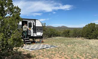
Incredible scenery, overlooking the valley and mountains in the West, with great sunsets. My first morning I was surrounded by a group of 5 cows grazing. They ended up laying 30 feet from the trailer all morning. Saw one other camper about a mile away.
The gravel roads are really tight for my 27" trailer, manageable but did rub on a couple of trees and shrubs on the drive in. Don't necessarily need a 4WD unless there is bad weather, but a few spots where ground clearance of a regular truck or SUV is important. Pretty isolated from supplies, which is the charm, but come prepared.
Great Starlink location and pretty good cell service (3/4 bars)
Don’t arrive when it’s dark. Not much going on, no fire rings, no wild horses to wake up to. Maybe it was too cold for the horses. No fire rings I saw nonetheless.
Area is open. There’s some trash right as you come in, but there’s plenty of clean spots not too much further in. Decent spot, though also popular.
There was a decent amount of snow but the road was easy enough to navigate. I came in from Las Alamos and went in about 7-8 miles. The site I found was amazing. There was a site available right as you pulled in and about 3-4 more half developed sites (fire rings) within a quarter mile walk in. It looks like there’s a bit of an OHV trail leading up the mountain, halfway. From there if you want to reach a peak you do have to bushwhack a bit. This was easily by top 10 dispersed campsites I’ve even been to and will definitely be coming back. Little to no service, roughly an hour 45 minutes from Albuquerque stayed 2 nights.
This place is about 20-30 minutes outside of Las Alamos. If you go through Santa Fe, you do have to go through a military checkpoint. There was a decent amount of snow, so I didn’t go very far in. I saw plenty of 4x4 trucks making it further than I did. The site was nice, but there was broken glass nearby so be careful. Made a couple of fires, and had a good time. From my site you could see the town below but thankfully it did not impede my view of the stars. I had full service too which was nice.
Mostly residential area until you get to the open space. I didn't make it to the actual coordinates as I took a wrong turn near the end, but there is a ton of open space out here. Easy to get to in 25' RV. Recommend.
After a long drive I found this site to be posted and closed. I’m a newbie so I could be incorrect but check USFS closures.
https://www.fs.usda.gov/alerts/santafe/alerts-notices/?aid=88339
This is my second time camping here and it is a perfect hidden gem for campervanning. Road gets a little sketchy at the end but you don’t have to go all the way to the coordinates. Beautiful sunrise and sunset. Wild horses in the area. And, you can clearly see the Milky Way. No light pollution except the beautiful view of the city far away.
We spent one night here in our class c while on our trip to Miami and yeah the road is to be taken slow but it was worth it! There is a tiny art gallery on the side of the road!! Check it out!
Campground is nestled in a bug group of dense pines and only a 15-20 minute drive from Los Alamos. Quite a few hiking trails in the areas to explore the high desert mesas and escape the heat of Albuquerque.
The place was clean. Our issues were two.
We paid $75 for one night and the WiFi was weak and we had no cell service. The place was lovely and the bathrooms were clean and easy to use. It’s located 12 miles out of the city. There is a grocery store near by with a good selection of food and alcohol.
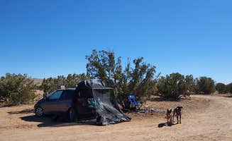
We parked a little further off 285 than most people so the road noise was minimal. A car drove past us on the dirt road in the morning which was surprising but nothing more. There was a rotting animal smell once in a while but we didn’t smell once inside the van. No toilet. Someone left a small fire ring. The road was rutted, don’t go if it’s wet. Fine for overnight lodging but I wouldn’t hang out there.
Top of New Mexico" near Albuquerque is a fantastic camping spot if you love open spaces and beautiful desert views. The sunsets here are breathtaking, and you might even spot wild horses roaming around. There's plenty of space for tents or RVs, and it's quiet and well-maintained, making it a perfect place to relax and enjoy nature. It can get a little windy, but that just adds to the experience. The road to get there winds through some houses, but once you arrive, you're surrounded by pure nature. also the food is so good, there are many food brands like subway menu who offers quality fast food services.
Unwisely, we decided to go here in a large RV. DON’T!
Stayed in #21. Sites 13 and 30 a!so good but avoid campsites downwind of toilets. No water while we were there. Very nice & helpful host. Several 1st come/1st serve sites but seems to fill up fast. Bathrooms cleanish & well used. Several convenient to back of campground. Trees. Good spot for screen tent.
This place sufficed due to the need to have somewhere for the night, if we had the chance we’d have gone somewhere else. Massive piles of trash everywhere, sites strewn with people’s leftover garbage from camping there.
Due to its close proximity to the landfill, it was extremely loud during the morning from around 7am onwards.
There was a partial closure banning camping in a section of the landfill, which was incredibly difficult to figure out where we could camp, as the map is not clear at all,
Coyotes at night were really cool.
Overall disappointing but glad we managed somewhere to sleep for the night
Excellent location and views, just need some lo g term resident clean up or eviction at entrance. We stayed for one night. Great set up and next to a brewery/restaurant in wish we would have visited. Clean bathrooms and nice sites.
We loved it. Very spacious. Fire pits here and there.
It's a lovely location, and the camp is hosted by the Army Corps. They do a good job, the facilities and grounds are very well maintained. Drinking and marijuana consumption is strictly prohibited, with the hosts making regular rounds. The sites are so close together it may as well be one big group camp; I could hear everything going on in the sites around me at all hours of the night. Even when folks were in their tents and campers. Forget trying to enjoy a quiet evening stargazing. Was surrounded by large family groups who were having a great time, which I'm glad about, but it is not my cup of tea for camping.
We loved the location. The hiking trails were awesome. We booked a reservable with hydro for one night and decided to extend our stay with the first come first serve system. The self pay stations are at each of the teo campground loops. The 2nd and 3rd night didn’t have hydro however the size of the site and view more than made up for it.
To use the dump station, you have to go to the Rangers Station and ask them to unlock the gate. The access is a bit tight and we were not able to fill our fresh water tank due to the State Park having to bring their water up by truck. All in all, it was worth it.
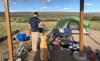
We expected a campground that was spread out, fire rings and vault toilets. It was perfect. The camp sites were far apart and you could chose between open meadows or in the trees. Hiking trails from the campground. Beautiful area.
There are no neighbors, and other vehicles are parked here, but they had to be a quarter of a mile away. Wild horses visit in the morning. We enjoyed the sunrise to sunset. There are easy hikes, and you can do some mountain biking.
Used Google Maps and had no problem finding the place. Lots of open area to choose from for parking. The road up to the location is paved but once you enter it is gravel. I have a pro master van and had absolutely no problems. Just drive slow and you should be fine. Might be worse if it was raining heavy or something but overall not a bad path. Saw wild horses which was awesome. The vegetation has a lot of thorns and spikes so for a casual hiker it’s best to stay on the gravel roads. The cell signal was pretty good but not perfect. Enough to have phone calls easy but internet connection was a bit slow.
We just happened upon this 1st come 1st serve campground & so glad we did! The camp host "Brad" was so very nice & helpful. He gave us info on all the things to do and see in the Jamez area (which is alot) Our campsite #12 was really nice. It has a large covered pavilion (not all sites have the covered pavilions) with oversized picnic table & a short path down to a private area at the Jamez River (which is really more like a creek) from our site. We left our chairs down there & frequently enjoyed relaxing there. The area is scenic & campground was very clean. There are water pumps outside the bathrooms. The cost for us was $5 per night using our America the Beautiful Senior Pass. This is a great home base for visiting the area. Would defiantly visit again!
Camping near Los Alamos, New Mexico, offers a mix of beautiful landscapes and unique experiences. Whether you're looking for a quiet spot to unwind or a base for outdoor adventures, there are plenty of options to explore.
Camping near Los Alamos, New Mexico, has something for everyone, from families to solo adventurers. Just be sure to plan ahead and enjoy the stunning scenery!
Frequently Asked Questions
What camping is available near Los Alamos, NM?
According to TheDyrt.com, Los Alamos, NM offers a wide range of camping options, with 137 campgrounds and RV parks near Los Alamos, NM and 40 free dispersed camping spots.
Which is the most popular campground near Los Alamos, NM?
According to TheDyrt.com, the most popular campground near Los Alamos, NM is Juniper Family Campground — Bandelier National Monument with a 4.7-star rating from 29 reviews.
Where can I find free dispersed camping near Los Alamos, NM?
According to TheDyrt.com, there are 40 free dispersed camping spots near Los Alamos, NM.
What parks are near Los Alamos, NM?
According to TheDyrt.com, there are 12 parks near Los Alamos, NM that allow camping, notably Santa Fe National Forest and Cochiti Lake.