

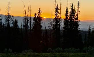
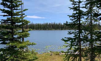
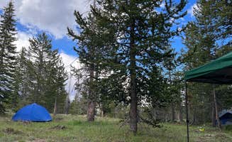
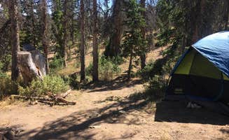
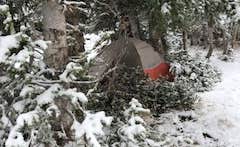


Dispersed Camping Willow Spring (Wasatch)
Ranger Review: Snapbuds and Dispersed Camping toward Willow Spring
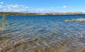
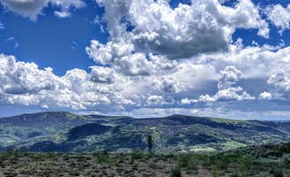
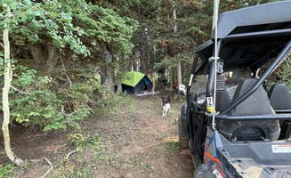
Campground Review: In my attempt to explore as many areas in Utah as I can, I came across this wonderful dispersed camping off Highway 40, south of Heber City toward Main Canyon. I had the intention of staying in a nearby campground. But when I felt the price was a bit too high for just one night, I sought adventure elsewhere. I randomly turned off toward Main Canyon and followed the dirt road until I found a spot I liked. I knew I was in dispersed national forest camping when there are signs indicating a 14 day limit. So all along this dirt road, which got pretty rocky at times, are spots to pull off and camp for the night. It can accommodate single tents, multiple tents, RVs (obviously no hookups) and trailers. There are man-made fire pits so if you start a fire, be sure to put it out completely and observe LNT (leave no trace) camping principles. Whatever you bring in with you is what you have as there are no amenities to speak of. The ground was soft and there were lots of trees from which to hang a hammock. I did forget to fill my water jug before I left my house so I had to search out a small run off stream from which I could filter water. But be sure to have a good water filter if you are going to go this route. The only real negative I have for this site (or area of sites) is that there was a lot of AVT/Side-by-side/dirtbike traffic. If that type of activity was on my list, this area would be first on my list. However, since I chose not to stay in a campground because I wanted the seclusion, the traffic was a little bit of a bummer. But, because the camping was free and everyone who passed waved and was really nice, I didn’t have too much of a problem with it. Also, the site I chose was right off the road (as majority of them are). If I wanted to hike with my stuff a little more, I found a very pretty meadow away from the road that would have been very peaceful. I guess that will have to be my next spot. OI verall, I have a love for free, dispersed camping and this area is large enough to explore for a wide variety of adventures.
Gear Review: Snapbuds
As a Ranger for the Dyrt, I get the opportunity to test out gear every so often from our amazing partners. I was given the opportunity to test out a new product called Snapbuds. The premise of this product is to help keep your earbud cords organized or untangled by use of magnets. They come in three different colors—grey, black, and white, so you can make them coordinate with your cords or stand out. The instructions are easy to follow and have a few options for how to set these little magnets into different configurations. It also has a really handy measuring tape/picture to make sure you can get the snapbuds in the right spot. I decided to try the standard configuration on my first pair of earbuds. These are designed to be permanent additions to your cords so be sure to pay attention to what direction you snap the magnets on. Once I got them on, I wrapped them up and threw them around in my bag. The magnets held and when I went to use them, all I had to do was pull the magnets apart and the cord was untangled. It was pretty sweet. I also used them while hiking around with my dog.
Overall, these are a pretty cool solution to a long standing annoyance of earbud cords.