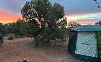
Camping near Bluff, Utah offers self-sufficient options at elevations ranging from 4,300 to 6,000 feet, with seasonal temperature variations that can exceed 30°F between day and night. The area sits at the intersection of the San Juan River watershed and high desert terrain, creating a landscape of sandstone formations and river corridors. Cellular service deteriorates quickly once outside town limits, with many dispersed camping areas having no connectivity.
What to do
Explore petroglyphs at Sand Island: Located 3 miles west of Bluff, this recreation area features extensive rock art panels. "The main attraction is the wonderful Sand Island petroglyphs, one of the best panels in the Southwest. They line a cliff on the north side of the campground... There is even one wonderful visual joke involving a kokopellis, then a group of big-horn sheep," notes a visitor to Sand Island BLM Campground.
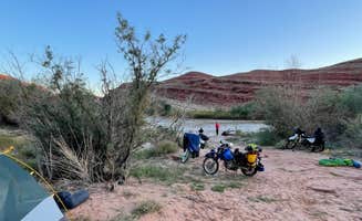
Raft the San Juan River: The river access points provide launch sites for water-based exploration. "We saw many groups of people launching rafts and kayaks down the San Juan River, so if in the area for sometime, maybe contact one of the services and go float the river," advises a camper at Sand Island.
Dark sky viewing: The minimal light pollution creates exceptional stargazing opportunities. At Goosenecks State Park, one camper explains that "It is also a Dark Sky site and has amazing star watching. Picnic table, and fire ring at each site. Location has free wifi from state park."
What campers like
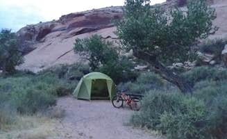
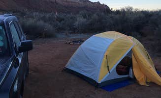
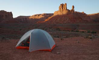
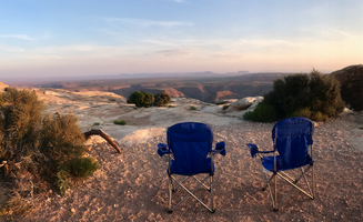
Solitude in remote settings: Many dispersed camping areas provide isolation from other visitors. At Valley of the Gods Road Dispersed, a camper reports, "We found a spot about 3km in from the 163 entrance. Great views. Windy in the afternoon but dies down around 5pm."
Wildlife viewing: The riparian zones attract diverse desert wildlife. A visitor to BLM Dispersed on San Juan River observed "Quiet, flat, beautiful. Stars were amazing at night. Lots of room. FREE!" while another mentioned seeing "hummingbirds and lizards" in the Valley of the Gods area.
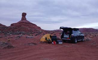
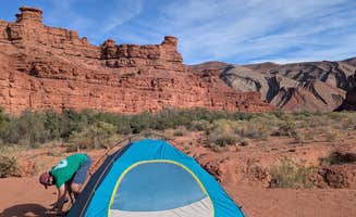
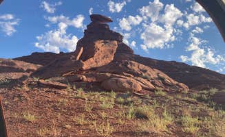
Geology and landscape: The dramatic geological formations provide both scenery and exploration opportunities. "It's like being alone on mars. This place is beautiful. The road is in great shape. The scenery is truly out of this world. Plenty of places to camp off Valley of the Gods Rd," explains a camper at Valley of the Gods Dispersed Camping.
What you should know
Road conditions vary significantly: Many dispersed sites require careful navigation. At Dispersed Mexican Hat Camping, a camper advises, "Keep left and drive past the private campground (sign says to pay online) up to the cattle grate into free BLM area."
Seasonal preparation: Weather patterns change dramatically throughout the year. A visitor to Valley of the Gods noted: "It is hot in July, but cools off at night. Constant breeze, no bugs. Bring shade as there are no trees except for a couple of spots by dry river beds."
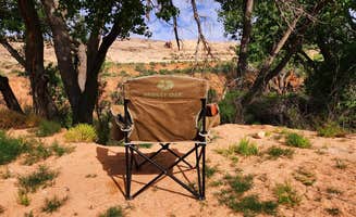
Limited facilities: Most dispersed camping areas have no services. At Goosenecks State Park, a camper points out it's "basically dispersed camping for $10 a night. There are about 4 picnic tables; they are close to the entrance and the day use area, as is the one restroom. I suggest bringing a porta potty of some kind."
Tips for camping with families
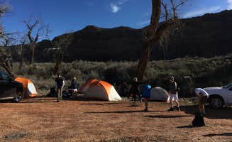
River access points: The San Juan River provides water-based recreation options. At Sand Island Recreation Area, one visitor noted it's "a cool location that really does feel like an oasis with the trees and water," and that "Loop A is quieter as it's farthest from the bridge/highway above Loop B."
Educational opportunities: Ancient cultural sites provide learning experiences. Sand Island features "hundreds of petroglyphs," and nearby "Butler wash down the road an mile or two has Boondocking and some amazing ruins that are just a mile or so off the road."
Heat management: Summer temperatures require planning. "Summers get hot, and I'd head up to Cedar Mesa if so," recommends one visitor to the area, explaining that higher elevations provide relief from extreme temperatures.
Tips from RVers
Site selection for larger vehicles: Designated areas accommodate different vehicle sizes. At Coral Sands RV Park, a visitor mentioned, "Great place to stay when in Bluff, Utah...Nancy, the campground host, is very nice and very accommodating."
Connectivity concerns: Working remotely has challenges in this region. A visitor noted that working from Coral Sands RV Park isn't ideal because "WiFi was a bit intermittent and cell reception was no better."
Level sites and utilities: RV-specific amenities vary widely. At Sand Island, "Loop B is dedicated to sizes over 26' as they are not allowed in Loop A," and "Sites are spacious with long flat gravel pads."


 Traveler