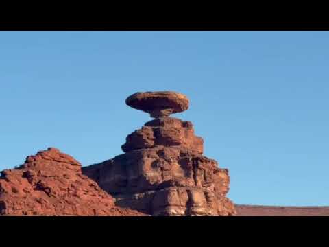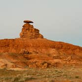
Dispersed camping along the San Juan River near Mexican Hat Rock offers free overnight stays on Bureau of Land Management land just outside the small town of Mexican Hat. Campers access multiple camping areas via dirt roads that branch off from the main route, with varying levels of difficulty depending on vehicle clearance and road conditions.
The road system provides options for different camping preferences and vehicle capabilities. Ismenia I. notes to "go past the fork (left side) towards the river," though warns the route becomes "very rugged" for lower-clearance vehicles. Several reviewers mention taking the first available spot rather than pushing deeper into rougher terrain. The camping areas spread across multiple dirt roads, with some sites suitable for larger RVs and others requiring high-clearance or 4WD vehicles to reach river-level locations.
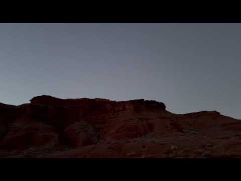
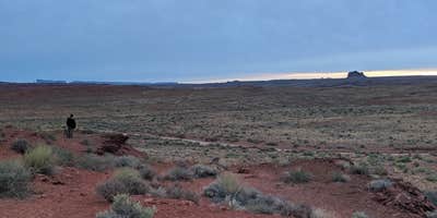
Most sites sit within walking distance of the San Juan River, where campers report deer sightings and evening wildlife activity. The proximity to Mexican Hat Rock provides a distinctive landmark visible from many camping spots. Dark skies make stargazing a highlight for overnight visitors. Rita Marie C. describes "a wide variety of spots and all a close walk to the river," including access to sandy beach areas for those willing to navigate more challenging roads.
Pack-in, pack-out policies apply throughout the dispersed camping area, with no services provided on-site. Several reviewers mention significant litter problems, particularly beer cans, requiring campers to be prepared for cleanup efforts. Cell phone coverage remains available from most sites. The nearby town provides basic resupply options, including water access at local businesses for those needing to fill tanks.
This free camping option works well for self-sufficient campers comfortable with primitive conditions and variable road access. For developed facilities, Goosenecks State Park Campground and Mexican Hat Rock provide alternative camping experiences in the immediate area.
Description
Lots of sites, all free, primitive. GREAT views of the Mexican Hat geological features. Good for 2wd cars.
RV Road Trip Guides


Map & DirectionsDispersed Mexican Hat Camping is located in Utah near Mexican Hat
Coordinates
37.17499057 N
109.85318055 W
Connectivity
 T-MobileNo CoverageVerified by 2 users
 VerizonLTEGood CoverageVerified by 32 usersLast on 6/27/26
- AT&TLTEGood CoverageVerified by 28 usersLast on 6/27/26
Connectivity
- T-MobileNo CoverageVerified by 2 users
- VerizonLTEGood CoverageVerified by 32 usersLast on 6/27/26
- AT&TLTEGood CoverageVerified by 28 usersLast on 6/27/26
Access
- Drive-InPark next to your site
Site Types
- Dispersed
Features
For Campers
- Drinking Water
- Toilets
DISPERSED CAMPING
Enjoy dispersed camping on government land and leave no trace. Pack in and pack out. No (or limited) services at this camping area. Permit may be required.
PERMIT might be REQUIRED
We curate permit requirements across the US for our PRO members. Try PRO to see if Dispersed Mexican Hat Camping needs a permit.
Drive Time
- 2 hrs 3 min from Farmington, NM
- 2 hrs 58 min from Flagstaff, AZ
- 3 hrs 36 min from Grand Junction, CO
- 4 hrs 41 min from St. George, UT