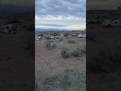
Off Highway 191 north of Moab, this dispersed camping area spreads across hundreds of sites along Klondike Bluff Road and its network of dirt offshoots. Campers access the area via a graded gravel road that deteriorates as it branches deeper into the terrain, with some sandy stretches near the entrance that challenge low-clearance vehicles.
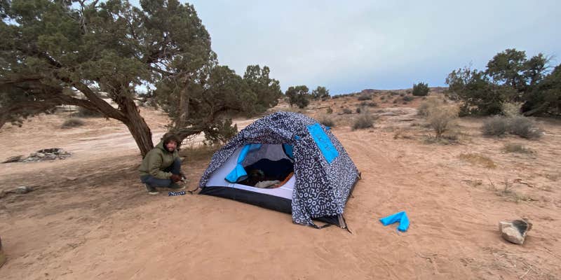
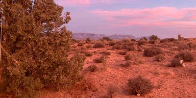
The landscape offers little natural shade among the juniper trees and red rock formations, but provides mountain views and enough space for RVs and tent campers to spread out. Bailey A. notes to "bring your own firewood, because all that is around the area are juniper trees" that grow too slowly to harvest sustainably. Most sites feature rock fire rings built by previous campers, and portable toilets are maintained near the entrance.
Road conditions vary significantly depending on how far back campers venture. The main route accommodates most vehicles for the first mile or two, but rougher terrain requires higher clearance. Some visitors report managing in front-wheel drive SUVs, while others recommend 4WD for accessing more remote sites. Cell service reaches parts of the area, particularly on Verizon networks.
The area serves as a base camp for Arches and Canyonlands National Parks, both within a 20-minute drive. Mountain biking trails connect directly from many campsites, and the location puts campers close to popular off-road vehicle routes. Sites fill quickly during peak seasons, with reviewers suggesting arrival before 3 PM to secure preferred spots.
Extended-stay campers sometimes occupy sites for weeks, creating a mix of short-term visitors and longer-term residents. The 14-day limit applies, and all trash must be packed out since no collection service operates in the dispersed area.
Description
The Moab Exchange lands were acquired by the State of Utah in 1965 in an exchange for sovereign lands within the newly-designated Canyonlands National Park. The Division of Forestry, Fire and State Lands is responsible for the management of 829-acre Prairie Dog Haven Unit and the 4,350 Dalton Wells Unit in Grand County, Utah.
In 2015, the Division of Forestry, Fire and State Lands completed the Moab Exchange Lands Comprehensive Management Plan (CMP). The CMP was designed to facilitate the management of the exchange lands under multiple-use, sustained yield principles and accommodating public and private uses to the extent that the uses do not substantially impair the public trust resources.
RV Road Trip Guides


Map & DirectionsDispersed Camping Outside of Moab is located in Utah near Moab
Coordinates
38.71815594961352 N
109.70123321286736 W
Connectivity
 T-MobileLTEGood CoverageVerified by 16 usersLast on 6/27/26
- VerizonLTEGood CoverageVerified by 14 usersLast on 6/27/26
 AT&T5GExcellent CoverageVerified by 22 usersLast on 6/27/26
Connectivity
- T-MobileLTEGood CoverageVerified by 16 usersLast on 6/27/26
- VerizonLTEGood CoverageVerified by 14 usersLast on 6/27/26
- AT&T5GExcellent CoverageVerified by 22 usersLast on 6/27/26
Access
- Drive-InPark next to your site
- Walk-InPark in a lot, walk to your site.
Site Types
- Dispersed
- Equestrian
Features
For Campers
- Trash
- Phone Service
- Drinking Water
- Alcohol
- Pets
- Fires
DISPERSED CAMPING
Enjoy dispersed camping on government land and leave no trace. Pack in and pack out. No (or limited) services at this camping area. Permit may be required.
Drive Time
- 1 hr 20 min from Grand Junction, CO
- 2 hrs 46 min from Provo, UT
- 3 hrs 16 min from Salt Lake City, UT
- 3 hrs 18 min from Farmington, NM