Camp Sites Near Lincoln, NM
Searching for the best camping near Lincoln, NM? Enjoy the scenic camping, fun activities, and sights and sounds of Lincoln. Find the best campgrounds near Lincoln, plus reviews and photos from other campers like you.
Valley of Fires recreation area is located immediately adjacent to the Malpais Lava Flow. Approximately 5,000 years ago, Little Black Peak erupted and flowed 44 miles into the Tularosa Basin, filling the basin with molten rock. The resulting lava flow is four to six miles wide, 160 feet thick and covers 125 square miles. The lava flow is considered to be one of the youngest lava flows in the continental United States. The Bureau of Land Management maintains and manages the Valley of Fires Recreation area, which is located four miles west of Carrizozo, NM, on US Highway 380. Valley of Fires offers both camping and day use. 20 of the campsites have 30 and 50 amp electrical hookups and water hookups, all sites have picnic shelters, tables, trashcans and barbeque grills. Two of the RV sites are accessible, as are the restrooms. Showers are provided in the main restroom/shower house. An RV dump station is also available. Two group shelters are accessible and available for rental. The 3/4 mile Malpais Nature Trail offers a close-up look of the lava surface.
Valley of Fires Recreation area offers opportunities for RV Camping (both full-service and primitive camp sites), tent camping and day use. The Malpais Nature trail offers a unique experience of getting trail users out into the lava. The trail is paved and accessible. Each campsite and group shelter is equipped with picnic shelter and picnic table(s) for the public's enjoyment.
From a distance, Valley of Fires appears as barren rock but when you walk through the nature trail there are many varieties of flowers, cactus, trees and bushes typical of the Chihuahuan desert. Animals include bats, roadrunners, quail, cottontails, mule deer, barbary sheep, and lizards. It's also a virtual birdwatcher's paradise with great horned owls, burrowing owls, turkey vultures, hawks, gnat catchers, cactus wrens, sparrows and golden eagles.
Carrizozo Land Partnership **The Carrizozo Land Partnership vehicle pass page is temporarily unavailable and the Roswell Field Office is currently unable to issue vehicle passes to cross private lands while collection policies for personal identifiable information are updated. All other open BLM lands remain accessible during this time. For more information please contact the Roswell Field Office at 575-627-0272.** The Carrizozo Land Partnership provides access to recreators wishing to enter public lands managed by the BLM, between the Carrizozo Lava Flow and the White Sands Missile Range which can only be reached by crossing private land. The CLP, a partnership between the BLM, private land owners and ranchers of this area, has arranged for public access to BLM lands in this area by a vehicle pass process. Once on the BLM lands in the area, the public is allowed to hunt, camp, hike, observe wildlife and other appropriate recreational activities. This partnership provides access to many miles of roads and thousands of acres of public lands for recreational enjoyment. Terrain is from flat to rolling, with some bluffy/hilly country overlooking the lava flows. High desert plant species inhabit this area, ranging from desert shrubs, multiple varieties of cactus and cedar/juniper trees. Other nearby camping/recreation opportunities: Other nearby fee areas include campgrounds in the Lincoln National Forest, and the BLM Rob Jagger's Campground. There are numerous private RV Campgrounds in the area as well. Additonal nearby attractions include Capitan, Lincoln, and Ruidoso. Capitan, located 24 miles east of the Valley of Fires on U.S. Highway 380, is known as the birthplace of Smokey Bear, and features a popular visitor center. Lincoln, located 37 miles east on U.S. Highway 380, is famous as the site of the historic Lincoln County Wars as well as the exploits of Billy the Kid and Sheriff Pat Garrett. Ruidoso is a popular resort town that features a horse racetrack, the Ski Apache skiing resort, and the Inn of the Mountain Gods casino. The BLM's Fort Stanton National Conservation Area, located approximately 27 miles east of the Valley of Fires on U.S. Highway 380, has 93 miles of sustainable horseback, mountain biking, and hiking trails that wind through open meadows and canyons. Trails are marked with flexible fiberglass markers with the trail name or an arrow attached to the marker. Cross-country horse and foot travel is allowed. Mountain bikes are strongly encouraged to stay on established trails to protect the rider as well as the landscape. The trails offer great views of the surrounding Sacramento and Capitan Mountains. The majority of the trails start at the Rob Jaggers Campground on NM 220 where you will find excellent camping opportunities, water for your animals, and vault toilets.
$25 / night
One of the top 5 RV parks in New Mexico according to RV Life Magazine! Over 200, 5-star Google reviews.
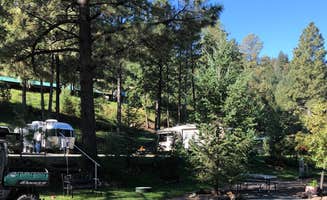
Midtown Mountain Campground & RV Park is located in the beautiful Lincoln National Forest and also offers tent sites and cabins, providing visitors with a comfortable and enjoyable camping experience. The campsites are well appointed and offer beautiful views of the surrounding mountains and forest. There’s convenient access to hiking, mountain biking and fishing and visitors can also explore nearby attractions, including the Ruidoso Downs Race Track and Casino, the Hubbard Museum of the American West, and the historic Village of Lincoln. It’s an ideal destination for families and groups with Ruidoso offering a solid selection of restaurants, shops and attractions.
$45 - $70 / night
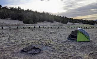
Several shelters, tables and fire rings are located here as well as a vault toilet. All sites are dry and on a first come/first served basis. The access road off of US 380 is graveled. There are no fees for camping in this area.
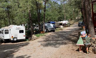
Beautiful park on the Rio Bonito. Come spend one night or longer with us at Bonito Hollow Rv park. Located 15 minutes north of Ruidoso. One of the best parks in Ruidoso area with a wooded environment. We accommodate rigs of all size. We have a large park area for your enjoyment, which includes sand volleyball, horseshoe pits and a dog run. Within seconds to the national forrest.
$40 - $54 / night
Slow Play RV Park
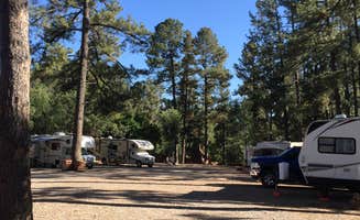
142 spacious sites with 30 and 50 amp full hookups. Formerly Circle B. Restroom and laundry facilities on site. General Store, pavilion, paved interior roads
Hi! We are Scott and Jennifer Allen, your camp hosts and concierges. We are super excited to help you have the best Ruidoso experience in Lincoln County! We are the new owners of the former Circle B RV Park in Ruidoso, NM and we can’t wait to put our twist on one of the biggest and nicest RV parks in town. We have grand ideas for the park to make your vacation the best it can be. We will be in the process of adding a playground for the kiddos, an outdoor movie park, arcade, and plenty of entertainment to help it feel like a Saturday at the park, every day!
We can’t wait to meet you!
Rob Jaggers Camping Area: This site consists of 2 large day use parking areas, 2 vault toilets, and facilities for staging horseback riding. There are 27 campsites with electricity and potable water hookups, and other potable water outlets scattered throughout. Campites and horse corrals are first-come, first-served. Camping is restricted to the campground only and no camping is permitted in the day use parking area. Occasionally the campground is rented out for Special Recreation Permitted events. When this happens notification will be made to the public in the form of a news release. BLM requires a Special Recreation Permit for some events. Please contact the Roswell Field Office to determine if a Special Recreation Permit is required for your event. There is water and electricity located at the group shelter. To make group shelter reservations, please contact the camp host at 575-322-0030, or for more information please contact the Roswell Field Office.
RECREATION OPPORTUNITIES This unique NCA has many opportunities for hiking, caving, horseback riding, mountain biking, camping, visiting cultural and historic sites, picnicking, hunting, wildlife viewing, nature study, and photography. There is drinking water and toilets at the Rob Jaggers Camping Area and at the Cave Campgrounds.__ Trails__ (Hiking, Biking, Horseback Riding) Fort Stanton NCA has 73 miles of sustainable horseback, mountain biking, and hiking trails that wind through open meadows and canyons. Trails are marked with flexible fiberglass markers with the trail name or an arrow attached to the marker. Cross-country horse and foot travel is allowed. Mountain bikes are strongly encouraged to stay on established trails to protect the rider as well as the landscape. The trails offer great views of the surrounding Sacramento and Capitan Mountains. The majority of the trails start at the Rob Jaggers Camping Area on NM 220 where you will find hitching rails, water for your animals, and a vault toilet.__ Rio Bonito Petroglyph National Recreation Trail Hike the Petroglyph Trail along the Rio Bonito and glimpse into the past. At the midpoint of the Trail, in the river bed, is Petroglyph Rock. Etched on this rock are depictions of an ancient people known as the Jornada Mogollon who have long since left the area. Very little evidence has stood the test of time, but here on the Petroglyph Trail remains a link to the culture and lifestyle of these ancient people.__ The Trail can be reached from NM 220, west of the Sierra Blanca Regional Airport. Follow the highway signs stating ___Upper Rio Bonito___ to the bottom of the hill and turn right for approximately 250 ft then take the next left until you reach the trailhead (high-clearance vehicles are recommended). Petroglyph Rock is a short 450 ft walk from the parking area. The loop trail is approximately 2.1 miles in total length and is easy-to-moderate hiking with a few hills and areas with loose footing. Plan to spend approximately one hour on the Trail.__ Historical Sites__ Historic Fort Stanton is one of very few intact frontier forts in the West. Many of the original Fort buildings still stand. From 1855 to 1896, the Fort played host to some of the most colorful units and personalities of the West, including the 9th Cavalry, and the 24th, 57th, and 125th Infantry Buffalo Soldiers, Billy the Kid, Lew Wallace, Colonel Kit Carson, and General ___Black Jack___ Pershing. The post was also a Merchant Marine hospital & tuberculosis sanatorium, and World War II prisoner of war camp. In 1953, the Fort and 1,320 surrounding acres were transferred from Federal to State ownership, becoming a state hospital and training school until 1955. Today, the Fort area is active with other State activities and the Fort Stanton Museum is open on a daily basis (http://fortstanton.org/).\_\_ Caving__ Fort Stanton Cave__ With over 40 miles of mapped passages, the Cave is normally open for recreational caving under permit from April 15 to November 1. However, due to the threat of White Nose Syndrome (WNS), which has killed 8 million bats in the eastern and southern states, and has been identified nearby in Texas, the Cave has been placed in a recreational caving moratorium pending research and monitoring of the unwanted arrival of WNS.__ The Cave is widely known for its rare velvet formations, and there are also interesting helictites, aragonite, selenite needles, and various forms of gypsum. During the winter months the Cave is closed to protect hibernating bats. The Cave is gated to protect other unique resources and to prevent unsupervised visitation. Please check back with this website for any changes to the recreational caving moratorium.__ Snowy River__ Very slow moving groundwater dissolved the grayish-brown limestone in which the Cave is formed and recrystallized that limestone into a white-colored mineral called calcite. Through numerous infillings of groundwater saturated with calcite, followed by draining and drying, repeated coats of calcite were laid on the bottom of the Cave through the entire 11 miles of Snowy River passage that has been surveyed to date. This unique white crystalline deposit glistens like snow and may be the longest calcite formation in North America. Several endemic microorganisms have been discovered in this new section of the Cave. In this sunless environment, species living here do not get their energy from the sun. Instead, they chemically break down rock. In the process, they create chemical byproducts that could have pharmaceutical uses. There are also several species that have formed symbiotic relationships with each other.__ Continuing exploration and scientific research will help us better understand the formation of caves in this area, improve our understanding of groundwater hydrology of the region, and increase our knowledge of the biology of the Cave. In the years to come, many new biological discoveries are anticipated. Due to the scientific importance of the Cave, the Snowy River passage is not open to the public. BLM is planning interpretive products in the future so the public can enjoy and better understand this unique resource.__ Camping__ The Fort Stanton NCA is open to overnight camping with a 14-day maximum length of stay. To camp, vehicles may pull off any of the dirt roads, but no more than 90 feet from the road. There are two formal camping areas: The Rob Jaggers Camping Area on NM 220 and the small Cave Campground near Fort Stanton Cave entrance.__ Cave Campground - Several tables and fire rings are located here, as well as a vault toilet. The access road is graveled.
Fort Stanton Snowy River Cave National Conservation Area: Surrounding the Rob Jagger's campground is the Fort Stanton Snowy River Cave National Conservation Area (NCA). At around 6300' elevation the NCA offers a diverse habitat of High Desert cedar/juniper hillsides with Ponderosa Pine stringers and hardwoods meandering through the canyon bottoms.__ Petroglyph Rock: Along the Rio Bonito River petroglyph trail is Petroglyph Rock. Etched on this rock are depictions of an ancient people known as the Jornada Mogollon who have long since left the area. Very little evidence has stood the test of time, but here on the Petroglyph Trail remains a link to the culture and lifestyle of these ancient people. Snowy River Cave: The Cave is widely known for its rare velvet formations, and there are also interesting helictites, aragonite, selenite needles, and various forms of gypsum. During the winter months the Cave is closed to protect hibernating bats. The Cave is gated to protect other unique resources and to prevent unsupervised visitation.__
__Nearby camping/recreation opportunities: The BLM's Fort Stanton National Conservation Area has 93 miles of sustainable horseback, mountain biking, and hiking trails that wind through open meadows and canyons. Trails are marked with flexible fiberglass markers with the trail name or an arrow attached to the marker. Cross-country horse and foot travel is allowed. Mountain bikes are strongly encouraged to stay on established trails to protect the rider as well as the landscape. The trails offer great views of the surrounding Sacramento and Capitan Mountains. The majority of the trails start at the Rob Jaggers Camping Area on NM 220 where you will find hitching rails, water for your animals, and a vault toilet. Additonal nearby attractions include Capitan, Lincoln, and Ruidoso. Capitan, located approximately 5 miles west of the Rob Jagger's Campground on U.S. Highway 380, is known as the birthplace of Smokey Bear, and features a popular visitor center. Lincoln, located 8 miles east on U.S. Highway 380, is famous as the site of the historic Lincoln County Wars as well as the exploits of Billy the Kid and Sheriff Pat Garrett. Ruidoso is a popular resort town that features a horse racetrack, the Ski Apache skiing resort, and the Inn of the Mountain Gods casino__ Valley of Fires Recreation Area: The Bureau of Land Management maintains and manages the Valley of Fires Recreation area, which is located four miles west of Carrizozo, NM, on US Highway 380 approximatley 27 miles west of Rob Jagger's Campground. Valley of Fires offers both camping and day use. Most of the campsites have 30 and 50 amp electrical hookups, water hookups, picnic shelters, tables, trash cans and barbeque grills.Other water hydrants are scattered throughut the recreation area. Two of the RV sites are accessible, as are the restrooms. Showers are provided in the main restroom/shower house. An RV dump station is also available. Two group shelters are wheelchair accessible and available for rental. The 3/4 mile Malpais Nature Trail offers a close-up look of the lava surface.__ Carrizozo Land Partnership: The Carrizozo Land Partnership (CLP) provides access to recreators wishing to enter public lands managed by the BLM, between the Carrizozo Lava Flow and the White Sands Missile Range which can only be reached by crossing private land. The CLP, a partnership between the BLM, private land owners and ranchers of this area, has arranged for public access to BLM lands in this area by a vehicle pass process. The form required for applying for access can be found here: https://www.blm.gov/programs/recreation/permits-and-passes/lotteries-and-permit-systems/new-mexico/carrizozo-land-partnership Please note that a vehicle pass is required for each vehicle (including OHVs) that will be entering the partnership area. Once on the BLM lands in the area, the public is allowed to hunt, camp, hike, observe wildlife and other appropriate recreational activities. This partnership provides access to many miles of roads and thousands of acres of public lands for recreational enjoyment.__The roads are extremly rocky and rough and a high clearance 4x4 vehicle or side by side is recomended. Terrain is from flat to rolling, with some bluffy/hilly country overlooking the lava flows. High desert plant species inhabit this area, ranging from desert shrubs, multiple varieties of cactus and cedar/juniper trees.__
$20 / night
Eagle Creek RV Resort is a perfect home for touring many of the popular attractions throughout southern New Mexico. Private & nestled on 33 acres we have a variety of sites that range from open to wooded. Once a ski resort the old wheel house & chair lift are still in place and add a unique flair to the forest scenery with hiking trails to the top of the mountain. We have an abundant of birds & wildlife including deer, elk and a herd of horses that are frequent visitors.
$40 - $45 / night
Valley of Fires recreation area is located immediately adjacent to the Malpais Lava Flow. Approximately 5,000 years ago, Little Black Peak erupted and flowed 44 miles into the Tularosa Basin, filling the basin with molten rock. The resulting lava flow is four to six miles wide, 160 feet thick and covers 125 square miles. The lava flow is considered to be one of the youngest lava flows in the continental United States. The Bureau of Land Management maintains and manages the Valley of Fires Recreation area, which is located four miles west of Carrizozo, NM, on US Highway 380. Valley of Fires offers both camping and day use. 20 of the campsites have 30 and 50 amp electrical hookups and water hookups, all sites have picnic shelters, tables, trashcans and barbeque grills. Two of the RV sites are accessible, as are the restrooms. Showers are provided in the main restroom/shower house. An RV dump station is also available. Two group shelters are accessible and available for rental. The 3/4 mile Malpais Nature Trail offers a close-up look of the lava surface.
Valley of Fires Recreation area offers opportunities for RV Camping (both full-service and primitive camp sites), tent camping and day use. The Malpais Nature trail offers a unique experience of getting trail users out into the lava. The trail is paved and accessible. Each campsite and group shelter is equipped with picnic shelter and picnic table(s) for the public's enjoyment.
From a distance, Valley of Fires appears as barren rock but when you walk through the nature trail there are many varieties of flowers, cactus, trees and bushes typical of the Chihuahuan desert. Animals include bats, roadrunners, quail, cottontails, mule deer, barbary sheep, and lizards. It's also a virtual birdwatcher's paradise with great horned owls, burrowing owls, turkey vultures, hawks, gnat catchers, cactus wrens, sparrows and golden eagles.
Carrizozo Land Partnership **The Carrizozo Land Partnership vehicle pass page is temporarily unavailable and the Roswell Field Office is currently unable to issue vehicle passes to cross private lands while collection policies for personal identifiable information are updated. All other open BLM lands remain accessible during this time. For more information please contact the Roswell Field Office at 575-627-0272.** The Carrizozo Land Partnership provides access to recreators wishing to enter public lands managed by the BLM, between the Carrizozo Lava Flow and the White Sands Missile Range which can only be reached by crossing private land. The CLP, a partnership between the BLM, private land owners and ranchers of this area, has arranged for public access to BLM lands in this area by a vehicle pass process. Once on the BLM lands in the area, the public is allowed to hunt, camp, hike, observe wildlife and other appropriate recreational activities. This partnership provides access to many miles of roads and thousands of acres of public lands for recreational enjoyment. Terrain is from flat to rolling, with some bluffy/hilly country overlooking the lava flows. High desert plant species inhabit this area, ranging from desert shrubs, multiple varieties of cactus and cedar/juniper trees. Other nearby camping/recreation opportunities: Other nearby fee areas include campgrounds in the Lincoln National Forest, and the BLM Rob Jagger's Campground. There are numerous private RV Campgrounds in the area as well. Additonal nearby attractions include Capitan, Lincoln, and Ruidoso. Capitan, located 24 miles east of the Valley of Fires on U.S. Highway 380, is known as the birthplace of Smokey Bear, and features a popular visitor center. Lincoln, located 37 miles east on U.S. Highway 380, is famous as the site of the historic Lincoln County Wars as well as the exploits of Billy the Kid and Sheriff Pat Garrett. Ruidoso is a popular resort town that features a horse racetrack, the Ski Apache skiing resort, and the Inn of the Mountain Gods casino. The BLM's Fort Stanton National Conservation Area, located approximately 27 miles east of the Valley of Fires on U.S. Highway 380, has 93 miles of sustainable horseback, mountain biking, and hiking trails that wind through open meadows and canyons. Trails are marked with flexible fiberglass markers with the trail name or an arrow attached to the marker. Cross-country horse and foot travel is allowed. Mountain bikes are strongly encouraged to stay on established trails to protect the rider as well as the landscape. The trails offer great views of the surrounding Sacramento and Capitan Mountains. The majority of the trails start at the Rob Jaggers Campground on NM 220 where you will find excellent camping opportunities, water for your animals, and vault toilets.
$25 / night
One of the top 5 RV parks in New Mexico according to RV Life Magazine! Over 200, 5-star Google reviews.
Midtown Mountain Campground & RV Park is located in the beautiful Lincoln National Forest and also offers tent sites and cabins, providing visitors with a comfortable and enjoyable camping experience. The campsites are well appointed and offer beautiful views of the surrounding mountains and forest. There’s convenient access to hiking, mountain biking and fishing and visitors can also explore nearby attractions, including the Ruidoso Downs Race Track and Casino, the Hubbard Museum of the American West, and the historic Village of Lincoln. It’s an ideal destination for families and groups with Ruidoso offering a solid selection of restaurants, shops and attractions.
$45 - $70 / night
Beautiful park on the Rio Bonito. Come spend one night or longer with us at Bonito Hollow Rv park. Located 15 minutes north of Ruidoso. One of the best parks in Ruidoso area with a wooded environment. We accommodate rigs of all size. We have a large park area for your enjoyment, which includes sand volleyball, horseshoe pits and a dog run. Within seconds to the national forrest.
$40 - $54 / night
Slow Play RV Park
142 spacious sites with 30 and 50 amp full hookups. Formerly Circle B. Restroom and laundry facilities on site. General Store, pavilion, paved interior roads
Hi! We are Scott and Jennifer Allen, your camp hosts and concierges. We are super excited to help you have the best Ruidoso experience in Lincoln County! We are the new owners of the former Circle B RV Park in Ruidoso, NM and we can’t wait to put our twist on one of the biggest and nicest RV parks in town. We have grand ideas for the park to make your vacation the best it can be. We will be in the process of adding a playground for the kiddos, an outdoor movie park, arcade, and plenty of entertainment to help it feel like a Saturday at the park, every day!
We can’t wait to meet you!
This is a very run down park, do not stop here! We stopped to dump and was told by the manager to go dump anywhere and then as soon as we dumped, it started back filling out. Then a lady came up to us and told us they were having sewer problems. Crazy that the manager would tell us yes when he knew it wouldn’t work for us.
Has one handicap accessible & next to bathroom). There is a group site that has three picnic tables under a shelter and two grills. 2 RV sites have covered picnic tables and grills and water and electric hookups. Five tent sites. One of the tent locations is at the handicap accessible site. CLEAN restrooms with flush toilets and drinking water are available. Pets are allowed in the campground(on leash), but are not allowed on the trails. Petroglyph trails are rocky, but not difficult (keep your eyes peeled, there are petroglyphs everywhere). Hosts were very nice. Campground has well-functioning electronic/pay check-in. Great BLM campground. Other places in area include Malpais lava flows. Sierra Blanca hovers to the east. Sunset was early in Nov. so if hiking trails in late afternoon take a flashlight. Nearby Carrizozo reportedly has a photo gallery or three that we were told were well worth checking out but we did not get chance to do so.
The pictures I saw didn’t do this park justice. That’s a switch. Yeah, the RV spots are gravel. But it’s southern New Mexico. There is an actual spring here. The trees around it have a couple of Great Horned owls who have come out nightly. But it’s the New Mexico sunsets and stars that make this such a nice place. Good price for full hook ups, and John our host is a really nice guy
We spent three nights here. It was far enough off the main road, a couple miles, so there was no traffic noise. The owner, Crystal, super attentive to communications. The camp hosts Bob and Mardyth were so sweet. We had truck trouble and had to take it to a mechanic, and Bob came and picked us up and brought us back to the park. The park has full hook ups, a nice shower and laundry and book exchange, and a central area for relaxing and barbecuing. Some nice hiking in the area. A good spot to have as a homebase to visit White Sands National Park and Alamogordo, where the Space museum was.
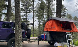
Not bad we had our son and 2 big doggos and a RTT we just wanted to rest for the night but it ended up being awesome for a little pull off. Very clean and nice only about 4-5 spots with car parking, others are across the bike bridge.
We had a great night drove through the entire area and off roads to find a nice quiet area we had our son and two big doggos and had plenty of space for them to roam. Lots of trails nearby and the lake of course!
Campsites are to close, Camp host DO NOT keep the quite hours. Parties destroy the quite. Parties going until 2AM.
Actually not really sure what the camp host does, they started a leaf blower during morning quit hours ( I could stay home for that).
Saddle and Apache are nice with campsites further apart....but stay away from silver.
On a good note, if you are in Cloudcroft go to Mad Jacks BBQ.....the Beef Ribs are AWESOME, it is REAL TEXAS bbq.
This was a beautiful location, near the town of Cloudcroft. We enjoyed the cooler weather up in the mountains. It was peaceful and quite. There were not very many spaces available. We should have have just stayed in the first location we found though. We went to the end of the road to find out that there was no way to turn our 29 ft trailer. We had to go in reverse about 1/4 mile to find a place to turn around.
Wanted to spend one nite in rivian with rooftop tent. Were told we are not allowed to plug-in our electric vehicle.
There is NO River, small stream in a ditch. LIE# 2. Internet indicates SHOWERS. However if your camper has a shower ACCESS TO SHOWERS. DENIED!!! Also No fires allowed ! Highway noise drowns out any Peaceful sounds. In truth: NO Amenities… play in the ditch or stay in your camper.
We have a 30 foot motor home and were so glad to find a dispersed spot in the mountains we could fit!
Rim Trails and Alamo Peak Trails in walking distance. There were other campers nearby but it was quiet and beautiful.
No cell service except for a few bars down the road toward Alamo Peak.
Elk, hummingbirds, all tucked away in aspen grove. This is a special spot.
Wrong time of year too come to Baca , snow covered. Able too park , spent one nite. Saw one other camper maybe two hundred yards away. Very quite. I’ll be back when the weather warms up for sure.
This was a really nice spot we stumbled upon. It's about 13 miles off the 54 on BLM land. The road was smooth (though gravel most of the way). It was also super quiet since it was so far away from the road. The actual camp was in the trees and great views of the surrounding mountains. Each spot has a table, fire pit, and gazebo. There are also a few trailheads at the back of camp. The only downside was that it cost $15.
This was a decision while we were in Alamogordo trying to find an RV place in Ruidoso. What sold us to be there was the 5 star review. We knew the spaces were tight and it was in a commercial area but we were curious what it was about.
We were very happy with the two nights we spent here. I think the ease of picking a spot that worked for our situation, the clean park and bathrooms and friendly staff and neighbors made it surprisingly one of the best RV experiences we’ve had.
The high was 75 and the low was 45. It rained the first morning for about an hour. The main road is noisy, but we knew what we were getting into so it didn’t bother us.
The best part about this place was how close it was to stores, food, and gas. It’s really opened my eyes to how we can RV parks as a pass through in our journey to take advantage of electric and water and experience the local food and shops.
Ruidoso alone is a quintessential mountain town and it’s a must see visit in Lincoln National Forrest.
Quiet, relaxing & convenient to the town of Cloudcroft. The owners are very nice and very accommodating. Everything was clean & in good working condition. Highly recommend and would definitely stay again if in the area.
First time ever I’m going to Ruidoso me and my wife didn’t really have a plan one night after sleeping in the Walmart parking lot we were driving down and saw midtown and asked if they do one night rentals at a time teepee site wasn’t fully done, but they allowed us to stay in there for a great price and helped us out when we had no idea what we were doing. I want to thank Midtown campground & RV park for the amazing time we had there
Three Rivers Petroglyph BLM , NM Campground: Great location between White Sands and Valley of the Fires. It is about 3 miles from the highway off a gravel road that is in good condition. (Scale 1- bad, 5-Very good
(71 yr olds in 17’ trailer.)
Overall Rating: 3 because most sites are in a large open gravel area . Our site: 4
Price 2024: $ w interagency pass
Security: No
Usage during visit: Full each night mostly with one or two night stays.
Site Privacy: 1 and 2 are set off by themselves a bit. The rest have no privacy.
Site Spacing: fine
Site surface: gravel
Reservations: First come first serve v
Campground Noise: Quiet
Outside Road Noise: No
Through Traffic in campground: Folks come in to hike.
Electric Hookup: Sites 1 & 2
Sewer Hookup: No
Dump Station: No
Potable Water Available: Yes. Filter the water.
Generators: Yes
Bathroom: Very well kept flush toilets.
Showers: No
Pull Throughs: Most are
Cell Service (AT&T): 1 to 2 bars.
Setting: Open desert shrubbery between the splendid looking White Mountains and
Recent Weather: Winy time of year.
Solar: Absolutely.
Insects: None.
Host: On site.
Rig Size: Some sites can fit a large 5th wheel.
Sites: Most of the few sites are spread out in a graveled area. There is not much distinction between sites. Sites 1 and 2 set off from the rest and are the best sites.
Valley of Fire CG, NM: The RV area sits on a ridge. Great views. Tenting area sits by itself. No views there, but looks nice. (Scale 1- bad, 5-Very good
(71 yr olds in 17’ trailer.)
Overall Rating: 5 for a campground offering space and extraordinary views.
Price 2024: $ 35 w interagency pass
Security: no
Usage during visit: RV area was full every day.
Site Privacy: no
Site Spacing: nice
Pad surface: blacktop
Reservations: Some sites require reservations. Some sites are first come first serve.
Campground Noise: Nice and quiet
Outside Road Noise: light trafficed highway might create some noise for the first few sites.
Through Traffic in campground: Some day visitors.
Electric Hookup: some sites
Sewer Hookup: no
Dump Station: yes
Potable Water Available: at most sites
Bathroom: one main bathroom. Also, two smaller bathrooms towards each end of the campground.
Showers: yes. Clean. Push button timer type. Hot water
Pull Throughs: yes
Cell Service (AT&T): four bars
Setting: on a ridge overlooking the black lava flow on one side and desert on the other
Recent Weather: windy
Solar: definitely
Insects: none
Host: yes
Rig Size: large rigs, no problem
Sites: 1-14: views both ways. Extraordinary sunset views. 15- 18: the views are nice, but one direction. away from the valley of fires view. 18 & 19 are more secluded.
James Canyon, NM: This is right off the highway, so easy access. There are only two sides when you can accommodate an RV.. A couple folks parked in the parking lot overnight. Ad jacent highway noise is very noticeable, however, traffic is pretty light and very late at night time. (Scale 1- bad, 5-Very good
(71 yr olds in 17’ trailer.)
Overall Rating: For a stop over: 4.
Price 2024: Free
Security: no
Usage during visit: two RV sites filled up. Ted sites for him to. Room in the parking lot. Small Riggs only
Site Privacy: no
Site Spacing: good
Pad surface: RV sites
Reservations: no
Campground Noise: no, no
Outside Road Noise: noticeable
Through Traffic in campground: no, except for stopping to use the bathrooms
Electric Hookup: no
Sewer Hookup: no, no
Dump Station: no
Potable Water Available: No
Generators: allowed
Bathroom: very clean pit toilets
Showers: no
Pull Throughs: both RV sites are back in. A little bit of extra work is required to back the trailer down to go to one of the two site.
Cell Service (AT&T): no
Setting: just off the highway
Recent Weather: cool nights
Solar: some
Insects: none
Host: no
Rig Size: much over 22’ would be difficult
While some of the sites are a little close together, the campground itself is very spacious (15 acres!) with a large dog park and a new building for activities. The bathhouse is a set of single bathrooms (one women’s, one men’s) with one toilet and one shower each, so I’d recommend using the bathroom in your rv if possible to avoid a line, but the bathrooms are very clean and feel like a bathroom you’d find inside someone’s home. Sites are placed far enough back from the road that there is very very minimal noise. The entire property was very quiet and peaceful, and Gail was a dream to work with.
My only complaint was the WiFi signal was very poor, and virtually unusable during the evenings—cell service is also minimal due to the location, but I was able to work remotely using my T-Mobile hotspot.
We stayed 2 nights. Bathrooms were clean and the hikes were very fun. To see and imagine the people who created the petroglyphs was incredible. We also drove to the mountain camp area and took a short hike up the 3 river. It was fun!
We were able to catch a first come first serve site. It had awesome views of the mountains and a nice shade shelter. The pit toilets were clean and showers are always a plus. The hike through the lava rocks was informative and easy. Love this place!
It's a decent pull off from a random dirt road in New Mexico. You have to drop off into a slight ditch to get to the spot, about 3-4 inches I'd say. We were fine in a truck camper but it's something to consider. There was a decent amount of local trees traffic on the road, but we were far enough away from the highway that we couldn't hear much of any road noise. Literally just a patch of somewhat level gravel
First come first serve. 2 sites w elec/water no sewer hook up. Great cel service. Perfect spot!
Three Rivers Campground finally reopened "for good" at the start of 2024 after some stops and starts due to fires around the area.
This place is unique as it is one of the few places you can camp on the Western edge of Sierra Blanca / the White Mountain Wilderness. Tons of hiking opportunities with 3 separate trails originating at the campground.
Well maintained dirt roads lead up to the campground. There's a single spot where water flows over the road but it was only an inch or so deep and padded with concrete.
$6 per vehicle per night. Hosts present and active. Very nice couple watching over the sites.
Please tread lightly, leave no trace, and be gentle with the wilderness. This place has gone through a lot of fire related hardships.
This was a good patch of dirt and trees up in the mountain with a good clearing to park the truck. Very much so dispersed camping with no amenities. The road up was a little muddy but over all smoother and easy. We picked a spot at the highest point along Bailey Canyon Rd. There were several other dispersed spot further down the road. Nobody in sight, no animal sightings either.
RV area is old and not really kept up, a lot of trucks park here and stay at the motel. Close to the railroad tracks south bound train just track noise , the north bound start blowing their horn I think a mile south of town and don’t quit until they are a mile north of town. The lady that manages the park is very friendly and helpful. Can’t say enough good about her.
Camping near Lincoln, New Mexico, offers a mix of stunning landscapes and unique experiences. Whether you’re looking for a quiet spot to unwind or an adventurous getaway, there are plenty of campgrounds to choose from.
Camping around Lincoln, NM, has something for everyone, from families to solo adventurers. Just remember to check the specifics of each campground to ensure a great experience!
Frequently Asked Questions
What camping is available near Lincoln, NM?
According to TheDyrt.com, Lincoln, NM offers a wide range of camping options, with 104 campgrounds and RV parks near Lincoln, NM and 16 free dispersed camping spots.
Which is the most popular campground near Lincoln, NM?
According to TheDyrt.com, the most popular campground near Lincoln, NM is Valley Of Fires Recreation Area with a 4.7-star rating from 32 reviews.
Where can I find free dispersed camping near Lincoln, NM?
According to TheDyrt.com, there are 16 free dispersed camping spots near Lincoln, NM.
What parks are near Lincoln, NM?
According to TheDyrt.com, there are 4 parks near Lincoln, NM that allow camping, notably Lincoln National Forest and Cibola National Forest and National Grasslands.