Best Tent Camping near Heeney, CO
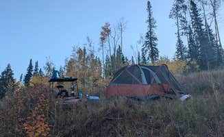
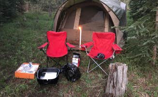
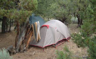
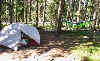
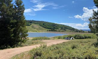
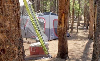
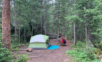
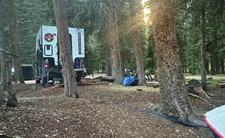
Looking for the best tent campgrounds near Heeney? The Dyrt helps you find campsites with tent camping near Heeney. From remote to easy-to-reach, these Heeney campsites are perfect for tent campers.
This designated dispersed camping area along County Road 10 has 23 sites.
**Please note: Camping is ONLY allowed in areas designated by a sign. ** Camping in undesignated spots could result in a citation from the U.S. Forest Service. Not adhering to camping duration maximums or using U.S. Forest land for residential purposes could result in a citation from the U.S. Forest Service.
Please refer to special orders and contact the USFS Offices with questions: https://www.fs.usda.gov/Internet/FSE_DOCUMENTS/fseprd842796.pdf
Regulations pertaining to designated dispersed camping are as follows:
Camp only in designated sites.
No camping at trailheads.
Food and garbage must be properly secured in bear-resistant containers or inside vehicles in sealed containers.
Pack out all waste: human, garbage, paper, organics, etc.
There are many dispersed camping opportunities in the forest ranging from backpacking to car-camping along designated Forest Roads. Visitors are encouraged to minimize resource impacts by utilizing established sites rather than creating new ones. Dispersed camping sites along Forest Roads are shown on Motor Vehicle Use Maps, which are available free of charge at ranger district offices.At the start of the tour you immediately have spectacular views of the Blue River Valley and the majestic Tenmile Range. The road, managed by Summit County, follows the old South Park and Pacific Railroad bed, climbing on a gradual 3% grade. The road climbs past Bakers Tank to the summit of Boreas Pass at the Continental Divide. The road then continues down the other side of Boreas Pass for another 10.4 miles to the town of Como in Park County. From 1872 to 1938 the road was used as a narrow-gauge railroad and gained fame as the nation’s highest narrow-gauge railroad, running from Como to Breckenridge. This is a great road to view Fall colors. This road is open to highway legal vehicles only during May-October, and closed to motorized vehicle access seasonally at Summit County discretion, generally October to May.
There are many dispersed camping opportunities on the forest ranging from backpacking to car-camping along designated Forest Roads. Visitors are encouraged to minimize resource impacts by utilizing established sites rather than creating new ones. Dispersed camping sites along Forest Roads are shown on Motor Vehicle Use Maps, which are available free of charge at ranger district offices. Visitors are permitted to drive vehicles up to 300 feet from designated routes for purposes of dispersed camping as long as no resource damage is incurred in the process. Dispersed camping within 100 feet of lakes, streams, and forest system trails is prohibited unless otherwise designated. Campers may stay for a maximum of 14 days. Some areas may have additional special restrictions. This dirt road begins at the paved Red Sandstone Road near Vail and ends at either Piney Lake or Hwy 131 north of Wolcott: This road gets heavy vehicle traffic and also a fair number of mountain bike riders, so please share the road. The climb is gradual and steady, and all but the very lowest of passenger cars can handle this relatively easy dirt road. The road winds its way up along Red Sandstone Creek and then Indian Creek with occasional views south over Vail Mountain, before reaching its high point near the trailhead for Lost Lake Trail. Here you can choose to head west toward Muddy Pass and Hwy 131, or head toward Piney Lake as your destination. Enjoy the peace and beauty here or take a hike up the Upper Piney River Trail, but remember that the lake is surrounded by the Eagles Nest Wilderness and is closed to bikes.
Five miles north of Nederland, National Forest System Road (NFSR) 226, commonly known as Gordon Gulch, turns east off of Colorado Highway 72. NFSR 226 intersects other forest roads: NFSR 314, 228, 233 and their off-shoots. There are 15 numbered, designated campsites scattered along the road system within 1.5 miles east of Highway 72. Camping is permitted in designated sites only. Take care when driving in this area. Snow and mud can persist through most of the year. The free Boulder Ranger District Motor Vehicle Use Map displays National Forest System (NFS) routes open to motorized travel and is available online and at the Boulder Ranger District offfice.
Streams; treat water for drinking.
This small campground with 5 campsites is located in the Cataract Creek drainage just above Green Mountain Reservoir. There are many trails in the area that access the Eagles Nest Wilderness.
Dispersed Camping information: https://www.fs.usda.gov/Internet/FSE_DOCUMENTS/fseprd577265.pdf
With a few exceptions, dispersed camping is allowed on national forest public lands. Camping in the national forest at one location is limited to 14 consecutive days. The campsite must then be moved a minimum of three miles. Camping can then continue for an additional 14 days. Camping is restricted to a maximum of 28 days in any 60-day period.
More than 40% of lands within the Arapaho National Forest boundary are private or otherwise owned. A map showing land ownership is recommended. It is YOUR responsibility to know if you are on private, city, county, state, national park or national forest land.
Pack out all trash. There are no services.
Practice Leave No Trace ethics
Free camping (dispersed) is allowed on most national forest lands except in highly developed areas - such as trailheads, campgrounds and picnic sites - and in some of our most visited places. Be sure to check for regulations in advance and look for signs in the area to indicate if camping is allowed.
Some areas allow camping in designated sites only.
Know Before You Go
Check the weather and road closures before heading up. Follow Leave No Trace principles. There are no facilities or trash receptacles. Pack out what you pack in. Make sure camping is allowed. Many lands within the national forest boundary are private or otherwise owned. Check that you’re on National Forest lands: maps. Don't stay too long. Camping is limited to 14 days.within any continuous 30-day period. at any location within the same 20-mile radius. see Order Plan on building a campfire? Campfire restrictions can occur any time of year. Check for fire restrictions and if you build a campfire, know how to extinguish it.
PLEASE NOTE: The water here contains heavy metals giving the water a distint blue/white color. People and pets should not drink from this water.
Please bring in drinking water
There are currently thirty designated sites with anticipation of adding more in the coming years. Please note that this area is surrounded by private land parcels and they aren't all marked. Campers must camp at a designated site or will otherwise likely be camping on private property.
Peru Creek is popular and will fill up on the weekends. Visitors should arrive early to make sure to get a site. The road can be narrow at times but is accessible to normal clearance vehicles. Low-clearance vehicles may have a hard time. Peru Creek Road is a popular place for OHV rentals to visit so drive slow and carefully. AT&T cell service is intermittent at the lower sites (1-8).
Bear activity has been increasing. For this reason a food storage order is in effect at all developed campgrounds on the Eagle/Holy Cross Ranger District, and the Piney Gaurd Station, Tigiwon Lodge, Mount of the Holy Cross Overlook, Homestake Road FSR 703, and Nolan Creek Road. This order requires all food and refuse to be stored in hard-sided vehicles, approved bear-resistant containers, or supended at least 10 feet clear of the ground at all points and four feet horizontally from any supporting tree or pole. This order has been issued to provide for public safety and wildlife conservation. Hopefully it will reduce wildlife habituation problems. The Halfmoon Campground is located at the top of Tigiwon Road #707 near the boundary for the Holy Cross Wilderness in a forested setting; all wilderness regulationsmust be observed when traveling in the wilderness (foot and horse travel only). This campground is located at the trailheads for several hiking trails and is heavily used by hikers who are climbing Mount of the Holy Cross. Due to the nature of the Forest Road to the campground and the short parking spurs within the campground, the Halfmoon Campground is not suitable for most RVs. There is a printable Recreation Quicksheet for this campground which is complete with directions, details, and other information about this campground.
The Eagle-Holy Cross Ranger District lies between the Gore Range, the Sawatch Range, and the Flat Tops, and includes the forest areas surrounding the towns of Vail, Avon, Red Cliff, Eagle, Gypsum, and Dotsero. Recreation opportunities abound on the Eagle-Holy Cross Ranger District. View Eagle-Holy Cross Ranger District Recreation Quicksheets for downloadable Recreation Opportunity Guides, maps and other information. See below for information on recreation activities of all sorts.
Bumpy ride up, but we were able to do it in our car SLOWLY. Absolutely beautiful place. Lots of campsite options. I was under the impression fires were allowed, as there were fire pits, but signs everywhere stating no campfires. Columbine Lake is a pretty hefty hike from the trailhead, but so worth the view. Had the entire place to ourselves pretty much all Friday. Beautiful beautiful beautiful
Camp sites were plenty when I visited on a Thursday. Only people I saw were the forest service workers who were friendly and just out reminding people of the fire ban.
$35/night. What a wonderful place to camp under the stars. One of the cleanest NP campgrounds I’ve come across. Closed until May 2025.
And in fact I believe they were KOA of the year 2023 or 2024. More expensive than we're used to, but has nice amenities. Sites level with concrete pads, fairly large. Some space between with trees. Nice metal patio furniture provided at each site(chairs, table, fire pit). Has decent showers, hot tubs, and off leash dog park. Inexpensive pancake breakfast and pizza/wings to your site are available, also an onsite store. Kind of at the top of a rise, so good views but also kind of chilly for July (60s/40s). Massive thunderstorms with hail and heavy rain two evengings (CO mountains tend to get afternoon t-storms). Communicate via text to let you know about goings on. Good radio station out of Idaho Springs KYGT 102.7 and 103.9
Great trip. Beautiful campground. Beautiful scenery
I spent the night at Base Camp because the campgrounds North and South of Ned were full and it was dark and getting late. You have to be lucky with those ones to get one of the few good spots that are there. I have been to the convenience store at BC before and it was closer to Idaho Springs (I was going there the next day to meet a friend). $39 per night for a tent site is INSANE. I could have stealth camped and there was another spot I could’ve gone too but BC was close and I was tired. I guess that’s how they make their business. Begrudgingly it worked for what I needed.
The place fills up on the weekend. I drove through most of the trail system and did not find a spot. Came back during the week and took a closer spot so as not to risk it. Trash is everywhere. Multiple poop spots are within 100ft of the fire pit with copious amounts of used tp lying around. Trees are slashed, cut, and the forest is not doing well. There are multiple long term campsites here so watch out for squatters. I stayed near the start and then a bit deeper, which prompted me to take photos. I forget the site numbers but honestly it’s not looking good in most places. At the very back are what look like a few nicer spots because they are hard to get to with a non off-road vehicle. It breaks my heart how this campground exists.
I came on a Sunday afternoon before Columbus Day and there were plenty of spots open. Super close to town and stunning views.
Multiple sites up here for camping. Trailer/RV friendly.
Doggies loved it, not many people
Two beat up, broken down cars at the entrance. Road is very rough, full of potholes from the start. Did not feel comfortable staying here.
Beautiful, but really need a compact 4x4 to get into and out of parking lot and there are tent sites only. We almost didn’t make it out with our 24 ft van (checked it out but didn’t stay overnight). Very crowded on a Saturday at 4:30pm.
Not super busy! Lots of open spaces when we arrived around 6pm.
I arrived after 6pm and the office was closed. However, self service was available. Though the only option was to pay by cash since the office was closed. Water Dump was not available and some toilets were closed. It has a great view of the lake from some spots, however, you can hear the road during night. Cell phone reception is poor but available.
I came in October when the aspens and birch still had some leaves . Beautiful colors on bareus pass
Just one mile further up the road or so you will reach Destinated camp sites which I prefer.
Although I saw 5 camp cars parked on the side of the road (this is a Monday night) facing the cliff that night and like 2 the next morning when I left for work. I was jealous a little bit of their views
Definitely would advise 4x4, and not for travel trailers at all. Bringing one up could lead to a serious situation , since there are no places to turn around whatsoever. That said, views were absolutely breathtaking. We also lucked out and saw the northern lights while at site.
This spot was really easy to get to and had at least one bar of service for Verizon and T Mobile. The spot was nice and secluded, but there was some trash left behind from previous campers:(
A little off the beaten path and may need 4wd to get down and out from campsite. Overlooks the beautifulu valley and is amazing to Lake Granby on three horizon. A little windy up there and trees are burnt up but the view is worth it. Very secluded at this spot. Did see 4 or 5 other cars/campers at other spots but very spread out.
My husband bought a new tent so we just wanted to find something kinda close to Denver but still beautiful for just a quick overnight trip. Our goal was Chinns lake but stupid Apple Maps took us here instead. It was still beautiful and there were a handful of spots still open for us. I wouldn’t recommend for a big group unless you get there early and claim the whole top but we really enjoyed it! The lake was low but still beautiful.
Place has very good views from the mountain, however, the terrain isn't level. I found it difficult to get a good spot for my camper to be leveled.
When I arrived, I found out the water had been turned off for the season and the dump station was closed, this should be noted on the website in a spot where you can’t miss it Almost all the spots are on the slope so there are steps you have to go down to your table. Spots are very close to each other, no privacy. Tables are old, wooden, and slanting in a lot of the spots. The worst part is the traffic noise, I definitely won’t return to this campground.
We camped here after a Red Rocks show. The spot is a great area. About 20 minutes off of I-70. There are many pull offs along this road that could theoretically be good camp sites. However there are “no camping” signs, which is why I gave it 3 stars. Everything is great besides that: beautiful stars, good tent site, safe parking area.
The spot we chose is a bit farther down the road than the one listed here. It’s in between the bend in the road. We parked at the pull off and walked down a small hill to find a good tent site and a fire ring.
Also be aware it’s pretty chilly compared to just a few miles up the road. It was in the mid 30s at night.
The FR611 is narrow and requires a high clearance vehicle. I had to go to 4LO multiple times. I went up Boreas Pass and turned down FR611 which made it down hill most the way. The spot it self is open enough for multiple vehicles had three old fire pits. Very pretty spot but no fall colors all pines in this valley.
Loved this campground in Rocky Mountain NP! Full of new growth pine trees. Elk wondered through on some days. Depending on site, lots of privacy. Not for big rigs, but perfect for vans, tents and smaller trailers. Bathrooms clean, flush toilets. Only drawback to this stay - the dump station was already closed down for the season. Water was available. We found a dump station down the road in Stillwater Recreational area.
Plenty of spots available. But land and trees are decimated from fire in 2020. But hey it’s a free spot to sleep
The road has been closed and there is no longer access to this camp area.
Frequently Asked Questions
Which is the most popular tent campsite near Heeney, CO?
According to TheDyrt.com, the most popular tent campground near Heeney, CO is Boreas Pass Road Designated Dispersed Camping with a 4.6-star rating from 37 reviews.
What is the best site to find tent camping near Heeney, CO?
TheDyrt.com has all 96 tent camping locations near Heeney, CO, with real photos and reviews from campers.