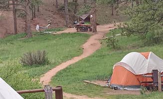
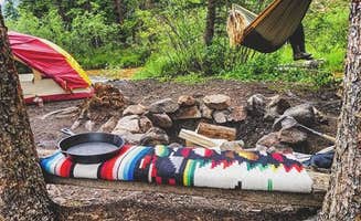
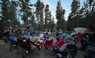
Best Tent Camping near Conifer, CO
Looking for the best tent campgrounds near Conifer? The Dyrt helps you find campsites with tent camping near Conifer. From remote to easy-to-reach, these Conifer campsites are perfect for tent campers.
Five miles north of Nederland, National Forest System Road (NFSR) 226, commonly known as Gordon Gulch, turns east off of Colorado Highway 72. NFSR 226 intersects other forest roads: NFSR 314, 228, 233 and their off-shoots. There are 15 numbered, designated campsites scattered along the road system within 1.5 miles east of Highway 72. Camping is permitted in designated sites only. Take care when driving in this area. Snow and mud can persist through most of the year. The free Boulder Ranger District Motor Vehicle Use Map displays National Forest System (NFS) routes open to motorized travel and is available online and at the Boulder Ranger District offfice.
Streams; treat water for drinking.
Mueller's campground has 136 campsites each with a picnic table and fire ring. There are 99 electric sites, many with tent pads and 22 basic walk-in sites in Prospector Ridge (sites 55-66) and Turkey Meadow (sites 100-109) Campgrounds. Sites 12 and 22 are handicapped designated sites. You must have a handicapped placard or license plate.
Campground Amenities The Comfort Station is open year-round. The Camper Services Building is open only in summer (Mid May - Mid October) Both buildings contain flush toilets. On-site accommodations include firewood for sale, a camper services building with coin-operated showers/laundry and modern restrooms, vault toilets, dump station and a playground.
Mueller offers three group campground opportunities nestled in the aspen and conifer forest, conveniently located near the Camper Services Building.
Winter Camping: Mid October - Mid May Mueller has 29 electrical sites available within the Peak View Campground and the Revenuers Ridge Campground (Sites 1 –9, 11-13, 15-22 and 81 – 89) during the winter. The Comfort Station, containing flush toilets, will remain open. Vault toilets will be open at Outlook Ridge, Peak View Campground and across from site #87. Water is available at the outside spigot at the Comfort Station; all other hydrants are closed, so we suggest bringing your own water. The dump station is dry dump only, which means you will not have water to rinse out your equipment.
$18.00 per night Mueller State Park has 4 backcountry campsites located in 2 separate groups. Both backcountry campsite groups require an approximate 1.5 mile hike from the Black Bear Trailhead to the sites. Sites are available to reserve from May 1 through October 31st.
$18 - $396 / night
This designated dispersed camping area along County Road 10 has 23 sites.
**Please note: Camping is ONLY allowed in areas designated by a sign. ** Camping in undesignated spots could result in a citation from the U.S. Forest Service. Not adhering to camping duration maximums or using U.S. Forest land for residential purposes could result in a citation from the U.S. Forest Service.
Please refer to special orders and contact the USFS Offices with questions: https://www.fs.usda.gov/Internet/FSE_DOCUMENTS/fseprd842796.pdf
Regulations pertaining to designated dispersed camping are as follows:
Camp only in designated sites.
No camping at trailheads.
Food and garbage must be properly secured in bear-resistant containers or inside vehicles in sealed containers.
Pack out all waste: human, garbage, paper, organics, etc.
There are many dispersed camping opportunities in the forest ranging from backpacking to car-camping along designated Forest Roads. Visitors are encouraged to minimize resource impacts by utilizing established sites rather than creating new ones. Dispersed camping sites along Forest Roads are shown on Motor Vehicle Use Maps, which are available free of charge at ranger district offices.At the start of the tour you immediately have spectacular views of the Blue River Valley and the majestic Tenmile Range. The road, managed by Summit County, follows the old South Park and Pacific Railroad bed, climbing on a gradual 3% grade. The road climbs past Bakers Tank to the summit of Boreas Pass at the Continental Divide. The road then continues down the other side of Boreas Pass for another 10.4 miles to the town of Como in Park County. From 1872 to 1938 the road was used as a narrow-gauge railroad and gained fame as the nation’s highest narrow-gauge railroad, running from Como to Breckenridge. This is a great road to view Fall colors. This road is open to highway legal vehicles only during May-October, and closed to motorized vehicle access seasonally at Summit County discretion, generally October to May.
Camping is allowed at numbered designated campsites. No fee is charged. Practice Leave No Trace Principles.
Camping is limited to 14 days in one location. After 14 days, your camp must be moved at least three miles away.
Maximum stay is 28 days within a 60-day period. After 28 days, all property and people must leave the Roosevelt National Forest.
Dispersed Camping information: https://www.fs.usda.gov/Internet/FSE_DOCUMENTS/fseprd577265.pdf
With a few exceptions, dispersed camping is allowed on national forest public lands. Camping in the national forest at one location is limited to 14 consecutive days. The campsite must then be moved a minimum of three miles. Camping can then continue for an additional 14 days. Camping is restricted to a maximum of 28 days in any 60-day period.
More than 40% of lands within the Arapaho National Forest boundary are private or otherwise owned. A map showing land ownership is recommended. It is YOUR responsibility to know if you are on private, city, county, state, national park or national forest land.
Pack out all trash. There are no services.
Practice Leave No Trace ethics
NOTE: Campers who build any fires face fines up to $5,000 and/or up to six months imprisonment for open fire violations.
Leave No Trace must be observed, as in any outdoor space.
In any season this area is prone to very strong dry winds that can pick up a hot coal from a campfire that has lain dormant for as much as three days and ignite dry vegetation, causing horrific devastation. People from outside Colorado may not understand how tinder dry this area can be. 197 homes in this area have been destroyed by wildfires. All of these fires were started by humans.
Local residents overlook this area and if they see visible flame or smoke they will call the Boulder County sheriff. Any campers who require a campfire are recommended to disperse camp near Sugarloaf Mountain where fires are permitted.
PLEASE NOTE: The water here contains heavy metals giving the water a distint blue/white color. People and pets should not drink from this water.
Please bring in drinking water
There are currently thirty designated sites with anticipation of adding more in the coming years. Please note that this area is surrounded by private land parcels and they aren't all marked. Campers must camp at a designated site or will otherwise likely be camping on private property.
Peru Creek is popular and will fill up on the weekends. Visitors should arrive early to make sure to get a site. The road can be narrow at times but is accessible to normal clearance vehicles. Low-clearance vehicles may have a hard time. Peru Creek Road is a popular place for OHV rentals to visit so drive slow and carefully. AT&T cell service is intermittent at the lower sites (1-8).
There were a lot of options for us to pull off and camp. We had gone the day after a snow storm and the road was decent. I guess snow plows go through often since there’s nearby residential. Each campsite was decently spaced and far enough from the road so that you can U turn it and it doesn’t feel like you’re just pulling off to the side (accommodated out RTT nicely) There were great views and the pups enjoyed it.
Bumpy ride up, but we were able to do it in our car SLOWLY. Absolutely beautiful place. Lots of campsite options. I was under the impression fires were allowed, as there were fire pits, but signs everywhere stating no campfires. Columbine Lake is a pretty hefty hike from the trailhead, but so worth the view. Had the entire place to ourselves pretty much all Friday. Beautiful beautiful beautiful
The road here has some gnarly washboards. I had to slow down to a crawl at points because it was thrashing my rig around so much. There is also one turn on the road where if you’re not careful, I could imagine getting stuck. However, the views are incredible and it was well worth the effort. Cell signal from Verizon is extremely good, I am getting 5G UWB and download speeds of 180mbps. There’s some cool hills to climb and many great views.
And in fact I believe they were KOA of the year 2023 or 2024. More expensive than we're used to, but has nice amenities. Sites level with concrete pads, fairly large. Some space between with trees. Nice metal patio furniture provided at each site(chairs, table, fire pit). Has decent showers, hot tubs, and off leash dog park. Inexpensive pancake breakfast and pizza/wings to your site are available, also an onsite store. Kind of at the top of a rise, so good views but also kind of chilly for July (60s/40s). Massive thunderstorms with hail and heavy rain two evengings (CO mountains tend to get afternoon t-storms). Communicate via text to let you know about goings on. Good radio station out of Idaho Springs KYGT 102.7 and 103.9
Stayed in spot RV24. Easy access right off freeway and convenient to TPB start. Some nice small trails in area for easy walking. Mostly pine trees. Orderly, camp hosts seem inclined to enforce rules. Quiet.No campfire pits so no burning allowed at all and most folks seem to knock off early. Showers are available for.25/2 min with a 4 min max. Appeared old, clean.
For road cyclists: Good place to stay for Triple Bypass
Food aside: Cooked Hatch green chile sausage and added to Sprouts Hatch mac and cheese and put into burritos. Ate leftovers for breakfast. Low FQ (fart quotient).
I spent the night at Base Camp because the campgrounds North and South of Ned were full and it was dark and getting late. You have to be lucky with those ones to get one of the few good spots that are there. I have been to the convenience store at BC before and it was closer to Idaho Springs (I was going there the next day to meet a friend). $39 per night for a tent site is INSANE. I could have stealth camped and there was another spot I could’ve gone too but BC was close and I was tired. I guess that’s how they make their business. Begrudgingly it worked for what I needed.
The place fills up on the weekend. I drove through most of the trail system and did not find a spot. Came back during the week and took a closer spot so as not to risk it. Trash is everywhere. Multiple poop spots are within 100ft of the fire pit with copious amounts of used tp lying around. Trees are slashed, cut, and the forest is not doing well. There are multiple long term campsites here so watch out for squatters. I stayed near the start and then a bit deeper, which prompted me to take photos. I forget the site numbers but honestly it’s not looking good in most places. At the very back are what look like a few nicer spots because they are hard to get to with a non off-road vehicle. It breaks my heart how this campground exists.
Situated of 9,400 ft. Altitude ! Not for everyone! Clean, in the forest.
Very clean, very well maintained. Large spaces near the lake.
I came on a Sunday afternoon before Columbus Day and there were plenty of spots open. Super close to town and stunning views.
Two beat up, broken down cars at the entrance. Road is very rough, full of potholes from the start. Did not feel comfortable staying here.
Beautiful, but really need a compact 4x4 to get into and out of parking lot and there are tent sites only. We almost didn’t make it out with our 24 ft van (checked it out but didn’t stay overnight). Very crowded on a Saturday at 4:30pm.
Not super busy! Lots of open spaces when we arrived around 6pm.
I came in October when the aspens and birch still had some leaves .
Just one mile further up the road or so you will reach Destinated camp sites which I prefer.
Although I saw 5 camp cars parked on the side of the road (this is a Monday night) facing the cliff that night and like 2 the next morning when I left for work. I was jealous a little bit of their views
Finally, a nice campsite on a road that isn't horrible. There are 30+ designated, numbered, dispersed campsites on this road. Each of them have a parking area right along the road with a fire ring a short distance away surrounded by awesome rock outcroppings. The parking areas tend to be very unlevel and there are only a few that you can pull right up to your campsite. #6 had a level spot large enough for my van and the camping area just a few steps away. These are great campsites and the area is really awesome. After so many horrible roads and places closed, it was a blessing to find this spot. The road is a bit of a washboard, but that is nothing compared to most of the forest roads in Colorado. Highly recommended! Cell service with At&t in site 6 is decent. Calling is 2 bars. at least half of the sites are big rig friendly. All of the sites are 100% free.
My husband bought a new tent so we just wanted to find something kinda close to Denver but still beautiful for just a quick overnight trip. Our goal was Chinns lake but stupid Apple Maps took us here instead. It was still beautiful and there were a handful of spots still open for us. I wouldn’t recommend for a big group unless you get there early and claim the whole top but we really enjoyed it! The lake was low but still beautiful.
We camped here after a Red Rocks show. The spot is a great area. About 20 minutes off of I-70. There are many pull offs along this road that could theoretically be good camp sites. However there are “no camping” signs, which is why I gave it 3 stars. Everything is great besides that: beautiful stars, good tent site, safe parking area.
The spot we chose is a bit farther down the road than the one listed here. It’s in between the bend in the road. We parked at the pull off and walked down a small hill to find a good tent site and a fire ring.
Also be aware it’s pretty chilly compared to just a few miles up the road. It was in the mid 30s at night.
The FR611 is narrow and requires a high clearance vehicle. I had to go to 4LO multiple times. I went up Boreas Pass and turned down FR611 which made it down hill most the way. The spot it self is open enough for multiple vehicles had three old fire pits. Very pretty spot but no fall colors all pines in this valley.
Site 4 featured 3 well established campfire rings, one with a lean-to. The three spots are separated enough to enjoy with seclusion, also had plenty of parking. There are a number of easily accessible trails nearby. Surrounded by pines there weren't a lot of Aspens turning for the season visible from camp, but the hikes in the area led to some beautiful vistas and meadows that afforded opportunities to see seas of leaves turning. This site required AWD and good clearance to get to, but well worth it and offered a good out of the way camping experience and great star gazing opportunity as there was a new moon when we went, so saw plenty of shooting stars and the milky way!
We camped a very short walk from the parking lot. Amazing camp site with not many people around.
Busy and right off highway
We stayed one Saturday on Hoosier and we were able to find a spot. Not super private and lots of off leash dogs but beautiful walking trails!
Overall a very fun spot if you have a vehicle with some ground clearance to get to the nice sites by the reservoir. My Peak Edition Atlas handled it well. Only complaint is the damn project at Gross reservoir is a 24 hour site and the lights are ridiculously bright.
We parked in the parking lot and walked into the valley. After a while we found quite a lot of options with fireplaces already there. So you should mostly find something.
It is quiet, but also a popular spot for hikers so early in the morning, some people arrived. But you can camp far enough in the valley and away from the trail. Water is available if you have a purifier or filter system.
We stayed on site 21, arrived around 5pm on a Thursday night and it was amazing! We were shocked the site was still available, a couple other sites also had great views but 21 was definitely impressive. We read the previous reviews which made it easy for us to find. Sunset was beautiful, it was quiet and peaceful, and the moon lit up the entire area. Each site had a stoned fire pit and there are marked site numbers. The road up was busy with people leaf peeping so drive carefully, as of Sept 19th aspens were bright yellow and leaves were changing beautifully.
We came here after failing to find a dispersed location closer to Silverthorne. It turned out to be a hidden gem with lots of secluded sites. Plus the drive in/out is super easy (apart from the final road to the campsite; that requires a 4WD vehicle, without question) - it was more-or-less the same drive time as original choice. Just without the hassle of navigating a busy one-way dirt road.
Frequently Asked Questions
Which is the most popular tent campsite near Conifer, CO?
According to TheDyrt.com, the most popular tent campground near Conifer, CO is Gordon Gulch Dispersed Area with a 3.6-star rating from 49 reviews.
What is the best site to find tent camping near Conifer, CO?
TheDyrt.com has all 72 tent camping locations near Conifer, CO, with real photos and reviews from campers.