The Ouachita National Forest surrounding Umpire, Arkansas sits at elevations ranging from 600 to 2,600 feet with rugged terrain characterized by east-west ridges and valleys. The region receives approximately 55 inches of rainfall annually, contributing to the lush forest environment and numerous waterways. Summer temperatures can reach the mid-90s with high humidity, while winter nights often drop below freezing between December and February.
What to do
**Kayaking opportunities: Cossatot River State Park's Falls area offers challenging whitewater during high flow periods. "The river is beautiful. The fishing is excellent. The park is quiet and very clean," notes one visitor to Cossatot Reefs - Gillham Lake. Swimming conditions vary based on water levels, with some rapids reaching Class IV difficulty.
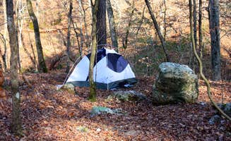
**Rock exploration: The geological formations at Cossatot Falls create natural climbing and scrambling areas. "It's not for the faint of heart or people avoiding physical activity because trekking the huge river boulders is not easy. But the beauty is worth it. The water is crystal clear and you can watch fish swim by," explains a reviewer at Cossatot Falls Campsites.
**Disconnected hiking: Trail systems throughout the region offer varying difficulty levels. "We go often for the hiking, the views, and the ability to disconnect with it all," reports a camper about Shady Lake Campground. Most trails remain accessible year-round, though heavy rainfall can make stream crossings challenging during winter and spring.
What campers like
**Creek-side camping: Stream-adjacent sites provide natural white noise. "We secured a spot right up from the creek. It was so nice to listen to the running water while sleeping," shares a camper from Shady Lake Campground. Creek access provides relief during hot summer months when temperatures regularly exceed 90°F.
**Diverse terrain: The region's topography creates distinct camping microclimates. "We parked at the visitor center and hiked the 5-6 miles to the state park. Beautiful moderate hike. If you go right after some heavy rain, all the falls along the trail will be flowing at full blast," reports a visitor to Cossatot Falls Campsites. Elevation changes create temperature variations of 5-10 degrees between valley and ridge sites.
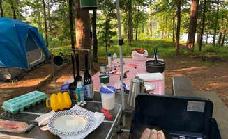
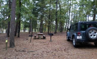
**Spacious campsites: Many campgrounds offer well-separated sites. "The sites had decent separation but the middle row of the Sandbar campground would be tight if there had been a lot of people," notes a camper at Cossatot River State Park. Site sizes vary significantly across the region, with some accommodating multiple tents while others best suit single setups.
What you should know
**Road conditions: Access routes to many sites require preparation. "Wish I could say the same thing about the gravel logging road in! O.o OH MY LORT!! It will test your suspension!!" warns a camper about Cossatot Falls. Most unpaved roads become significantly more challenging after rainfall, with some impassable in wet conditions.
**Limited connectivity: Cell service varies dramatically across the region. "Oh - no cell service. You can decide whether that is a good thing or not (I loved it). If you're really desperate, you can drive 5 mins down the road and get a signal," explains a visitor to Shady Lake Campground. The mountainous terrain creates cellular dead zones, particularly in valleys.
**Water level fluctuations: Stream and lake conditions change rapidly. "ALERT: WATER SUBJECT TO SUDDEN RISE," notes information about COE Lake Greeson Star of the West. Flash flooding can occur within hours of heavy rainfall, particularly during spring storm season.
Tips for camping with families
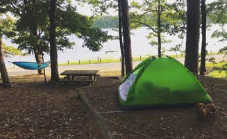
**Water recreation options: Multiple swimming areas cater to different abilities. "Lake swimming is super simple but we enjoyed it. There's a dock a little way out from the shore to swim to and jump off of. The bottom is covered with leaves, but hey, it's a lake," shares a Shady Lake Campground visitor. Most designated swimming areas remain shallow near shore, deepening gradually.
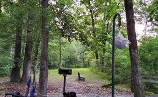
**Wildlife viewing opportunities: The diverse ecosystem supports varied animal sightings. "You can hear the Owls and Coyotes at night," notes a camper at Daisy State Park Campground. Dawn and dusk offer the best wildlife viewing times, with white-tailed deer common throughout the region.
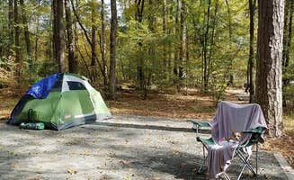
**Tent pad considerations: Camping surfaces vary between locations. "The campsites are gravel and good luck putting your tent spikes in!! Ain't gonna happen," warns a Cossatot River visitor. Many established sites include wooden tent platforms or compacted gravel that requires specialized stakes.
Tips from RVers
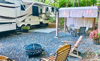
**Hookup variations: Electric service differs between campgrounds. "All sites are 1st come, no reservations. About 16-20 sites with water and electricity. Water spigots around park for dry campers to fill their tanks," explains a visitor to Shady Lake Campground. Most RV-accessible sites offer 30-amp service, with 50-amp connections available at select locations.
**Site positioning challenges: Some campgrounds have awkward layouts. "The water faucet at the site was so far from the RV pad we had to go into town and buy additional hose but that was just fine! Now we have extra!" reports a camper at Mama Gaia's Zen Garden. Water connections often require 50+ feet of hose, particularly at older campgrounds.
**Seasonal road access: RV routing requires planning during certain times. "The campground is not in walking distance to the Cossatot River," clarifies a reviewer. Many remote campgrounds require navigating narrow forest roads with limited turnaround options, necessitating advance research on maximum vehicle lengths.


 Guide
Guide