Best Dispersed Camping near Manti-La Sal National Forest

CAMPER SUMMARY PRESENTED BYFord

Several dispersed camping options surround the Manti-La Sal National Forest in central Utah, with Willow Creek Road offering particularly accessible sites. Most areas permit tent camping with drive-in access on forest service roads. Jimmy's Fork and Willow Creek Road dispersed sites provide free camping with fire rings but no amenities. Both locations sit at elevations near 8,000 feet, making them unsuitable for winter camping.

Backcountry areas like Rochester Rock Camping and Fish Lake National Forest offer more remote experiences with remarkable night skies. According to a recent review, Rochester Rock features "a trail out to a petroglyph site" with "really smooth" gravel road access. Most dispersed sites allow pets and campfires, though seasonal fire restrictions apply. No drinking water, toilets, or trash service exists at these locations, requiring visitors to pack out all waste. Weekend traffic increases significantly, particularly in summer months. A camper noted, "For best selection arrive in the middle of the week."

Map showing campgrounds near Manti-La Sal National Forest, UtahExplore the Map

Best Dispersed Sites Near Manti-La Sal National Forest (66)

    1. Willow Creek Road - Dispersed Site

    3 Reviews
    Ephraim, UT
    5 miles
    Website
    +1 (435) 636-3500

    "Turn left at the map coordinates. You are at almost 8000 ft so not a winter camping spot. There is some ATV traffic but respectfully slow."

    "This was a great site to stop and pitch my rooftop tent. Not too far up the canyon, and it was very quiet."

    2. Jimmy's Fork - Dispersed Campsite

    1 Review
    Ephraim, UT
    5 miles
    Website

    "Good UTV trails nearby."

    4. New Joe's Bouldering Area Campground

    2 Reviews
    Orangeville, UT
    17 miles
    +1 (435) 636-3600

    "This BLM campground now has designated campsites, a picnic table, large deep fire rings, pit toilets and no trash service. Also no water.  "

    "Free camping and plenty of activities to do in the area.  Climbing (Bouldering) 

    Site seeing (Not far from The Wedge)

    Beautiful area"

    6. Wedge Overlook

    22 Reviews
    Castle Dale, UT
    38 miles
    Website
    +1 (435) 636-3600

    "Around dusk the wind picked up and almpst destroyed our camp and sent it into the canyon. Tie everything down or be in camp for the show! The ground is hard for tent stakes."

    "This is a free campground on public lands (BLM) in Utah’s San Rafael Swell. There is one vault toilet and a few campsites along the edge of a beautiful canyon carved by the San Rafael River."

    7. Fish Lake National Forest

    6 Reviews
    Salina, UT
    31 miles

    "This was our first time boondocking and this spot did not disappoint! It’s convenient to I-70 but feels very remote. We passed one other camper on the way in."

    "Pulled about 3/4 mile back from the coordinates, into the trees. Quiet and beautiful"

    CAMPER SUMMARY PRESENTED BYFord

    9. Sheep Creek Dispersed Camping Area

    30 Reviews
    Mapleton, UT
    48 miles
    Website
    +1 (801) 798-3571

    "This is a great spot just a about 2 miles off the main highway. It’s paved until you get to the campground turn off which is a good dirt road. Wide open space with tons of options to tent or RV."

    "Lots of places to pick from but only a couple trees providing shade. Access road is well maintained and low clearance friendly"

    10. Rochester Rock Camping

    2 Reviews
    Emery, UT
    29 miles
    Website
    +1 (435) 636-3600

    "Camping is only 5 mins down the dirt road that is very good for 2WD. So the hike to the petroglyphs, it’s 1 mile RT."

    "There's a trail out to a petroglyph site which was really neat. We hiked out in the morning and didn't encounter anyone else. The gravel road to the parking area is really smooth."

Show More
Showing results 1-10 of 66 campgrounds

2025 Detourist Giveaway

Presented byToyota Trucks

Review Campgrounds. Win Prizes.

Enter to Win


Dispersed Camping Reviews near Manti-La Sal National Forest

178 Reviews of 66 Manti-La Sal National Forest Campgrounds


  • Aliyah B.The Dyrt PRO User
    Oct. 16, 2018

    Sheep Creek Dispersed Camping Area

    Great Free Dispersed Camping

    This is a great spot just a about 2 miles off the main highway. It’s paved until you get to the campground turn off which is a good dirt road. Wide open space with tons of options to tent or RV. There’s a huge sign that says Sheep Creek Campground so you can’t miss it. Drove here with my front wheel drive sedan and tent camped. Train goes by occasionally but not loud enough to disturb. Access to hiking trails all around because it’s national forest land. You can stay 14 days. No permit required. No amenities.

  • Tyrinn B.The Dyrt PRO User
    Apr. 11, 2025

    Skyline Drive

    Roadside Oasis

    This is down a little dirt road near the Ghost town remnants of Tucker, Utah. There is a cute little creek, plenty of places to pull into to camp, and lots of neat rock formations to observe. We stayed 2 nights, and after dusk, the noise was minimal. You can hear some traffic noise from the highway, but it's faint. Be sure to mind the signs posted for private property. It seems as though some people have left their trash behind, and it's very unfortunate because this is by far the best spot we found on this HWY near Spanish Fork. Pack in and pack out is a must as there are no amenities other than nature's amenities. I found a few fossils in my wandering of our site. Some spots by the creek have been washed out, and the ground seems to have given way, so be mindful of where you park. The spot we stayed in was the 3rd spot after the private property signs on the left-hand side. Be sure to scout the turn-off roads before attempting to drive down them. This is a sandy spot, and the ground is not the most sound due to water damage. Cool little spot to unwind and enjoy nature's surroundings.

  • LThe Dyrt PRO User
    Oct. 6, 2023

    New Joe's Bouldering Area Campground

    This camp is now halfway between an organized campground and dispersed camp

        This BLM campground now has designated campsites, a picnic table, large deep fire rings, pit toilets and no trash service. Also no water.  The actual site now in October is 

    somewhat overgrown with tumble weeds. Ground is very rocky but there are quite a few tents pitched.  

         Views are 7 on a 10 scale.

         Camp fee is now $15 per night. We used a senior pass and paid $7.50

          There also appears to be true dispersed camping on BLM land just to the NE of this organized camp and more about a quarter mile south on a dirt road.  There don’t appear to be any picnic tables, fire rings or toilets.

  • Greg L.The Dyrt PRO User
    Sep. 28, 2022

    Buckhorn Draw fee designated Campsites 23-24

    Double Designated fee site

    Two fee designatef campsites in a scenic alcove in towering sandstone walls. Access road is sandy so recon first. Tables and fire rings but no water, no toilet, no trash and no cell signal

  • AThe Dyrt PRO User
    Aug. 3, 2025

    Goshen Road Dispersed Camping

    Pretty location

    Site is pretty dirty, some have never heard of leave no trace . It is 7 pm and still extremely hot not much shade up here at this location

  • Doc P.
    Apr. 18, 2024

    Lone Warrior Canyon Camp

    Even if it is busy, there is ample room to find your solace

    San Rafael Swell is a large area full of dirt roads, trails, and camping and Lone Warrior Canyon Camp is one of many great locations. This specific location has more space than it seems at first. There are campsites and pull offs in the trees and in the alcoves of the rock. Given that there weren’t any reviews for this spot yet, I expected to be the only one there. It is 12 miles down a dirt road that intersects many other dirt roads. However, there must have been an event of some sort because it was packed. Even so, I still had my own space and wasn’t crowded.

    Camping There are a ton of pull offs. Most are side roads like driveways to areas that have a lot of space. One area had 3 campers over 30’ each and several trucks and ATVs - a lot of the areas are like that. So you can come out and set up a city, basically, which would be admittedly awesome. It is a bit crowded (I stayed mid-April on a Wed-Thu) but there is enough space to spread out. I would have stopped earlier but I wanted to come to the exact point listed here to give a good idea of what you’d find if you followed those coordinates. It’s deceptively remote. There are sections of the road/trail that are maybe 400m from I-70 but there is “no access” from the dirt roads to the interstate. Not legal ones anyway. So it’s about 12 miles to this campsite on the dirt road then when you get to I-70, it’s about 45 miles to the next town and it isn’t a big one. Thus it may feel like you’re right there in site of civilization, but you aren’t. Civilization may come to you, though. I chose to just pull off on the side of an unused loop of trail because all the alcoves and treed areas around this location were packed with tents, trailers, and vehicles. Those big adventure tents - one even had a 20’ flag pole. I think it was a waypoint for a trip, I don’t know if this is the norm.

    The Approach and Ace Test I used exit 131 Temple Rock/Sinbad Rd which go well together, it would seem. Pavement gives way to gravel gives way to sand at the very end. It is mostly dirt/gravel road and definitely passes the Ace test (for those who don’t know, Ace was my VW Jetta (2wd sedan) that I often took overland). There are some blind hills and a lot of cattle so don’t be mislead by the easy road and fly down it. Speed limit is posted 25 and I’d stick to that. If you follow the coordinates on here, the last probably 400m is deep sand and I would not attempt that unless you have clearance. You may not need 4x4, but definitely clearance. NOT Ace friendly. There is a good parking space at the turn before the final approach, so you could park there and walk the last bit and set up camp in the trees. That would be better for the wind and sand anyway. If it’s raining, then I’d stay away from this area - at least this last 400m stretch - without 4x4 and a friend to pull you out with their vehicle or get covered in mud helping push and dig. Makes for a good story either way.

    Activities Hiking is great around this iconic rock. Not hard to get to, as I’ve mentioned, but it’s a process. The people you meet on the rock and have earned the right to share with you so no huffing that it’s crowded or that you’re “in their space.” Y’all know who I’m talking about. So, there must have been a convention because in the space under the rock and the alcove next to it were more than 20 4x4 vehicles. I saw some markers on the way in so it might be this was a waypoint for over landing. Which is awesome. Just caught me off guard as there weren’t any reviews for this spot and it’s pretty full today. Other than hiking, it’s great for photography. Spires and rock formations everywhere.

    Weather Mid-April the weather was good. 75 during the day and about 55 at night. It was pretty gusty when I was there which would have been great except that the sand all around the camp is what we call “moon dust” which puffs out and up to your knees just walking through it let alone gusts of wind throwing it around. If you don’t have dust in your car/gear yet, you will - and there’s nothing you can do about. So embrace it and enjoy the extra texture in your food and exfoliating effect on your skin.

    Cell service Said I had 1 bar Verizon LTE but could not send iMessages. Can’t access anything so make sure you do your research before you come because you can’t do it out here. I have a Garmin I use to text - mainly for updates on campsite coordinates to my safety people as well as emergency stuff. Water No water, creek dry

  • Michele
    Aug. 28, 2020

    Skyline Drive

    Cratal clear bubbling brook

    The sites closest to the little creek have the most shade. There’s only 4 though that are right on the creek and along the first mile or so of skyline. Good shade and soft ground. The creek was low flow when we were there but still had the great sound of a bigger creek. Not sure creekside would be a wise choice during heavy rains as the bank is not very high along the camp spots. Further up the road gets away from the creek and the banks are much higher. Not much shade and more open. Nobody was camped there in a Thursday in late Afternoon August, Fire scars are still pretty obvious but there’s still enough vegetation to be enjoyed. albeit with the constant reminder of why it’s necessary to maybe opt out of a campfire or at least be overly conscious when dry and windy, as well as making sure your fire is completely doused and cold. Leaving just one hot cinder behind can wreck havoc. There is a tempting spot that encroaches on private property. Best to stay away from that. Beyond the open shade less spots there are a few more spots with trees about 5 miles down on skyline drive. We were just scouting after camping the night with our pull behind trailer.

  • Dave L.
    Aug. 7, 2020

    Wedge Overlook

    Worth the drive to the little grand canyon!

    This was a great campground! Small campground with about 10 sites. Some were pretty big and could accommodate an RV. We used a tent.

    Around dusk the wind picked up and almpst destroyed our camp and sent it into the canyon. Tie everything down or be in camp for the show! The ground is hard for tent stakes. There are a few scrub mesquite trees for shade. 

    There is a pit toilet in the campground, but no water and no power. This is primitive camping! 

    We hung out on the rim of the canyon for sunrise and sunset. Awesome experience!

  • Brad B.The Dyrt PRO User
    Aug. 20, 2019

    Black Flat Cua Dispersed

    Close to U.M. Creek. The views are amazing!!

    This is a GEM if you like to not see a lot of people and love the outdoors. This is a first come first serve camp area and there is no picnic tables and few out houses so please pack out your garbage and keep this area beautiful. There is some amazing fly fishing in the creeks and lakes in this area. The dirt road is well maintained and you can get a car or truck or trailer in no problem. Lots of amazing trails for side by sides and 4 wheelers.


Guide to Manti-La Sal National Forest

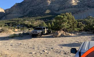
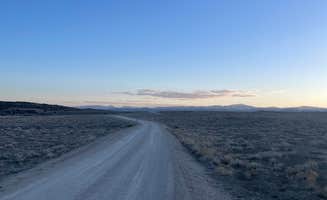
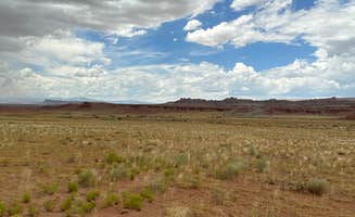
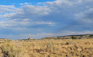
Primitive camping near Manti-La Sal National Forest offers self-sufficient backcountry experiences across various elevations ranging from 5,000 to 9,000 feet. The region features stark desert landscapes contrasting with forested mountains, creating distinct temperature variations that can exceed 30°F between day and night. Most dispersed sites require high-clearance vehicles due to unmaintained forest roads that become impassable during wet conditions.

What to do

Bouldering opportunities: New Joe's Bouldering Area provides access to quality climbing routes with basic facilities. According to Jake L., there's "climbing (bouldering)" and "site seeing (not far from The Wedge)" making it a "beautiful area" for outdoor enthusiasts.

Petroglyph exploration: Rochester Rock Camping features ancient rock art accessible via a short trail. Erin G. notes: "There's a trail out to a petroglyph site which was really neat. We hiked out in the morning and didn't encounter anyone else."

Target practice: Sites like Willow Creek Bowl offer natural features for shooting activities. Mandi M. describes access to "a 'hollow' with a high bank that's perfect for target practice of any kind" at this dispersed location.

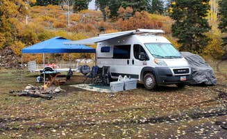
Mountain biking access: Several sites connect directly to trail systems. Daniel S. notes about Willow Creek Road: "It is RIGHT next to a mountain bike trail, so expect some early-morning bikers to be coming down."

What campers like

Reliable cell coverage: Unlike many remote areas, several sites maintain connectivity. At Fish Lake National Forest, Alisa H. reports: "had cell service - T-Mobile. Private, only had 3 cars drive by in 18 hours."

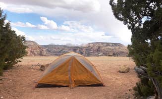
Isolation during weekdays: Wedge Overlook provides greater solitude midweek. As Honeymooners O. explains: "Very peaceful and quiet during the week, however it fills up quickly on the weekends."

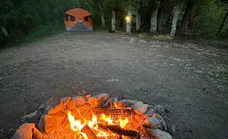
Strategic positioning: Some sites offer specific natural features. About Willow Creek Bowl, Mandi M. describes: "Wide open meadow. Set back from the road... Lots of afternoon shade."

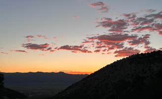
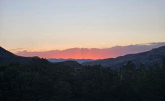
Sunset visibility: The landscape's western exposure creates dramatic evening light. Dalton at Willow Creek Road reports: "Campsite I stayed at/the drive up is amazing during sunset."

What you should know

Muddy conditions after rain: Wet weather makes access challenging at some sites. Isabelle K. warns about Sheep Creek Dispersed Camping Area: "Be wary that when it rains, this field turns into a super slick and deep mud."

Water access limitations: Even sites near water sources require preparation. Mandi M. notes: "It's a bit of a walk to the creek for water, so bring lots."

Management changes: Some areas are transitioning to fee systems. Greg L. reports: "BLM is going to construct a new developed fee CG in 2023 and fees of $20 will be charged. Not sure if all the existing free designated dispersed will go away."

Livestock presence: Cattle grazing occurs throughout the region. Laurie H. observed at Fish Lake National Forest: "Cows meander around the campsite..didn't bother us."

Tips for camping with families

Spacious gathering areas: Some locations accommodate multiple groups. At Sheep Creek, Mike C. notes: "Got crowded as the evening went on but plenty of room for all."

Educational opportunities: Sites with historical features engage children. Julie K. at Rochester Rock Camping mentions: "So the hike to the petroglyphs, it's 1 mile RT."

Weather planning: Prepare for temperature swings. Glen B. advises: "This is Desert, so it will be hot. This is also Mountainous so it might get cold fast, so pack accordingly."

Accessible exploration: Kid-friendly activities exist even at primitive sites. Abigail T. at Ephraim Manti Dispersed shares: "It was about 45 minutes to an hour out of town and lots of twisty roads, the scenery was pretty."

Tips from RVers

Size restrictions: Many roads limit larger vehicles. Rick W. cautions about Sheep Creek: "Road is in ok shape. Only few places small vehicle can park. Not for RV's or larger trucks really."

Pull-through availability: Some sites accommodate easier parking. Christy S. at Fish Lake National Forest found: "It had a pull through and trees and was a bit more private."

Road conditions: Surface quality varies significantly. Carrie C. explains: "What I lived about our site (site 5) was that is was at the halfway point of the mountain bike trail."

Level parking concerns: Finding flat spots challenges larger vehicles. At Wedge Overlook, Andy O. advises: "Some areas you can put a RV but it is a first come first serve area."

Frequently Asked Questions

Where are the best dispersed camping spots in Manti-La Sal National Forest?

Manti-La Sal National Forest offers excellent dispersed camping options. Sheep Creek Dispersed Camping Area stands out with its wide open spaces just 2 miles off the main highway, accessible via a good dirt road with plenty of options for both tents and RVs. Black Flat Cua Dispersed is another gem for those seeking solitude, offering amazing fly fishing in nearby creeks and lakes. Other notable spots include Skyline Drive (look for sites near the creek for shade), Wedge Overlook (featuring canyon views), and Lone Warrior Canyon Camp in the San Rafael Swell. Most dispersed sites have no amenities, so come prepared with water and pack out all trash to preserve these beautiful areas.

What are the rules and regulations for dispersed camping in Manti-La Sal National Forest?

Dispersed camping in Manti-La Sal National Forest follows standard Forest Service regulations. Campers should practice Leave No Trace principles, particularly important at areas like Goshen Road Dispersed Camping where improper trash disposal has been noted. Camp in established sites when possible and avoid creating new impact areas. Most locations allow stays up to 14 days within a 30-day period. Campfires are permitted in existing fire rings when there are no fire restrictions in effect. At New Joe's Bouldering Area Campground, there are designated campsites with fire rings and pit toilets but no water or trash service. Some areas like Buckhorn Draw have fee-designated sites with tables and fire rings. Remember to bring your own water and pack out all trash regardless of where you camp.

Where are the best dispersed camping spots in Manti-La Sal National Forest?

Manti-La Sal National Forest offers excellent dispersed camping options. Sheep Creek Dispersed Camping Area stands out with its wide open spaces just 2 miles off the main highway, accessible via a good dirt road with plenty of options for both tents and RVs. Black Flat Cua Dispersed is another gem for those seeking solitude, offering amazing fly fishing in nearby creeks and lakes. Other notable spots include Skyline Drive (look for sites near the creek for shade), Wedge Overlook (featuring canyon views), and Lone Warrior Canyon Camp in the San Rafael Swell. Most dispersed sites have no amenities, so come prepared with water and pack out all trash to preserve these beautiful areas.

Do I need a permit for dispersed camping in Manti-La Sal National Forest?

No permit is required for general dispersed camping in Manti-La Sal National Forest. Most areas are free and operate on a first-come, first-served basis. However, some specific locations like Buckhorn Draw fee designated Campsites do require a fee payment for overnight stays. At Wedge Overlook, camping is free on BLM public lands with no advance permits needed. While permits aren't typically required, it's always wise to check with the local ranger district office before your trip, as regulations can change seasonally. Fire restrictions may be implemented during dry periods, which could affect your camping plans. Remember that most dispersed sites have no facilities, so prepare accordingly.