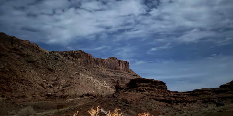
Off a rugged dirt road requiring high clearance vehicles, Chicken Corners Dispersed sits on BLM land southwest of Moab. Despite its name, the actual camping spots are located along the access route rather than at the scenic overlook itself. Each designated site costs $20 per night and includes a fire ring and picnic table on level rock and dirt surfaces.
The Bureau of Land Management maintains vault toilets and dumpsters throughout the area. Cell service is nonexistent. Confident drivers with high clearance SUVs can access these well-maintained sites, while campers seeking easier access might consider Dead Horse Point State Park Campground to the northwest.
Description
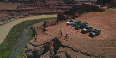
This 4X4 route travels the Colorado River Canyon just below Moab, follows a spectacular part of Kane Springs Canyon, climbs the Kane Creek anticline to Hurrah Pass, and descends to benches above the Colorado River. The route dead-ends about 400 feet above the river across from Dead Horse Point State Park.
Camping on public lands away from developed recreation facilities is referred to as dispersed camping. Most of the remainder of public lands are open to dispersed camping, as long as it does not conflict with other authorized uses or in areas posted "closed to camping," or in some way adversely affects wildlife species or natural resources.
Dispersed camping is allowed on public land for a period not to exceed 14 days within a 28 consecutive day period. The 28 day period begins when a camper initially occupies a specific location on public lands. The 14 day limit may be reached either through a number of separate visits or through 14 days of continuous overnight occupation during the 28 day period. After the 14th day of occupation, the camper must move outside of a 25 mile radius of the previous location until the 29th day since the initial occupation. The purpose of this special rule is to prevent damage to sensitive resources caused by continual use of any particular areas. In addition, campers must not leave any personal property unattended for more than 10 days (12 months in Alaska).
Campsite Selection Dispersed camp sites are located along most secondary roads and may not be marked. Popular locations can be recognized by the telltale flat disturbed area that has been used as a camp site before. Not all flat spots are sites. If possible, please use existing sites to avoid creating new disturbances. To further protect your public lands, campers must not dispose of any refuse, hazardous materials, sewage, or in any manner pollute the surrounding area.
RV Road Trip Guides


Map & DirectionsChicken Corners Dispersed is located in Utah near Moab
Coordinates
38.45062345470761 N
109.71524575452959 W
Connectivity
 T-MobileNo Coverage
- VerizonNo Coverage
- AT&TNo Coverage
Connectivity
- T-MobileNo Coverage
- VerizonNo Coverage
- AT&TNo Coverage
Access
- Drive-InPark next to your site
Site Types
- Tent Sites
- Standard (Tent/RV)
- Dispersed
- Group
Features
For Campers
- Picnic Table
- Toilets
- Alcohol
- Pets
- Fires
DISPERSED CAMPING
Enjoy dispersed camping on government land and leave no trace. Pack in and pack out. No (or limited) services at this camping area. Permit may be required.
PERMIT might be REQUIRED
We curate permit requirements across the US for our PRO members. Try PRO to see if Chicken Corners Dispersed needs a permit.
Drive Time
- 3 hrs 6 min from Grand Junction, CO
- 4 hrs 25 min from Farmington, NM
- 4 hrs 30 min from Provo, UT
- 5 hrs 1 min from Salt Lake City, UT


