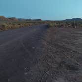
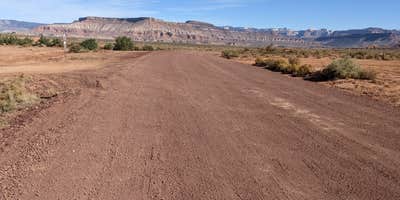
The Bureau of Land Management's Hurricane Cliffs system provides designated dispersed camping across multiple spurs, with this first section containing sites 1 through 12. Located off the washboarded Sheep Bridge Road, these numbered sites offer free boondocking without amenities like tables, water, or dumpsters. The area attracts mountain bikers accessing nearby Jem trails that bisect the camping spur.
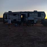
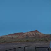
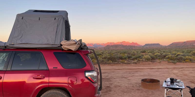
Sites here accommodate RVs and travel trailers on flat, hardened dirt spots, though campers should expect rutted conditions on the spur roads. Greg L. notes there are "no trees and no shade but the views are awesome." Free-roaming cattle wander through the area and graze around campsites. Sites sit relatively close together, so solitary camping experiences are rare here.
The washboard main road challenges some visitors, particularly those in larger rigs, though most manage the access successfully by driving slowly. Weather conditions significantly affect road conditions—wet clay becomes impassable. Cell coverage remains strong with 5G signals reported on major carriers. Mountain biking trails including Goosebumps and Hurricane Rim provide nearby recreation, with world-class riding at Gooseberry Mesa within reach.
Demand runs high even midweek during peak seasons, with some campers unable to secure sites upon arrival. The area serves as a convenient base for Zion National Park visits, located about 40 minutes away. Paula B. describes them as "flat spots with beautiful views" while warning against attempting access during wet conditions.
Check road conditions before arrival and bring all supplies including water, as no services exist on-site.
Description
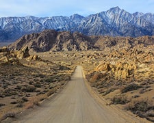
This expansive trail system was planned with mountain biking in mind and currently includes nearly 40 miles of beginner and intermediate trails. The iconic scenery and flowing singletrack that define the area attract visitors from around the around.
The trail system is defined by La Verkin and Hurricane, UT immediately to the west, UT State Route 9 as the northern boundary, and the sheer flanks of Gooseberry Mesa looming to the east.
Numerous trailheads and access points along UT State Route 59 as well as Sheep Bridge Road provide unlimited opportunity for creative loops and variety for trail users. Please see Directions for recommended day-use parking.
Camping throughout Hurricane Cliffs is limited to 56 Designated Dispersed Sites that were implemented to protect the expansive views and scenic integrity of the area.
Each official site contains a numbered placard and metal fire ring. Camping outside of official, designated sites is prohibited. All sites are typically accessible by any medium clearance vehicle. Camping on BLM Lands is allowed for a period not to exceed 14 days within a 28 consecutive day period.
RV Road Trip Guides

Map & DirectionsHurricane Cliffs BLM dispersed #1-12 spur is located in Utah near Virgin
Coordinates
37.16324258760447 N
113.25236824932017 W
Connectivity
 T-Mobile5GExcellent CoverageVerified by 15 usersLast on 7/24/26
 VerizonLTEGood CoverageVerified by 29 usersLast on 7/24/26
- AT&T5GExcellent CoverageVerified by 11 usersLast on 7/24/26
Connectivity
- T-Mobile5GExcellent CoverageVerified by 15 usersLast on 7/24/26
- VerizonLTEGood CoverageVerified by 29 usersLast on 7/24/26
- AT&T5GExcellent CoverageVerified by 11 usersLast on 7/24/26
Access
- Drive-InPark next to your site
- Walk-InPark in a lot, walk to your site.
Features
For Campers
- Phone Service
- Alcohol
- Pets
- Fires
For Vehicles
- Big Rig Friendly
FREE established camping
Enjoy camping on government land. Limited or no services at this camping area.
PERMIT might be REQUIRED
We curate permit requirements across the US for our PRO members. Try PRO to see if Hurricane Cliffs BLM dispersed #1-12 spur needs a permit.
Drive Time
- 22 min from St. George, UT
- 2 hrs 4 min from Las Vegas, NV
- 3 hrs 49 min from Flagstaff, AZ
- 5 hrs 2 min from Prescott Valley, AZ