Tent camping near Delano, Tennessee offers primitive wilderness experiences with limited facilities and basic terrain. The region sits within the Cherokee National Forest at elevations ranging from 700 to 2,000 feet, creating varied microclimates across camping areas. Most sites require campers to traverse gravel roads that can become challenging after heavy rainfall, particularly during the spring storm season.
What to do
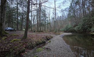
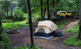
Creek fishing opportunities: Lost Creek Campground provides access to small streams suitable for fishing. "The creek can be used for shallow water wading or fishing," notes one camper who visited during winter when the area was completely empty.
Mountain biking exploration: The remote forest roads surrounding tent sites offer excellent cycling terrain. As one visitor to Lost Creek Campground shared, "Many places to explore on bike or hiking. Super remote area, ride were in decent shape, I could see them being bad after a heavy storm."
Hiking to mountain summits: For experienced hikers seeking views, the Big Frog Area trails lead to impressive vistas. One camper described the winter landscape as "white and just absolutely gorgeous the views are spectacular," though they cautioned about the remote nature and lack of facilities.
What campers like
Natural creek sounds: Campsites positioned along waterways provide natural soundscapes. At Goforth Creek Campground E, visitors appreciate the "nice site along the creek that has plenty of space for multiple tents," though they note it "could be buggy in the summer but a good option in the fall."
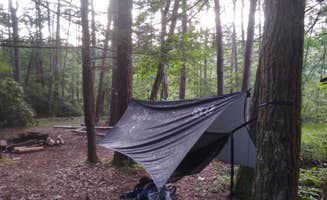
Privacy between sites: Many primitive campsites offer reasonable separation from other campers. The Starr Mountain Area requires "a very intense hike up the mountain but the views are worth it," with campers noting "hammock camping is ideal here, unsure of tent camping possibilities."
Wildlife observation: The remote settings increase chances for wildlife encounters. In the Big Frog Area, campers need to "watch out for bears," making proper food storage essential when tent camping in these secluded locations.
What you should know
Road conditions: Access to remote sites often involves navigating unpaved forest roads. The 7-mile gravel road to Lost Creek Campground "can be bad after a heavy storm," though typically "ride were in decent shape" according to regular visitors.
Water sources: Many primitive sites have no reliable drinking water. At Hiwassee River Area, "water spigots throughout the campground but not directly at each site," while more remote locations require filtering from streams or bringing sufficient supply.
Weather variability: Mountain elevations create unpredictable conditions. Starr Mountain campers warn to "come prepared to hike hard and to experience unexpected weather if it occurs," particularly important for tent campers without solid shelter.
Tips for camping with families
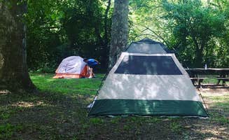
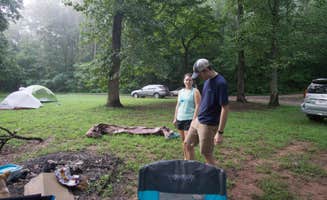
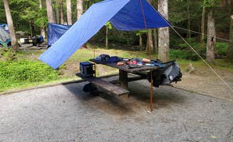
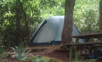
Site selection priorities: Choose established campgrounds for easier family experiences. At Hiwassee River Area, "each campsite has a picnic table and fire ring. Very spacious camping on level dirt or grass ground. We had 2 tents and could have fit 3 more."
Water activity planning: The Hiwassee River offers family-friendly recreation with seasonal considerations. One family noted, "The river is smooth until 11am. We went fly fishing right from the campsite. The water gets released at 11am, so the current picks up and water levels will rise quickly."
Bathroom facilities: Most primitive sites lack restrooms entirely. At Goforth Creek Campground F, there are no facilities, making it "a very small site alongside the trail" that's "probably best suited for hammock camping" rather than family tent setups.
Tips from RVers
Small vehicle access only: Most tent camping areas near Delano have limited vehicle access. At Lost Creek Campground, "sites can accommodate tents and small RVs," though the 7-mile gravel road makes access challenging for larger vehicles.
Campsite surfaces: RV campers should note ground conditions at primitive sites. Lost Creek offers "concrete picnic tables, lantern post, a pit toilet and bear safe trash receptacles," with some sites featuring concrete pads suitable for small campers.
Connectivity limitations: Cell service is virtually nonexistent at most sites. Visitors to Lost Creek noted "no Verizon cell reception," while Hiwassee River Area campers mentioned "no phone signal which is ok with us because we like to unplug."