

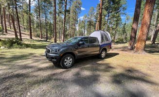
Dolomite K. Scout
Scout
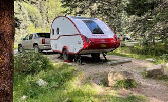
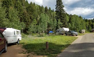
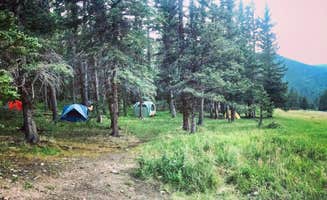
South Area Campground — Storrie Lake State Park
Storrie Lake
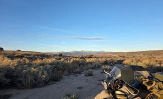
Primitive camping is good for drive in camping.
205 campgrounds · Check availability for any dates.
Located in the Carson National Forest of northern New Mexico, Truchas offers camping options ranging from developed sites to dispersed areas on public lands. The Santa Barbara Campground, situated in the mountains near Vadito, provides tent and RV sites with amenities including drinking water, trash collection, and picnic tables. Agua Piedra Campground near Tres Ritos offers similar facilities with additional options for cabin stays. Several primitive camping areas can be found along forest roads, with Trampas Trailhead Campground providing free tent sites with basic facilities including pit toilets.
Northern New Mexico's camping season varies significantly by elevation, with most developed campgrounds operating from May through October. Many campgrounds in higher elevations close during winter months due to snow and cold temperatures. Road conditions can be challenging, particularly after rainfall. A visitor commented, "The road to Campground was well taken care of. Beautiful trails throughout area," regarding Santa Barbara Campground. The terrain near Truchas features mountain landscapes with elevations that provide cooler temperatures even during summer months. Cell phone coverage is limited throughout the region, and campers should prepare for self-sufficient stays with adequate water and supplies, as services are limited.
Riverside camping ranks highly among visitors to the Truchas area, with several campgrounds positioned along mountain streams offering fishing opportunities. Campers frequently mention the scenic mountain views and relatively uncrowded nature of the camping areas compared to more popular destinations in New Mexico. One reviewer noted that their campsite was "located near some of the smaller ski slopes about 30 miles south of Taos NM on Highway 518" with "picnic tables and fire rings and clean Pit toilets." The hiking trails accessible from campgrounds near Truchas provide opportunities to explore the surrounding wilderness, though some visitors mention highway noise can be a factor at roadside camping areas. Most campgrounds feature fire rings, though seasonal fire restrictions may apply during dry periods.
"Driving into the camp, you have three options: Walk-In Camping, Camping With Parking Access & Limited Access."
"To begin, the lots are far enough away from fellow campers that you're seldom disturbed by noise or movement."
from $20 / night
Check Availability"New Mexico, in general, has some of the least expensive camping in the contiguous 48 states. The road in is a little rough in spots, but a pretty short drive along dirt from the pavement. "
"As others have said, you can get water at the North Lake campground, but there's a pass you'll need to buy to get in. "
"Campground is a little off the beaten path, about 30m from the High Drive highway. Dirt roads were nothing to worry about, should be fine for any SUV or sedan."
"About a 15min drive from the highway. Only 5 or 6 sites. Close to the Rio Mario Trail trailhead. Campsite is at elevation over 8,000ft so it can get chilly at night. Worked great for tent camping."
"Stay at Santa Barbara Campground in Northern New Mexico. Was a beautiful spot. Road to Campground was well taken care of Beautiful trails throughout area"
"This campground has a PERFECT location, right on the border of the Pecos wilderness with fabulous hiking. There is also fantastic fishing there, which many guests took advantage of all weekend. "
from $30 - $80 / night
Check Availability"Tent camped at this location in the middle of September (a week before closing). Very beautiful place to watch the leaves change, trailheads close by and picnic tables at each site."
"just went hiking in the surrounding area. But drove around and looked at the campsite looks like a nice place to go camping definitely willing to try it."
from $30 - $175 / night
Check Availability"This small state park, located just 6 miles outside of downtown Santa Fe, might provide the least expensive lodging options for visiting this wonderful city."
"It has a table, grill and fire pit. 2 Vault toilets nearby. Spaced far enough to enjoy the space. Occasional road noise that died as the night came from mountain traffic."
from $15 - $150 / night
Check Availability"The RV sites are more private Than at Rio Bravo, but Rio Bravo is next to the river. We liked our location. The restrooms were immaculate and the camp host was very helpful."
"Showers still aren't working but otherwise it's a quiet spot next to the river with plenty of hiking nearby. Shout out to the friendly and helpful camp host"
from $5 - $15 / night
Check Availability"The Trampas Trailhead campground gets 4 stars not because it's a great campground (it's good, don't get me wrong) but because it provides great access to an amazing trail."
"Wonderful trails and mountain views, I have been there 2 times in the last 10 years..."
"We got there a bit later and the day and all of the drive in sites were taken up by either campers or fishermen. Ended up getting one of the walk in sites. I’d recommend one of these."
"This campground is just above 8200ft in the forest, more specifically in the Santa Fe National Forest at the edge of the Pecos Wilderness. We stayed at site 3, more or less right next to the creek."
from $8 / night
Check Availability"Much more vegetation than you would expect from a campground close to town. The staff are friendly. The facilities were clean. The park is older but in an charming New Mexico way."
"If your wanting to get out and play in the snow or explore more in depth the beautiful culture of New Mexico, Taos has a little for everyone"


Primitive camping is good for drive in camping.
So the coordinates bring you to the end of the town but then bridges you to the start of the national forest area, you’ll pass the paid camping then the dispersed camping starts, the spots are beautifully tucked by the river! You get to be lulled to sleep by running water. You do hear a bit of car traffic but it’s free so no complaints here! We didn’t go too far and found a spot so not sure how many spots there are. Definitely do not have cell service in this area.
Really lovely spot in the National Monument- I suspect it gets passed over for mountain campgrounds, but you have a great view of the Río and the campground is amidst an ocean of sagebrush and high desert plants and flowers. There are a few other campgrounds nearby, and all of them are connected by a gravel walking path that goes in a big meandering loop. It's a really nice trail to take for a long walk at the end of the day. We walked for a while around sunset and it was beautiful. In the morning, several bighorn sheep came out of the gorge probably 75 feet from the campsite and we got to watch them do their thing for a while (a bunch of young males who seemed all about the tussling with each other). Photos were taken from the car on our way out as they were hanging out right by the road.
For other amenities, there were pit toilets and shade structures at the sites. The campsites are not individual "pull in" but its literally a matter of a dozen steps or so from the parking spaces to the campsites.
On the positive side, it is free and there’s plenty of room and I met nice people. I wouldn’t wanna stay here for more than a night or so because it’s right next to the landfill which you can hear operating and beep beep beep. No smell.
Exceptionally well maintained RV Resort. Lots of weekly activities. Live music several nights per week. Level concrete pads with nice picnic tables. Very nice laundry and bath facilities.
Very helpful hosts. Found another beautiful spot.
No hookups; clean flush toilets and water; convenient to find
Nice people run the place. Good restrooms with showers. Laundry facilities. Beautiful vistas. Easy on/off Cerillos Road/NM 14 or 599. Have stayed here several times over 20 years, in a friend's camping trailer(s).
Right now, it is very quiet and lots of open spots. Why not does need to watch the length of the spots because many of them can only fit a 20 foot and under trailer. There are a few pull through that can handle bigger rigs, but those are gonna be worn demand.
The campground is set off the main road to the visitor center, so does avoid all of that traffic. The Pueblo Trail, and the cliff dwelling hike is way worth it.
Dispersed camping sites near Truchas, New Mexico provide access to mountain terrain in the Carson National Forest at elevations between 8,000-9,000 feet. Several primitive camping areas exist along forest roads in this region, offering cooler temperatures than lower elevations even during July and August. Winter camping remains challenging due to snow accumulation and limited road access from November through April.
Hiking to mountain lakes: Agua Piedra Campground offers direct trail access to higher elevation destinations. "There is a trail head with 2 trails, one atv accessible and one hiking/horse that goes up to Indian Lake. Beautiful views and about 1200' elevation change," notes Tammy V. These trails typically remain accessible from late May through early October.
Creek exploration: Children can safely play in the shallow mountain streams at several campgrounds in the area. "We went exploring in the river next to the campground and then took a short hike up the river to some amazing river canyon views," shares Donaji R. from Santa Barbara Campground. These waterways run highest during spring snowmelt in May and early June.
Winter activities: Big Tesuque Campground remains accessible during winter months despite its 10,000-foot elevation. "Road is paved all the way and regularly plowed during the cold seasons. I'm sure this is very busy during the warm seasons but we had the place to ourselves during the week in early December," writes Jorge G. Cross-country skiing and snowshoeing routes connect to nearby trail systems.
Mountain stream sounds: Most campsites near flowing water receive positive reviews for their natural ambiance. "All sites are close enough to the river to hear it from a tent. The site has drinking water and pit toilets, but no cell service. Overall, stay was very peaceful and relaxing," Jacqueline D. comments about Santa Barbara Campground.
Fall colors: The aspen groves surrounding Truchas camping areas provide spectacular autumn displays. "Beautiful spot for fall camping since the leaves are changing colors and temperatures are cooler," reports Megan E. about Hyde Memorial State Park. The color peak typically occurs between late September and mid-October depending on elevation.
Privacy between sites: Agua Piedra Campground receives praise for site layout. "Some campsites were more separated and others were close together if you were with a group. River runs along the camp for fishing, and they were catching fish," mentions Tammy V. The diverse site configurations accommodate both group and solitary campers.
Limited connectivity: Cell service remains inconsistent throughout the region. "No cell/wifi service. BUT what it does have is quiet, and peacefulness, and charm, and views views views. It is just what WE want when we go camping," explains Robin T. about Agua Piedra Campground. For internet access, some travelers visit nearby communities.
Water availability varies: Not all campgrounds maintain reliable water sources year-round. "Water was not available. Very peaceful and quiet with lots of great views," notes Julie F. about her May stay at Agua Piedra. Campers should bring adequate water supplies regardless of posted amenities.
Seasonal wildlife: Borrego Mesa Campground visitors encounter both domestic and wild animals. "Campground is on ranch land (keep an eye out for cows)," warns Katherine C. Yellow jackets become particularly active at this location during late summer, according to Mac M., who observed "a good number of yellow jackets around" during their stay.
Playground access: Black Canyon Campground offers built play structures not commonly found at more primitive sites. "There is also a nice playground for those traveling with little ones who may need to burn some steam," mentions Deacon J. This feature proves valuable during extended stays.
Kid-friendly hiking: Trails with minimal elevation gain work best for younger children. "The trail is phenomenal. The incline is quite steep, but the loop is a reasonable length and I've seen families with young children and elderly folks successfully complete the loop," reports Luke M. about Black Canyon. Most sites have at least one trail suitable for beginners.
Weather preparation: Mountain conditions change rapidly regardless of season. "Chilly, even in July, just FYI, come prepared," warns C.J. L. about Big Tesuque Campground. Temperature drops of 30°F between day and night occur regularly, making layered clothing essential for family comfort.
Site access challenges: Overlook Campground provides magnificent views but requires careful driving. "Dirt road leading up to campground was totally drivable but heavily washboarded at the beginning, so be advised if you're towing," cautions PJ M. The campground accommodates up to 25-foot travel trailers, though larger rigs can access certain sites.
Limited hookups: Truchas-area camping prioritizes primitive experiences over amenities. "No water, power, or dump station, but there are individual garbage containers at each site," explains PJ M. about Overlook Campground. RV campers typically need to travel 20+ miles to find full-service dump stations.
Elevation considerations: Higher elevation camping sites near Truchas affect RV systems and comfort. "Submersed in the forest. Some sites weren't level, so if you're in a RTT or RV, be sure to have plenty of leveling tools," advises Cheryl M. about Black Canyon, adding "If you aren't used to elevation, the camp sits up 8400 feet, it'll take a bit more time to do normal activities."
Frequently Asked Questions
What camping is available near Truchas, NM?
According to TheDyrt.com, Truchas, NM offers a wide range of camping options, with 205 campgrounds and RV parks near Truchas, NM and 49 free dispersed camping spots.
Which is the most popular campground near Truchas, NM?
According to TheDyrt.com, the most popular campground near Truchas, NM is Black Canyon Campground with a 4.2-star rating from 29 reviews.
Where can I find free dispersed camping near Truchas, NM?
According to TheDyrt.com, there are 49 free dispersed camping spots near Truchas, NM.
What parks are near Truchas, NM?
According to TheDyrt.com, there are 8 parks near Truchas, NM that allow camping, notably Santa Fe National Forest and Carson National Forest.
Keep Exploring