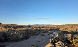
The camping sites near Española, New Mexico range from high desert areas at 5,500 feet to mountain forests exceeding 8,500 feet, creating significant temperature variations throughout the year. Most dispersed camping options are on Santa Fe National Forest or BLM land, where summer temperatures can reach 95°F while higher elevations may experience nighttime lows in the 40s even during summer months. Cell service varies dramatically between locations, with higher elevation sites generally offering better connectivity.
What to do
Hiking from camp: At Black Canyon Campground, trails are accessible directly from your site. "The trail is phenomenal. The incline is quite steep, but the loop is a reasonable length and I've seen families with young children and elderly folks successfully complete the loop," notes Luke M. The campground provides access to several hiking options "from easy to advanced," according to Deacon J.
Wildlife viewing: Early mornings and evenings at Pajarito Springs offer good wildlife spotting opportunities. "Nice, quiet, and saw lots of elk during our stay," reports Meghan B. Higher elevation camping areas provide better opportunities for seeing larger mammals, while desert areas host various reptile and bird species.
Archaeological exploration: The region contains numerous ancestral Puebloan sites. When staying at Juniper Family Campground, visitors can access Bandelier National Monument trails directly from camp. "We stayed here one night and did the hike in the morning! Such an enjoyable stay. The hike in the canyon is easy and well maintained," says Kenz P.
What campers like
Early morning soaking: Thermal springs access is a highlight for campers staying at specific sites. "You get early access to the pools, you'll have them nearly to yourselves 7:30-10am and 20% off admission," explains Jolene C. about staying at Ojo Caliente Mineral Springs Resort.
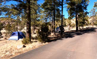
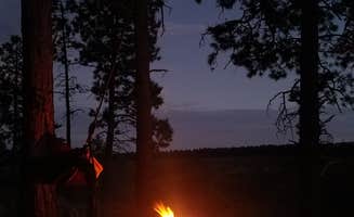
Night sky viewing: The region's minimal light pollution creates excellent stargazing conditions. At Pajarito Springs, "from my site you could see the town below but thankfully it did not impede my view of the stars," shares Josh M. Many dispersed sites on forest roads offer unobstructed celestial views due to sparse tree coverage.
Proximity to groceries: Some camping locations offer convenient access to supplies. The White Rock Visitor Center RV Park provides "the grocery store within walking distance," according to Aly J., while sites further from town require more planning. For camps near Española, most supply runs require 15-30 minute drives to stores.
What you should know
Limited availability: Many campgrounds fill quickly during peak seasons. For Santa Fe National Forest BLM dispersed camping, "it was completely deserted, except for one RV" during winter, notes Alice C., while summer months see much heavier use.
Variable road conditions: Access roads to many sites require careful navigation. The Overlook Campground road is "winding and rough gravel" according to AdventurousMagpie, while roads to Pajarito Springs have "huge canyon sized holes due to previous rain," reports Charity S.
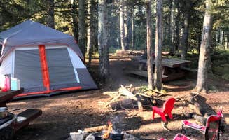
Water scarcity: Most dispersed camping areas lack water sources. "No amenities whatsoever," notes Chrischelle N. about Santa Fe BLM land. At established campgrounds like Black Canyon, a camper noted "no water, plenty of shade" with many visitors bringing their own supply from town.
Seasonal closures: Weather impacts accessibility to many camping areas. "When I drove in the next night to stay, I noticed that there was a sign up that said 'no overnight camping'," reports Georgia R. about a seasonal closure at a dispersed site, highlighting the importance of checking current status.
Tips for camping with families
Playground access: Some campgrounds offer facilities specifically for children. Black Canyon has "a nice playground for those traveling with little ones who may need to burn some steam," according to Deacon J.
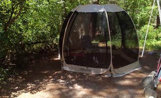
Site selection for shade: Finding shaded sites is crucial during summer months. At Santa Cruz Lake Overlook Campground, "some mesquite for shade and privacy, and each campsite has an open roof over the tables," notes AdventurousMagpie, providing partial protection from intense sun.
Age restrictions: Check facility policies if planning water activities with children. "I would have given this property 5 stars but they've become unfriendly to families. Children under 13 are not allowed in the hot springs," reports Colorado C. about Ojo Caliente Mineral Springs.
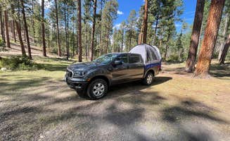
Elevation awareness: Higher elevation camping requires additional preparation for families. At Black Canyon (8,400 feet elevation), "if you aren't used to elevation, the camp sits up 8400 feet, it'll take a bit more time to do normal activities. This Florida gal had to learn to slow down," advises Cheryl M.
Tips from RVers
Leveling requirements: Many sites require equipment for leveling. At White Rock Visitor Center RV Park, "sites are all sloping downhill toward the Fire Station, you will very likely need to use blocks if you don't have a mechanical leveling system," advises Rick F.
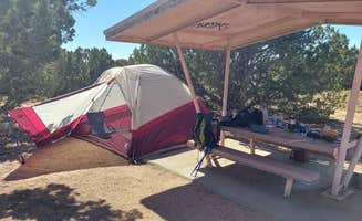
Hookup limitations: RVers should confirm available services. At Juniper Campground, a camper noted that "$12.00 for a paved back in or pull through site" includes no hookups, and "if it would've had water I would've given it a 5."
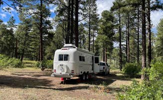
Size restrictions: Larger RVs face limitations at many forest sites. At Black Canyon, "our rig is 29 feet, 3 inches, and we were in a spot that maxed out at 32 feet. We barely fit. We saw very few sites that could have accommodate much more. I don't think any site would have been able to handle more than 35 feet," reports Reuben.
Reservation changes: Check for updated reservation systems. At White Rock RV Park, a camper discovered "they changed it about 6 months ago and it was no longer first come first served" despite outdated information online, highlighting the importance of calling ahead.