Top Free Dispersed Camping near Theodosia, MO
Looking for the best Theodosia dispersed camping? Find everything from dispersed backcountry camping to boondocking with The Dyrt. Find the perfect dispersed campsite for your next adventure.
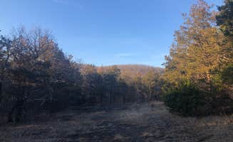
Hercules Glades Wilderness Area is 12,413 acres of the most scenic and unique country in the Midwest. Its combination of open grassland, forested knobs, steep rocky hillsides, and narrow drainages offers unusual beauty and a measure of solitude within easy reach of wilderness lovers. The area is characterized by shallow droughty soils and limestone rock outcroppings. Eastern red cedar and oak trees are interspersed with open glades supporting native tall prairie grasses. Redbud and dogwood provide beautiful spring flowers, while smoke tree and maple put on vivid fall colors. A variety of wildlife species live within the Hercules Glades including white-tailed deer, raccoons rabbits, squirrels, turkey, quail, songbirds, lizards and snakes. Copperheads and rattlesnakes may be encountered. Roadrunners, collared lizards, tarantulas, wild hogs and black bears are some of the more uncommon wildlife residents. Limit your party size to 10 persons. No camping within 100 feet of trails, water sources and other camps.Practice Leave No Trace outdoor ethics; Never tie stock directly to trees. No motorized or mechanized equipment allowed. Trails: From the trailheads there is 32 miles of maintained trails which follows along open glades, forested ridgetops and Long Creek, the primary drainage of the area. Cross country hiking in other parts of the area is allowed. Key attractions along the trail include Long Creek Falls, panoramic views of the Ozarks countryside, and a variety of native communities including open limestone glades and mixed forests. Rating: More Difficult to Most Difficult with steep terrain, stream crossings, sparsely marked trail, and elevations from 600 to 1200 feet. Length: 32 miles Best Seasons: Fall, winter, and spring. Leave No Trace: Pack out what you pack in. Restrictions: Foot and Horse only. Safety: No drinking water is available at parking areas or along the trail; bring what you will need, or be prepared to sterilize water you find. During temperate months, be prepared for biting insects, poison ivy and high temperatures. Be advised of hunting seasons. Avoid using the trail during excessively wet periods. Surface Type: Unsurfaced, native material.
Many people enjoy the solitude and peaceful experience of camping away from large groups of people. Dispersed camping is the term used for free camping anywhere in the National Forest OUTSIDE of a designated campground and at least 100 feet from any administrative site to include trails, buildings and designated recreational areas. Dispersed camping means there are no toilets, no structures, no trash cans, no treated water, and no fire grates. There are extra responsibilities required for this type of camp. It's a must to educate yourself before you try it, but we hope the adventure of dispersed camping in the Mark Twain National Forest calls to you!
Picking a Campsite
If you are going to an area where others have camped, pick a site that's been used before. If there is no existing campsite, then follow these Leave No Trace guidelines:
Camp on bare soil if possible, to avoid damaging or killing plants and grass. Camp 100 feet away from any water source - plants near water and water sources are fragile. Camp 100 feet away from any administrative site (Trails, Recreational Areas and/or Building).
White Ranch Conservation Area is located in Howell County, approximately 11 miles south of West Plains. White Ranch is the local name for a region of land previously owned by Harry White. The 6,703-acre area is mostly forested. Visitors to the area will find abundant populations of deer, turkey, and other forest wildlife species. The area offers fishing opportunities along the South Fork of the Spring River. A shooting range is located near the end of Trail #6. Its facilities include a 50- and 100-yard rifle range, plus an area set aside for shotguns. The parking lot, ranges, and public restrooms are accessible to disabled users. During your visit to the area, you may notice various forest management activities that are designed to improve tree growth, quality, and species composition. These practices also improve wildlife habitat and watershed quality.
Ok place to camp, pretty secluded, old campground but most spots no longer seemed camp friendly, as new tree growth has taken over. Seems to be a guy living in a rv at the end of the road which is really close to the one camping friendly spot, kinda kills the dispersed camping vibe.
Tried to camp out before backpacking through Hercules Glade Wilderness but the trailheads were packed (weekend). There are two fire rings along this road. Both locations have full bars (Verizon). Little to no man made noise but be respectful, there is a private residence at the end of the road.
I have visited this spot multiple times and camped right on the riverbank. Beautiful scenery year-round. I just tried to make a trip up there at the end of April (2022) and the final stretch of access road was blocked off due to erosion according to NPS. Not sure when main road will reopen. Ended up camping out at bakers ford just a few miles away.
This was a beautiful park with a campground that we really enjoyed riding around and exploring. We were there in April and the dogwoods were blooming. There were hiking trails, nice clean restrooms, lots of bike riding and nice large spaces. We had full hookups to boot!
So many options to make your home away from home! Grassy meadows or river side oasis, you choose! This is definitely the place to go to enjoy magnificent scenery and not be distracted by technology. Late September visit means the river is low, nights are cool and days are filled with sunshine. Bring the bug spray and sunscreen.
We got here on a pretty hilly/twisty road late at night, found a spot close to the trailhead and had a quiet, peaceful night sleep. We saw just one other camper with a trailer close to the inlet. Just a quick stop on our way, we didn’t hike long in the morning but the trail seemed quiet and secluded; we didn’t see anyone else.
I took a canoe trip down the buffalo river a few springs ago and I believe this was one of my stops. It was still early in the season so restroom facilities weren’t open yet. Bare bones camp sites with only fire pit rings. Beautiful area!
This area is a wilderness area so camping is plentiful. However in this particular are there is no organized campsite specifically. Instead there are several areas where you can with permissions hike in and stay.
My suggestion for camping along this area are to check with local restrictions, there are some that you will want to make sure you know first hand. Sometimes fire restrictions do change and these can be found at the beginning of the trails on the kiosks. Some areas also are not permitted for overnight parking so you want to check those out before venturing into the wilderness for a lengthy time.
Check with rangers of the area to make sure you are not in a register only or permit only area for camping!! Very important in this region.
Bring everything and then plot your course.
The 4 mile hike is amazing and has many beautiful view points however it is also quite treacherous in some areas. This area is also one which you will find many snakes lurking during warmer months so beware!!!!
I always suggest on wilderness hikes to not hike alone or camp alone but this one I found to be more problematic with limited to no cell service for assistance should you encounter danger.
Be careful but have fun!!!
This is a very primitive campground, but it's one of our favorites! We can almost always find a spot to camp and it's super easy to pull our trailer into every spot there. It's a horse camp and there are many spots with shade and some with none. There are two vault bathrooms, no tables provided, and not trash. We love the peacefulness of this place and will continue coming back.
Nice camping spots at the trailhead for Hercules glades. It was a beautiful, quiet area.
I did the Coy Bald hike and loved it. Most of the trail was fairly easy to navigate, however the areas of open meadows were a little more difficult to find where it picks back up. The falls are a great rock feature when it’s dry and beautiful when they’re flowing.
This is a short four mile hike into cool shut ins that provide a swimming hole and water falls. Along the way on the ridge you can see all the way down into Arkansas.
Lots of fond memories hiking and camping back into the glades. Began hiking these trails over forty years ago. I have hiked all four Sean’s and even spent a December wedding anniversary there with my husband. Our daughters, now in their forties grew up hiking those trails.
Once I even rode horseback to the shut ins.
This is a good place for hiking/backpacking. There are several sites around the access road and miles of hiking trails. The only ammenities are some fire rings and 1 toilet. It's a beautiful area but fairly remote and immediate services. Again, good for backpacking/hiking.
Hercules Glades Wilderness Area is part of mark Twain National Forest. It's a bit off the beaten path, but worth it for a day hike or a bit of backpacking.
Since it's wilderness area, you can camp just about anywhere with few restrictions. There are a few primitive sites at the trailhead, no water or toilets.
A few hundred yards from the Coy Bald Trailhead there is a fork in the trail. Going left gets you to the falls and the majority of the camp sites with the shortest route, about three miles.
The trail is pretty rough and rocky with moderate elevation changes. I'd rate it on the low side of moderate difficulty.
About a mile in you'll cross the river for the first time. There are camp sites with fire rings on both sides of the river. This is a scenic area with bluffs on one side of the river, but forested, so no views to speak of.
About three miles in, you'll cross the river the second time. There are a number of camping areas with fire rings along the river.
Downstream a few hundred feet are the falls that most people go to see. Unfortunately for us, there wasn't enough water for them to be running. There was enough water to wade around in and soak the feet. It was quite nice!
The area is pretty and quiet, we saw only a handful of people in the two days we were there. The only issue was the ticks, they were the worst I'd dealt with in some time.
All in all, a nice hike and a nice bit if camping. I'd go back to see the falls again.
Was really peaceful out here
Camping near Theodosia, Missouri, offers a mix of beautiful landscapes and fun activities for everyone. Whether you're looking to relax by the water or explore the great outdoors, there are plenty of campgrounds to choose from.
Camping near Theodosia, Missouri, has something for everyone, from families to solo adventurers. With beautiful campgrounds and plenty of activities, you're sure to have a great time!
Frequently Asked Questions
Which is the most popular dispersed campsite near Theodosia, MO?
According to TheDyrt.com, the most popular dispersed campground near Theodosia, MO is Hercules-Glades Wilderness Area with a 4.5-star rating from 4 reviews.
What is the best site to find dispersed camping near Theodosia, MO?
TheDyrt.com has all 7 dispersed camping locations near Theodosia, MO, with real photos and reviews from campers.