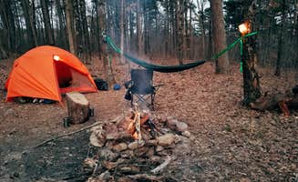
Dispersed camping near Ponca, Arkansas centers around sites in the Ozark National Forest, Buffalo National River, and adjacent public lands. Primitive campsites provide access to hiking trails with elevations ranging from 800 to 2,500 feet. Winter camping temperatures can drop below freezing, while summer heat regularly exceeds 90°F with high humidity.
What to do
Hiking to waterfalls: Falling Water Creek has several waterfall access points nearby. "Great spot" for exploring cascades after rainfall when water levels are higher.
Rock climbing: Sam's Throne Recreation Area offers numerous climbing routes on sandstone bluffs. "Road is kinda sketchy on the way up but the bluffs are fantastic!" according to climbers who visit specifically for the rock features.
Trail exploration: Forest roads provide access to multiple hiking paths with varying difficulty. At Morgan Mountain Road, "There are walking trails, with Spy Rock a short distance away" offering valley views without requiring technical skills.
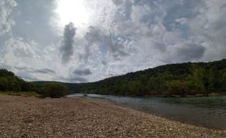
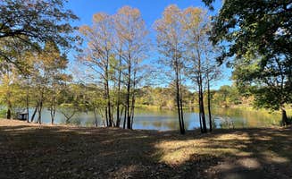
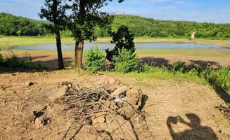
River activities: During warmer months, swimming and fishing spots are accessible from multiple camping areas. At Woolum Dispersed Area, campers enjoy "both a rock and sand beach currently. Fire rings. Only one other camper that's at the other end of the campground."
What campers like
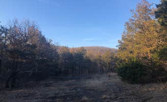
Night sky viewing: Clear nights at higher elevations offer exceptional stargazing opportunities. At Morgan Mtn Rd/Spy Rock Dispersed, campers "listen to the birds and sit in silence under the dark skies" away from light pollution.
Privacy between sites: Many dispersed areas feature natural separation. At Sam's Throne, sites are "separated by trees, so some privacy" which allows for a more secluded experience even when other campers are present.
Wildlife encounters: Dawn and dusk bring opportunities to see native species. One camper at Sam's Throne noted "Bambi and her mom also seem to live here," referencing regular deer sightings near campsites.
Early spring flowers: The forest understory blooms with dogwoods and wildflowers beginning in April. Visitors to Woolum Dispersed Area reported "the dogwoods were blooming" creating scenic spring camping conditions.
What you should know
Permit requirements: Some wildlife management areas require specific documentation. At Gene Rush Wildlife Management Area, "100% of Wildlife Management Areas in the state of Arkansas require a Hunting license or WMA camping permit purchased though Arkansas Game and Fish" costing $5.
Road condition variability: Forest service roads range from well-maintained gravel to challenging tracks. For Buffalo Creek Trail, "Approach from Cavern Mountain Rd 5, not Madison/404. The final half mile of Madison/404 was too steep and rough to proceed."
Designated sites only: Free camping near Ponca is generally restricted to established areas. In Gene Rush, "There is only a handful of sites spread throughout the WMA and you can only camp in those designated by the game and fish. This isn't the national forest, you can't just pull off and camp anywhere you please."
Cell service patterns: Coverage varies significantly by location and carrier. At Morgan Mountain, "T-Mobile has anywhere from one bar LTE to three bars of 5G extended to 2 bars 5G here. I was able to stream video on my phone before bedtime each night."
Tips for camping with families
Site selection for river access: Choose riverside locations for built-in activities. Woolum Dispersed Area provides "a very primitive campground, but it's one of our favorites! We can almost always find a spot to camp and it's super easy to pull our trailer into every spot there."
Pack bug protection: Insect activity increases during warmer months. At Woolum, campers note it can be "Buggy but Beautiful" and recommend to "Bring the bug spray and sunscreen."
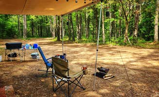
Bathroom facilities: Most dispersed sites lack modern facilities. Sam's Throne Recreation Area has "vault toilets only and no running water" which requires planning ahead, especially with children.
Food storage requirements: Bear activity requires proper precautions. Experienced campers advise "There are a few bears in the region so I would hang my food just to be safe" regardless of which campsite you choose.
Tips from RVers
Vehicle clearance concerns: Low-clearance RVs face access challenges on forest roads. At Forest Service Rd 82 Dispersed, "Any car should be fine on the gravel road, just go steady on the way up!" but larger rigs may struggle with steeper sections.
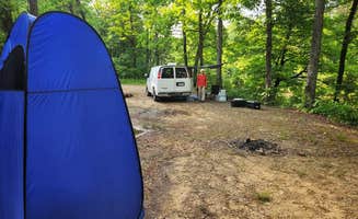
Self-contained setups required: No hookups exist at dispersed sites. Woolum is described as "a horse camp and there are many spots with shade and some with none. There are two vault bathrooms, no tables provided, and not trash."
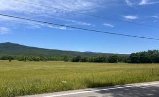
Site levelness varies: Many forest campsites have natural slopes. At Meadows Knob Road, "The campsite is in open area" and offers "a level, dirt surface" which is important for RV stability.
Off-season accessibility: Winter camping provides more solitude but potential weather challenges. In December, campers at Sam's Throne found "Campground was completely empty when I arrived on a Thursday evening" making it ideal for those seeking quiet camping near Ponca.