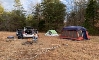
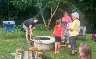
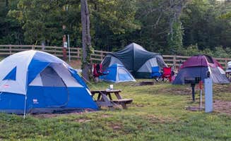
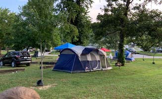
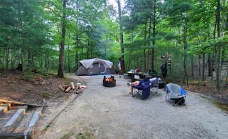
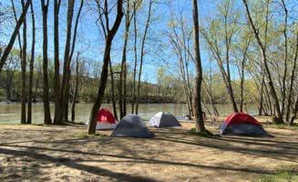
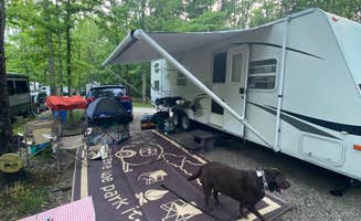
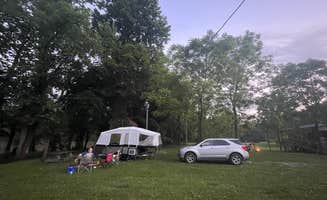
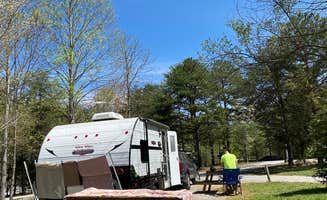
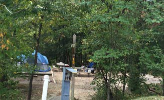
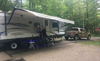
Campground photo 1
Campground photo 2
Campground photo 3

Places to Camp near Rockholds, KY

596 Reviews

Searching for the best camping near Rockholds, KY? There are tons of hikes and other fun activities to partake in. Experience some of the most stunning views that Kentucky camping has to offer. You're sure to find the perfect campground for your Rockholds camping trip.

Best Camping Sites Near Rockholds, KY (120)

  1. Camper-submitted photo from Cumberland Falls State Resort Park
  2. Camper-submitted photo from Indian Mountain State Park Campground — Indian Mountain State Park
  3. Camper-submitted photo from Blue Heron Campground — Big South Fork National River and Recreation Area

    3.

    Blue Heron Campground — Big South Fork National River and Recreation Area

    21 Reviews
    126 Photos
    31 Saves
    Stearns, Kentucky

    Overview

    Blue Heron Campground is a rustic and spacious campground, situated on the Kentucky side of The Big South Fork National River and Recreation Area--a vast and scenic expanse of land that offers visitors countless recreational activities.

    Recreation

    Numerous trails snake through the Recreation Area, offering mountain biking, hiking and horseback riding for visitors. The main river of the Big South Fork is also a short drive away, offering fishing opportunities.

    Facilities

    Blue Heron Campground combines the experience of traditional woods camping with the modern convenience of flush toilets, hot showers and electric hookups. Sites can accommodate both RV and tent camping. The campsites are spacious and provide picnic areas and plenty of shade.

    Natural Features

    The Big South Fork is located in north central Tennessee and southeastern Kentucky in some of the most rugged terrain of the Cumberland Plateau. The park encompasses approximately 125,000 acres of both rocky gorges and forested plateaus. Numerous pristine streams unite with the free-flowing Big South Fork of the Cumberland River. Over thousands of years, this ceaselessly moving water has carved the sandstone of the plateau into impressive cliffs, arches and chimneys that are found throughout the park.

    Nearby Attractions

    Just a few miles from the campground is Blue Heron Mine, also known as Mine 18, a historic abandoned mining town that has been rebuilt as an outdoor museum. Visitors can hear audio presentations from actual people who lived in the community in the 1950s. The Big South Fork Scenic Railway Depot is located about 9 miles away in the town of Stearns, which offers train rides and other educational opportunities for campers. More information can be found online at https://bsfsry.com. Additional attractions include the Daniel Boone National Forest and Cumberland Falls State Resort Park, offering additional recreation opportunities.

    • Pets
    • Fires
    • Electric Hookups
    • Phone Service
    • RVs
    • Tents

    $35 / night

  4. Camper-submitted photo from Holly Bay

    4.

    Holly Bay

    13 Reviews
    62 Photos
    128 Saves
    Keavy, Kentucky

    Overview

    Holly Bay, located two miles north of the Laurel River Dam, sits on the west side of Laurel River Lake. Visitors enjoy the campground for its proximity to the water and beautifully forested location. Plus, Holly Bay is ideal for activities like power boating, canoeing and fishing. The forest was named after Daniel Boone, a famous frontiersman and explorer who settled in Kentucky in the late 18th century.

    Recreation

    Boating and water skiing are a big hit. A boat ramp and fish cleaning station are located a short distance from the campground. Hikers take pleasure in the 4.2-mile Sheltowee Trace Trail that leads from the campground to the dam.

    Facilities

    The campground offers single and double-family campsites, some of which have 20, 30 or 50-amp electric hookups. Some campsites overlook the lake.Flush toilets (one is accessible), two shower houses, drinking water and a dump station are provided. Firewood and ice are available for purchase. Educational programs are held during the summer. AmericanLL.com__

    Natural Features

    Most campsites are surrounded by a mixture of hardwood trees that provide picture-perfect colors in autumn. Laurel River Lake spans 5,600 acres of deep, clear water and 192 miles of cliff-lined shore. Bountiful hills from the Appalachian foothills create a backdrop for the lake area.

    Nearby Attractions

    Head to the Cumberland Falls Trail that begins at Cumberland Falls and ends at the mouth of the Laurel River. This trail is a 30-45 minute drive from the campground.

    contact_info

    For facility specific information, please call (606) 878-8134.

    • Pets
    • Fires
    • Electric Hookups
    • Phone Service
    • RVs
    • Tents

    $38 / night

  5. Camper-submitted photo from Corbin - Laurel Lake KOA

    5.

    Corbin - Laurel Lake KOA

    10 Reviews
    35 Photos
    34 Saves
    Corbin, Kentucky
    • Pets
    • Fires
    • Electric Hookups
    • Phone Service
    • Reservable
    • ADA Access
  6. Camper-submitted photo from Levi Jackson Wilderness State Park Campground
  7. Camper-submitted photo from Bandy Creek Campground — Big South Fork National River and Recreation Area

    7.

    Bandy Creek Campground — Big South Fork National River and Recreation Area

    40 Reviews
    129 Photos
    82 Saves
    Rugby, Tennessee

    Overview

    Bandy Creek is a spacious and modern campground, situated in The Big South Fork National River and Recreation Area--a vast and scenic expanse of land that offers visitors countless recreational activities.

    Recreation

    Numerous trails snake through the Recreation Area, offering mountain biking, hiking and horseback riding for visitors. A swimming pool, along with on-site volleyball court, playgrounds and ball fields, make Bandy Creek an ideal spot for families. The main river of the Big South Fork is also a short drive away, offering fishing opportunities.

    Facilities

    Bandy Creek combines the experience of traditional woods camping with the modern conveniences of flush toilets, hot showers and electric hookups. Sites can accommodate groups and both RV and tent camping. The campsites are spacious and provide picnic areas and plenty of shade.

    Natural Features

    The Big South Fork is located in north central Tennessee and southeastern Kentucky in some of the most rugged terrain of the Cumberland Plateau. The park encompasses approximately 125,000 acres including rocky gorges and forested plateaus. Numerous pristine streams unite with the free-flowing Big South Fork of the Cumberland River. Over thousands of years, ceaselessly moving water has carved the sandstone of the plateau into impressive cliffs, arches and chimneys, which are found throughout the park.

    Nearby Attractions

    Located just under 20 miles from Bandy Creek is the Blue Heron Mine, also known as Mine 18, a historic abandoned mining town that has been rebuilt as an outdoor museum. Visitors can hear audio presentations from actual people who lived in the community in the 1950s.

    • Pets
    • Fires
    • Electric Hookups
    • Phone Service
    • RVs
    • Tents

    $140 / night

  8. 8.

    Clayton Geneva Memorial Campground

    7 Reviews
    66 Photos
    41 Saves
    Williamsburg, Kentucky

    Thank you for considering Clayton Geneva memorial campground for your camping trip. Please read the entire description including our rules and regulations. Also be sure to view the site map. The gravel driveway to the sites is passable with any vehicle. If you choose to use our alternate parking there will be a hike to your site, appropriately 1/8 of a mile. I can’t stress enough that it is primitive camping, there is a restroom available at the top of the hill. We are inviting you to enjoy a peaceful, primitive camping experience on a spacious plot right on the sandy banks of the Cumberland River. We offer a tree canopy covered, serene spot that offers river swimming, fishing, enjoy a camp fire or just plain nothing but peace and quiet. Each site is equipt with a fire ring. The drive way to the primitive sites is a little lane that wraps around a mountain side that leads to the primitive sites. We do our best to keep up with it however due to the nature of weather, gravity and water it’s a constant chore. Your welcome to hike in to the sites, it’s not mandatory that you driver on down. If you feel comfortable by all means slowly drive directly to your site. If your not sure of the lane please hike to your site. Hikers, Horses and riders welcome, located a couple miles from Daniel Boone National Forrest, seemingly endless trails through some of the most beautiful country. Bring your canoe and kayaks. Located 16 miles from Cumberland Falls State Park. Located 11 miles from Sheltowee Trade Adventure Park. Located 11 miles from Kentucky Splash Water Park. Located 11 miles from Wal-Mart, restaurants and Pilot

    • Pets
    • Fires
    • Electric Hookups
    • Phone Service
    • Reservable
    • ADA Access

    $20 - $70 / night

  9. Camper-submitted photo from Bee Rock Rec Area

    9.

    Bee Rock Rec Area

    10 Reviews
    29 Photos
    35 Saves
    Laurel River Lake, Kentucky

    In March 2019 a record flood devastated the campground, boat ramp, and trails in this area. Bee Rock Campground will remain closed until recreation facilities are safely restored. View Bee Rock Closure Order. To find other campgrounds nearby, contact the London Ranger District at 606-864-4163, Monday-Friday 8 a.m. to 4:30 p.m. Campground facilities at nearby Laurel River Lake open on April 12.Bee Rock Campground, located on London Ranger District, has developed campsites on both sides of the Rockcastle River. The campground is a US Fee Area. The Laurel County side, with 9 sites, is open all year. The Pulaski County side, with 19 sites, is open from mid-April through mid-October. An overlook along Bee Rock Loop Trail provides a scenic view of the rocks and cliffs along Rockcastle River. Bee Rock Boat Rampprovides river access. The campground features Old Sublimity Bridge, a historic structure built by the Civilian Conservation Corp (CCC) in the late 1930s. The stone used in the abutments was quarried from the adjacent sandstone cliffs. The bridge has been restored for foot travel only. The name Bee Rock comes from a local legend which states that a large number of wild honeybees used to live in this area, using a hollow area under this cliff as their hive. Tired of the wild honeybees invading their hives, local beekeepers dynamited the rock, destroying the hive and causing honey to flow down the cliff into the Rockcastle River. Make this page look nicer by submitting photos of your visit to Bee Rock Campground. Learn more... Bee Rock Campground Map Campfires are permitted in fire rings only. Make sure fires are out before retiring at night or when leaving your campsite. Parking is available at campsites, boat ramp and overflow parking area. Restrooms are accessible vault toilets. Drinking water is available except during winter months. No climbing or rappelling from cliffs, arches or other rock formations at Bee Rock Overlook. Low lying areas are prone to flooding, so be alert for flooding when driving, camping or crossing streams in this area. Swift currents and undertows can make swimming and wading very hazardous. View Bee Rock Campground Guide & Map (pdf) Nearby Trails: Bee Rock Loop Trail #529 Rockcastle Narrows Trail #503 Rockcastle Connector Trail #401A Sheltowee Trace Section 25

    • Pets
    • Fires
    • Electric Hookups
    • Reservable
    • ADA Access
    • RVs

    $8 - $12 / night

  10. Camper-submitted photo from Sheltowee Trace Adventure Resort

    10.

    Sheltowee Trace Adventure Resort

    8 Reviews
    35 Photos
    14 Saves
    Rockholds, Kentucky
    • Pets
    • Fires
    • Electric Hookups
    • Reservable
    • ADA Access
    • RVs

    $25 - $174 / night


Popular Camping Styles near Rockholds

Pet-friendly camping near Rockholds

Recent Reviews In Rockholds

596 Reviews of 120 Rockholds Campgrounds