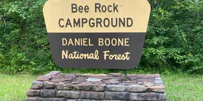
Within Daniel Boone National Forest, Bee Rock Rec Area sits along the Laurel River where flood-prone terrain shapes the camping experience. The US Forest Service manages this campground from April through October, with sites positioned across from the riverbank along a road that sees regular motorcycle traffic during peak hours.
Most campsites feature gravel paths and stairs leading down from small parking areas to leveled tent platforms, picnic tables, and fire rings. The campground operates on two sides of the river, with electric hookups available on one section and walk-in tent sites on the other. Recent flood damage led to reconstruction of many facilities, and Tony E. notes "the picnic tables on the lower loop chained down so they don't float away." Sites accommodate RVs up to 45 feet, though access conditions can be rough.
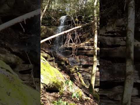
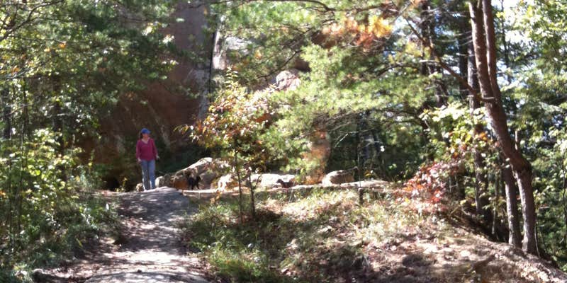
The Bee Rock hiking trail starts from the campground and leads to waterfalls and river overlooks. Anglers fish directly from the riverbank, while paddlers launch from a small sandy area at the road's end. Traffic typically quiets by 10 PM, and reviewers consistently mention the area's historical significance, including old cemetery sites that some visitors find noteworthy. For those exploring the broader region, campgrounds around Daniel Boone National Forest provide additional options across this expansive wilderness area.
Description
In March 2019 a record flood devastated the campground, boat ramp, and trails in this area. Bee Rock Campground will remain closed until recreation facilities are safely restored. View Bee Rock Closure Order. To find other campgrounds nearby, contact the London Ranger District at 606-864-4163, Monday-Friday 8 a.m. to 4:30 p.m. Campground facilities at nearby Laurel River Lake open on April 12.Bee Rock Campground, located on London Ranger District, has developed campsites on both sides of the Rockcastle River. The campground is a US Fee Area. The Laurel County side, with 9 sites, is open all year. The Pulaski County side, with 19 sites, is open from mid-April through mid-October. An overlook along Bee Rock Loop Trail provides a scenic view of the rocks and cliffs along Rockcastle River. Bee Rock Boat Rampprovides river access. The campground features Old Sublimity Bridge, a historic structure built by the Civilian Conservation Corp (CCC) in the late 1930s. The stone used in the abutments was quarried from the adjacent sandstone cliffs. The bridge has been restored for foot travel only. The name Bee Rock comes from a local legend which states that a large number of wild honeybees used to live in this area, using a hollow area under this cliff as their hive. Tired of the wild honeybees invading their hives, local beekeepers dynamited the rock, destroying the hive and causing honey to flow down the cliff into the Rockcastle River. Make this page look nicer by submitting photos of your visit to Bee Rock Campground. Learn more... Bee Rock Campground Map Campfires are permitted in fire rings only. Make sure fires are out before retiring at night or when leaving your campsite. Parking is available at campsites, boat ramp and overflow parking area. Restrooms are accessible vault toilets. Drinking water is available except during winter months. No climbing or rappelling from cliffs, arches or other rock formations at Bee Rock Overlook. Low lying areas are prone to flooding, so be alert for flooding when driving, camping or crossing streams in this area. Swift currents and undertows can make swimming and wading very hazardous. View Bee Rock Campground Guide & Map (pdf) Nearby Trails: Bee Rock Loop Trail #529 Rockcastle Narrows Trail #503 Rockcastle Connector Trail #401A Sheltowee Trace Section 25
Location
Public CampgroundBee Rock Rec Area is located in Kentucky
Directions
From I-75 at London exit 38 (London), turn west on KY 192, go 18 miles to the bridge over Rockcastle River between Somerset and London.
Coordinates
37.02900009 N
84.31700035 W
Connectivity
 T-MobileNo Coverage
- VerizonNo CoverageVerified by 1 userLast on 5/4/26
- AT&TNo Coverage
Connectivity
- T-MobileNo Coverage
- VerizonNo CoverageVerified by 1 userLast on 5/4/26
- AT&TNo Coverage
Access
- Drive-InPark next to your site
- Walk-InPark in a lot, walk to your site.
- Hike-InBackcountry sites.
- Boat-InSites accessible by watercraft.
Site Types
- Tent Sites
- RV Sites
- Standard (Tent/RV)
- Group
Features
For Campers
- ADA Access
- Trash
- Picnic Table
- Reservable
- Drinking Water
- Electric Hookups
- Toilets
- Alcohol
- Pets
- Fires
For Vehicles
- Pull-Through Sites
- Big Rig Friendly
Drive Time
- 1 hr 23 min from Lexington, KY
- 1 hr 37 min from Knoxville, TN
- 2 hrs 5 min from Morristown, TN
- 2 hrs 8 min from Elizabethtown, KY