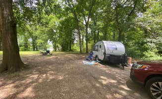
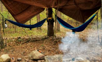
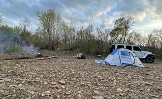
Top Tent Camping near Greenwood, AR
Looking for tent camping near Greenwood? Find the best tent camping sites near Greenwood. From remote to easy-to-reach, these Greenwood campsites are perfect for tent campers.
Jack Creek Recreation Area is located in a picturesque setting alongside towering rock bluffs and flowing waters. The area was constructed in the 1930’s by the Civilian Conservation Corp (CCC) and displays several unique, historic facilities. There is a short trail that climbs a couple of hundred feet to a recently restored rock overlook vista that offers a panoramic view of whispering pine trees and colorful fall vegetation. Jack Creek offers day use and a primitive campground at no cost. Also from Jack Creek Recreation Area is a trailhead for the Hole-In-The-Ground Mountain Hiking Trail and Sugar Creek Hiking Trail. Hole-In-The-Ground Trail is not a loop trail and extends approximately four miles in length. The Sugar Creek Hiking Trail extends approximately three miles connecting Jack Creek to Knopper’s Ford Recreation Area. Click here for more information.
If you are one of those folks who prefers a different, more rugged camp experience, primitive camping is allowed almost anywhere in the Ouachita National Forest unless there is a sign stating otherwise, or it is a wildlife food plot. Located throughout the Forests are areas that have been campsites for many years. These are located along roadsides, trails, mountain tops, or near streams. Camping at dispersed locations have additional responsibilities: "Leave No Trace" so others can have a similar backcountry experience, pack out any trash or litter, scatter campfire ash around so it doesn't pile up, and leave the area better than you found it.
Please filter water before drinking! Beware of stream crossings after heavy rains.
Please read the Dispersed Camping guidelines before heading out.
This recreation area is part of Ozark Lake
$30 - $100 / night
The picturesque and scenic Ouachita River is one of the most beautiful and clear rivers in the Ouachitas. Beginning in the Ouachita Mountains near Mena, AR, the Ouachita River is a popular floating and fishing river as it flows easterly through the Ouachita National Forest, eventually becoming part of Lake Ouachita and Lake Hamilton near Hot Springs, before continuing its journey south towards Louisiana.
Beginning near Pine Ridge, AR, the Ouachita offers about 45 miles of floatable river until it become Lake Ouachita near AR Hwy 27. Along this stretch, there are seven landing sites, five of which are float camps. These float camps include Shirley Creek, Rocky shoals, Fulton Branch. Dragover and River Bluff. All five float camps are free to the public. These Float camps typically have openings, even on some holiday weekends when other campgrounds are full. Only rarely are these float camps filled up.
Shirley Creek Float Camp is located off of AR Hwy 88, west Pencil Bluff, and is situated right on the banks of the Ouachita River approx. 6 miles downstream from the Pine Ridge Access. This float camp offers six camping sites, as well as picnicking sites, a vault toilet and canoe access to the river.
Shirley Creek Float Camp is typically open Spring through Fall for overnight use, and is available for day use only the rest of the year.
Attractive wooded setting on stream bank.
Always remember to LNT in dispersed camping areas.
The campground is a hidden gem. The RV and primitive camping are clean and well-maintained. The bathroom/shower requires a passcode to enter and is always clean to use. It's a great escape for off-roading and overloading. Be sure to stop by the Oark Cafe in Oark, Arkansas, which is a 25-minute drive from the campground. They serve one of the best burgers in Arkansas (Wednesday-Sunday).
Very nice campground, mostly flat land for RV and primitive campground. The bathroom/shower house is very clean to use. This area is great for getaways, off-roading, or overloading.
A little older of an area. Stayed in site B10. Close to level. We have a 36' 5th wheel, tow vehicle, plus another vehicle. Easy entry into site and large enough for all vehicles. Asphalt with concrete patio. There is a picnic table and fire ring. 50/30/20A We can kind of see the river from this site. Very roomy sites in the woods with plenty of shade. Mostly dirt ground. Older but clean restrooms. We didn't use them. There are single person combined toilet and shower rooms at the front of park. There are mountain bike/hiking trails all over, even a little bike park with ramps and jumps. Playground and boat ramp. No sewer hookups, but there is a dump station. Lots of mosquitoes in the evening. Although some sites need maintenance and the restrooms are old, this is a nice park. We stayed 2 days and would definitely stay again.
Older Park. Renovations are being done... Pads, 10 ft picnic tables, playground... Right off the lake with awesome scenery. Couple who manages the place is really nice and helpful. Would stop here again.
The scenery here is really beautiful, Geometry Dash Breeze but it is so deserted that it is a bit scary at night.
21 RV spots available around a small, family lake. Water and electric hook ups and clean dump station. Small park/play area and two large pavilions. Hiking trail located at the back of the park. Lake is great for fishing and kayaking. Not a major boating or water sport lake. First come first serve spots. Camp host is helpful and friendly. Calm and quiet stay
Fantastic smaller campground minutes from Mount Magazine. It seems to be overshadowed by much larger, better known places like Devils Den, so it's fairly quiet even when it's 'busy.' We also learned that it has new management as of this year (2024), a young family that's extremely hands-on.
We stayed as a group (three families with 7 kiddos total, ranging from 6-15), across two adjacent sites: 1 & 3. You could see the lake from our sites, but they don't sit right over the lake like some do. With so many kids in our group, we actually wanted that. Sites are extremely spacious and well spaced from each other, and would feel even more private later in the season when the trees are full. Bathrooms are simple pit toilets, but clean and well-maintained.
Boat rentals right onsite, concessions, even a small beach area! We will 100% be back. No cell service whatsoever with Verizon.
Only 1 other camper the night I stayed, but some people used the river access during the day. Access to Spy Rock trail, but the vast amount of cobwebs made it seem like it’s not used much. Actually wish it hadn’t been so empty, since I was a bit sketched out to camp alone with only 1 other person around. Clean bathroom. Hot in July, but cooler than it was on I-40 due to higher elevations.
The Petit Jean River, flowing from an outlet, divides this US Army Corp of Engineers campround into two areas. There are 38 campsites, with electricity and water hookups. This includes three multi-family sites. Fees range from $18 to $40. Reservations are made on recreation.gov or by calling 877-444-6777. First come, first served sites may be available outside the reservation season. The campground description at recreation.gov indicates that the campground is located on Blue Mountain Lake, but there is no lake access from here. A drive to Waveland Park is required for Blue Mountain Lake recreation. Most sites are waterfront; a few are just a short walk away from the Petit Jean River. Most sites have picnic table shelters. There are 12 sites and a restroom/shower house along the north bank of the river. The remaining campsites, along with a restroom/shower house, are on the south side of the river. The sites on the north side, except site #6, are in a open area offering little shade. The sites on the south side are along a forest and are more shaded. There is no privacy between campsites; several sites, especially on the south side, are close to each other. The north side restroom/shower house was closed. The south side restroom/shower house was very clean. The roads accessing and in the campground are paved. The campground is setup to accommodate RVs and big rigs, although tent camping is possible. Fishing in the river appears to be the main recreation activity. Walking access to the river bank is provided by stairs. Two playgrounds are at the south side camping area.
Coordinates: 35.02531, -93.88228. Located just off of Girard Road (Forest Road 20) - a maintained gravel/dirt forest road. This road is mostly a single track - narrow with some minor erosion in a few places. A lifted 4x4 vehicle is NOT needed to drive to the site. The dispersed site is located 1.3 miles south of the turnoff to Jack Creek Recreation Area. This site is set off from the forest road on a narrow undesignated dirt track which is easy to miss. It is a small site with enough room for one vehicle - truck camper size and smaller. The site is mostly level on a dirt surface with a rock fire ring. It is mostly shaded, although solar recharging may be possible during the afternoon with solar panels being placed on the access track in front of the site. Tent and hammock camping are possible. Received a strong T-Mobile 5G signal here. Except for some peace and quiet, there is nothing remarkable about this particular campsite. However, is is located in the Jack Creek area of the Arkansas Ouachitas. This area has a few nice swimming holes and hiking trails which one can drive to. OHV recreation is also possible in the area.
I didn't camp here, but thought I leave an updated review. Previous review still applies. This is a free primitive campground, but a permit is required to camp here; see COE Web site for info. There is a very clean portable john with tp in the campground. It appears that the campsites themselves have not been maintained in a while, although the campgound itself looks nice, with a view of the lake. Some of the sites are close together offering no privacy. I received T-Mobile cell service. Convenient boat ramp nearby. I wouldn't make this campground a multi-day vacation destinition, but it's convenient for an overnight stay and for those using the lake for recreation.
There is not a lot to do, and it is pretty far from the city. However, there are big RV sites and amazing sunsets. There is also a lake nearby.
Dog friendly.
There are lots of nature trails, but none very long.
Lots of ticks, tricky to get good starlink connection.
#1. We paid $135 in advance for 3 days and nights for 3 adult and 7 kids. On day two our kids was accused of throwing trash on the ground at creekbank ( lie ) we didn't allow our kids out of camp with food or drinks.
#2. Was accused of being neglectful parents for not being at waters edge anytime our kids was in the water even tho our kids had floaties or life jackets on and in site the entire time.
#3. We adults Was accused of vandalizing park table because we had placed extinguished cigarettes on the table keeping them off the ground.
#4. Wasn't told any park rules when paying or after until into the second evening.
When being griped at for using the provided electric and water we was told the camp sites was equipped with. ( No mention of extra charge at the time of reservation for using it).
#5. Was going to charge us for being there Thursday -sun when we arrived on Friday morning at approximately 8:30am.
#6.Griped about two visitors showing up. One of witch was just there a few minutes to pick up a member of our paid group who had to leave early.
#7.Their website says they understand things happen and people need to cancel their reservations so they give rainchecks in regards to refunds.
On the second evening when we needed to adjust our agreed reservations and was told ( ABSOLUTELY NO ! ).
Note: At no time was we asked to or told to leave but because of all above mentioned we chose to leave that second evening of our 3 nights.
With so many trails that you can access just by walking out of the camp site. This is my favorite spot to camp in Oklahoma
We drove slowly back and forth along the road exactly where the coordinates lead us to but there is no vehicle access to the forest there. It’s completely overgrown
I don’t have many nice things to say about this campground. The bugs were out of control. The bathroom was out of order and a porta potty was set up beside it. The site we chose,#3, was the best site. We found some good trees to set up our hammocks with a view of the forest. 1 and 2 were ok, 4-9 were downright terrible. Basically a parking spot with a picnic area. All the sites were close together. The check in process consisted of a guy in an unmarked vehicle driving up and striking up a conversation without identifying himself. Check out works the same. If you have a boat or tv this park may be nice but I wouldn’t camp here. The hike around nearby lake Alma was the highlight of our trip.
Exact location: 35.21834, -93.49261. Located in the Mt. Magazine Wildlife Management Area in the Ozark National Forest. Level dirt camping area that loops around a dead tree. The site is at the beginning of Forest Road 96019A, a very short distance off of Eickleberry Road (FR 1613). Can accomodate up to 3 SUVs, campervans or rigs with RTT. Probably only one truck camper can manuever and comfortably fit in this site. The short drive on FR96019A, accessing the site, is a little eroded but a 2wd vehicle can handle it. There are two tracks from the site that can be hiked. There are a lot of trees surrounding the site. It is mostly private from Eickleberry Rd. During our mid-week stay, there was very little vehicle and OHV traffic on the gravel Eickleberry Rd, and no one attempted to access FR90019A which is gated just past the site. No AT&T and T-Mobile cell service. Except for wonderful nature sounds, very quiet and peaceful night. Buzzards Rock overlook is north at the end of Eickleberry Rd (35.25265, -93.49427). Big Shoal Falls is located about a half-hour southwest along Spring Lake Rd (35.19472, -93.54479). Really enjoyed disperse camping here; looking forward to returning.
Exact location: 35.24838,-93.48166. Located in the Mt. Magazine Wildlife Management Area of the Ozark National Forest. The dispersed campsite is on Forest Road 96022B, after the end of Eickleberry Road (FR 1613). There are no obstacles with accessing the site on the forest roads. It is at the junction of designated OHV trails, and located next to a parking area for an unnamed overlook. This parking lot probably serves as a staging area for offroad rigs. Buzzards Rock overlook is almost 1 mile away from the campsite - an easy hike down an OHV trail. Other OHV trails in the area are hikeable. There is a pond near the campsite but don't know if there are fish in it. The campsite is small - enough room for one truck camper or smaller. Had to use leveling blocks to level our van. There is a rock fire ring at the site. The site is surrounded by OHV trails resulting in noise. There was plenty of OHV activity here during our mid-week stay. The site is semi open. There is AT&T and T-Mobile LTE service.
Actual location: 35.15609,-93.42893. Located along gravel County Road 35, just south of County Road 561, right on the west side of Spring Lake. Beautiful view of the lake. Large enough for two rigs - truck camper size and smaller. Level area for tents. This is a pull through site with two entrances/exits; the north access is easier. Canoe and kayak access to lake. Bank fishing also possible. No fire rings, although there are a few spots of past campfires. This appears to be a popular site. Note that there is some broken glass on this dirt site; did the best we can to pick it up. No amenities. Had some AT&T and T-Mobile LTE service. The site is located within the Mt. Magazine Wildlife Management Area in the Ozark National Forest. The Spring Lake Recreation Area is located across the lake.
Actual location: 35.15604,-93.42697. This site is mostly used for bank fishing on Spring Lake. Its a large loop at the end of a short narrow Forest Road 96001F. The site can accomodate a few rigs - truck camper size and smaller. A truck camper may get pinstripped along the access road. There is a large rock fire ring in the middle of the loop. The area is not level, so leveling youir rig may be needed. The site did have some trash at the time of our visit. The site offers a beautiful view of the lake. Easy walking access to the bank for fishing. No amenities. This site is located within the the Mt. Magazine Wildlife Management Area, and is close to the Spring Lake Recreation Area in the Ozark National Forest.
Camped here mid-week on May 28, 2024, just after Memorial Day weedend. The Spring Lake Receation Area is open from Memorial Day weekend through Labor Day weekend. The recreation area is gated between 10pm and 6am. It has a day use area, and a campground which is a long walk or short drive away from the day use area. The day use area has picnic tables, grills, beach and a central restroom/shower facility. Day use fee is $4. The small campgound is situated in the woods along Spring Lake across from the day use area. Camping fee is $15 ($7.50 for federal pass holders). Sounds from folks enjoying the day use area can be heard in the campground during the day, but it's very quiet during the night when the day use is closed. The campground has 13 sites. All of the sites can accomodate tent camping. Each site is unpaved and has a level tent pad, table, metal fire ring and lantern pole. Most of the sites are small with little privacy between sites. The sites are in the woods and have a view of the lake, with some actually on the lake shore. Our site, #8, has a short walking path to the shoreline - good for bank fishing. The campground has two single unit vault toilets which were reasonably clean. For showers and flush toilets, campers will have to use the central restroom/shower facilites in the day use area. The campgound has two water spigots, and trash reeceptacles. There is also a playground with swings and a group pavilion in the campground. There are no hookups at the campsites. I don't recommend this campground for RV camping; Cove Lake Recreation Area is a better choice. Because of the campsite sizes, levelness and ability to access, I believe sites 1, 5, 7 and 8 can accomodate van, RTT or SUV camping, and possibly small towables such as a pop-up or tear drop campers. In my opinion, all of the other sites are too small with tight access and not level enough for anything other than tent camping. Our site, #8, had a level pad which accomodated our camper van, plus a smaller seperate tent pad. The camp host was very friendly and provided good information. There is an iron ranger with payment envelopes at the campground entrance; cash and checks are accepted. There was no AT&T and T-Mobile reception, although cell reception may be possible at other locations around the lake. I came across three possible disperse camping spots around the lake (see separate listings). Overall, this is a beautiful campground. It was quiet and peaceful during the night. I would stay here again, especially in the Fall.
This was my first camping experience since I was a kid and I loved it!! Everyone was so nice, but also gave us our space and didn’t try and start conversation. It did seem to be kind of a lawless land- no markings or signs to mark campsites, check in, or anything. To this day I have not been asked my name or my confirmation number!😂 Our spot backed right up to the river, and he said we could trim up some branches to make it our own if we wanted. But there was a big opening to the river just a 30 second walk away:) It’s a suuuuper clean river that doesn’t go above your knees, so perfect for walking around and cooling off. One downfall is there is only one bathhouse that has only one shower/toilet/sink combo, so there might be a good wait. However, when we went it was mostly RV’s there who have their own showers and toilets, so the waits were never more than say 10 minutes!
The river and creek merging was so beautiful! It was a beautiful drive there. But whoever was there before me trashed it out. It’s sad.
Stayed here over a non drill weekend, and the whole place was deserted. Nice spot on the end with trees and the fishing pond. Must be self contained, no bath house. Conveniently located near Fort Smith AR.
This is not a campsite anymore. Code enforcement will call cops and have you trespassed!
Camped here on Sept 1, 2023. $10 camping fee ($5 with federal pass); pay station. Site sizes are okay; more than enough room for a single rig. The 6 sites are close to the unpaved campground road. Each site has a metal fire ring; most sites have grills. No tables. Campground road end at a loop. Some road noise from highway 215. Access to the Mulberry River for swimming & fishing. No water. Trash dispensers. Vault toilets were pretty dirty during our stay, so we set up our own toilet system at our campsite.
Contacted owner late in the evening looking for a spot after a 9hour drive. This place had everything and the bathhouse was just like taking a shower at home! Would stop here again when passing through!!
Frequently Asked Questions
Which is the most popular tent campsite near Greenwood, AR?
According to TheDyrt.com, the most popular tent campground near Greenwood, AR is Jack Creek Recreation Area with a 4.7-star rating from 3 reviews.
What is the best site to find tent camping near Greenwood, AR?
TheDyrt.com has all 12 tent camping locations near Greenwood, AR, with real photos and reviews from campers.