Paddlers and anglers gain direct water access at this National Forest campground along Shirley Creek in the Ozark Mountains. Reached via gravel road, the site provides vault toilets, picnic tables, and trash service among shaded terrain near the creek confluence.
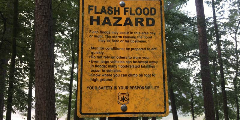
Current signage indicates day-use only status, though established camping infrastructure including fire rings and lantern hooks remains in place. Water levels fluctuate seasonally and can reach high stages that prompt flood warnings. Campers report limited cell service in this forested location. The area serves as a staging point for campgrounds around Oden and river access along this section of the Ouachita River system.
Description
The picturesque and scenic Ouachita River is one of the most beautiful and clear rivers in the Ouachitas. Beginning in the Ouachita Mountains near Mena, AR, the Ouachita River is a popular floating and fishing river as it flows easterly through the Ouachita National Forest, eventually becoming part of Lake Ouachita and Lake Hamilton near Hot Springs, before continuing its journey south towards Louisiana.
Beginning near Pine Ridge, AR, the Ouachita offers about 45 miles of floatable river until it become Lake Ouachita near AR Hwy 27. Along this stretch, there are seven landing sites, five of which are float camps. These float camps include Shirley Creek, Rocky shoals, Fulton Branch. Dragover and River Bluff. All five float camps are free to the public. These Float camps typically have openings, even on some holiday weekends when other campgrounds are full. Only rarely are these float camps filled up.
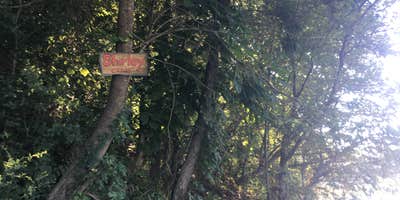
Shirley Creek Float Camp is located off of AR Hwy 88, west Pencil Bluff, and is situated right on the banks of the Ouachita River approx. 6 miles downstream from the Pine Ridge Access. This float camp offers six camping sites, as well as picnicking sites, a vault toilet and canoe access to the river.
Shirley Creek Float Camp is typically open Spring through Fall for overnight use, and is available for day use only the rest of the year.
RV Road Trip Guides


Map & DirectionsShirley Creek is located in Arkansas near Oden
Directions
From Pencil Bluff, head West on AR Hwy 88 for approx. 6.1 miles. Turn Left onto FR#7991/Shirley Creek Ln and go about ½ mile to the entrance.
Coordinates
34.60800006 N
93.83100067 W
Connectivity
 T-MobileNo CoverageVerified by 1 user
 VerizonLTESome Coverage
- AT&TNo Coverage
Connectivity
- T-MobileNo CoverageVerified by 1 user
- VerizonLTESome Coverage
- AT&TNo Coverage
Access
- Walk-InPark in a lot, walk to your site.
- Boat-InSites accessible by watercraft.
Site Types
- Tent Sites
Features
For Campers
- Trash
- Picnic Table
- Toilets
Drive Time
- 1 hr from Hot Springs, AR
- 1 hr 34 min from Fort Smith, AR
- 1 hr 46 min from Little Rock, AR
- 2 hrs 16 min from Texarkana, TX


