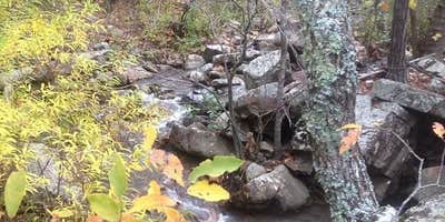
Billy Creek sits along the flowing waters of its namesake creek within the Ouachita National Forest, accessed via forest service roads that can become challenging during wet conditions. This 12-site campground operates on a first-come, first-served basis with no reservation system or entrance fees.
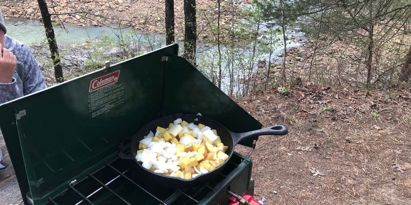
About half the sites position campers directly along the creek, where the sound of water moving over rocks provides a constant backdrop. Each site includes a fire ring, picnic table, and grill, though amenities vary significantly based on seasonal maintenance. "The campsite has tons of big trees," notes Janna R., providing natural shade throughout the developed area. Water availability fluctuates, with central spigots sometimes operational and vault toilets that may be locked during certain periods.
The campground serves as a hub for mixed-use trail access, with ATV, motorcycle, and hiking routes radiating from the area. Creek crossings on foot typically result in wet boots, but the water offers swimming opportunities during warmer months. Forest service roads provide additional exploration options for high-clearance vehicles. Traffic from recreational vehicles using nearby trails can generate noise during busy weekends, though weeknight visits often yield solitude broken only by creek sounds.
For campers wanting full hookups and consistent amenities, Big Cedar Cabins & RV Park provides a more developed alternative southeast of the forest boundary.
Description
The camping area lies along a small stream, which provides a great spot to fish for sunfish in the small pools. Billy Creek Trail starts here and climbs to the top of Winding Stair Mountain. The trail intersects the Ouachita National Recreation Trail, which travels east from Talimena State Park in Oklahoma to Pinnacle Mountain State Park in Arkansas for 225 miles. Printer-friendly guides to Billy Creek Recreation Area and Billy Creek Trail.
RV Road Trip Guides

Map & DirectionsBilly Creek is located in Oklahoma near Muse
Directions
From Hodgen, OK, take U.S. Rt. 270 south 10.4 miles to U.S. Rt. 259 sign. Turn right after sign onto Rt. 259 and go 9.2 miles to State Rt. 63 sign. Turn right onto Rt. 63 and go 5.7 miles to campground sign. Turn right at sign onto Forest Rt. 6022 (dirt, single lane with no turnouts) and go 0.1 miles to an intersection. Turn left and go 1.4 miles to a "Y" intersection. Bear left onto Billy Creek Rd. and go 0.1 miles into campground.
Coordinates
34.68700046 N
94.73500075 W
Connectivity
 T-MobileNo Coverage
 VerizonLTESome CoverageVerified by 3 usersLast on 7/1/26
 AT&T5GGood CoverageVerified by 4 usersLast on 7/1/26
Connectivity
- T-MobileNo Coverage
- VerizonLTESome CoverageVerified by 3 usersLast on 7/1/26
- AT&T5GGood CoverageVerified by 4 usersLast on 7/1/26
Access
- Drive-InPark next to your site
- Walk-InPark in a lot, walk to your site.
- Hike-InBackcountry sites.
- Boat-InSites accessible by watercraft.
Site Types
- Tent Sites
- RV Sites
- Standard (Tent/RV)
- Group
- Equestrian
Features
For Campers
- Trash
- Picnic Table
- Phone Service
- Drinking Water
- Electric Hookups
- Toilets
- Alcohol
- Pets
- Fires
For Vehicles
- Water Hookups
Drive Time
- 1 hr 12 min from Fort Smith, AR
- 1 hr 59 min from Fayetteville, AR
- 2 hrs 4 min from Hot Springs, AR
- 2 hrs 14 min from Texarkana, TX


