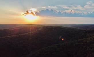
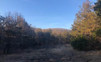
Dispersed camping near Compton, Arkansas offers rustic wilderness experiences within the Ozark National Forest and Buffalo National River areas. Situated in the Boston Mountains, most campsites lie between 1,500-2,300 feet elevation where fall colors typically peak in late October through early November. Winter camping remains possible with temperatures rarely dropping below 20°F, though forest service roads can become challenging after rainfall.
What to do
Hiking to scenic overlooks: The Morgan Mtn Rd/Spy Rock Dispersed area provides access to spectacular mountain vistas. "Spy Rock overlook is down the road and the view is spectacular. There are also nearby waterfalls to hike to," notes one camper. The trail requires some effort but rewards with panoramic views.
Rock climbing options: Sam's Throne Recreation Area serves as a premier climbing destination. A visitor explains, "This facility has day-use for rock climbing" with numerous routes available. The area attracts climbers of various skill levels throughout spring and fall months when temperatures are most favorable.
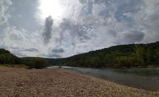
River activities: Riverside camping at Woolum Dispersed Area offers excellent swimming and paddling opportunities. "Right on the river with both a rock and sand beach currently," mentions a recent visitor. The Buffalo River provides gentle swimming holes in summer months when water levels are lower.
What campers like
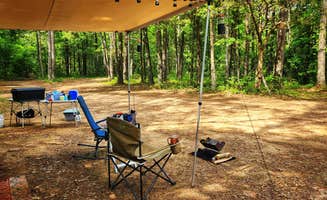
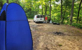
Spacious, private sites: Campers appreciate the separation between sites at many dispersed areas. At Sam's Throne, "Private camping spots, with trees separating each site" create a sense of solitude even when the campground has multiple occupants.
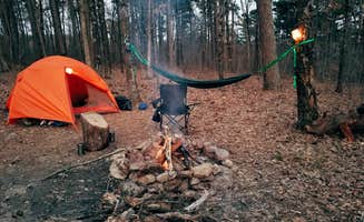
Night sky viewing: The minimal light pollution around primitive Compton camping areas makes for excellent stargazing. One camper at Sam's Throne Recreation Area noted, "On the right dark night you can see every star in the sky."
Wildlife encounters: Natural surroundings provide opportunities for wildlife observation. "Bambi and her mom also seem to live here," shares a visitor about the deer frequently spotted at Sam's Throne. Early mornings and evenings offer the best viewing opportunities for deer and other wildlife.
What you should know
Permit requirements: Gene Rush Wildlife Management Area requires specific permits for overnight stays. "100% of Wildlife Management Areas in the state of Arkansas require a Hunting license or WMA camping permit purchased though Arkansas Game and Fish," explains one reviewer. These permits cost $5 and can be purchased through the AGFC website.
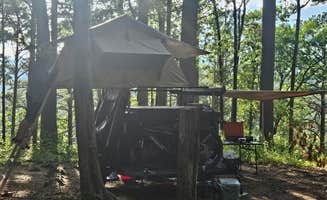
Road conditions vary significantly: Forest service roads may challenge some vehicles. At FR1802A, Meadows Knob Rd Dispersed, "FR1802A toward the site has some erosion; low clearance vehicles may high center in one or two spots." High clearance vehicles are recommended for accessing more remote sites.
Cell service variations: Connectivity differs greatly by location and carrier. Some campers report, "Good AT&T and T-Mobile 5G service" at certain sites, while others have no service. Morgan Mountain dispersed sites frequently show 1-3 bars of service depending on exact location and carrier.
Tips for camping with families
Choose sites with amenities: For family camping, consider locations with basic facilities. "There are a few vault toilets, but no running water" at Sam's Throne, making it more suitable than completely undeveloped areas when camping with children.
Water safety planning: When camping near Buffalo River, recognize water conditions can change rapidly. "The trailhead to Spy Rock is about a mile north of this site," providing an alternative activity if river conditions aren't suitable for swimming.
Wildlife awareness: Teach children proper wildlife protocols for the Ozarks. "There are a few bears in the region so I would hang my food just to be safe," advises a camper at Sam's Throne. Food storage containers or vehicle storage is recommended for all food items.
Tips from RVers
Site leveling challenges: Many primitive sites require work to level rigs. At Woolum Dispersed Area, "We can almost always find a spot to camp and it's super easy to pull our trailer into every spot there," though leveling blocks may still be necessary.
Generator considerations: Most dispersed sites have no restrictions on generator use, but proximity to other campers dictates courtesy hours. Early morning and late night generator use should be avoided, especially at more populated areas like Sam's Throne.
Access road assessment: Check road conditions before committing to remote sites with an RV. "The gravel road has some ruts but if you take your time small SUVs can make it fine," notes one camper about Morgan Mountain Road. Larger rigs should stick to more established areas during wet conditions.