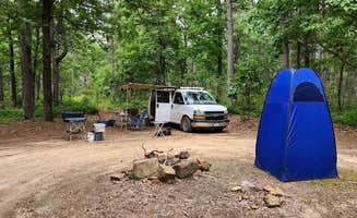
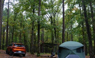
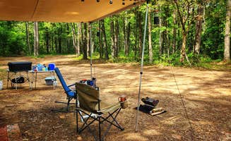
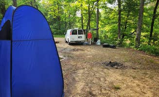
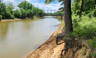
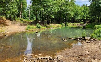
Dispersed camping near Clarksville, Arkansas offers primitive outdoor experiences throughout the Ozark National Forest at elevations ranging from 800 to 2,500 feet. The region receives about 46 inches of rainfall annually, creating lush forests and seasonal waterfalls. Most sites provide dirt or gravel surfaces with basic rock fire rings but require complete self-sufficiency for water, waste management, and other necessities.
What to do
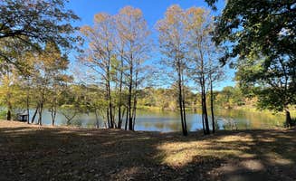
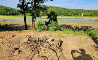
Fishing at local lakes: Spring Lake offers bank fishing opportunities with easy access from dispersed sites. "This site is mostly used for bank fishing on Spring Lake. Its a large loop at the end of a short narrow Forest Road 96001F," notes a camper at Spring Lake FR96001F Dispersed.
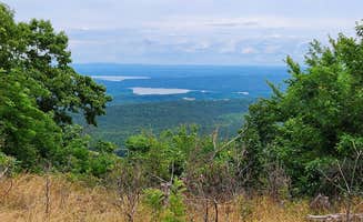
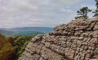
Hiking to viewpoints: The area features numerous hiking trails leading to scenic overlooks. At Morgan Mtn Rd/Spy Rock Dispersed, "Spy Rock overlook is down the road and the view is spectacular. There are also nearby waterfalls to hike to," according to one camper.
Stargazing: Clear night skies provide excellent stargazing conditions at many sites. "On the right dark night you can see every star in the sky," reports a visitor to Sam's Throne Recreation Area, which sits higher in elevation than many of the dispersed sites near Clarksville.
What campers like
Privacy between sites: Many dispersed camping areas offer good separation between campsites. At Sam's Throne Recreation Area, "Private camping spots, with trees separating each site" make for a more secluded experience according to one reviewer.
Wildlife encounters: The opportunity to observe local wildlife is a highlight for many campers. At Cane Creek Recreation Area, one camper advises: "Also, be aware if you use a flashlight, you WILL see eyeballs looking back at you from the other side of the water."
Clean facilities: Where vault toilets exist, they're generally well-maintained. "Compost bathrooms were super clean," notes a camper at Sam's Throne, while another mentions they are "cleaned every other day."
What you should know
Road conditions vary significantly: Many forest roads require careful navigation. At Meadows Knob Rd Dispersed, "Expect pinstriping along the access track to this secluded dispersed campsite. FR1802A toward the site has some erosion; low clearance vehicles may high center in one or two spots."
Weather preparedness: Storms in the Ozarks can develop quickly and intensely. A camper at Cane Creek advises: "Have a weather app, if you're not local storms here are fast to arrive and violent compared to other parts of the country."
Limited amenities: Most primitive camping areas near Clarksville lack basic services. "No water, trash, or toilets. Town is a nice 15 minute country drive, minimal amenities there but freeway is only another 10 minutes," reports a Cane Creek visitor.
Tips for camping with families
Wildlife viewing opportunities: Children often enjoy spotting local animals. "Bambi and her mom also seem to live here," notes a camper at Sam's Throne, making it appealing for families wanting to introduce children to wildlife observation.
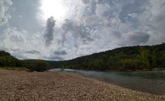
Plan for no facilities: Families need to bring everything required for their stay. At Forest Service Rd 82 Dispersed, a camper explains: "Forest Rd. 82 has 3-4 spots, all about 1-2 miles in. There may be more the further you go, but I didn't go that far. Easy access to the Redding Recreation Area for fishing/swimming."
Select level sites for tents: Finding flat ground for family-sized tents can be challenging. "The site is not level - slopes downhill a little toward the ridge. Camping rigs may need leveling depending on the parking spot," warns a camper at Morgan Mountain Road.
Tips from RVers
Size limitations: Most primitive sites near Clarksville accommodate smaller RVs only. At Eickleberry Rd Dispersed, "Level dirt camping area that loops around a dead tree...Can accomodate up to 3 SUVs, campervans or rigs with RTT. Probably only one truck camper can manuever and comfortably fit in this site."
Self-containment essential: Without hookups or facilities, RVers must be fully self-sufficient. A camper at Cane Creek Recreation Area notes: "Excellent free campground if you are self contained. No water/electric or toilet. Secluded and safe."
Leveling requirements: Many dispersed sites feature uneven terrain. "I had to use leveling blocks to level our van," shares a camper at Buzzards Rock Dispersed, highlighting the importance of bringing adequate leveling equipment.