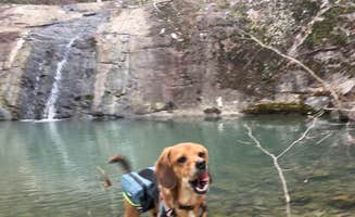
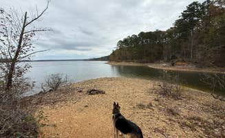
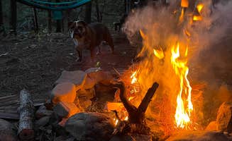
Top Dog Friendly Camping near Boles, AR

Looking for the best options for camping with dogs near Boles? Find the best information on pet-friendly camping near Boles, including sites, reviews, and tips for getting the most out of your RVing experience. Whether you're looking for a quiet location in the woods or a place near local attractions, The Dyrt makes it easy to find the perfect spot for you and your pup.

Best Dog-Friendly Sites Near Boles, AR (130)

    Camper-submitted photo from Queen Wilhelmina State Park — Queen Wihelmina State Park
    Camper-submitted photo from Queen Wilhelmina State Park — Queen Wihelmina State Park
    Camper-submitted photo from Queen Wilhelmina State Park — Queen Wihelmina State Park
    Camper-submitted photo from Queen Wilhelmina State Park — Queen Wihelmina State Park
    Camper-submitted photo from Queen Wilhelmina State Park — Queen Wihelmina State Park
    Camper-submitted photo from Queen Wilhelmina State Park — Queen Wihelmina State Park

    1.

    Queen Wilhelmina State Park — Queen Wihelmina State Park

    18 Reviews
    72 Photos
    58 Saves
    Mena, Arkansas
    • Pets
    • Fires
    • Electric Hookups
    • Phone Service
    • Reservable
    • ADA Access

    $23 / night

    Camper-submitted photo from Mount Magazine State Park Campground
    Camper-submitted photo from Mount Magazine State Park Campground
    Camper-submitted photo from Mount Magazine State Park Campground
    Camper-submitted photo from Mount Magazine State Park Campground
    Camper-submitted photo from Mount Magazine State Park Campground
    Camper-submitted photo from Mount Magazine State Park Campground

    2.

    Mount Magazine State Park Campground

    31 Reviews
    168 Photos
    202 Saves
    Blue Mountain, Arkansas

    Nestled between the Ozark National Forest to the north, and the Ouachita National Forest to the south, Mount Magazine State Park boasts the highest point in the state of Arkansas: Mount Magazine at 2753 feet. Located just 100 miles northwest of Little Rock, this area has been a recreation destination since the late 1800s. Recreation at Mount Magazine really started booming in the 1930s and 40s with the construction of a lodge, campgrounds and trails. Visitors came to beat the heat of the surrounding valleys, as well as to enjoy the panoramic views, abundant wildflowers, autumn color, and numerous opportunities to play outdoors. The area finally became a state park in 1998.

    Whether you prefer a posh lodge or cabin, a fully-equipped RV pad, or a rustic campsite, there’s a place for you to stay and play at Mount Magazine. The park’s campground offers 18 spacious sites with full or partial hookups. Amenities include flush toilets, hot showers and a dump station. Campers are required to store food and trash properly to minimize black bear encounters. For more luxuriant accommodations, the park’s lodge offers 60 guest rooms and spa suites with a variety of comforts, as well as 13 full-equipped cabins with up to three bedrooms. Not in the mood for hot dogs over the campfire? The large dining room at the Skycrest Restaurant serves daily meals while overlooking the Petit Jean River Valley.

    When you’re ready to play on Mount Magazine, you can do it by foot, wheels or wings. Hikers have access to 14 miles of trails, ranging from 1 to 3 miles, with connecting options for going farther. The 34-mile Huckleberry Mountain Trail is great for mountain biking and horseback riding. For gravity-defying activities, the park offers more than 100 climbing routes on its southern bluff, as well as a hang gliding launch point over the Petit Jean River Valley. Less strenuous activities include bird and wildlife watching, guided ranger walks, historic site tours and various interpretive programs and outdoor skills workshops. There’s also spectacular leaf-peeping in the fall when the forest takes on its vibrant autumn transformation.

    • Pets
    • Fires
    • Electric Hookups
    • Phone Service
    • Reservable
    • ADA Access

    $35 / night

    Camper-submitted photo from COE Lake Ouachita Crystal Springs Campground
    Camper-submitted photo from COE Lake Ouachita Crystal Springs Campground
    Camper-submitted photo from COE Lake Ouachita Crystal Springs Campground
    Camper-submitted photo from COE Lake Ouachita Crystal Springs Campground
    Camper-submitted photo from COE Lake Ouachita Crystal Springs Campground
    Camper-submitted photo from COE Lake Ouachita Crystal Springs Campground

    3.

    COE Lake Ouachita Crystal Springs Campground

    43 Reviews
    53 Photos
    45 Saves
    Royal, Arkansas

    Overview

    Crystal Springs Campground, perched on the shores of Lake Ouachita in Arkansas, is an ideal spot for families, friends and couples. Approximately 1.2 million people visit the lake each year to explore its crystal clear waters and scenic mountain landscape.Click here for the Lake Ouachita Virtual Tour.

    Recreation

    Visitors enjoy fishing, water skiing, hiking and boating. Scuba diving is particularly popular because of the lake's high underwater visibility. Small and rare freshwater jellyfish (non-stinging) can be found, in addition to many types of fish, including the striped bass, lazily drifting between rocks. Bald eagles are a big attraction for bird watchers and photographers in winter months.

    Facilities

    Visitors enjoy fishing, water skiing, hiking and boating. Scuba diving is particularly popular because of the lake's high underwater visibility. Small and rare freshwater jellyfish (non-stinging) can be found, in addition to many types of fish, including the striped bass, lazily drifting between rocks. Bald eagles are a big attraction for bird watchers and photographers in winter months.

    Natural Features

    Lake Ouachita is nestled in the Ouachita Mountains just 10 miles west of Hot Springs National Park. The pool is fed by the cool waters of the Ouachita River and extends about 30 miles over 40,000 surface acres.

    contact_info

    This location is unstaffed. To speak with our main office for general information, please call: (501) 767-2101.

    Nearby Attractions

    Part of the scenic 223-mile Ouachita National Recreation Trail runs just north of the lake. Here, hikers and mountain bikers can explore an array of breathtaking views in the Ouachita Mountains.

    • Pets
    • Fires
    • Electric Hookups
    • Phone Service
    • Reservable
    • RVs

    $18 - $20 / night

    Camper-submitted photo from Shady Lake Campground
    Camper-submitted photo from Shady Lake Campground
    Camper-submitted photo from Shady Lake Campground
    Camper-submitted photo from Shady Lake Campground
    Camper-submitted photo from Shady Lake Campground
    Camper-submitted photo from Shady Lake Campground

    4.

    Shady Lake Campground

    12 Reviews
    26 Photos
    99 Saves
    Umpire, Arkansas

    Scenic 25-acre lake in remote mountain setting.The Civilian Conservation Corps developed the Shady Lake Recreation Area in 1937. The Shady Lake Trail traverses Saline Creek and passes the historic Shady Lake Dam. It continues along the eastern edge of the campground. The trail is ideal for day hiking. Mountain bikers may also use the trail. Individual campsite temporary closings: For your safety, the following campsites are closed while being evaluated for risk of flooding: B12, B14, B18, B20, B21, C1, C2, C3, C4, D4, D6, D8, D10

    • Pets
    • Fires
    • Electric Hookups
    • Phone Service
    • Reservable
    • ADA Access
    Camper-submitted photo from Denby Point
    Camper-submitted photo from Denby Point
    Camper-submitted photo from Denby Point
    Camper-submitted photo from Denby Point
    Camper-submitted photo from Denby Point
    Camper-submitted photo from Denby Point

    5.

    Denby Point

    18 Reviews
    56 Photos
    99 Saves
    Mount Ida, Arkansas

    Overview

    Groups and families of all sizes come to camp at Denby Point for its scenic views, year-round fishing and convenient boating facilities. The campground promises to entertain jet skiers, boaters, hikers and birders alike. Click here for the Lake Ouachita Virtual Tour.

    Recreation

    World-class striper fishing brings crowds of anglers year-round, and incredibly clear waters attract scuba divers, hoping to explore the flooded forests and mountain valleys below the lake's surface. Hikers take pleasure in the Lake Ouachita Vista Trail (LOViT), which lines the southern end of the lake.

    Facilities

    World-class striper fishing brings crowds of anglers year-round, and incredibly clear waters attract scuba divers, hoping to explore the flooded forests and mountain valleys below the lake's surface. Hikers take pleasure in the Lake Ouachita Vista Trail (LOViT), which lines the southern end of the lake.

    Natural Features

    Lake Ouachita sits in the heart of the Ouachita Mountains, just 28 miles west of Hot Springs National Park. The lake stems from the Ouachita River and boasts 692 miles of shoreline and over 40,000 surface acres.

    Nearby Attractions

    Explore Ouachita National Forest's 1.8 million acres, surrounding Lake Ouachita and extending across central Arkansas and southeastern Oklahoma.

    contact_info

    This location is unstaffed. To speak with our main office for general information, please call: (501) 767-2101.

    • Pets
    • Fires
    • Electric Hookups
    • Phone Service
    • Reservable
    • RVs

    $60 / night

    Camper-submitted photo from Daisy State Park Campground
    Camper-submitted photo from Daisy State Park Campground
    Camper-submitted photo from Daisy State Park Campground
    Camper-submitted photo from Daisy State Park Campground
    Camper-submitted photo from Daisy State Park Campground
    Camper-submitted photo from Daisy State Park Campground

    6.

    Daisy State Park Campground

    24 Reviews
    66 Photos
    116 Saves
    New Melones Lake, California

    Located in a scenic setting in the beautiful Ouachita Mountains, Lake Greeson and the Little Missouri River create a destination for outdoor recreation. Situated on Lake Greeson, Daisy State Park is a popular place for fishing and kayaking with rentals available. Lake tours offer views of magnificent rock formations that you may not otherwise see. The Little Missouri River also offers impressive fishing for trout and excellent floating in the spring. Other activities include ATV riding on the Bear Cycle Trail. Daisy is near Crater of Diamonds State Park which makes a great day trip from your campsite. There are three YURTs, 100 campsites (26 Class A, 56 Class B, and 18 tent sites), picnic areas, a pavilion, launch ramps, and a playground.

    • Pets
    • Fires
    • Electric Hookups
    • Phone Service
    • Reservable
    • ADA Access
    Camper-submitted photo from Crystal Campground
    Camper-submitted photo from Crystal Campground
    Camper-submitted photo from Crystal Campground
    Camper-submitted photo from Crystal Campground
    Camper-submitted photo from Crystal Campground
    Camper-submitted photo from Crystal Campground

    8.

    Crystal Campground

    10 Reviews
    54 Photos
    219 Saves
    Norman, Arkansas

    Small campground in an attractive wooded site next to a small stream. More recreation opportunities in the Caddo/Womble Ranger District

    • Pets
    • Fires
    • ADA Access
    • RVs
    • Tents
    • Standard (Tent/RV)
    Camper-submitted photo from CMA Iron Mountain Cabins and Campground
    Camper-submitted photo from CMA Iron Mountain Cabins and Campground
    Camper-submitted photo from CMA Iron Mountain Cabins and Campground
    Camper-submitted photo from CMA Iron Mountain Cabins and Campground
    Camper-submitted photo from CMA Iron Mountain Cabins and Campground
    Camper-submitted photo from CMA Iron Mountain Cabins and Campground

    9.

    CMA Iron Mountain Cabins and Campground

    5 Reviews
    12 Photos
    10 Saves
    Mena, Arkansas

    Welcome Home! Iron Mountain is a beautiful facility nestled in the Ouachita Mountains in West Central Arkansas. On Iron Mountain we have four beautiful cabins, two deluxe cabins and two camping cabins. We also offer over 70 full service RV sites, and hundreds of cultivated camping sites. Iron Mountain is also a great place to hold an event in a Christian atmosphere. We have three unique meeting areas available, including a 40,000 square foot Pavilion, where you can host a variety of different events. With its beautiful rustic mountain scenery, yet easy highway accessibility, Iron Mountain is a perfect place to stay or to host an event. Contact us for a one of a kind experience.

    • Pets
    • Fires
    • Electric Hookups
    • Phone Service
    • Reservable
    • ADA Access

    $12 - $105 / night

  • 10.

    Heavener Runestone Park

    8 Reviews
    94 Photos
    173 Saves
    Heavener, Oklahoma

    Heavener Runestone Park is a 55-acre park located in Le Flore County, Oklahoma. It is located near the city of Heavener, Oklahoma. Formerly a state park of Oklahoma, it was transferred to the City of Heavener in 2011, and is now operated by the Friends of Heavener Runestone, a non-profit organization. The park features a little over 2 miles of hiking trails, seasonal waterfall, playground, gift shop, over a dozen camp sites and spectacular views. There are clean facilities on site including free hot showers for all campers. Located just on the edge of town for the quick trip for things forgotten but still gives the forest camping vibe.

    • Pets
    • Fires
    • Electric Hookups
    • Phone Service
    • Reservable
    • ADA Access

    $15 - $20 / night

Showing results 1-10 of 130 campgrounds

Recent Dog-Friendly Reviews In Boles

509 Reviews of 130 Boles Campgrounds


  • Camper-submitted photo from Springhill
    September 12, 2024

    Springhill

    2 Days Nice

    A little older of an area. Stayed in site B10. Close to level. We have a 36' 5th wheel, tow vehicle, plus another vehicle. Easy entry into site and large enough for all vehicles. Asphalt with concrete patio. There is a picnic table and fire ring. 50/30/20A We can kind of see the river from this site. Very roomy sites in the woods with plenty of shade. Mostly dirt ground. Older but clean restrooms. We didn't use them. There are single person combined toilet and shower rooms at the front of park. There are mountain bike/hiking trails all over, even a little bike park with ramps and jumps. Playground and boat ramp. No sewer hookups, but there is a dump station. Lots of mosquitoes in the evening. Although some sites need maintenance and the restrooms are old, this is a nice park. We stayed 2 days and would definitely stay again.

  • Camper-submitted photo from Cove Lake Complex
    July 25, 2024

    Cove Lake Complex

    Hidden gem in the Ozarks

    Fantastic smaller campground minutes from Mount Magazine. It seems to be overshadowed by much larger, better known places like Devils Den, so it's fairly quiet even when it's 'busy.' We also learned that it has new management as of this year (2024), a young family that's extremely hands-on.

    We stayed as a group (three families with 7 kiddos total, ranging from 6-15), across two adjacent sites: 1 & 3. You could see the lake from our sites, but they don't sit right over the lake like some do. With so many kids in our group, we actually wanted that. Sites are extremely spacious and well spaced from each other, and would feel even more private later in the season when the trees are full. Bathrooms are simple pit toilets, but clean and well-maintained. 

    Boat rentals right onsite, concessions, even a small beach area! We will 100% be back. No cell service whatsoever with Verizon.

  • Camper-submitted photo from Jack Creek Dispersed, Ouachita National Forest, AR
    July 22, 2024

    Jack Creek Dispersed, Ouachita National Forest, AR

    Large wooded dispersed campsite near creek

    Coordinates: 35.02281, -93.81060. Located 2.5 miles past the entrance of the Jack Creek Recreation Area, and almost 1 mile past the turn off to the shooting range. Jack Creek Road is a mixed dirt/gravel road, wider than a single track; it is well maintained with some minor erosion in a few places. The campsite is well off of Jack Creek Road, down an undesignated dirt track, offering a lot of privacy. Access is easy although the dirt track may be muddy during the wet season. This is a large wooded dispersed campsite that has a short path down to Jack Creek. Depending on the water level, fishing and wading are possible at the creek. The site has a level dirt surface which can accommodate 4 rigs - truck camper size and smaller. Tent and hammock camping are possible. The site has a clean rock fire ring. There is a lot of shade during the summer. Solar charging is possible in an open field at the entrance of the site. This is a wonerful site to camp in. Jack Creek Recreation Area and the Sugar Creek hiking trail are a short drive away. I received no t-Mobile cell service.

  • Camper-submitted photo from Jack Creek Rd Pull Thru Dispersed, Ouachita National Forest, AR
    July 21, 2024

    Jack Creek Rd Pull Thru Dispersed, Ouachita National Forest, AR

    Small Pull Thru Site with Easy Access

    Coordinates: 35.02422, -93.81997. Located 2 miles past the entrance of the Jack Creek Recreation Area, and 1/3rd mile past the turn off to the shooting range. It is a small pull though campsite with a small rock fire ring, close to Jack Creek Road (forest road); there is very little privacy from the forest road. Jack Creek Road is a mixed dirt/gravel road, wider than a single track; it is well maintained with some minor erosion in a few places. This campsite can receive dust from passing vehicles. The site can easily accommodate 2 vehicles, truck camper size and smaller, parked one behind the other. The site is shaded with a level dirt surface. Small tent & hammock camping is possible near rock fire ring which is located between the pull through driveway and the forest road. Easy access into the site. There is no T-Mobile cell service. There is nothing special about this campsite; no recreation, such as hiking trails, in the immediate vicinity. Jack Creek Recreation Area and the Sugar Creek hiking trail are a short drive away.

  • Camper-submitted photo from Jack Creek Road Dispersed, Ouachita National Forest, AR
    July 19, 2024

    Jack Creek Road Dispersed, Ouachita National Forest, AR

    Large wooded site just off Jack Creek Road

    Not sure if the pin location is accurate, so here are the coordinates: 35.02802, -93.82913.  Located 1.3 miles past the entrance of the Jack Creek Recreation Area. It is a large site with a large rock fire ring, set back a little from Jack Creek Road (forest road). Jack Creek Road is a mixed dirt/gravel road, wider than a single track; it is well maintained with some minor erosion in a few places. The campsite has a mostly level dirt surface that can accommodate 2 vehicles - truck camper size and smaller. Tent and hammock camping is possible. The site is mostly shaded in the summer. There is an old undesignated track near the rear of the site; this may lead down to Jack Creek, but I was not able to verify this due to large mud puddles on the track. There was a little bit of trash at the site, but not too bad. I received no T-Mobile cell service. There is nothing special about this campsite; just a nice place to camp in for a night or two. Jack Creek Recreation Area and the Sugar Creek hiking trail are a short drive away.

  • Camper-submitted photo from Girard Rd/Forest Road 20 Dispersed, Ouachita National Forest, AR
    July 17, 2024

    Girard Rd/Forest Road 20 Dispersed, Ouachita National Forest, AR

    Somewhat private dispersed site off of unbusy forest road

    Coordinates: 35.02531, -93.88228. Located just off of Girard Road (Forest Road 20) - a maintained gravel/dirt forest road. This road is mostly a single track - narrow with some minor erosion in a few places. A lifted 4x4 vehicle is NOT needed to drive to the site. The dispersed site is located 1.3 miles south of the turnoff to Jack Creek Recreation Area. This site is set off from the forest road on a narrow undesignated dirt track which is easy to miss. It is a small site with enough room for one vehicle - truck camper size and smaller. The site is mostly level on a dirt surface with a rock fire ring. It is mostly shaded, although solar recharging may be possible during the afternoon with solar panels being placed on the access track in front of the site. Tent and hammock camping are possible. Received a strong T-Mobile 5G signal here. Except for some peace and quiet, there is nothing remarkable about this particular campsite. However, is is located in the Jack Creek area of the Arkansas Ouachitas. This area has a few nice swimming holes and hiking trails which one can drive to. OHV recreation is also possible in the area.

  • Camper-submitted photo from Ashley Creek Recreation Area
    July 17, 2024

    Ashley Creek Recreation Area

    Pretty Location, Free Primitive Camping

    I didn't camp here, but thought I leave an updated review. Previous review still applies. This is a free primitive campground, but a permit is required to camp here; see COE Web site for info. There is a very clean portable john with tp in the campground. It appears that the campsites themselves have not been maintained in a while, although the campgound itself looks nice, with a view of the lake. Some of the sites are close together offering no privacy. I received T-Mobile cell service. Convenient boat ramp nearby. I wouldn't make this campground a multi-day vacation destinition, but it's convenient for an overnight stay and for those using the lake for recreation.

  • Camper-submitted photo from Mount Magazine State Park Campground
    July 8, 2024

    Mount Magazine State Park Campground

    Nice Two Day Place

    There is not a lot to do, and it is pretty far from the city. However, there are big RV sites and amazing sunsets. There is also a lake nearby. 

    Dog friendly.

    There are lots of nature trails, but none very long.

    Lots of ticks, tricky to get good starlink connection.

  • Camper-submitted photo from Cove Mountain Group Dispersed, FR83W/CR9, Ouachita NF, AR
    June 16, 2024

    Cove Mountain Group Dispersed, FR83W/CR9, Ouachita NF, AR

    Large Winter Season Group Site

    Coordinates: 34.91054, -93.20432. Large dispersed group site with a large rock fire ring. Suitable for winter season activities such as hunting. Can also accommodate a group of overlanders. It's a large open site with a forest backdrop. Can park several rigs. The site is level with a dirt and grass base. I wouldn't camp here in the summer; the grass and weeds are too high for comfort (see photos). When I visited this spot in February a few years ago, the site was much better. Track F70B is about 2000 feet to the east; this 1.4 mile track is closed to vehicles but can be hiked.

  • Camper-submitted photo from Off FR83W/CR9 Dispersed, Ouachita NF, AR
    June 15, 2024

    Off FR83W/CR9 Dispersed, Ouachita NF, AR

    Winter season dispersed camping

    Coordinates: 34.90850, -93.21840. This is a nice winter season dispersed site. During the summer, this site is overrun by high grass and weeds as can be seen in the photos. When I visited this site during February a few years ago, all of that stuff was dead and matted down, with easy access to the rock fire ring. This site is located along an unnamed 4WD track just off of Forest Road 83W / County Road 9. The forest road is in great shape; the 4WD track is badly eroded just past the campsite. This track is not on any of the forest service maps (including the MVUM) that GAIA GPS provides. It does show up as a 4WD track on the USGS Topo map. The track may be a good hiking trail for exploring the forest. There is a clearing along the track for parking a vehicle - campervan size and smaller.

  • Camper-submitted photo from FR 83W/CR84 Dispersed near Pond, Ouachita NF, AR
    June 15, 2024

    FR 83W/CR84 Dispersed near Pond, Ouachita NF, AR

    Overnight Dispersed Site on FR83W

    Coordinates: 34.90529, -93.27455. Along Forest Rd 83W (also called CR 84). This small site is close to the forest road; can get dusty. Big enough for a truck camper; easy access. Slight downward slope. The site was clean when I visited. Clean rock fire ring. A pond, probably a wildlife watering hole, is a short walk through the woods behind site. The forest behind the site is nice; good area to walk and explore. The FR83W was in great shape; no issues with accessing this site. No hiking trails nearby. No T-Mobile cell service.

  • Camper-submitted photo from Fourche Mountain Campground
    June 15, 2024

    Fourche Mountain Campground

    Free Overnight Stay in the Ouachita National Forest

    Stayed here on June 11, 2024. Small 5-site primitive campground. No water. No electric. Clean vault toilets with tp, and a trash barrel. Clean campground & campsites. Sites are small with reasonable separation, but no privacy. Sites have clean picnic tables, fire ring/grill. Some have lantern plies. Gravel drive. Sites nearly level. No tent pads, but tents can be set up. Sites may be able to accommodate a truck camper & smaller. Lots of highway noise from nearby Hwy 27, but not too bad overnight. There was logging activity elsewhere in the national forest, so log haulers were driving by during the day. Campground is located at eastbound turnoff onto Forest Road 83W - a well maintained gravel road. Pine & oak trees in the campground. Probably a beautiful view of distant mountains during the winter. This campground is good for an overnight stay when exploring the national forest or passing by on Highway 27. There is no recreation in this recreation area; no water access, no hiking trails. Good T-Mobile cell service. Despite some of the road noise from nearby Highway 27, I really liked this campground.

  • Camper-submitted photo from CR133/FR146 Hogan Creek Dispersed, Ouachita NF, AR
    June 15, 2024

    CR133/FR146 Hogan Creek Dispersed, Ouachita NF, AR

    Small Dispersed Site, Tucked Away

    Coordinates: 34.93095,-93.32258. This a small dispersed camp site tucked away a short way from County Road 133/ Forest Rd 146 in the Ouachita National Forest. It's at the end of a short dirt track which may have been an old forest road. Above Hogan Creek, sounds of the creek can be head at this site. There is a path along the creek behind the campsite; it eventually provides access down hill to the creek. This is a secluded spot which can not be easily seen from CR133/FR146. Backing your vehicle into the site is best. There is a small rock fire ring at the end of the access track. The site's entrance is on the right hand side just after the bridge crossing Hogan Creek when coming from the west on CR133/FR146. A truck camper and smaller can fit into the site. A little bit of leveling may be required. Tent camping is also possible. It's a pretty campsite. The forest road is in great shape.

  • Camper-submitted photo from Creekside Dispersed, Hogan Creek, Nimrod Lake Rec Area, AR
    June 14, 2024

    Creekside Dispersed, Hogan Creek, Nimrod Lake Rec Area, AR

    Rugged Creekside Site in the Forest

    Coordinates: 34.93556,-93.32764. Located down narrow, rocky inclined track toward Hogan Creek, off of County Road 133. It is within the boundary of US Army Corps of Engineers Nimrod Recreation Area in Yell County. Should accomodate a single vehicle, jeep or similar sized 4x4 high clearence rig. Can also park along side CR133 and walk the short track down to the site. There is a pull-off just at the entrance of the track. The camping area is small with a small rock fire ring. The surface is rocky in places. Should be able to find a spot for a small tent. Hammock camping may also be possible since there are lots of trees at this spot. Leveling may be required if camping in a vehicle. Its a pretty spot along Hogan Creek; the sound of the flowing creek is nice. The area is prone to flooding.

  • Camper-submitted photo from Wards Crossing Dispersed, Nimrod Lake Rec Area, AR
    June 14, 2024

    Wards Crossing Dispersed, Nimrod Lake Rec Area, AR

    Large dispersed site along Fourche La Fave River

    Large dispersed campsite along the Fourche La Fave River on US Army Corps of Engineers land in the Nimrod Lake area. A boat launch to the river is next to the site. Because of erosion, direct access to the river bank from behind the site is difficult. This site can accomodate multiple rigs. Tent camping is possible. The level site surface is a mixture of dirt, sand & gravel. A small rock fire ring, lantern pole and a broken picnic table is included. There was some trash at the site but not too bad. Access to the site is on River Road which is gravel and a little pot-holed. A small RV, small towable, truck camper and any rig smaller should have no problem accessing the site. Note that accessing it on Duck Pond Rd from the south, you have to cross the narrow Wards Crossing Bridge which has a 3 ton weight limit.

  • Camper-submitted photo from Sunlight Bay
    June 14, 2024

    Sunlight Bay

    Nice Class A COE Campground

    Visited on June 11, 2024. Current fees range from $18 to $40 (half price with federal pass). Most sites are reservation only via Recreation.gov. This is a clean Class A campground with flush toilets, hot showers, trailer dump station, trash dumpster, electrical hookups, water hookups, playground, boat launch ramps, and fish cleaning station. 29 campsites with electricity and water and 1 picnic shelter. Site driveways are paved. This is also a day use; day use fees apply. Located on a  Wilson Slough of the Fourche La Fave River; looks like a good spot for bank fishing, and for lauching canoes & kayaks for exploring the river. I didn't see specific tent sites, but I believe its possible on a few sites. I saw a Corps of Engineers park ranger on site. Nice location, but most sites are sparsley shaded. Most sites include a shelter over the picnic tables. Some sites are close togther, and there is no privacy between sites. Access to the campground on Sunlight Bay Rd is on a well maintained gravel road; the roads within the campground are paved.

  • Camper-submitted photo from Ouachita National Forest Fourche Mountain
    June 11, 2024

    Ouachita National Forest Fourche Mountain

    No dispersed site at coordinates

    The coordinates placed me at a gated forest road. There is no dispersed campsite here. There is also no river access or creeks at this location. I bet the original reviewer is describing a location down Forest Road 796 which goes westbound from near this location toward the Fourche La Fave River.

  • Camper-submitted photo from Pigeon Creek Dispersed
    June 9, 2024

    Pigeon Creek Dispersed

    No access

    We drove slowly back and forth along the road exactly where the coordinates lead us to but there is no vehicle access to the forest there. It’s completely overgrown

  • Camper-submitted photo from Clear Creek - Ozark Lake (AR)
    June 6, 2024

    Clear Creek - Ozark Lake (AR)

    Bugs bugs bugs

    I don’t have many nice things to say about this campground. The bugs were out of control. The bathroom was out of order and a porta potty was set up beside it. The site we chose,#3, was the best site. We found some good trees to set up our hammocks with a view of the forest. 1 and 2 were ok, 4-9 were downright terrible. Basically a parking spot with a picnic area. All the sites were close together. The check in process consisted of a guy in an unmarked vehicle driving up and striking up a conversation without identifying himself. Check out works the same. If you have a boat or tv this park may be nice but I wouldn’t camp here. The hike around nearby lake Alma was the highlight of our trip.

  • Camper-submitted photo from Eickleberry Rd Dispersed, Ozarks NF, AR
    June 1, 2024

    Eickleberry Rd Dispersed, Ozarks NF, AR

    Nice Spot in the Woods

    Exact location: 35.21834, -93.49261. Located in the Mt. Magazine Wildlife Management Area in the Ozark National Forest. Level dirt camping area that loops around a dead tree. The site is at the beginning of Forest Road 96019A, a very short distance off of Eickleberry Road (FR 1613). Can accomodate up to 3 SUVs, campervans or rigs with RTT. Probably only one truck camper can manuever and comfortably fit in this site. The short drive on FR96019A, accessing the site, is a little eroded but a 2wd vehicle can handle it. There are two tracks from the site that can be hiked. There are a lot of trees surrounding the site. It is mostly private from Eickleberry Rd. During our mid-week stay, there was very little vehicle and OHV traffic on the gravel Eickleberry Rd, and no one attempted to access FR90019A which is gated just past the site. No AT&T and T-Mobile cell service. Except for wonderful nature sounds, very quiet and peaceful night. Buzzards Rock overlook is north at the end of Eickleberry Rd (35.25265, -93.49427). Big Shoal Falls is located about a half-hour southwest along Spring Lake Rd (35.19472, -93.54479). Really enjoyed disperse camping here; looking forward to returning.

  • Camper-submitted photo from Buzzards Rock Dispersed, Ozark NF, AR
    June 1, 2024

    Buzzards Rock Dispersed, Ozark NF, AR

    OHV Trails Dirpersed Camping

    Exact location: 35.24838,-93.48166. Located in the Mt. Magazine Wildlife Management Area of the Ozark National Forest. The dispersed campsite is on Forest Road 96022B, after the end of Eickleberry Road (FR 1613). There are no obstacles with accessing the site on the forest roads. It is at the junction of designated OHV trails, and located next to a parking area for an unnamed overlook. This parking lot probably serves as a staging area for offroad rigs. Buzzards Rock overlook is almost 1 mile away from the campsite - an easy hike down an OHV trail.  Other OHV trails in the area are hikeable. There is a pond near the campsite but don't know if there are fish in it. The campsite is small - enough room for one truck camper or smaller. Had to use leveling blocks to level our van. There is a rock fire ring at the site. The site is surrounded by OHV trails resulting in noise. There was plenty of OHV activity here during our mid-week stay. The site is semi open. There is AT&T and T-Mobile LTE service.

  • Camper-submitted photo from Below Spring Lake Dam dispersed, Ozark NF, AR
    May 31, 2024

    Below Spring Lake Dam dispersed, Ozark NF, AR

    River side dispersed camping below dam

    This dispersed site is located down a narrow track to the river just below Spring Lake. The track is on an incline ending is a large mud puddle at the bottom. Access via a 4x4 vehicle should be no problem. I didn't go into the site since it was already being occupied. Just wanted to list it here in case others want to give it a try. From what I can see, its a beautiful, secluded spot along a stream. The sound of the stream is very pleasing. Access to the track is from unpaved County Road 35. Note that County Road 438 (FR1602A) does not connect to County Road 35 from the Spring Lake Recreation campground. This is an error on the maps used by TheDyrt, Google maps & GAIA GPS. This site is located in the Mt. Magazine Wildlife Management Area of the Ozark National Forest.

  • Camper-submitted photo from West Side Spring Lake Dispersed, Ozark NF, AR
    May 31, 2024

    West Side Spring Lake Dispersed, Ozark NF, AR

    Beautiful View of Spring Lake

    Actual location: 35.15609,-93.42893. Located along gravel County Road 35, just south of County Road 561, right on the west side of Spring Lake. Beautiful view of the lake. Large enough for two rigs - truck camper size and smaller. Level area for tents. This is a pull through site with two entrances/exits; the north access is easier. Canoe and kayak access to lake. Bank fishing also possible. No fire rings, although there are a few spots of past campfires. This appears to be a popular site. Note that there is some broken glass on this dirt site; did the best we can to pick it up. No amenities. Had some AT&T and T-Mobile LTE service. The site is located within the Mt. Magazine Wildlife Management Area in the Ozark National Forest. The Spring Lake Recreation Area is located across the lake.

  • Camper-submitted photo from Spring Lake FR96001F Dispersed, Ozark NF AR
    May 31, 2024

    Spring Lake FR96001F Dispersed, Ozark NF AR

    Dispersed Camping at Fishing Spot

    Actual location: 35.15604,-93.42697. This site is mostly used for bank fishing on Spring Lake. Its a large loop at the end of a short narrow Forest Road 96001F. The site can accomodate a few rigs - truck camper size and smaller. A truck camper may get pinstripped along the access road. There is a large rock fire ring in the middle of the loop. The area is not level, so leveling youir rig may be needed. The site did have some trash at the time of our visit. The site offers a beautiful view of the lake. Easy walking access to the bank for fishing. No amenities. This site is located within the the Mt. Magazine Wildlife Management Area, and is close to the Spring Lake Recreation Area in the Ozark National Forest.

  • Camper-submitted photo from Pigeon Creek Dispersed
    May 26, 2024

    Pigeon Creek Dispersed

    Would have been perfect

    The river and creek merging was so beautiful! It was a beautiful drive there. But whoever was there before me trashed it out. It’s sad.


Guide to Boles

Camping near Boles, Arkansas, offers a mix of beautiful landscapes and outdoor activities. Whether you're looking for a peaceful retreat or an adventure-filled getaway, there are several campgrounds to choose from.

What to do

  • Hiking: Explore the nature trails around Mount Magazine State Park Campground. One reviewer mentioned, "There are lots of nature trails, but none very long," making it a great spot for a quick hike.
  • Fishing: Head to Denby Point for some fishing fun. A camper shared, "The swim beach was nice and we found a shady spot," perfect for a family day by the water.
  • Wildlife Watching: Enjoy the scenery at Queen Wilhelmina State Park. One visitor noted, "The views are top notch, with some incredible sunsets," ideal for spotting local wildlife.

What campers like

  • Clean Facilities: Campers appreciate the well-maintained restrooms and showers at Cossatot Falls Campsites. A review stated, "The bathroom was clean and well stocked," which is always a plus.
  • Spacious Sites: Many enjoy the roomy campsites at Cedar Lake (Oklahoma) Equestrian Camp. One camper mentioned, "There is lots of space between sites more than most campgrounds!!!"
  • Scenic Views: Campers rave about the stunning views at Waveland Park. A visitor said, "The scenery was amazing! We went in mid-September and there were no annoying bugs."

What you should know

  • Limited Amenities: Some campgrounds, like Cossatot Falls Campsites, have no drinking water or electric hookups. A review noted, "No running water or electricity but it was a great place to have a picnic and explore!"
  • Cell Service: Be prepared for spotty cell service in areas like Queen Wilhelmina State Park. One camper mentioned, "Cell service was spotty," so plan accordingly.
  • First-Come, First-Serve: Some sites, such as those at Cedar Lake (Oklahoma) Equestrian Camp, operate on a first-come, first-serve basis. A visitor shared, "Limited camp sites; first come first serve at times."

Tips for camping with families

  • Kid-Friendly Activities: Look for campgrounds with swimming areas, like Denby Point. A family shared, "We had a great time with our 2 and 4-year-old. The swim beach was nice."
  • Nature Exploration: Choose spots with easy access to trails, such as Mount Magazine State Park Campground. One reviewer said, "There are lots of nature trails," perfect for little explorers.
  • Pack Snacks: Bring along snacks and drinks, especially for places like Shady Lake Campground, where amenities may be limited. A camper noted, "The campground seemed well maintained and everyone respectful of each other."

Tips from RVers

  • Check Site Size: Make sure your RV fits the site, especially at Queen Wilhelmina State Park. One reviewer mentioned, "The campsite layout is…weird," so be cautious.
  • Bring a Booster: If you rely on cell service, consider bringing a booster. A camper at Cedar Lake (Oklahoma) Equestrian Camp said, "Cell Service is bad...was only able to get a weak signal."
  • Plan for Water Access: Some campgrounds, like Cossatot Falls Campsites, lack water hookups. A visitor noted, "There are six very large pads right by the river," so be prepared to bring your own water.

Camping near Boles, Arkansas, has something for everyone, from families to RV enthusiasts. Just remember to plan ahead and enjoy the great outdoors!

Frequently Asked Questions

  • Which is the most popular dog-friendly campsite near Boles, AR?

    According to TheDyrt.com, the most popular dog-friendly campground near Boles, AR is Queen Wilhelmina State Park — Queen Wihelmina State Park with a 3.7-star rating from 18 reviews.

  • What is the best site to find dog-friendly camping near Boles, AR?

    TheDyrt.com has all 130 dog-friendly camping locations near Boles, AR, with real photos and reviews from campers.