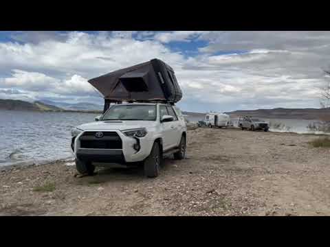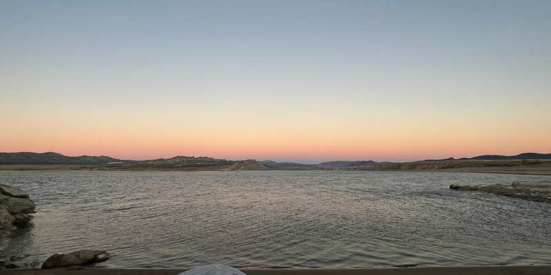
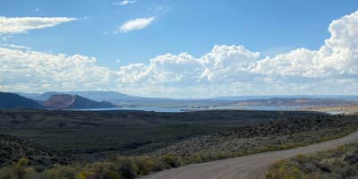
The sound of generators and ATVs echoes across this dispersed camping area along Flaming Gorge Reservoir's shoreline. Jug Hollow Road provides free camping on both hillside spots overlooking the water and sites directly at the lake's edge, accessible via a dirt access road that becomes challenging when wet.
Stone fire rings mark established spots throughout the area, though shade remains limited without tree cover. Wind off the reservoir can intensify quickly, making sheltered locations further from the water more comfortable for tent campers. Cell service reaches most of the camping area, and the 16-day stay limit allows extended visits. Lin notes that "wind off the lake can be furious" and recommends finding "a spot further in, especially if you are tent camping."
Open range conditions mean cattle move through the area regularly, and the lack of facilities requires pack-in, pack-out practices. The access road shows washboard sections and sandy spots, with Route 319 providing the current entry point. An eagle's nest occupies a small island visible from shore, and hiking trails lead directly from camping areas. Power sports activity and generator use continue through evening hours, particularly near waterfront sites.
Campers can explore free camping near Ashley National Forest for additional dispersed options in the region.
Description
The Flaming Gorge NRA is located in the northeast corner of Utah and the southwest corner of Wyoming. It is South of I-80, between Green River and Rock Springs, Wyoming and extends into the Uintah Mountains towards Vernal, Utah. The area is a mixture of climate, topography, and recreation opportunities well suited to a variety of summer and winter interests. With 43 campgrounds hosting over 700 individual campsites and 27 group sites, all spread over nearly 91 water-miles (with a whopping 360 miles of shore line) plus countless mountain retreats. There is plenty of room for everyone. There is also the opportunity to set up “primitive” camping for those wishing a more secluded adventure, or river camps for those extending their river runs for more than a day. Close at hand are the quaint communities of Manila and Dutch John, Utah to offer accommodations and other services for more traditional vacationers.
RV Road Trip Guides

Map & DirectionsJug Hollow Road is located in Wyoming near Ashley National Forest
Coordinates
40.98879684 N
109.56011818 W
Connectivity
 T-Mobile5GExcellent Coverage
 VerizonNo Coverage
- AT&T5GExcellent CoverageVerified by 8 usersLast on 6/20/26
Connectivity
- T-Mobile5GExcellent Coverage
- VerizonNo Coverage
- AT&T5GExcellent CoverageVerified by 8 usersLast on 6/20/26
Access
- Drive-InPark next to your site
- Walk-InPark in a lot, walk to your site.
Site Types
- Tent Sites
- RV Sites
- Dispersed
- Group
- Equestrian
Features
For Campers
- Phone Service
- Alcohol
- Pets
- Fires
For Vehicles
- Pull-Through Sites
DISPERSED CAMPING
Enjoy dispersed camping on government land and leave no trace. Pack in and pack out. No (or limited) services at this camping area. Permit may be required.
PERMIT might be REQUIRED
We curate permit requirements across the US for our PRO members. Try PRO to see if Jug Hollow Road - Dispersed Camp needs a permit.
Drive Time
- 3 hrs 32 min from Ogden, UT
- 3 hrs 40 min from Salt Lake City, UT
- 3 hrs 48 min from Provo, UT
- 3 hrs 52 min from Logan, UT