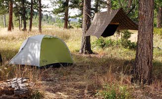
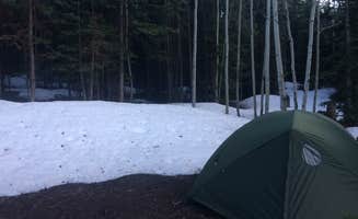
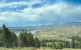
Rustic camping near Bond, Colorado provides opportunities for overnight stays in the mountainous terrain at 6,900 feet elevation. The area experiences dramatic temperature fluctuations, with summer days reaching the 80s while nights drop into the 40s even in July. Winter snow typically makes most dispersed sites inaccessible from November through April, with spring mud season creating additional access challenges.
What to do
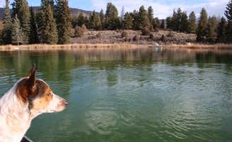
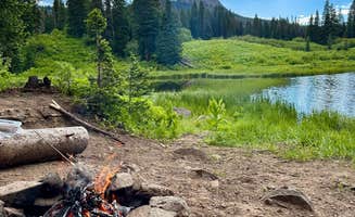
Hike to mountain lakes: From Blue Lake Camp, several well-marked hiking trails offer routes to alpine water features. "A few kind souls have even left their row boats in the woods next to the lake... just please remember to put the boats and paddles back where you find them," notes camper Isabelle K.
Soak in natural hot springs: The hiking trail near Pinion Pine Dispersed Campground leads to thermal waters. "Camped here in order to do the hike to the Radium Hot Springs down the road," reports Richard R., who appreciated the riverside location.
Bird watching: The forest areas provide habitat for multiple species. At Rock Creek Designated Dispersed Camping, one visitor noted, "So many types of birds—great spot for birdwatchers!!!" The early morning hours offer the best viewing opportunities.
What campers like
Secluded campsites: Many campers value the privacy found in certain areas. At Rock Creek Trailhead, a camper observed that sites are "generally spaced pretty far apart although some sites are clustered together," providing options for different preferences.
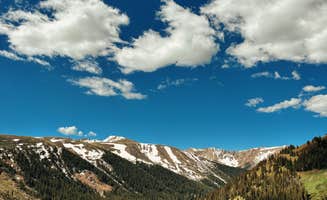
Mountain vistas: The surrounding terrain offers scenic landscapes. Will S. noted Rock Creek sites feature "views of snow capped mountains with a gurgling creek running next to camp," creating a classic Colorado camping setting.
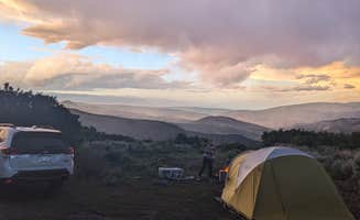
Clear night skies: The minimal light pollution makes stargazing possible. One Red Sandstone visitor mentioned, "The stars at night are incredible. It is a hidden gem," highlighting the astronomical viewing opportunities.
What you should know
Road conditions require proper vehicles: Most access routes demand appropriate transportation. At BLM Mountain View, a visitor noted the "rough road, be prepared. Nothing crazy but definitely bumpy," which represents the better road conditions in the area.
Weather changes quickly: Mountain conditions shift rapidly throughout the day. Campers should pack for temperature swings of 30-40 degrees between day and night, even in summer months.
Variable site availability: Competition for spots increases on weekends and holidays. "We pulled in around noon and barely snagged one of the last open sites," reported a Rock Creek Trailhead visitor, adding "by 1 p.m., it felt like a game of musical chairs. Drivers looping, turning around, hoping someone packed up."
Tips for camping with families
Plan for insects: Mosquitoes are common in summer months. At Rock Creek Rec Area, a camper mentioned it was "definitely buggy during the summer, but manageable," suggesting bringing insect repellent.
Prepare for limited shade: Despite forested areas, direct sun exposure affects many sites. A camper noted, "In the heat of summer, the sun cuts straight through the gaps. I was glad we brought extra cover—without it, the tent would've turned into an oven by mid-afternoon."
Wildlife encounters: Small animals may visit your campsite. At Rock Creek Trailhead, one camper's "only complaints was the pesky chipmunks. Cute though," suggesting keeping food secure even from smaller creatures.
Tips from RVers
Trailer access limitations: Many roads prohibit larger vehicles. At Bellyache Road, a camper warned, "Absolutely requires four-wheel drive for two and a half miles of extremely rough unpaved road that goes up a thousand feet... I don't regret bringing my travel trailer up here because it's meant for rough roads but had I known the road was this rough I wouldn't have started."
Limited turning space: Consider the need to turn around on narrow roads. One camper at Lone Lick Lakes warned, "turning around is not easy," which can create significant challenges for larger vehicles.
Campsite selection for larger vehicles: Look for sites with adequate space. Some designated areas like Rock Creek Designated Dispersed Camping have "sites for all sizes," according to one reviewer, making them more accommodating for RVs than many primitive sites in the area.


 Guide
Guide