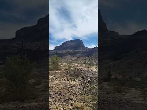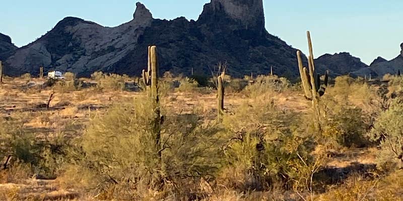
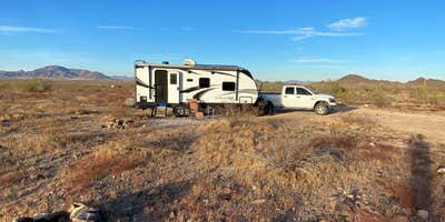
The Lower Sonoran Field Office manages this dispersed camping area where campers spread across desert terrain beneath the namesake mountain. Multiple dirt roads branch off from West Courthouse Road, providing access to sites at varying distances from the rocky peak that dominates the landscape.
Road conditions vary significantly depending on which entrance campers choose. Several reviewers mention the eastern access roads become quite rocky, requiring careful navigation and potentially limiting larger RVs to smoother western routes. Danny T. notes "most rv's or big rigs can get pretty close to the mountain before the road becomes too tough." Campers can position themselves anywhere from near the main highway to within 100 yards of the mountain base, with closer sites offering more dramatic views but requiring better ground clearance.
The area attracts rockhounds searching for chalcedony and fire agates scattered across the desert floor. Hiking trails wind up the mountain, and some visitors report finding petroglyphs during exploration. ATV riders use the terrain, though most reviewers describe them as respectful of other campers. Weekend target shooting occurs on the eastern side, which some find intrusive while others consider it minor background noise.
Cell coverage proves strong for major carriers, though one reviewer warns that high latency from nearby towers can hamper streaming despite good signal bars. The Palo Verde Nuclear Plant sits several miles away, creating visible lights at night along with occasional industrial activity. For supplies, campers drive to places to camp near Tonopah, where a Dollar General and small market provide basics. A private ranch five miles away offers tank services for a fee.
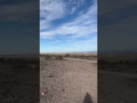
Sites accommodate everything from tents to large RVs, with the rocky ground requiring some scouting for level spots. The 14-day limit applies, and while crowds can build during peak season, the expansive area typically provides adequate spacing between campers.
Description
Approximate location. Many sites for primitive camping off W. Courthouse Rd. and W. Salome Rd.
RV Road Trip Guides


Map & DirectionsSaddle Mountain BLM (Tonopah, AZ) is located in Arizona near Tonopah
Coordinates
33.46381069 N
113.03654097 W
Connectivity
 T-Mobile5GExcellent CoverageVerified by 4 usersLast on 7/26/26
- Verizon5GExcellent CoverageVerified by 30 usersLast on 7/26/26
 AT&TLTEGood CoverageVerified by 15 usersLast on 7/26/26
Connectivity
- T-Mobile5GExcellent CoverageVerified by 4 usersLast on 7/26/26
- Verizon5GExcellent CoverageVerified by 30 usersLast on 7/26/26
- AT&TLTEGood CoverageVerified by 15 usersLast on 7/26/26
Access
- Drive-InPark next to your site
Site Types
- Tent Sites
- RV Sites
- Standard (Tent/RV)
- Dispersed
Features
For Campers
- Market
- ADA Access
- Firewood Available
- Phone Service
- Reservable
- WiFi
- Showers
- Electric Hookups
- Alcohol
- Pets
- Fires
For Vehicles
- Sanitary Dump
- Sewer Hookups
- Water Hookups
- Big Rig Friendly
DISPERSED CAMPING
Enjoy dispersed camping on government land and leave no trace. Pack in and pack out. No (or limited) services at this camping area. Permit may be required.
Drive Time
- 1 hr from Phoenix, AZ
- 2 hrs from Prescott Valley, AZ
- 2 hrs 23 min from Yuma, AZ
- 2 hrs 25 min from Lake Havasu City, AZ