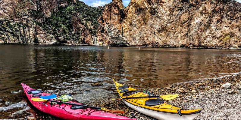
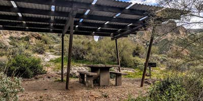
Two miles upriver from Mormon Flat Dam, The Point Campground sits on Canyon Lake within Tonto National Forest, accessible only by boat. The US Forest Service maintains four designated sites here, each equipped with a covered picnic table and fire pit, plus composting toilets and a boat dock capable of handling larger watercraft.
Sites show some wear according to recent visitors, and restroom facilities may lack supplies or maintenance. No drinking water is available on-site, requiring campers to pack at least one gallon per person per day. Wind conditions can intensify through this canyon corridor, making weather checks essential before departure. The campground operates on a first-come, first-served basis with no fees required, and pet-friendly camping near Tonto National Forest welcomes dogs. Wildlife sightings include various bird species and bighorn sheep along the upstream route toward Horse Mesa Dam.
Description
Boat access only.
The Point is located in the Mesa Ranger District and is mostly known for boat access only camping on Canyon Lake. There are only three designated camp units at this site, but the camp units can also be used as picnic sites for day use. Boaters enjoy The Point during summer months along with fishermen because of the courtesy dock. No garbage collection. Pack it in, Pack it out.
RV Road Trip Guides


Map & DirectionsThe Point Campground is located in Arizona near Tortilla Flat
Directions
This site is 17 miles northeast of Apache Junction on Arizona State Hwy. 88, (historic “Apache Trail”). From Mesa, take US 60 to the Idaho Road exit. Go north on Idaho Road to State Hwy. 88 and turn right. After crossing the first bridge at the lake, watch for Palo Verde Recreation Site sign and turn left into site. The entire route to the lake is paved with narrow, sharp curves; traffic is heavy. The last 3 miles are by boat. Click Here For Map.
Coordinates
33.55809707 N
111.40931482 W
Connectivity
 T-MobileNo Coverage
 VerizonLTESome Coverage
- AT&TNo Coverage
Connectivity
- T-MobileNo Coverage
- VerizonLTESome Coverage
- AT&TNo Coverage
Access
- Boat-InSites accessible by watercraft.
Site Types
- Tent Sites
Features
For Campers
- Picnic Table
- Toilets
- Alcohol
- Pets
- Fires
FREE established camping
Enjoy camping on government land. Limited or no services at this camping area.
PERMIT might be REQUIRED
We curate permit requirements across the US for our PRO members. Try PRO to see if The Point Campground needs a permit.
Drive Time
- 2 hrs 24 min from Phoenix, AZ
- 3 hrs 27 min from Prescott Valley, AZ
- 3 hrs 30 min from Tucson, AZ
- 4 hrs 10 min from Flagstaff, AZ


