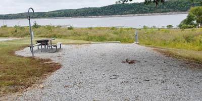
Within the Harry Truman Recreation Area, Talley Bend provides Army Corps of Engineers camping along the forested shoreline of Harry S. Truman Lake. The campground accommodates RVs up to 100 feet with electric hookups, plus tent sites scattered through the wooded terrain. Campers have access to shower facilities and a dump station, with campfires permitted throughout the grounds.
Rates range from $14 to $20 per night, with advance reservations available through the Corps system. The lakeside location puts campers near fishing and boating opportunities, while pets are welcome on leash. For those wanting a different lakeside experience, Berry Bend offers another Corps option northeast along the same reservoir.
Description
Overview
TALLEY BEND CAMPGROUND HAS BEEN CLOSED. THE BOAT RAMP IS STILL AVAILABLE.
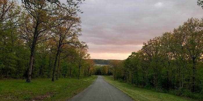
Talley Bend Campground sits on the shores of Harry S. Truman Lake in the hills of western Missouri.
Visitors enjoy fishing, hunting and boating.
Recreation
Talley Bend is an excellent fishing location. Anglers find crappie, largemouth bass and blue and flathead catfish. Truman Lake is also a popular destination for tournament fishermen.
Facilities
Natural Features
Truman Lake lies among rolling hills and rocky bluffs. Dense hardwood forests studded with mature pine trees cover the area.
Wildlife is abundant in and around Talley Bend. Whitetail deer, turkey, hummingbirds, hawks and ospreys are commonly seen. Bald eagles can be viewed during the winter months.
Nearby Attractions
The 950 miles of shoreline around Truman Lake provide plentiful opportunities for fun in the outdoors. Many parks surround the lake, including Harry S. Truman State Park.
The Harry S. Truman Visitor Center sits atop Kaysinger Bluff and provides a spectacular view of the dam and reservoir. Exhibits provide information about the rich history of the Osage River Valley from pre-civilization to modern day. Waterfowl, bald eagles and turkey vultures are commonly seen from the observation deck.
RV Road Trip Guides

Map & DirectionsTalley Bend is located in Missouri near Lowry City
Directions
From Highway 13, travel east on Highway C for 6 miles. Follow signs to the boat ramp.
Coordinates
38.1360005 N
93.61400018 W
Connectivity
 T-MobileNo Coverage
 VerizonLTESome Coverage
- AT&TLTESome Coverage
Connectivity
- T-MobileNo Coverage
- VerizonLTESome Coverage
- AT&TLTESome Coverage
Access
- Drive-InPark next to your site
Site Types
- Tent Sites
- RV Sites
- Standard (Tent/RV)
Features
For Campers
- Reservable
- Showers
- Electric Hookups
- Pets
- Fires
For Vehicles
- Sanitary Dump
- Pull-Through Sites
- 30 Amp Hookups
Drive Time
- 1 hr 23 min from Springfield, MO
- 1 hr 41 min from Kansas City, MO
- 2 hrs 7 min from Joplin, MO
- 2 hrs 20 min from Jefferson City, MO

