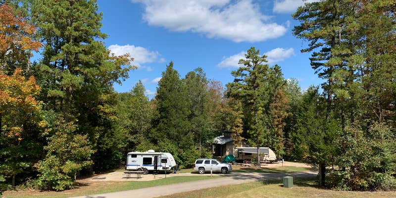

Six separate camping loops spread across this state park campground, each offering different amenities from walk-in sites to full hookups for RVs up to 60 feet. Loop 2 provides full hookups with 50-amp service, while Loop 3 offers electric-only sites, and Loop 4 remains primitive. The equestrian loop accommodates horse trailers with water and electric connections.
Concrete pads anchor most sites, extending to include fire pits in what one reviewer describes as "massive concrete pads - 'double wides.'" Sites maintain generous spacing with natural foliage providing separation between neighbors. Lee D. notes "each site was very generous in size and reasonably distanced from each other" with level placement throughout the campground. A gravel walking path bisects the loops, connecting different areas for easy exploration on foot.
The famous shut-ins remain separate from the camping area, requiring either a drive or walk along a paved trail to reach the natural rock formations and swimming holes. This separation means day-use crowds don't impact campground quiet, though summer weekends still draw significant visitors. Cell service reaches most areas with 5G capability, though older networks may struggle. The visitor center and camp store operate seasonally, with weekend-only hours during cooler months.
Shower houses feature individual toilet-sink combinations plus family restrooms, though some campers note concrete floors and occasional musty odors. The central laundry facility charges $1 each for washers and dryers. Check-in operates through text or QR code scanning when staff aren't present, so reliable cell service helps during arrival. Nearby alternatives include Tom Sauk Mountain State Park for mountain camping or Bell Mountain Wilderness Area for backcountry experiences.
Description
Loop 2 Sewer Electric Water
RV Road Trip Guides

Map & DirectionsJohnson's Shut-Ins State Park Campground is located in Missouri near Black
Directions
From St. Louis Johnson's Shut-Ins State Park is approximately 130 miles from St. Louis (South County); the trip will take about two or two and one-half hours depending on traffic. Take I-270 south to I-55 south. When you get to the Festus area, take U.S. Hwy. 67 south to Farmington. At the second Farmington exit, turn right onto Hwy. 221 toward Doe Run. Travel 17 miles on Hwy. 221 (will merge with Route NN). At the flashing red light, turn right/north onto Hwy. 21. Travel about one-half mile and turn left onto Route N. Go 13 miles on Route N to the park entrance on the left.
Address
148 Taum Sauk Trail
Middle Brook, MO 63656
Coordinates
37.56077972 N
90.8604967 W
Connectivity
 T-MobileNo Coverage
 VerizonLTESome Coverage
 AT&T5GExcellent CoverageVerified by 2 usersLast on 5/2/26
Connectivity
- T-MobileNo Coverage
- VerizonLTESome Coverage
- AT&T5GExcellent CoverageVerified by 2 usersLast on 5/2/26
Access
- Walk-InPark in a lot, walk to your site.
Site Types
- Tent Sites
- RV Sites
- Standard (Tent/RV)
- Group
- Cabins
- Equestrian
Features
For Campers
- Market
- ADA Access
- Firewood Available
- Phone Service
- Reservable
- Showers
- Electric Hookups
- Alcohol
For Vehicles
- Sewer Hookups
- Water Hookups
- 50 Amp Hookups
- Big Rig Friendly
Contact
General Info
Reservations
Drive Time
- 1 hr 49 min from Cape Girardeau, MO
- 2 hrs from St. Louis, MO
- 2 hrs 19 min from Jefferson City, MO
- 2 hrs 39 min from Jonesboro, AR