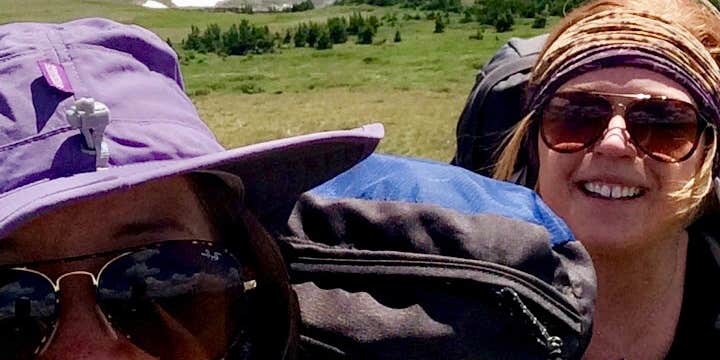
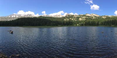
Hiking to Native Lake gives campers a chance to overnight at the water's edge in San Isabel National Forest, with dispersed sites along the alpine shoreline marked by pre-established fire rings. The area around the lake runs wet and swampy, so expect soft ground near the water and plan to search uphill for dry firewood after rain. Mosquitoes are active at dusk and dawn. Temperatures stay cool, often below 40°F even in summer, so warm sleep layers are necessary. The campground is free, allows pets, and suits hikers comfortable with carrying all gear in. Campers based in places to camp near Leadville will recognize this as a well-known local overnight route.
Description
Mount Massive (14,421 feet), Colorado's second highest peak, and other mountains of the Sawatch Range have two distinctive characteristics: great height, and a huge, sloping bulk that makes them relatively easy to climb. Nowhere along the Continental Divide does the ground rise higher than the Sawatch Range, the crest of this continent. Just south of the Wilderness stands Mount Elbert at 14,443 feet, Colorado's highest summit. The divide marks the western boundary of this area, with the Hunter-Fryingpan Wilderness immediately to the other side. Dry lodgepole pine forests, typical of the eastern slopes of the divide, cover much of the lower elevations and give way to spruce and fir higher up before all trees yield to alpine tundra.
The Leadville National Fish Hatchery, managed by the US Fish and Wildlife Service, comprises approximately 2,500 acres. The majority of the Fish Hatchery lies within the boundary of the Mount Massive Wilderness. The hatchery land inside the Wilderness boundary is co-managed by the U.S. Forest Service and U.S. Fish & Wildlife Service (USFWS). The U.S. Forest Service is the principal land manager, protecting the Wilderness resources. The USFWS manages the fishery and water resources to protect and perpetuate native fish species.
There are multiple pre-established campsites around this lake which is part of the Mount Massive Wilderness Area. The campground is accessible only on foot and does require a 8.4 mile round trip hike.
RV Road Trip Guides


Map & DirectionsNative Lake Primitive Camping is located in Colorado near Leadville
Directions
From Leadville, follow signs to Turquoise Lake. Take the southern lake route (Lake County Road 4) to the junction of Forest Service Road 104. The trailhead is about 3 miles up the Hagerman Pass Road (Forest Service Road 105), with parking on the south side of the road.
Coordinates
39.22553781 N
106.45913 W
Connectivity
 T-MobileNo Coverage
- VerizonNo Coverage
- AT&TNo Coverage
Connectivity
- T-MobileNo Coverage
- VerizonNo Coverage
- AT&TNo Coverage
Access
- Walk-InPark in a lot, walk to your site.
- Hike-InBackcountry sites.
Site Types
- Dispersed
Features
For Campers
- Pets
- Fires
DISPERSED CAMPING
Enjoy dispersed camping on government land and leave no trace. Pack in and pack out. No (or limited) services at this camping area. Permit may be required.
PERMIT might be REQUIRED
We curate permit requirements across the US for our PRO members. Try PRO to see if Native Lake Primitive Camping needs a permit.
Drive Time
- 2 hrs 19 min from Denver, CO
- 2 hrs 29 min from Boulder, CO
- 2 hrs 52 min from Colorado Springs, CO
- 3 hrs 15 min from Grand Junction, CO