Free dispersed camping in San Isabel National Forest starts with a road worth taking seriously. The roughly 5-mile drive in on County Road 250 transitions from pavement to gravel before turning rocky, rutted, and steep in sections, with some washouts reported. Most reviewers drove SUVs or trucks; sedans have made it, but the road takes a toll, and high clearance makes the trip considerably less stressful.
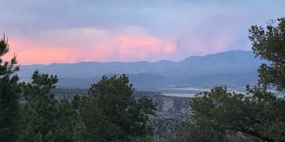
Once past the rough stretch, the plateau opens up with room for dozens of rigs spread across wide, open sites. Several spots include fire rings. Views face toward the surrounding mountains, and campers who position themselves away from the tree line get open sightlines toward the ridgeline. Sites near a creek tend to fill before noon on weekdays in fall, so arriving early matters if water access is a priority. The area is dry overall, cactus is present on the lower ridge, and there is no water on-site. The nearest dump station is at the Crossroads Visitor Center in Poncha Springs, roughly two miles away.
Wildlife sightings include cattle that move through the area, which reviewers with dogs flagged as worth watching. Elk bugling has been reported in October. Cell coverage is inconsistent: AT&T users have logged two bars in some spots, Verizon has tested well, and T-Mobile is less reliable. Rangers do patrol and enforce the 14-day stay limit. Mount Shavano and Mount Tabequache trailhead sits just northeast, making this a practical overnight base before a summit push. Campers looking at campsites near Poncha Springs will find additional options in the corridor. As Fabein D. puts it: "Road kinda rocky, but manageable."
Description
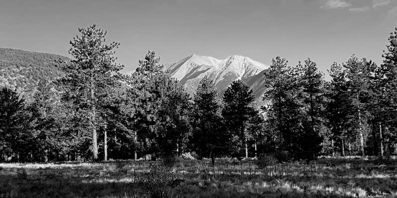
Dispersed camping at the base of Mount Shavano outside Salida, CO.
WARNING! Hikers descending from Tabequache should not descend into McCoy Gulch! This is a dangerous route and a number of climbers have been injured or killed.
Reservation Info
There are many dispersed camp sites located along Forest Road 252 or past the trailhead parking area on the left. Camp away from the stream and pack all trash out. No reservation required.
RV Road Trip Guides


Map & DirectionsMount Shavano Dispersed Camping is located in Colorado near Poncha Springs
Directions
From Poncha Springs, travel west on Highway 50 for 2 miles to the junction of County Road 250 located on the right side of the highway. Turn right onto CR 250 and travel west for 4.5 miles to the boundary of Forest and BLM lands. At this point, the road forks. Take the left fork which continues at Forest Road 252. Stay on this road for approximately 3 miles to the trailhead. The Jenning Creek access located off of Forest Road 240 is permanently closed.
Coordinates
38.59557109 N
106.19916636 W
Connectivity
 T-MobileNo CoverageVerified by 1 userLast on 6/14/26
 VerizonLTESome Coverage
- AT&TLTESome Coverage
Connectivity
- T-MobileNo CoverageVerified by 1 userLast on 6/14/26
- VerizonLTESome Coverage
- AT&TLTESome Coverage
Access
- Drive-InPark next to your site
- Walk-InPark in a lot, walk to your site.
Site Types
- Tent Sites
- RV Sites
- Standard (Tent/RV)
- Dispersed
- Group
Features
For Campers
- Phone Service
- Toilets
- Alcohol
- Pets
- Fires
For Vehicles
- Pull-Through Sites
- Big Rig Friendly
DISPERSED CAMPING
Enjoy dispersed camping on government land and leave no trace. Pack in and pack out. No (or limited) services at this camping area. Permit may be required.
PERMIT might be REQUIRED
We curate permit requirements across the US for our PRO members. Try PRO to see if Mount Shavano Dispersed Camping needs a permit.
Drive Time
- 2 hrs 3 min from Pueblo, CO
- 2 hrs 22 min from Colorado Springs, CO
- 2 hrs 45 min from Denver, CO
- 2 hrs 54 min from Boulder, CO