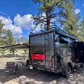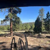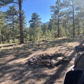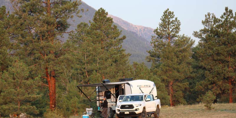
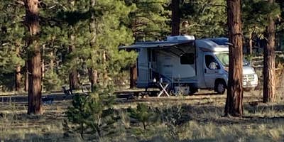
Browns Creek (South) Dispersed Camping, near Nathrop, Colorado, is a fantastic spot for those who crave a little solitude and stunning mountain views. This area offers spacious, open sites where you can truly escape the hustle and bustle of everyday life.
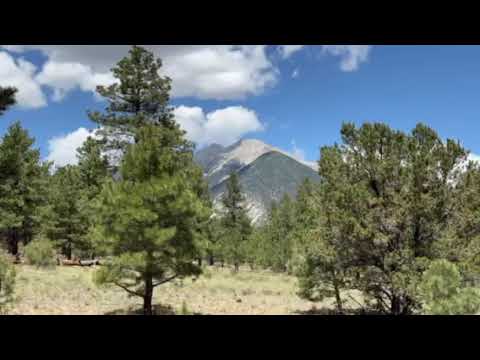
Visitors rave about the peaceful atmosphere and the abundance of hiking opportunities, especially around Browns Creek. One camper shared, “The views of the mountains were amazing and great hiking,” highlighting the natural beauty that surrounds you here. While there are no amenities like drinking water or picnic tables, the freedom to camp wherever you find a suitable spot is a big draw for many.
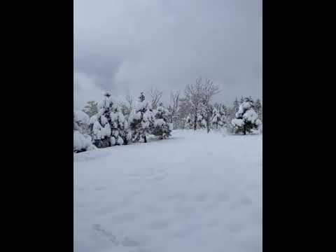
If you’re up for an adventure, the nearby trails lead to breathtaking vistas and serene lakes. Just be aware that the roads can get muddy after rain or snow, so a vehicle with good traction is a must. Campers have also noted the presence of wildlife, including free-roaming cows, which adds to the rustic charm of the area.
For those looking to explore beyond the campsite, you’re just a short drive from Salida and Buena Vista, where you can grab a bite or enjoy local attractions. Whether you’re pitching a tent or parking your RV, Browns Creek (South) offers a laid-back camping experience that’s hard to beat.
Description
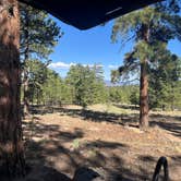
The Browns Creek trail offers beautiful scenery with changing vistas and vegetation. The trail follows the stream and small waterfalls can be found along the way. The lower portion of the trail begins in primarily a Ponderosa pine environment and gradually moves into spruce/fir forest. At higher elevations the trail travels through pristine meadows that end at Brown's Lake. Camping is not permitted at the trailhead, in order to prevent erosion of the banks along Little Browns Creek. Campers are encouraged to find camp sites further south on County Road 272.
RV Road Trip Guides


Map & DirectionsBrowns Creek (South) Dispersed Camping is located in Colorado near Nathrop
Directions
From Highway 285, midway between Poncha Springs and Buena Vista, take County Road 270 west for approximately 1.5 miles to a 4-way intersection. From the yield sign, continue traveling west. The road continues as Forest Road 272. Stay on FR 272 for about 2 miles. A sign at the cattle guard will indicate you entrance onto Nation Forest lands. Continue traveling west from the boundary sign for 2 miles. At the intersection, turn left and travel south for 1.5 miles to the trailhead.
Coordinates
38.64156177 N
106.155475 W
Connectivity
 T-Mobile5GExcellent Coverage
 VerizonLTESome CoverageVerified by 6 usersLast on 7/13/26
 AT&T5GGood Coverage
Connectivity
- T-Mobile5GExcellent Coverage
- VerizonLTESome CoverageVerified by 6 usersLast on 7/13/26
- AT&T5GGood Coverage
Access
- Drive-InPark next to your site
Site Types
- Tent Sites
- Standard (Tent/RV)
- Dispersed
Features
For Campers
- Phone Service
- Alcohol
- Pets
For Vehicles
- Pull-Through Sites
- Big Rig Friendly
DISPERSED CAMPING
Enjoy dispersed camping on government land and leave no trace. Pack in and pack out. No (or limited) services at this camping area. Permit may be required.
PERMIT might be REQUIRED
We curate permit requirements across the US for our PRO members. Try PRO to see if Browns Creek (South) Dispersed Camping needs a permit.
Drive Time
- 2 hrs 1 min from Pueblo, CO
- 2 hrs 7 min from Colorado Springs, CO
- 2 hrs 30 min from Denver, CO
- 2 hrs 39 min from Boulder, CO