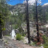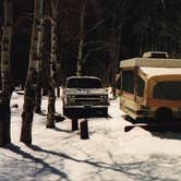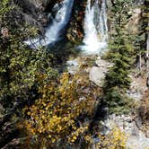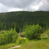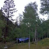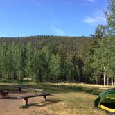
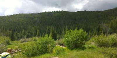
The North Fork South Arkansas River flows past this Forest Service campground, creating a constant water soundtrack that masks most other sounds. Angel of Shavano Group sits at 9,200 feet elevation in San Isabel National Forest, where aspen groves provide shade and the Colorado Trail passes directly through camp.
Most of the 17 sites cluster tightly in the center area, with tent pads just 15 feet apart according to recent visitors. The perimeter sites offer more space and privacy, particularly site 16 which campers report as secluded even when the campground fills on summer weekends. All sites include picnic tables and fire rings, with water and sewer hookups available for RVs up to 40 feet. The campground features its own fishing pond plus access to beaver ponds nearby.
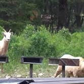
Road access requires attention - the county road loses cell signal after leaving Highway 50, and several reviewers mention rough conditions. "Live water ran behind our campsite and was easily accessible to collect for filtering," notes Glenn K.. Wildlife sightings include Dall sheep and moose wandering through camp. A hand pump provides water, though some sites require walking to access it.
Summer weekends fill completely by Friday morning, making reservations essential for guaranteed spots during peak season.
Description
Overview
Angel of Shavano Group Campground is considered one of the area's best kept camping secrets. It is situated next to the North Fork South Arkansas River and offers a variety of recreational activities, including hiking, biking, and fishing. Reservations are REQUIRED at this facility. Reservations can be made up to 1 year in advance.
Recreation
The Colorado Trail begins within the campground and provides excellent hiking, horseback riding and biking opportunities. The trail stretches 487 miles across Colorado from Denver to Durango, with segments ranging in elevation from 5,500 to 13,300 feet. The North Fork South Arkansas River flows next to the campground and it__offers rainbow and brook trout fishing. Fun facilities like a volleyball court, baseball field and horseshoe pits are available within the campground. Visitors must bring their own equipment.
Facilities
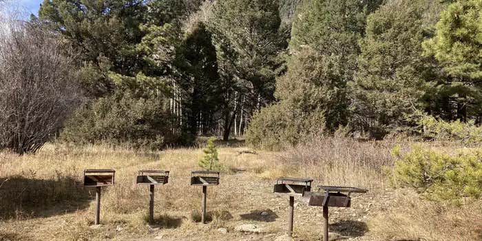
Angel of Shavano offers one group campsite best suited for tent camping. It can accommodate up to 100 people and 12-14 vehicles. Parking is not available for large RVs. The site is equipped with a picnic shelter, tables, six pedestal grills and a campfire circle with benches. Vault toilets and trash collection are provided. No drinking water is available within the group site, but it is available at the nearby family campground.
Natural Features
The campground is named after an image of an angel that appears as winter snow fall on Shavano Mountain. The site lies at an elevation of 9,200 feet along the North Fork South Arkansas River. A forest of aspen and pine covers the area. Beaver ponds dot the landscape at the base of nearby Shavano Mountain.
Contact Info
For facility specific information, please call (661) 702-1420.
Nearby Attractions
From the Angel of Shavano Group Campground the road continues west for 6 miles to the North Fork reservoir and campground. The road__is extremely rocky and rough and high clearance vehicles are recommend. The reservoir is regularly stocked with rainbow trout and it offers anglers a chance to fish one of the area's most popular high elevation lakes. It is situated at 11,000 feet so anglers should be prepared for all types of weather. The Monarch Crest Scenic Tramway is located on the top of Monarch Pass at 11,312 feet (3.45 km), which is on the Continental Divide at the southern end of the Sawatch Mountain Range. The Monarch Crest is along the border between Gunnison and Chaffee counties, approximately 25 miles (40 km) west of the town of Salida.
Charges & Cancellations
Group Sites Group Facility (including Cabins and Lookouts): A visitor who cancels a group overnight facility reservation less than 14 days before the arrival date will pay a $10.00 service fee AND forfeit the first night's use fee. No-Shows A no-show visitor is one who does not arrive at a campground and does not cancel the reservation by check-out time on the day after the scheduled arrival date. Staff will hold a campsite until check-out time on the day following the arrival date. No-shows are assessed $20.00 service fee and forfeit the first night's rate, taxes and applicable add-on for a campsite. Refunds Visitors may submit a refund request through their Recreation.gov profile within 7 days of the end date of their reservation. Refunds will not be issued after the 7 days has ended. Refunds for debit or credit card payments will be issued as a credit to the original bank or credit card used to pay. For check or cash purchases, Recreation.gov will mail a Treasury check for refunds of cash, check, or money order payments to the address associated with the reservation. Treasury check refunds may take up to 6-8 weeks to arrive. In the event of an emergency closure, the Recreation.gov team or facility manager will refund all fees and will attempt to notify you using the contact information within the Recreation.gov visitor profile.
Fee Info
Warning 1 Alert is In Effect
There is 1 alert for this campground. Camp safely!
Warning 1 Alert is In Effect
There is 1 alert for this campground. Camp safely!
PIKE-SAN ISABEL NATIONAL FORESTS & CIMARRON AND COMANCHE NATIONAL GRASSLANDS** STAGE 1 FIRE PROHIBITIONS **** PROHIBITIONS**Pursuant to 16 U.S.C. 551 and 36 C.F.R. 261.50(a), the following are prohibited on the National Forest System (NFS) in the Leadville, Salida, San Carlos, Pikes Peak, South Park and South Platte Ranger Districts of the Pike-San Isabel National Forests & Cimarron and Comanche National Grasslands, described below and shown on the attached map incorporated into this Order as Exhibit A, hereinafter referred to as the Described Area:
- Building, maintaining, attending, or using a fire (including fires fueled by charcoal or briquettes), except if it is in
- A permanent metal or concrete fire pit or grate that the U.S. Forest Service has installed and maintained at its developed recreation sites (campgrounds and picnic areas);
- A device solely fueled by liquid or gas that can be turned on and off used in an area barren or cleared of all flammable materials within three feet of the device; or
- A fully enclosed metal stove with a chimney at least five feet in length and a mesh screen spark arrestor with a screen opening of a inch or less used in an area that is barren or cleared of all flammable materials within 10 feet of the device.36 CFR 261.52(a).
- Using an explosive. 36 C.F.R. 261.52(b)
- Smoking is prohibited, except in an enclosed vehicle or building, a developed recreation site, or while stopped in an area at least three feet in diameter that is barren or cleared of all flammable materials. 36 CFR 261.52(d)
- Welding, or operating acetylene or other torch with open flame, except if in a cleared area of at least 10 feet in diameter and a chemical pressurized fire extinguisher (with a minimum 8 oz. capacity and rating of Class 2A) is kept with the operator. 36 CFR 261.52(h) EXEMPTIONS Pursuantto36 C.F.R.261.50(e), thefollowingpersons areexemptfrom thisOrder:
- Persons with Forest Service Permit No. FS-7700-48 (Permit for Use of Roads, Trails, or Areas Restricted by Regulation or Order), specifically exempting them from this Order or a written determination by a Forest Service authorized officer that a permit is not required under 36 C.F.R. 251.50(e)(1) or (2).
- Any Federal, State, or Local Officer, or member of an organized rescue or firefighting service in the performance of an official duty. DESCRIBEDAREA All National Forest System lands, roads, and trails within the exterior boundaries of the Pikes Peak, South Platte, South Park, Leadville, Salida and San Carlos Ranger Districts of the Pike-San Isabel National Forests & Cimarron and Comanche National Grasslands, as depicted on the map attached as Exhibit A of this Order. PURPOSE Thepurposeof this Order is to protect natural resources and public health and safety. IMPLEMENTATION
- This Order shall be in effect from August 21, 2026, at 12:01 a.m. through August November 14, 2026, at 11:59 p.m., unless rescinded.
RV Road Trip Guides


Map & DirectionsAngel Of Shavano Group is located in Colorado near Monarch
 Public Campground
Directions
From Poncha Springs, Colorado, take U.S. Highway 50 west 6 miles, then right on County Road 240 and travel 4 miles to the campground.
Address
CAMPGROUNDS CAN NOT BE CONTACTED DUE TO REMOTE LOCATION
SALIDA RANGER DISTRICT OFFICE
5575 CLEORA RD
Salida, CO 81201
Coordinates
38.5827778 N
106.22 W
Connectivity
 T-MobileNo Coverage
 VerizonLTEGood CoverageVerified by 13 usersLast on 10/19/26
- AT&TNo Coverage
Connectivity
- T-MobileNo Coverage
- VerizonLTEGood CoverageVerified by 13 usersLast on 10/19/26
- AT&TNo Coverage
Access
- Drive-InPark next to your site
Site Types
- Tent Sites
- RV Sites
- Standard (Tent/RV)
- Group
Features
For Campers
- Reservable
- Pets
- Fires
For Vehicles
- Sewer Hookups
- Water Hookups
Drive Time
- 2 hrs 2 min from Pueblo, CO
- 2 hrs 24 min from Colorado Springs, CO
- 2 hrs 47 min from Denver, CO
- 2 hrs 57 min from Boulder, CO