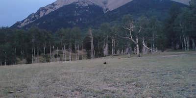
Mount Shavano and Mount Tabequache offer camping in a region characterized by mountainous terrain. Temperatures can range from lows in the 30s Fahrenheit during cooler months to highs in the 80s during warmer seasons. Nearby attractions include the Arkansas River for water activities and the town of Salida for dining and shopping.
Description
The trail travels along a saddle south of the summit and the last .5 miles to the summit is marked by a few rock cairns. To continue on to Mount Tabequache, follow the ridge, northwest, from the summit. WARNING! Hikers descending from Tabequache should not descend into McCoy Gulch! This is a dangerous route and a number of climbers have been injuried or killed. The Jenning Creek access located off of Forest Road 240 is permanently closed. For detailed information about climbing these peaks visit the Colorado Fourteeners Initiative website at : www.14ers.org
RV Road Trip Guides


Map & DirectionsMount Shavano and Mount Tabequache is located in Colorado near Poncha Springs
Directions
From Poncha Springs, travel west on Highway 50 for 2 miles to the junction of County Road 250 located on the right side of the highway. Turn right onto CR 250 and travel west for 4.5 miles to the boundary of Forest and BLM lands. At this point, the road forks. Take the left fork which continues at Forest Road 252. Stay on this road for approximately 3 miles to the trailhead. A restroom and parking area are provided.
Coordinates
38.59669549 N
106.19658182 W
Connectivity
 T-MobileNo CoverageVerified by 1 userLast on 6/14/26
- VerizonNo Coverage
- AT&TNo Coverage
Connectivity
- T-MobileNo CoverageVerified by 1 userLast on 6/14/26
- VerizonNo Coverage
- AT&TNo Coverage
Access
Site Types
- Tent Sites
Features
Drive Time
- 2 hrs 3 min from Pueblo, CO
- 2 hrs 22 min from Colorado Springs, CO
- 2 hrs 44 min from Denver, CO
- 2 hrs 54 min from Boulder, CO


