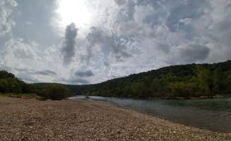
Dispersed camping in the Ozark National Forest near Ozone, Arkansas offers rugged terrain with elevations between 1,500 and 2,500 feet. The region's mixed hardwood forests create seasonal camping experiences with dense summer canopy and open winter vistas across the Buffalo River watershed. Forest access roads throughout the area provide numerous free primitive campsites with varying difficulty levels depending on recent weather patterns.
What to do
Hiking to waterfalls: Access unnamed waterfalls near Adams Mountain Rd Dispersed Campsite with a short 1.25-mile trek. A visitor noted, "A 1 1/4 mile hike takes you to a small unnamed waterfall, which may not be running during the dry season."
Rock climbing: The sandstone bluffs at Sam's Throne Recreation Area offer multiple climbing routes for various skill levels. A camper reported, "Amazing peaceful campsite... Beautiful path to walk to see the open ozarks but not much else to do here."
Stargazing: Clear night skies provide excellent viewing conditions away from city lights. As one camper at Sam's Throne shared, "On the right dark night you can see every star in the sky."
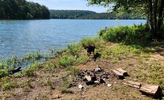
Wildlife watching: Keep eyes open for native Arkansas wildlife, including deer. One visitor mentioned, "Bambi and her mom also seem to live here."
What campers like
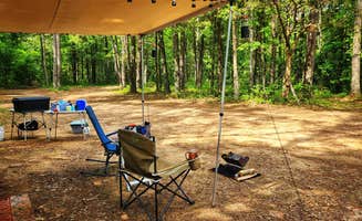
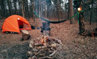
Privacy between sites: Many dispersed sites offer separation from other campers. At Morgan Mtn Rd/Spy Rock Dispersed, a camper noted, "The site is large enough for 3, maybe 4 Overlanding Rigs. Couple established fire rings."
Cell service in select areas: Connectivity varies significantly by location and carrier. At Morgan Mountain Road, a camper reported, "T-Mobile has anywhere from one bar LTE to three bars of 5G extended to 2 bars 5G here. I was able to stream video on my phone before bedtime each night."
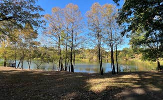
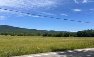
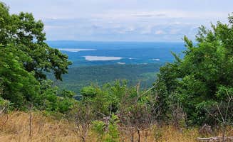
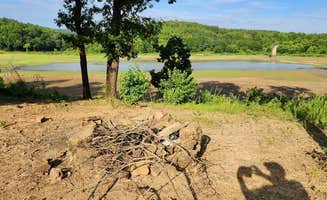
Winter views: Leaf-off season provides expanded vistas at many sites. One camper at FR1802A, Meadows Knob Rd Dispersed observed, "There is a partial view of the distant mountains."
Clean facilities: While most sites lack amenities, the few with vault toilets maintain them regularly. At Sam's Throne, a visitor mentioned, "Bathrooms are cleaned every other day."
What you should know
Road conditions: Many forest roads require careful driving, especially after rain. At Forest Service Rd 82 Dispersed, a camper advised, "Any car should be fine on the gravel road, just go steady on the way up!"
Poison ivy: Be vigilant about plant identification in camping areas. At Adams Mountain Road, a reviewer warned, "Campsite surface is dirt, with lots of poison ivy in the surrounding foliage."
Seasonal preparedness: Weather patterns change rapidly in the Ozarks. At Cane Creek Recreation Area, a visitor suggested, "Have a weather app, if you're not local storms here are fast to arrive and violent compared to other parts of the country."
Hunting activity: Be aware of seasonal hunting in wildlife management areas. The Piney Creek WMA near Adams Mountain Road has active hunting seasons that campers should research before visiting.
Tips for camping with families
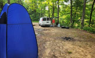
Site selection for safety: Choose established areas with level ground for family camping. At Morgan Mountain Road, a visitor noted, "Various camp sites along a dirt road, that my AWD Equinox made it fine. Just go slow, as there are some ruts from previous rains."
Bring all supplies: No services means complete self-sufficiency is required. A camper at Cane Creek explained, "No water, trash, or toilets. Town is a nice 15 minute country drive, minimal amenities there but freeway is only another 10 minutes."
Wildlife education: Use wildlife sightings as learning opportunities but maintain appropriate distance. A visitor at Sam's Throne mentioned, "Bambi and her mom also seem to live here," providing natural educational moments for children.
Know your route: GPS directions may not account for road conditions. One camper at Buffalo Creek Trail advised, "Approach from Cavern Mountain Rd 5, not Madison/404. The final half mile of Madison/404 was too steep and rough to proceed."
Tips from RVers
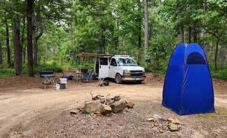
Size limitations: Most dispersed sites accommodate smaller RVs only. At Morgan Mountain, a camper observed, "The camp I'm at has the land cleared fairly well of grasses and such. The others further down the road are for one vehicle type camps with longer grass."
Leveling requirements: Many sites have uneven terrain requiring equipment. A visitor noted, "Except for one small spot, the site is not level - slopes downhill a little toward the ridge. Camping rigs may need leveling depending on the parking spot."
Clearance considerations: Access roads often have erosion issues. A reviewer at Meadows Knob Road warned, "FR1802A toward the site has some erosion; low clearance vehicles may high center in one or two spots."
Satellite access: Sites with minimal tree cover allow for satellite internet options. A camper at Meadows Knob noted, "No shade; access to Starlink is possible."