Best Dispersed Camping near Mount Judea, AR

Dispersed camping opportunities abound in the Mount Judea area of Arkansas, with several free primitive sites available throughout the Ozark National Forest and Buffalo National River regions. Sam's Throne Recreation Area offers established free camping with vault toilets and fire rings but no running water. According to reviews, "There are surrounding trails that lead to nice spots for a stunning sunset." Woolum Dispersed Area along Buffalo National River provides riverside camping options with vault toilets. Gene Rush Wildlife Management Area requires special permits purchased through Arkansas Game and Fish Commission.

Most dispersed sites feature dirt surfaces with established rock fire rings. Vehicle access varies significantly between locations. Forest roads like Charleston Road are generally well-maintained gravel, but many access tracks require high-clearance vehicles. Several campers noted that "low clearance vehicles may high center in one or two spots" on certain forest roads. Watch for poison ivy around many campsites, particularly during summer months. Cell service is spotty but available at some locations, with T-Mobile and AT&T coverage reported at certain sites. No potable water exists at these locations; campers must pack in all necessary supplies.

Weather conditions can change rapidly in the Ozarks. Summer brings hot, humid conditions with abundant insects; fall offers cooler temperatures and spectacular foliage. Wildlife is present throughout the area, including bears in some regions. Food storage precautions are recommended. Pack-in, pack-out principles apply at all sites, as trash service is not provided. During hunting seasons (September through May), camping in Wildlife Management Areas may be restricted or require additional permits. The area features numerous hiking trails, rock climbing opportunities, and scenic overlooks accessible from many campsites.

Best Dispersed Sites Near Mount Judea, Arkansas (19)

Show More
Showing results 1-10 of 19 campgrounds

2025 Detourist Giveaway

Presented byToyota Trucks

Review Campgrounds. Win Prizes.

Enter to Win


Dispersed Camping Reviews near Mount Judea, AR

38 Reviews of 19 Mount Judea Campgrounds


  • Fred S.The Dyrt PRO User
    Jul. 7, 2024

    Brock Creek - Charleston Rd Dispersed, Ozark NF, AR

    Nice Dispersed Site Above Brock Creek

    Not sure if the location pin is correct, so here are the coordinates: 35.49995, -92.80930. A large, wooded dispersed site situated above Brock Creek off of Charleston Road in a popular national forest OHV and multi-use trail area. Charleston Road is a wide, well maintained gravel road. The dispersed site can accommodate 2 or 3 vehicles - campervan size and smaller. There are 2 access driveways into the site. Access for a truck camper is tight due to the location of trees on the site. Access for 2WD low clearance vehicles may be rough due to some erosion. The dispersed site is a dirt surface with some embedded rocks jutting out. Some leveling may be required depending where the rig is parked. Tent camping is possible. There is a vehicle turnaround at the rear of the site. The site is shaded, so solar charging is limited. Except for a little bit of glass and some bullet shell casings scattered about, the site was clean at the time of my visit. The site has a large rock fire ring. There is a wide track that leads off the site toward the south along and above the creek. This track does not appears on any of the current forest service maps (including MVUM) that I have, so I'm assuming that it is not a legal motorized vehicle track. The track is hikeable. The site is convenient to OHV and multi-use trails. It was a pretty site during my summertime visit, but I bet it's beautiful during the Fall season. It is set back from Charleston Road. It is a really nice spot.

  • Fred S.The Dyrt PRO User
    Jan. 6, 2025

    FR1802A, Meadows Knob Rd Dispersed

    Secluded, Light Usage, Dispersed Camping in the Ozarks

    Coordinates: 35.58695,-93.20723. Camped here Dec 29, 2024. Set well off of Meadows Knob Rd. Expect pinstriping along the access track to this secluded dispersed campsite. FR1802A toward the site has some erosion; low clearance vehicles may high center in one or two spots. The main forest road into this part of the Ozark National Forest is okay. The campsite is in open area, located in an old clear cut area. There is a partial view of the distant mountains. The site is a level, dirt surface. Not a large site; okay for one rig. Tent camping possible. No nearby mature trees for hammock camping. The site is overgrown with grass and weeds; a weed whacker is needed to clear the rock fire ring. There is a spot on the ground where a previous campfire was made. Good AT&T and T-Mobile 5G service. No shade; access to Starlink is possible. No hiking trails, although there is a 2-track for hiking that leads down into Graves Creek Canyon and some unnamed waterfalls. The hike along this trck is nice. This is not a pretty dispersed site, but it is well off of the main forest road; very private. Access to the site may be difficult for some vehicles. High clearance 4x4 vehicles should have no problems.

  • Fred S.The Dyrt PRO User
    May. 26, 2022

    Middle Fork Dispersed Site AR Ozarks

    Creekside Dispersed Site, Middle Fork Illinois Bayou

    Large clearing along the Middle Fork of the Illinois Bayou. Located on Middle Fork Road, about a 1/4 mile in from AR Hwy 27, near Hector, AR. The site is on national forest land and appears to be popular. It's large enough for 3 car/truck/campervan rigs. Area is level for rigs & tents, although the ground is mostly hard buried gravel - maybe uncomfortable to sleep on without pads. Three large puddles on the site. Three ways to enter the site from  Middle Fork Road. Middle Fork Rd itself can easily accommodate 2wd passenger vehicles. Other dispersed sites further down the road along the creek. The site is not pristine, but it's nice to camp close to the bayou. Very peaceful, but there is occasional faint truck noise from Hwy 27. A half dozen or so vehicles passed by, some were residents who live further down the road. No facilities; need to bring your own water. No trash pickup; pack in, pack out.

  • Fred S.The Dyrt PRO User
    Jul. 6, 2024

    Group Dispersed, Charleston Road, Ozark NF, AR

    Large Group Dispersed Camping

    Coordinates: 35.50873, -92.81549. Group dispersed site located less than a 1/4-mile south of the Zing Trailhead on Charleston Road. Charleston Road is a wide, well maintained gravel road located in a popular national forest OHV area. This dispersed site is a level with a dirt and grass surface. The site can accomodate multiple vehicles; tent camping is possible. There is a large rock fire ring at the rear of the site. The site is open with little shade, making recharging with solar panels possible. Other than accommodating a group of OHV and offroad enthusiasts, and stargazing at night, there is nothing remarkable about this campsite.

  • Fred S.The Dyrt PRO User
    Jul. 4, 2024

    Charleston Road Dispersed, Ozark NF, AR

    Convenient to National Forest OHV Area

    Pin location may not be correct, so here are the coordinates: 35.52534, -92.83158. Located on Charleston Road in a popular national forest OHV area - 1/2 mile southeast of the Mountain Man Trailhead. Charleston Road is a well maintained gravel road. The site is at the beginning of an old unnamed, closed, dirt track - close to Charleston Road. The site has a dirt surface; not quite level, but more level toward the rear. It is a pull-in site which can accommodate one campervan and smaller. Tent camping is possible. The site is mostly shaded. There is poison ivy around the perimeter of the site. The site includes a large rock fire ring. Except for a little bit of trash in the fire ring, the site was pretty much clean. The old track is gated just past the site,; the track is hikeable, leading up to the northern-most Stoebuck Mountain (there are two "Stoebuck Mountains" in this area). Except for being convenient to OHV trails, there is nothing remarkable about this dispersed site. It is good for an overnight stay.

  • Fred S.The Dyrt PRO User
    Jul. 2, 2024

    Austin Trailhead Dispersed, Wilderness Trail Rd, Ozark NF, AR

    Dispersed camping convenient to OHV/multi-use national forest trails

    Not sure if the pin location is correct, so here are the exact coordinates: 35.53654, -92.80322.  Small dispersed campsite just off Wilderness Trail Road. Wilderness Trail Road is a wide gravel country road located in a popular national forest OHV area. More specifically, the site is located on multi-use/OHV trail Brock Creek #42, Forest Road 2321 - just a few hundred feet south of Wilderness Trail (not in the trailhead parking lot, where camping is not allowed). Its a small, level dirt site, mostly shaded in a small clearing in the trees, close to the track - not private. It has a small rock fire ring. Tent camping is possible. It's a pull-in site which can accommodate one vehicle - truck camper and smaller. Except for being convenient to OHV trails, there is nothing remarkable about this dispersed site.

  • Fred S.The Dyrt PRO User
    Jul. 9, 2024

    Brock Creek Lake View Dispersed, Ozark NF, AR

    Lake View Dispersed Camping

    Coordinates: 35.49123, -92.80548. Large open dispersed site set back from Charleston Road, just north of Bell Rd (Forest Road 1334). Located in a popular national forest OHV and multi-use trails area. Charleston Road is a wide, well-maintained gravel road. Access to the site from Charleston Road is on a 400 foot long narrow dirt track; pinstripping is possible. The dispersed site has a dirt surface with some embedded rocks. It's on a rise above the lake, offering a nice view. Solar recharging is possible in this open site. The site is on what appears to be a parking area along an old dirt track; this track appears as an older section of Charleston Rd on some maps. There is a dirt ramp into the lake. There is room for multiple rigs at the campsite. Some leveling may be required depending on the spot the vehicle is parked. There are two rock fire rings - one large and one small. Tent Camping is possible near the fire rings. The lake was drained at the time of my visit; otherwise, it's a really nice view.

  • Fred S.The Dyrt PRO User
    Nov. 23, 2024

    Morgan Mtn Rd/Spy Rock Dispersed

    Large dispersed with a view

    Coordinates: 35.69300,-93.76803. Large dispersed site with a view, especially in the winter, of the mountains to the west. Located along Morgan Mountain Road, Forest Road 1504, a little over a mile north of AR Hwy 215. The trailhead to Spy Rock is about a mile north of this site. Altough eroded in spots due to recent heavy rains, Morgan Mountain Road was in good condition - no obstacles. A 2wd passenger car can carefully make it over the eroded areas. Except for one small spot, the site is not level - slopes downhill a little toward the ridge. Camping rigs may need leveling depending on the parking spot. Access into the site from the forest road is easy. There is a clean rock fire ring. Tenting camping is possible. Hammock camping may be possible using nearby trees. The site is mostly shaded. The forest surrounding this campsite is beautiful. I received no T-Mobile service during my visit. I decided not to camp here during my visit due to a brisk, cold north-northwest wind blowing through the campsite.

  • b
    Aug. 14, 2021

    Ozark National Forest - Dispersed Camping

    Not a camp spot (private propery)

    This was not at all a campsite. Most of the forest is private property with house everywhere. This location in particular is no different. Go to Sam's throne to camp


Guide to Mount Judea

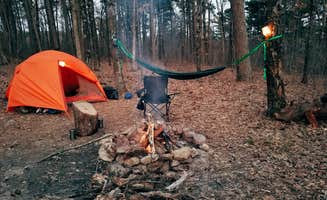
Mount Judea offers primitive camping options across public lands at elevations between 1,000-2,300 feet in the Arkansas Ozarks. Summer temperatures average 85-95°F with high humidity, while fall brings 50-75°F days with cooler nights. Most rustic sites feature uneven terrain with exposed roots and rocks, requiring careful tent placement.

What to do

Rock climbing access: Sam's Throne Recreation Area serves as a hub for climbers. "Road is kinda sketchy on the way up but the bluffs are fantastic!" notes Clayton R. Multiple climbing routes accommodate various skill levels.

Waterfall hiking: Several seasonal waterfalls flow after rainfall in spring months. Near Falling Water Creek, primitive camping spots provide access to cascades. "Great spot" for waterfall viewing according to Austin W., especially March through June when water levels peak.

Wildlife observation: Gene Rush Wildlife Management Area offers excellent wildlife viewing opportunities. "Must purchase camping license from Game and Fishing Commission" for $5 online, advises Robert B. Early mornings and evenings provide optimal viewing times for deer and turkey.

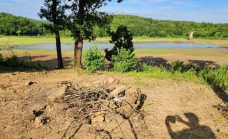
Creek exploration: Middle Fork Illinois Bayou area features multiple spots for wading and exploring. "It's nice to camp close to the bayou," reports Fred S., though he cautions about "three large puddles on the site" after rain. Water levels fluctuate seasonally.

What campers like

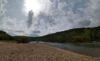
River access: Woolum Dispersed Area offers direct Buffalo River frontage. "Right on the river with both a rock and sand beach currently," writes William M. Sites closest to the water fill quickly during summer weekends.

Solitude: Many dispersed sites around Mount Judea remain uncrowded, especially midweek. "Campground was completely empty when I arrived on a Thursday evening in December," reports Alexandra about Sam's Throne. Fall and winter provide the most isolation.

Night skies: Limited light pollution creates outstanding stargazing. "On the right dark night you can see every star in the sky," says Bri about Sam's Throne Recreation Area. New moon periods offer optimal viewing conditions.

Privacy between sites: Natural vegetation creates separation at many locations. "Private camping spots, with trees separating each site," notes Kelsey R. about Sam's Throne. Most sites accommodate 1-2 tents with adequate spacing.

What you should know

Permit requirements: Gene Rush Wildlife Management Area enforces strict rules. "100% of Wildlife Management Areas in the state of Arkansas require a Hunting license or WMA camping permit purchased though Arkansas Game and Fish," explains Poopy B. Permits cost $5 and can be purchased online.

Road conditions: Access roads vary dramatically in quality. On Meadows Knob Road, "FR1802A toward the site has some erosion; low clearance vehicles may high center in one or two spots," warns Fred S. Access deteriorates after heavy rain.

Seasonal closures: Some roads temporarily close during winter or after flooding. "The final stretch of access road was blocked off due to erosion according to NPS," reports John W. about Woolum. Always check current status before departing.

Limited facilities: Most sites provide minimal infrastructure. "The site is overgrown with grass and weeds; a weed whacker is needed to clear the rock fire ring," notes Fred S. about dispersed camping at Meadows Knob Road. Bring all essential supplies.

Tips for camping with families

River swimming: Buffalo Creek Trail provides creek access for cooling off. "Approach from Cavern Mountain Rd 5, not Madison/404," advises Ollie P., as "the final half mile of Madison/404 was too steep and rough to proceed." Best swimming spots are 50-100 yards downstream from camp areas.

Wildlife education: Morning walks offer teaching opportunities about Ozark ecology. At Woolum, "Buggy but Beautiful" conditions create excellent insect observation chances, according to Candace R., who adds "bring the bug spray and sunscreen."

Bathroom planning: Toilet facilities vary widely between locations. Woolum offers "two vault bathrooms," according to Shelly J., while most primitive sites have none. Some campgrounds have composting toilets cleaned "every other day" per Bri's experience.

Weather preparation: Temperature swings require layered clothing. At Woolum, "Late September visit means the river is low, nights are cool and days are filled with sunshine," reports Candace R. Pack extra layers for unexpected cold fronts.

Tips from RVers

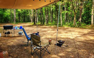
Site leveling: Most rustic camping near Mount Judea requires careful positioning. At Middle Fork Dispersed Site, the "area is level for rigs & tents, although the ground is mostly hard buried gravel - maybe uncomfortable to sleep without pads," cautions Fred S.

Size limitations: Few dispersed sites accommodate large rigs. Meadows Knob Road site "is not a large site; okay for one rig," reports Fred S. Most areas best suit truck campers, campervans, or tents.

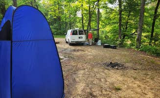
Self-contained needs: No hookups exist at dispersed sites. Woolum provides "super easy" pull-in for trailers but remains "very primitive" with "no tables provided, and not trash," notes Shelly J. Bring all water, power, and waste management solutions.

Route planning: Navigation apps sometimes suggest problematic routes. "Google routed us a bunch of dirt roads to get here. I'd recommend driving around on the highways," warns Ollie P. about Buffalo Creek Trail access. Research alternate routes before travel.

Frequently Asked Questions

Which is the most popular dispersed campsite near Mount Judea, AR?

According to TheDyrt.com, the most popular dispersed campground near Mount Judea, AR is Sam's Throne Recreation Area with a 4.5-star rating from 16 reviews.

What is the best site to find dispersed camping near Mount Judea, AR?

TheDyrt.com has all 19 dispersed camping locations near Mount Judea, AR, with real photos and reviews from campers.