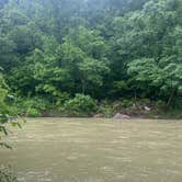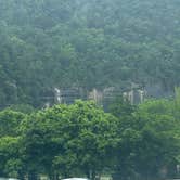
The Buffalo National River encompasses Steel Creek Campground, a National Park Service facility that sits alongside the Buffalo River near towering limestone bluffs. This established campground operates on a reservation system through Recreation.gov at $20 per night, with 26 sites arranged in two distinct areas—one closer to the parking area and another nearer the wooded riverbank.
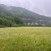
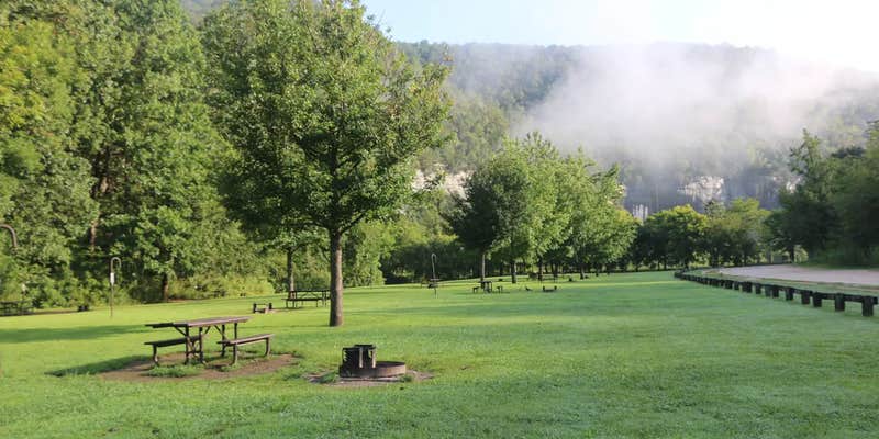
The campground occupies a large field setting where sites sit relatively close together, typically 20 feet apart. "You can walk to the river from the campground which is very convenient," notes Christina, though the Buffalo River remains hidden behind a line of trees until campers make the short walk down. Sites along the treeline offer the quickest river access and better shade options. Each campsite includes a picnic table, fire ring, and lantern post, with many locations providing suitable trees for hammock setup.
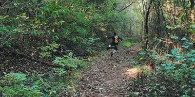
River access makes Steel Creek popular with paddlers and anglers, while hikers can access the Old River Trail directly from the campground or drive 15 minutes to reach the Centerpoint Trail and Big Bluff area. The campground provides flush toilets that receive daily cleaning, drinking water spigots, and a dump station, though no shower facilities exist. Rangers patrol regularly and maintain a station beyond the adjacent horse camping area.
The access road presents challenges with its steep grade, sharp curves, and narrow width—conditions that prompt warnings against large RVs despite the campground's big rig designation. Cell service remains unavailable at the campsite, requiring a 10-minute drive to Ponca for connectivity. Weekend crowds fill the campground regularly during peak season, while weekday visits offer more solitude. For additional camping in the region, visitors can explore campgrounds around Ponca or other sites throughout the Buffalo National River corridor.
Description
Overview
Steel Creek Campground is situated along the Buffalo River under the towering and picturesque Roark Bluff. One section of the campground offers 26 walk-in tent sites and another section of the campground offers 13 sites for those camping with horses. All sites are available by reservation only. Steel Creek is located about 3 miles (5 km) east of Ponca, just off Highway 74.
Recreation
Paddling conditions in the upper (westernmost) district of Buffalo National River are extremely dependent upon rainfall. On an average year, the upper river is only navigable by boat in the spring and early summer when consistent rainfall feeds into the watershed. Some sections on the upper end of the river are technical and should not be attempted by novices. For current paddling conditions, please check with an outfitter (visit our Guided Services web page ), call the Tyler Bend Visitor Center at 870-439-2502, or check the Buffalo National River Float Guide Dashboard
Facilities
Steel Creek has 26 tent only sites and 13 sites for campers with horses/stock animals (six people and four stock animals allowed per site). All sites are available by reservations only. There are no electrical amenities or water hookups, but flush restrooms and water spigots are available from approximately March 15 through November 15 each year.
Natural Features
The Buffalo National River flows free over swift running rapids and quiet pools for its 135-mile (217 km) length. One of the few remaining rivers in the lower 48 states without dams, the Buffalo cuts its way through massive limestone bluffs traveling eastward through the Arkansas Ozarks and into the White River.
Contact Info
For facility specific information, please call (870) 439-2502.
Nearby Attractions
The Buffalo River Trail runs through Steel Creek and offers great day hiking or overnight backcountry opportunities.__Boxley Valley is nearby and is home to Lost Valley, an easy to moderate trail that leads hikers past geologic and water formations. Visit the park's Hiking Trails web page for more information..
Charges & Cancellations
Fee Info
Fees for the walk-in tent sites and primitive horse-only sites (non-electric) are $20 a night for up to 6 people and per site. Horse-only sites are allowed up to 6 stock per site.
RV Road Trip Guides


Map & DirectionsSteel Creek Campground is located in Arkansas near Ponca
Directions
From Fayetteville, Arkansas drive north and take US Highway 412 East for approximately 42 miles (67.5 km) to the intersection with State Highway 21. Take highway 21 South for approximately 17 miles (27 km) to the intersection of State Highway 43. Here, take highway 43 East for about 5 miles (8 km) to the intersection of State Highway 74. Here, turn right onto highway 74 and drive about 2 miles (3.2 km) to Steel Creek Road. Turn left and drive approximately .5 miles (.8 km) down into the campground. At the bottom of the hill the main campground will be to your left and the horse camp will be to your right. From Little Rock, Arkansas take Interstate 40 West for approximately 93 miles (150 km) to Exit 64. At Exit 64 take Business Highway 64 west through the town of Lamar for about 4 miles (6.5 km) to the intersection of State Highway 21. Take Highway North for about 48 miles (77 km) to the intersection of State Highway 43. Here, take highway 43 East for about 5 miles (8 km) to the intersection of State Highway 74. Here, turn right onto highway 74 and drive about 2 miles (3.2 km) to Steel Creek Road. Turn left and drive approximately .5 miles (.8 km) down into the campground. At the bottom of the hill the main campground will be your left and the horse camp will be on your right. From Springfield, Missouri take US Highway 65 South for approximately 70 miles (112.6 km) to the town of Harrison. In Harrison, take State Highway 7 South about 1 mile (1.6 km) through downtown Harrison until you come to the intersection of State Highway 43 on your right. Follow highway 43 for about 25 miles (40 km) until to get to the intersection of State Highway 74. Turn left onto highway 74 and drive about 2 miles (3.2 km) to Steel Creek Road. Turn left and drive approximately .5 miles (.8 km) down into the campground. At the bottom of the hill the main campground will be your left and the horse camp will be on your right.
Address
386 NC 2104
Jasper, AR 72641
Coordinates
36.030169 N
93.341853 W
Connectivity
 T-MobileNo Coverage
- VerizonNo Coverage
- AT&TNo Coverage
Connectivity
- T-MobileNo Coverage
- VerizonNo Coverage
- AT&TNo Coverage
Access
- Drive-InPark next to your site
Site Types
- Tent Sites
- Standard (Tent/RV)
- Dispersed
- Equestrian
Features
For Campers
- Trash
- Picnic Table
- Firewood Available
- Reservable
- Drinking Water
- Toilets
- Alcohol
- Pets
- Fires
For Vehicles
- Sanitary Dump
- Big Rig Friendly
Drive Time
- 1 hr 15 min from Fayetteville, AR
- 1 hr 42 min from Springfield, MO
- 1 hr 56 min from Fort Smith, AR
- 2 hrs 19 min from Joplin, MO