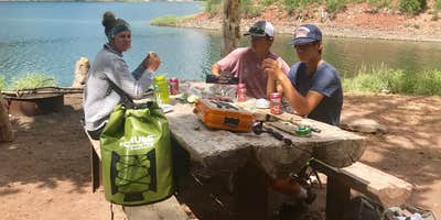
Accessible only by hiking 1.75 miles along Poker Creek Trail, Lake Alice provides free primitive camping within Bridger National Forest. The US Forest Service maintains metal fire rings with grills, an outhouse, and log picnic tables at this hike-in site, though some equipment shows wear from heavy use.
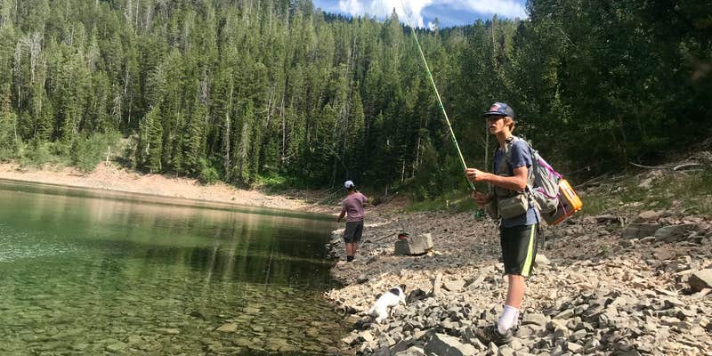
The campground sits on the east side of Lake Alice, which holds Wyoming's only pure strain of Bonneville Cutthroat Trout. Horseback riders frequently use the trail system, and one campsite includes a primitive horse corral. Canoe access requires packing watercraft in on foot. Campers can continue hiking to Mount Isabel five miles beyond the lake or follow the trail nine miles to LaBarge Creek Road for campgrounds near Smoot.
Description
Lake Alice Campground has 9 campsites and is a 1.5 mile hike east from the Hobble Creek Campground. Lake Alice provides beautiful views, fishing and a variety of hiking and horseback opportunities to visitors. Visitors are strongly encouraged to practice clean camping techniques and to store attractants (e.g. food, toothpaste) in a manner that makes them unavailable to bears.
RV Road Trip Guides

Map & DirectionsLake Alice is located in Wyoming near Smoot
Directions
From the Town of Kemmerer, Wyoming, head west on United States Highway 30 (US-30) for 44 miles to the Town of Cokeville, WY. Make a right turn on Wyoming State Highway 232 (WY-232)/Big Spring Scenic Backway, and after approximately 12.5 miles take a right onto Forest Service Road 10062 (FS-10062). Follow FS-10062 for 8.5 miles and take a left onto Hobble Creek Road/FS-10193. Follow FS-10193 for 4.8 miles and then take the first left to stay on said road. Continue following FS-10193 for an additional 1.3 miles and bear left at the fork to stay on FS-10193 and continue for an additional 7.7 miles and take a right at the fork. Continue driving past the campground and take another right at the second fork towards Lake Alice Trailhead at the end of the road. Begin hiking on Lake Alice Trail/National Forest System Trail 1025, crossing the bridge and staying left at the trail junction just beyond the bridge and continue approximately 1.6 miles to Lake Alice. Once at Lake Alice stay right and follow the trail along the southern shore of the lake and Lake Alice Campground is an additional 0.6 miles down this trail. Approximate travel details from the Town of Kemmerer: 79 miles, 1 hour and 45 minutes for drive time plus 40 minutes hiking time.
Coordinates
42.40600001 N
110.74400055 W
Connectivity
 T-MobileNo Coverage
- VerizonNo Coverage
- AT&TNo Coverage
Connectivity
- T-MobileNo Coverage
- VerizonNo Coverage
- AT&TNo Coverage
Access
- Hike-InBackcountry sites.
Site Types
- Tent Sites
- Standard (Tent/RV)
Features
For Campers
- Picnic Table
- Toilets
- Alcohol
- Pets
- Fires
FREE established camping
Enjoy camping on government land. Limited or no services at this camping area.
PERMIT might be REQUIRED
We curate permit requirements across the US for our PRO members. Try PRO to see if Lake Alice needs a permit.
Drive Time
- 2 hrs 43 min from Logan, UT
- 3 hrs 4 min from Pocatello, ID
- 3 hrs 19 min from Ogden, UT
- 3 hrs 36 min from Idaho Falls, ID


