Sugarloaf Campground, near Centennial, Wyoming, is a fantastic spot for those looking to soak in stunning mountain views and enjoy the great outdoors. With a small number of sites, it offers a cozy atmosphere where you can truly connect with nature.
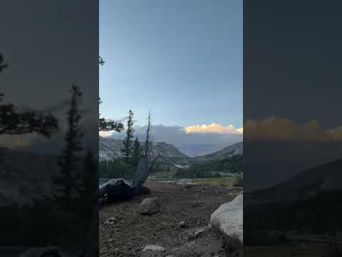
This campground is known for its clean facilities, including well-maintained vault toilets and a hand pump for drinking water. Visitors rave about the breathtaking scenery, especially the views of the Snowy Range, which make for a perfect backdrop while you relax at your site. As one camper put it, “Such beautiful views of the mountain from our site.”
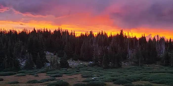
If you’re up for some adventure, there are plenty of hiking trails nearby that lead to picturesque alpine lakes and wildflower-filled meadows. The area is also a great place for stargazing, with clear skies that let you see millions of stars at night. Just be prepared for some wind; it’s a common theme here, but it helps keep the mosquitoes at bay.
Sugarloaf Campground is open from mid-July to early September, so plan your visit accordingly. Whether you’re pitching a tent or parking your RV, this spot is a great launchpad for exploring the Medicine Bow-Routt National Forest and enjoying a peaceful getaway in the mountains.
Description
Overview
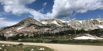
At an elevation of 10,800 feet, Sugarloaf is the highest elevation campground that the Medicine Bow-Routt National Forest has to offer and it is one of the highest elevation campgrounds in the United States. The sites at this location offer a breathtaking panorama of the Snowy Range which peaks out at 12,000 feet.__There is little or no shade in the campground due to elevation, the pine beetle infestation, and the removal of hazard trees.This campground will have a mix of reservation sites and first-come, first-served sites for the 2026 season. If you are not reserving your site, you may be able to pay for your campsite(s) by cash or check once you are at the campground.
Recreation
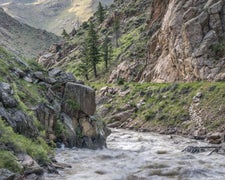
Sugarloaf Campground is near a variety of hiking trails and two crystal clear snow-melt lakes: Libby and Lewis Lakes. Non-motorized craft can be used on these lakes but you must carry your boat to the water's edge. Both Libby and Lewis lakes contain brook trout and splake (a hybrid of a male brook trout and female lake trout). Lewis Lake is annually stocked by the Wyoming Game and Fish Department (WGFD). Use of live-bait fish is prohibited in lakes and streams within the Forest. Three popular trailheads originate in this area that range in difficulty level to accomadate visitor's interests. Savage Run Wilderness and Platte River Wilderness are nearby to the south for visitors that desire a more remote setting.
Facilities
Sugarloaf Campground has 16 sites and can accomodate small trailers up to 22 feet long. Sites are equipped with tent pads, picnic tables, and fire rings. Tents must be set up inside the provided tent pads. All sites have access to a water handpump, a vault toilet, and trash collection. No electrical hook-ups, water hook-ups, or black water hook-ups are available. Handpump water may be available in this campground from July to September. These dates may vary due to weather, well and/or pump maintenance, and water testing requirements. As such, we encourage you to bring your own water or call ahead.
Natural Features
The campground sits on a spruce and fir-lined hillside in the midst of a fisherman's paradise of 102 recreational lakes. This is a rustic, picturesque campground where every site has delightful views of the Snowy Range. The Medicine Bow-Routt National Forests and Thunder Basin National Grassland encompass nearly 3 million acres from central and northeastern Wyoming to north-central Colorado. Black bear, bobcat, coyote, elk, marmots, moose, mule deer, and pikas are just some of the many animals that inhabit these rich and diverse lands.
Nearby Attractions
The campground is 1.5 miles from the Libby Flats Observation Area. Visitors can find many more outdoor opportunities in the surrounding Medicine Bow-Routt National Forest including hiking, biking, camping, horseback riding, fishing, hunting, sightseeing, and winter sports.
Reservation Info
Open/close dates weather dependent.
RV Road Trip Guides

Map & DirectionsSugarloaf Campground is located in Wyoming near Centennial
Directions
The campground is 43 miles west of Laramie, WY and 39 miles east of Saratoga, WY on State Highway 130. Coming from either Laramie or Saratoga on State Highway 130, turn north on to Forest Service Road 346 and the campground will be in three quarters of a mile on your right.
Coordinates
41.353997958 N
106.293837652 W
Connectivity
 T-MobileNo CoverageVerified by 8 usersLast on 6/23/26
 VerizonPossible CoverageVerified by 11 usersLast on 6/23/26
- AT&TNo CoverageVerified by 7 usersLast on 6/23/26
Connectivity
- T-MobileNo CoverageVerified by 8 usersLast on 6/23/26
- VerizonPossible CoverageVerified by 11 usersLast on 6/23/26
- AT&TNo CoverageVerified by 7 usersLast on 6/23/26
Access
- Drive-InPark next to your site
Site Types
- Tent Sites
- RV Sites
- Standard (Tent/RV)
Features
For Campers
- Trash
- Reservable
- Drinking Water
- Toilets
- Alcohol
- Pets
For Vehicles
- Water Hookups
Drive Time
- 1 hr 26 min from Cheyenne, WY
- 1 hr 46 min from Fort Collins, CO
- 2 hrs 11 min from Greeley, CO
- 2 hrs 49 min from Casper, WY