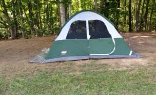
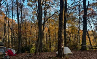
Camping near Coeburn, Virginia positions visitors in the midst of Jefferson National Forest's diverse ecosystems ranging from 2,000 to 4,200 feet in elevation. The region experiences all four seasons distinctly, with summer temperatures averaging 75-85°F and winter lows frequently dropping below freezing. Cell service throughout the camping areas varies significantly with the mountainous terrain, often disappearing completely in valley campsites.
What to do
Explore the greenway trail system: Jessie Lea RV Park in Big Stone Gap connects directly to the town's walking trail via a draw bridge across the Powell River. One camper noted, "There's a great walking trail that runs right by," making it convenient for morning strolls or evening walks from your campsite.
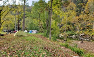
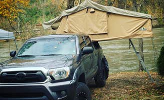
Visit the Clinch River: Natural Tunnel State Park Campground offers access to canoeing on the Clinch River. "We canoed Clinch River, caved in the park, and took a short guided hike through Stock Creek to backside of tunnel," shared one visitor who enjoyed water activities combined with exploring the park's geological features.
Mountain biking adventures: Warriors' Path State Park Main Campground houses "an acclaimed mountain bike trail area" according to reviews. Located about 40 minutes from Coeburn, the park offers multiple trail options for various skill levels, making it a worthwhile day trip for biking enthusiasts.
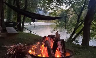
Fish at nearby lakes: Campgrounds around Coeburn provide access to several fishing spots. "We enjoyed fishing and kayaking during our stay," reported a visitor at Pound River Campground, which sits directly on the river creating "a very serene atmosphere" for anglers.
What campers like
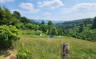
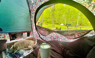
Secluded mountain experiences: Flag Rock Recreation Area Campground sits high on one of Virginia's mountains with spacious sites. "We drove up a twisty road with a few hairpin turns, wondering if there is really a campground. We got to the top and there were two loops of campsites with electric, and we were the only ones there," one camper shared about the secluded experience.
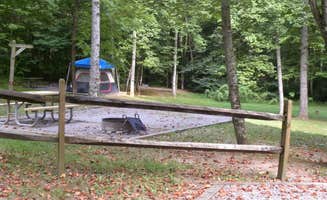
Clean facilities: Despite remote locations, many campgrounds maintain high cleanliness standards. A camper at Jessie Lea RV Park noted, "The bathrooms are the cleanest I've ever seen," while another at Flag Rock mentioned being "surprised to find clean flush toilets and hot showers."
Easy self-registration systems: Several smaller campgrounds use simple registration processes. A Flag Rock visitor explained, "Very easy show up put your money in an envelope take the tag put it on the dash of your truck pick a spot $20 not electricity hook ups and it's a very nice campground."
Access to historical areas: Cliffhanger Ranch Adventure Outpost offers proximity to multiple historical sites. A camper observed, "The entrance is directly across from the Jefferson National Forrest. There we were able to kayak at Bark Camp Lake which was not busy at all and hike at Little Stoney Falls."
What you should know
Seasonal operations: Most forest service campgrounds have limited seasons. Jefferson National Forest High Knob Campground operates only from May 15 to September 15, as does Cane Patch Campground. Prepare for seasonal closures when planning trips outside summer months.
Road conditions: Mountain access roads can be challenging. Flag Rock requires driving "up a twisty road with a few hairpin turns" with some visitors wondering if they were on the correct route. Be prepared for steep grades and narrow passages.
Limited supplies: Breaks Interstate Park Campground visitors warn to "bring all necessary supplies BEFORE you get here, nearest stores are a 20 minute drive away on crooked mountain roads." Stock up in larger towns before heading to remote camping areas.
Weather preparedness: Mountain elevations mean rapidly changing conditions. Temperature swings of 30°F between day and night are common in spring and fall. Pack accordingly with layers and rain gear regardless of forecasts.
Tips for camping with families
Look for educational activities: Natural Tunnel State Park offers ranger-led programs suitable for children. "Spent the night in a tent at Lovers Leap campground. Campground and park are clean, well maintained and up to date. Canoed Clinch River, caved in the park, and took a short guided hike," a visitor mentioned.
Consider playgrounds and recreation: Warriors' Path State Park Main Campground features "a Boundless Playground" according to reviews. One family reported, "The kids loved riding their bikes and scooters on the paved road through the park. My son and I enjoyed a round of disk golf while my wife and daughters made use of their awesome playground."
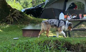
Wildlife viewing opportunities: Many campgrounds offer chances to see native wildlife. At Breath of Dawn, a camper noted there were "plenty of space with short grass. Small rock fire pit and log bench. Excellent views and lots of deer and birds about," making it perfect for nature observation with children.
Check shower and bathroom facilities: Family camping requires adequate facilities. At Jessie Lea RV Park, visitors appreciate that "The bath house was clean and decorated very nice. Looks like it has been freshly painted," making it more comfortable for families with young children.
Tips from RVers
Site selection cautions: At Warriors' Path State Park, reviews warn "pay attention to the site size as some RVs had issues getting their larger RVs in their sites with the road/site layout." Research specific site dimensions before booking.
Leveling requirements: Many mountain campgrounds have uneven sites. One RVer at Warriors' Path noted, "There are a lot of uneven campsites, so bring your leveling blocks."
Hookup variations: Jessie Lea RV Park offers full hookups for most sites. A visitor commented, "Our campsite was on the bank of the river with a fire pit and very level soft ground," highlighting the importance of selecting sites with appropriate hookups and terrain for your specific RV needs.
Navigational challenges: Breaks Interstate Park Campground presents access challenges for larger rigs. An RVer with "a 38' 5er and a CrewCab Dually tow vehicle" reported, "The roads to this amazing State Park are two lane and twisting. We didn't have a lot of issues getting here but it is quite mountainous with a lot of climbs."