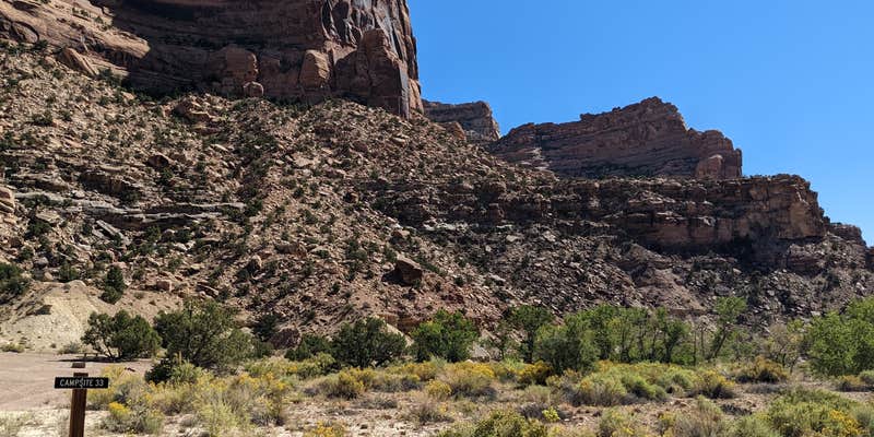
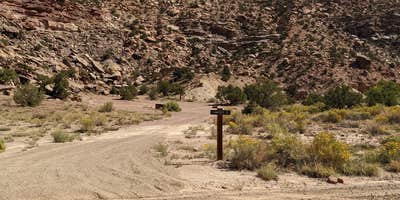
Where Buckhorn Draw winds through BLM land in central Utah, this designated group campsite sits as the final dispersed option before reaching the developed fee campgrounds downstream. The site accommodates larger parties with a picnic table and fire ring, though campers should come prepared with their own water and plan to pack out all trash. No restroom facilities exist on-site.
Located roughly 20 miles from campgrounds around Cleveland, the campsite offers no cell service according to recent visitors. The $50 nightly fee reflects its group designation, making it a budget consideration for solo travelers or small parties who might find better value at nearby Buckhorn Draw Campsites 30-32 just a tenth of a mile west.
Description
Buckhorn Draw is a stunning canyon cut into the Navajo, Kayenta, and Wingate Sandstones. Carsonite posts mark where there are primitive campsites where lucky campers might spot bighorn sheep running across the ledges. Camping in Buckhorn Wash is limited to designated sites that are marked with camping signs. Creating new campsites is not allowed. Reservations not available. If there are no marked and designated sites available when you arrive, find another place to camp outside Buckhorn Draw (Check out the Swinging Bridge Campgrounds).
RV Road Trip Guides


Map & DirectionsBuckhorn Draw group Campsite #33 is located in Utah near Cleveland
Directions
Buckhorn Draw dispersed camping is approximately 15 miles east of Castle Dale, UT. From I-70 take exit 131 and travel north for 25 miles until you enter Buckhorn Draw. Contact the Price Field Office for driving directions.
Coordinates
39.09718 N
110.664499 W
Connectivity
 T-Mobile5GGood Coverage
 VerizonLTESome CoverageVerified by 1 userLast on 7/16/26
- AT&TLTESome CoverageVerified by 3 usersLast on 7/20/26
Connectivity
- T-Mobile5GGood Coverage
- VerizonLTESome CoverageVerified by 1 userLast on 7/16/26
- AT&TLTESome CoverageVerified by 3 usersLast on 7/20/26
Access
- Drive-InPark next to your site
Site Types
- Tent Sites
- RV Sites
- Group
Features
For Campers
- Alcohol
- Pets
- Fires
DISPERSED CAMPING
Enjoy dispersed camping on government land and leave no trace. Pack in and pack out. No (or limited) services at this camping area. Permit may be required.
PERMIT might be REQUIRED
We curate permit requirements across the US for our PRO members. Try PRO to see if Buckhorn Draw group Campsite #33 needs a permit.
Drive Time
- 3 hrs 2 min from Grand Junction, CO
- 3 hrs 3 min from Provo, UT
- 3 hrs 34 min from Salt Lake City, UT
- 4 hrs 2 min from Ogden, UT


