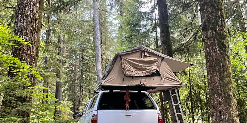
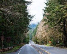
Where the Ohanapecosh River winds through Mount Rainier National Park's southeast corner, this 188-site campground spreads across multiple loops beneath towering old-growth forest. The drive in requires navigating tight, winding roads that limit RVs to 32 feet maximum, with rough sections that can challenge larger rigs during wet conditions.
Dense canopy creates heavy shade across most sites, with dirt camping pads and standard amenities including bear boxes, picnic tables, and fire rings. Lee D. notes that "most sites are very shaded due to the abundance of trees," though sites backing up to the river command premium status among campers. Loop boundaries blur in places, leading some families to inadvertently share space with neighboring sites during busy periods.
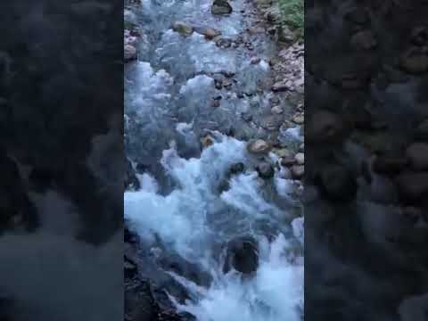
The Ohanapecosh River provides constant background noise as it flows through the campground, offering cold-water access for those brave enough to test the glacier-fed temperatures. Silver Falls Trail and Grove of the Patriarchs both start directly from the campground, while hot springs bubble up near the visitor center along an interpretive trail. Cell service disappears entirely within the campground boundaries, though patches of signal emerge during the drive toward other park areas.
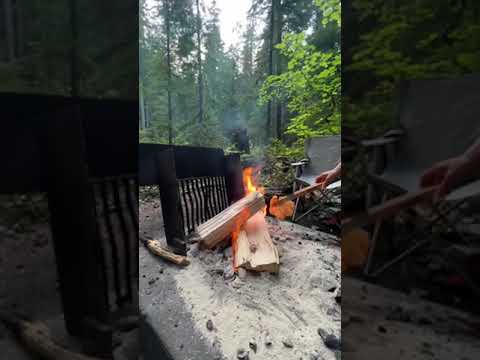
This campground operates on reservations from Memorial Day weekend through Columbus Day at $20 per night, with no hookups but dump station access available. The visitor center provides ranger assistance between 10 AM and 4 PM when open, though COVID closures have affected services. Camp hosts drive through selling firewood bundles, and flush toilets serve each loop, though Elliott B. found facilities "could have used a little TLC" during peak season visits.
Campers seeking additional options in the region can explore camping destinations outside Mount Rainier National Park. The 45-minute drive to Paradise means planning day trips carefully, but the forest setting and river access create a base camp worth the trade-off.
Description
Overview
Ohanapecosh Campground, on the southeast side of Mount Rainier National Park, is surrounded by old growth forest and crossed by an exceptionally beautiful snow-fed river. Close to Ohanapecosh are popular hikes to Silver Falls. The Grove of the Patriarchs trail is closed to public access until the bridge accessing the Grove is replaced. The main attraction at Mount Rainier National Park is the mountain itself, a glacier-clad volcano of immense proportions. At 14,411 ft., it dominates the skyline for hundreds of miles. Visitors travel through majestic old-growth forests, past tumbling waterfalls and historic buildings to reach sub-alpine meadows, where world-famous wildflower displays are seen in July and August. Popular activities in the park include sight-seeing, hiking, climbing and camping. Ohanapecosh campground has an elevation of 1,914 feet. Weather is dry, cool and sunny in the summer with daytime temperatures in the 60 to 80-degree range. Even though the eastern side of the park can be sunnier than other areas, weather can be variable and visitors should come prepared.
Recreation
The most popular campground in the park, Ohanapecosh is convenient to both the Paradise and Sunrise areas. Numerous hiking trails originate both in and nearby the facility, including the several trails that lead to Silver Falls waterfall. For visitors who would like to learn more about natural and cultural history, the Ohanapecosh Visitor Center is close by as well.Grove of the Patriarchs - The Grove of the Patriarchs is CLOSED to all public entry due to flooding in November 2021 which caused significant damage to the suspension bridge that provides the only safe access to the area (News Release, 11/17/21). See the attached emergency regulation signed by the Deputy Superintendent. The Grove of the Patriarchs Trail will remain closed until the bridge can be replaced. During the closure, the Grove of the Patriarchs parking lot and restrooms have normal seasonal access, along with the Eastside and Silver Falls Trails. Construction to replace the bridge is scheduled to begin summer 2027. In addition to site clearing, the project will require supplies transport, bridge construction, trail reconstruction to meet the new bridge. This process is expected to take several years and construction work is limited to the summer season. Summers represent the only viable construction season in the park due to the heavy snow that blankets the park from roughly November through May.
Facilities
This large campground has 188 individual sites for RV or tent camping situated among the ancient trees. There is drinking water, but no electric hookups. Visitors must use extra caution with food storage, as bear and other animals inhabit the area around the campground.
Natural Features
Ohanapecosh is thought to be a Taidnapam Indian word for "standing on the edge" of the Ohanapecosh River. The river itself is lined with mossy boulders and drains cold, clear water down from higher elevations. Its banks are lined with thick, old growth Douglas fir trees and other evergreens. There is no view of Mt. Rainier directly from the campground, though the mountain dominates the landscape in nearby areas of the park.
Charges & Cancellations
__If a camper does not check-in at the Ohanapecosh Visitor Center at the campground window by 12:00pm check-out time the day after the scheduled arrival date, their reservation will be cancelled, the camper will incur a $10.00 service fee, and forfeit the first night's camping fee.
Reservation Info
First come first served
Closed For the Season
This campground is closed for the season from October 11, 2025 through May 27, 2026.
Warning 2 Alerts are In Effect
There are 2 alerts for this campground. Camp safely!
Closed For the Season
This campground is closed for the season from October 11, 2025 through May 27, 2026.
Warning 2 Alerts are In Effect
There are 2 alerts for this campground. Camp safely!
We now expect the Ohanapecosh Campground rehabilitation project to continue into the spring and early summer of 2026. We will reopen the campground as soon after the completion of the project as possible, but we cannot predict an exact opening date. Information on how to secure a campsite for summer 2026, will be posted to the Mount Rainier National Park website at Campgrounds - Mount Rainier National Park (U.S. National Park Service)prior to the 2026 camping season_._
The dump station at the Ohanapecosh Campground is closed. The nearest dump station is located at the Maple Grove Resort 28 miles west on Hwy 12.
RV Road Trip Guides

Location
Public CampgroundOhanapecosh Campground — Mount Rainier National Park is located in Washington
Directions
Located on State Route 123, four miles north of State Route 12.
Address
208 Ohanapecosh Road
Packwood, WA 98361
Coordinates
46.7311111 N
121.5702778 W
Connectivity
 T-MobileNo Coverage
- VerizonNo Coverage
- AT&TNo Coverage
Connectivity
- T-MobileNo Coverage
- VerizonNo Coverage
- AT&TNo Coverage
Access
- Drive-InPark next to your site
- Walk-InPark in a lot, walk to your site.
- Hike-InBackcountry sites.
Site Types
- Tent Sites
- RV Sites
- Standard (Tent/RV)
- Group
Features
For Campers
- Market
- Trash
- Picnic Table
- Firewood Available
- Reservable
- Drinking Water
- Toilets
- Alcohol
- Pets
- Fires
For Vehicles
- Sanitary Dump
- Big Rig Friendly
Drive Time
- 1 hr 16 min from Yakima, WA
- 2 hrs 57 min from Wenatchee, WA
- 3 hrs 15 min from Seattle, WA
- 4 hrs 1 min from Olympia, WA